Monika and Gnash’s Adventure along the Guernsey Coastal Path – A Four-Day Circuit around the Island.
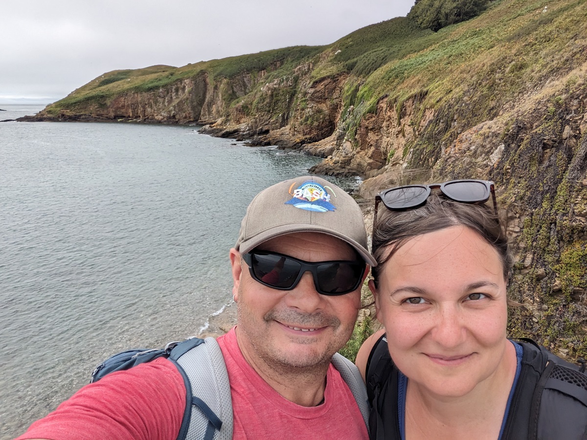
As some of you are aware, I’m a big fan of a coastal walk, having previously walked a part of the Pembrokeshire Coast Path, Fife Coastal Path, and North Norfolk Coastal Path. When we added the Channel Islands to our portfolio last year, I knew immediately that either the Jersey or Guernsey Coastal Path would be at the top of the list of routes I would like to walk as my Familiarisation Trip this season. I was absolutely delighted to be given an opportunity to walk the Guernsey Coastal Path. This year, I was joined by my partner, Gnash.
The Guernsey Coastal Path is a 38-mile circular route that loops around the island’s coastline, beginning and ending in St Peter Port. The route offers a mix of rugged cliffs, sandy beaches, sheltered bays, and an abundance of historic landmarks.
Day 1: St Peter Port to Petit Bôt Bay
After a delicious breakfast at our first night’s accommodation, we set off through the cobbled streets of St Peter Port towards the seafront. It was a clear and warm day, which made it ideal walking weather.
Leaving the town and its marina behind, we continued down the South Esplanade towards Havelet Bay. We passed the La Vallette Underground Military Museum (which, sadly, we couldn’t visit, as it doesn’t open until 10am) and the bathing pools, where people were already enjoying a dip just after 9am in the morning.
From there, we began our first climb of the day to Clarence Battery. We would later find out that it would be the first of many climbs we would encounter on our first couple of days of walking along the coastal path, as the south-eastern coast of the island is very rocky.
The steps leading to the battery have words inscribed on them from a poem written by Chloe Gallie. The poem aims to give words of encouragement to those using the steps and give a new perspective to the area, with one word on each step.
We spent a short while exploring the 18th-century fortification and looked back at where we came from, with views of Castle Cornet and St Peter Port seen in the distance.
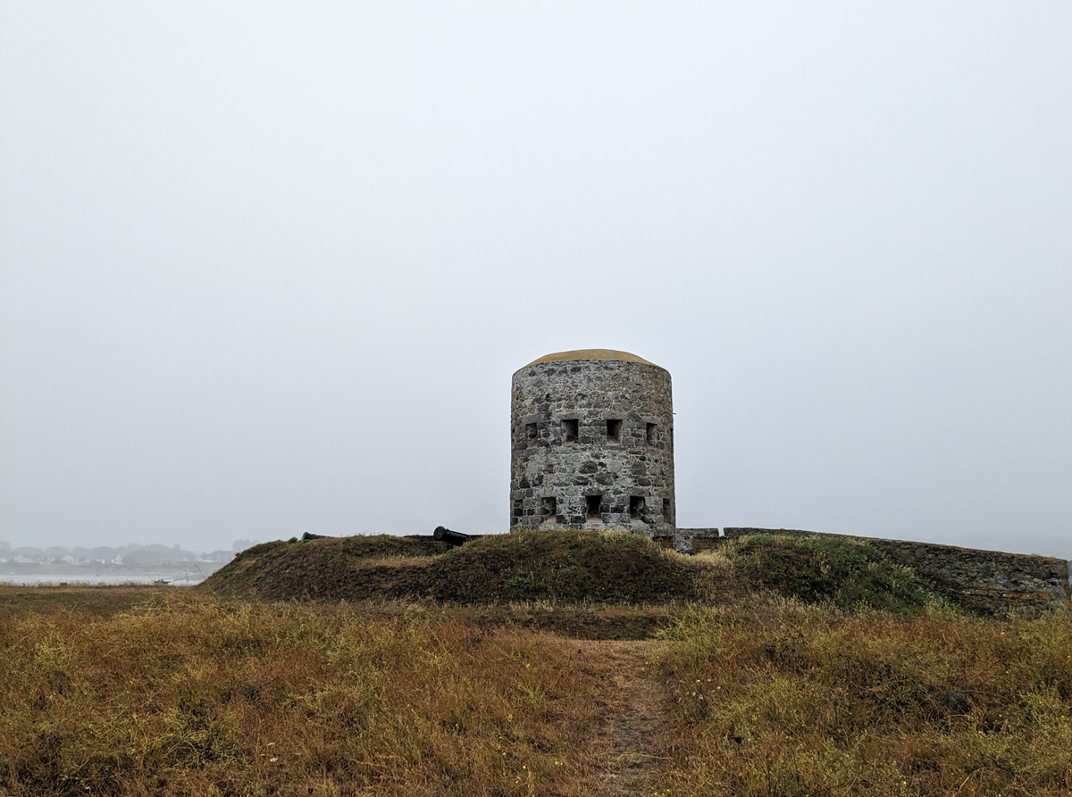
We then followed some woodland paths, only occasionally catching glimpses of the sea. This section really didn’t feel like a coastal path, which I suppose made the walk even more interesting. Soon, we were out of the woods, descending towards Fermain Bay with its loophole tower, known as the Pepper Pot. We would later find out that it was the first of many loophole towers that we would come across on our coastal walk this week. The ‘Pepper Pot’ was number 15 of a series of 15 towers built by the British at strategic points around the coast between 1778 and 1780 to deter possible French attacks, of which 12 still remain. Muskets could be fired from the loopholes in every possible approach, and a cannon could be fired from its roof.
We climbed some steps out of Fermain Bay and headed round Marble Bay between some bushes, brambles, and flowers towards St Martin’s Point and its lighthouse. From here, it was a steep climb up some 232 steps to Strassburg Naval Battery Command Bunker, sitting at the top of Jerbourg, another reminder of the German Occupation of Guernsey during World War II.
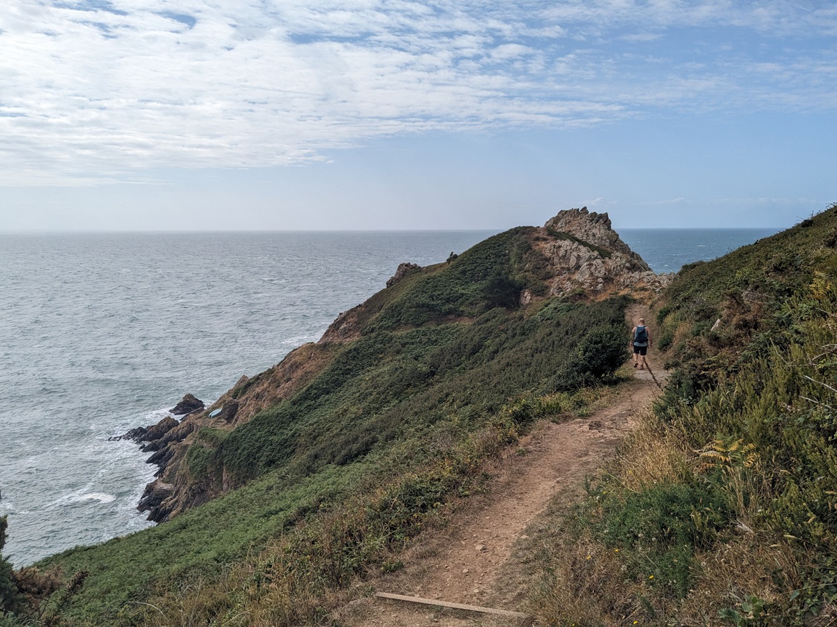
From there, we took a quiet country lane before re-joining the coastal path shortly after, heading around Jerbourg Point, where we were rewarded with views of Petit Port, Moulin Huet Bay, and Icart Point. We continued along the grassy, cliff-top path for another couple of miles until we reached Moulin Huet Bay, where we found a lovely tea room overlooking the sea and decided to stop for a late morning treat.
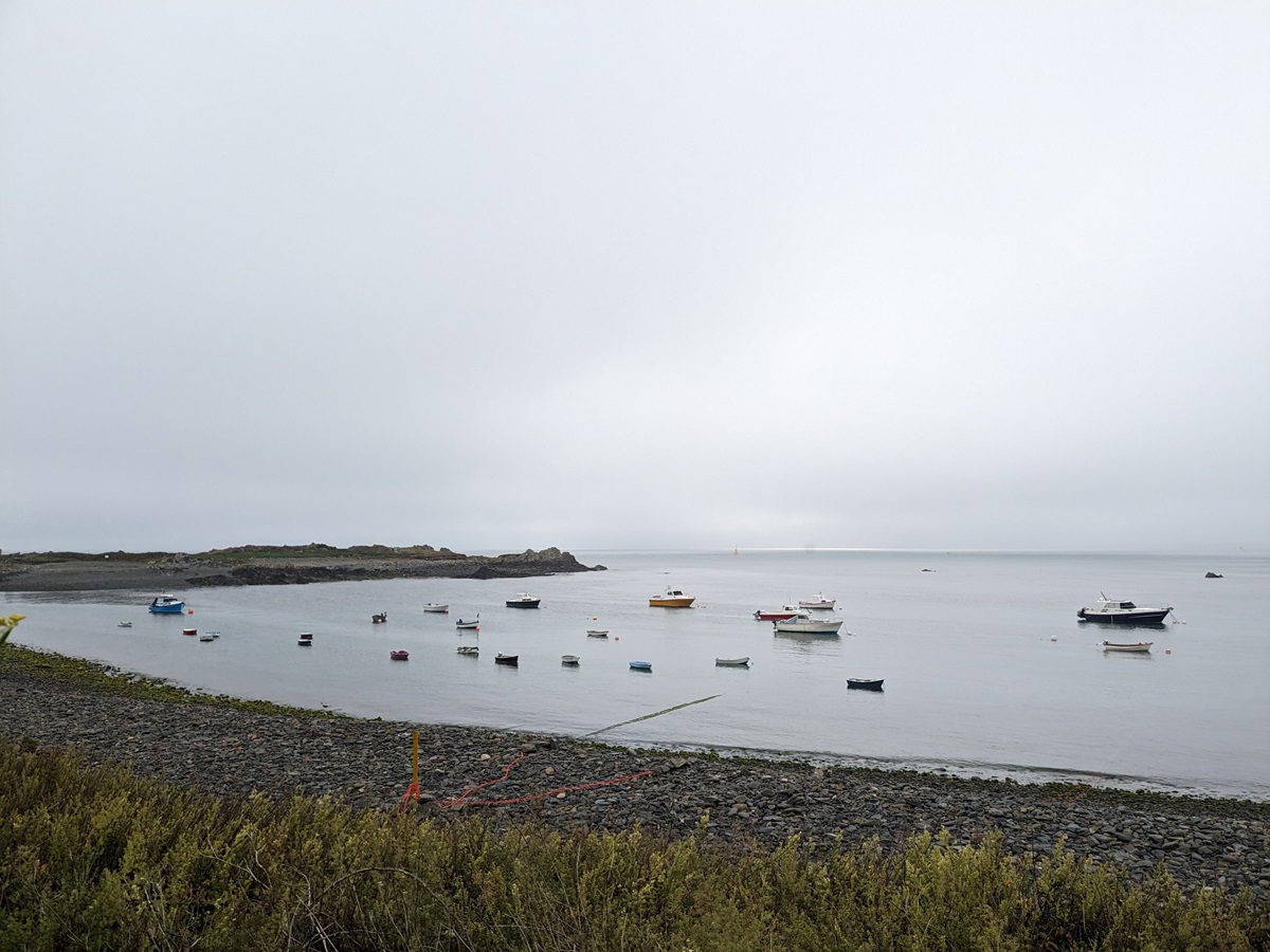
Having enjoyed some refreshments at the Renoir Tea Garden, we set off on the next part of our walk, unsurprisingly by climbing another 200 steps out of the bay. The next three miles took us past Saints Bay, with its delightful harbour, where we spotted a dozen or so small sailing boats (and a Loophole Tower, no. 14) before heading round Icart Point, where we were rewarded with stunning views across the bay, spotting Guernsey’s bigger sibling, Jersey, in the distance.
We continued on the clifftop path, with more ups and downs, skirting round La Bette Bay and La Jaonnet Bay.
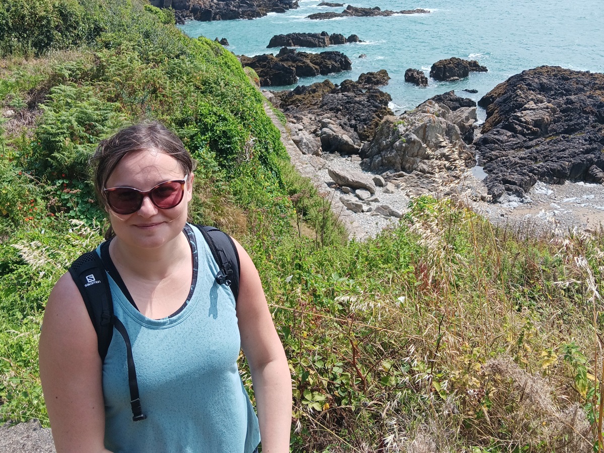
One last steep descent, and we arrived at a quiet Bay of Petit Bôt, with another loophole tower (no. 13), tucked between two steep hillsides, where we decided to stop for an ice cream and to enjoy the surrounding scenery before making our way to our overnight accommodation (a short 20-minute walk).
Day 2: Petit Bôt Bay to Vazon
We were once again very lucky with the weather this morning. It was warm and sunny with a gentle breeze – perfect walking weather!
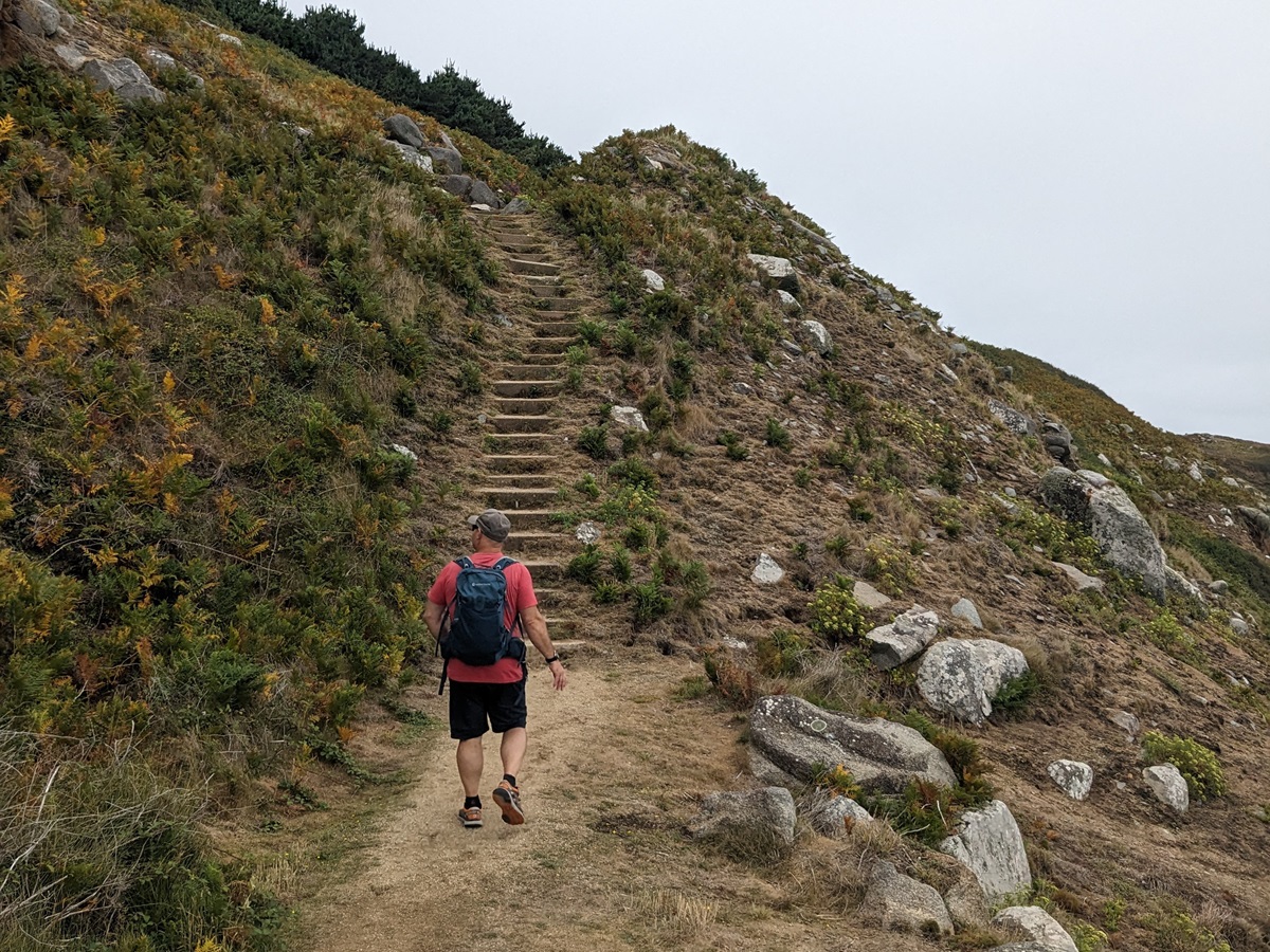
Having retraced our steps back to Petit Bôt Bay, we began today’s walk with a climb up some 200 steps towards Le Gouffre. The path quickly entered a wooded area as we skirted round Portelet Bay, where we could only occasionally catch glimpses of the sea. We eventually joined a clifftop path with more steps going up and down around the top of the next cove, and onto Pointe de la Moye, followed by Le Gouffre.
The path then took us slightly inland at Le Bigard before heading back to the coast towards La Corbière. More ups and downs brought us to a German Observation Tower at La Prevoté. An original tower was built here in the 18th century in response to the threat of invasion by Napoleonic forces. A more substantial concrete tower was later built on the site during the German occupation of Guernsey during World War II.
Leaving the tower behind, we continued on the path between bracken and gorse bushes, with more ups and downs, until we reached the headland at Les Tielles, which rewarded us with amazing views along the rugged cliffs all the way to Pleinmont Point, where we would be heading next. We continued on the coastal path, which was starting to become a little bit easier, as the climbs were not as frequent anymore and the terrain was starting to level out.
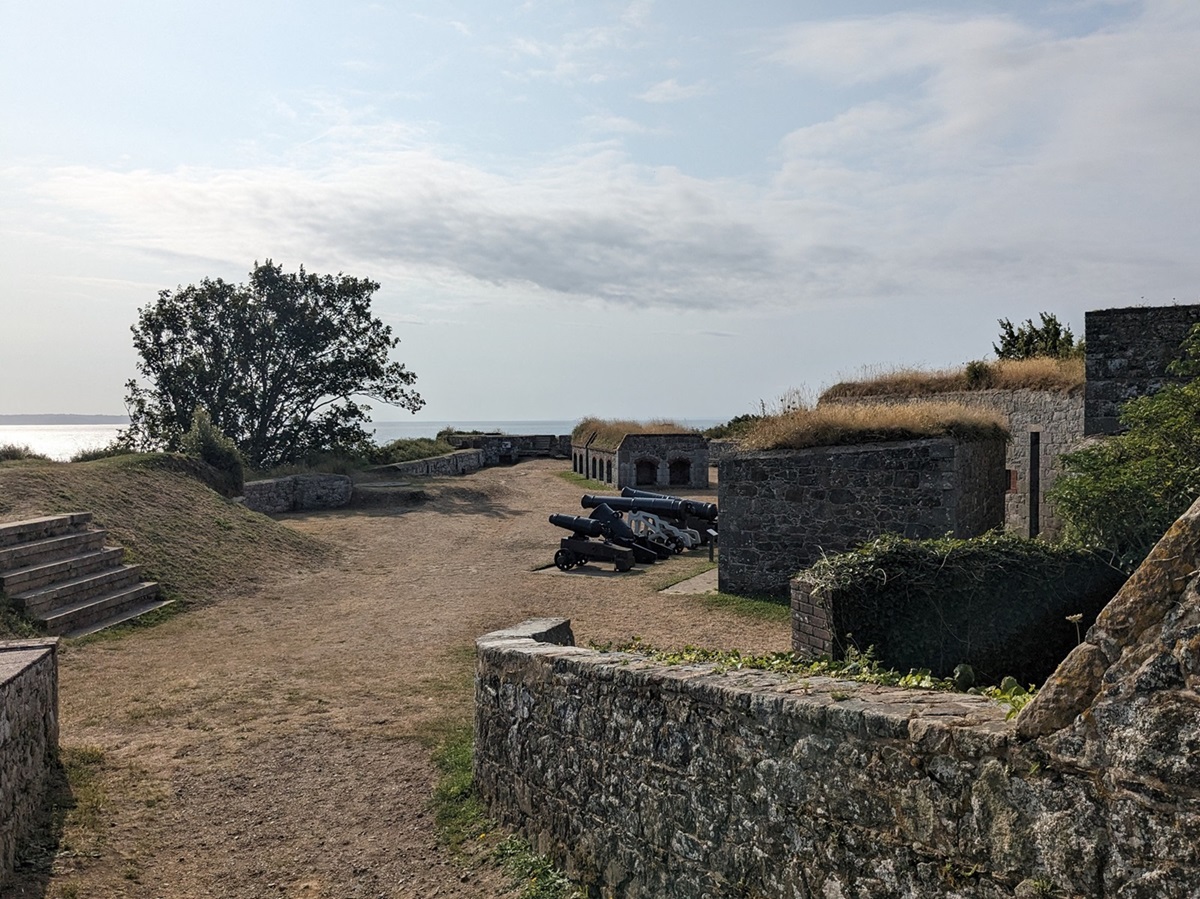
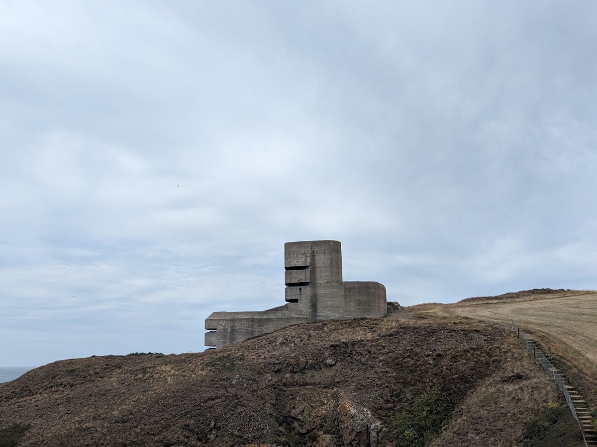
We were now walking alongside some fields until we reached the Mont Hérault Watch House, another one of the 18th-century structures built against the threat of French invasion before and during the Napoleonic Wars. What came next was an immense L’Angle Observation Tower, which is one of the very few observation towers that are open to the public. You can explore its five levels; however, there’s very little natural light in some parts of the tower, so we decided to only have a look around a couple of levels. It was interesting to see what a vast area could be spotted from the tower.
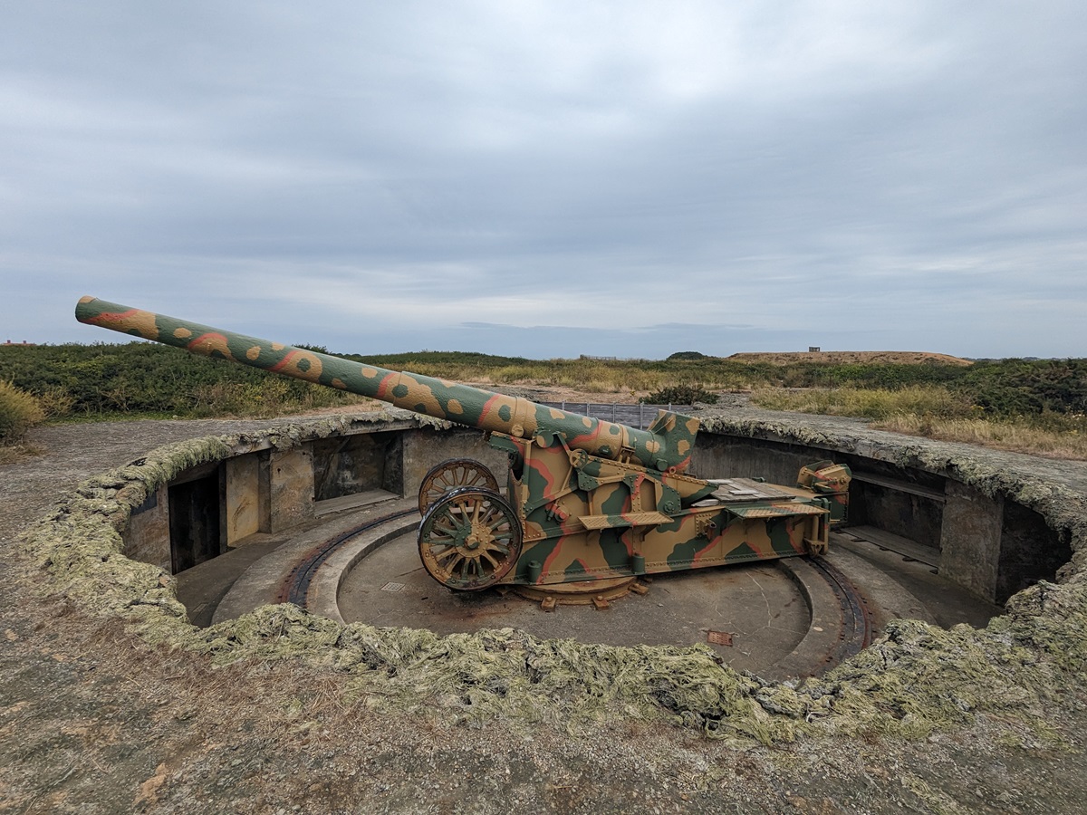
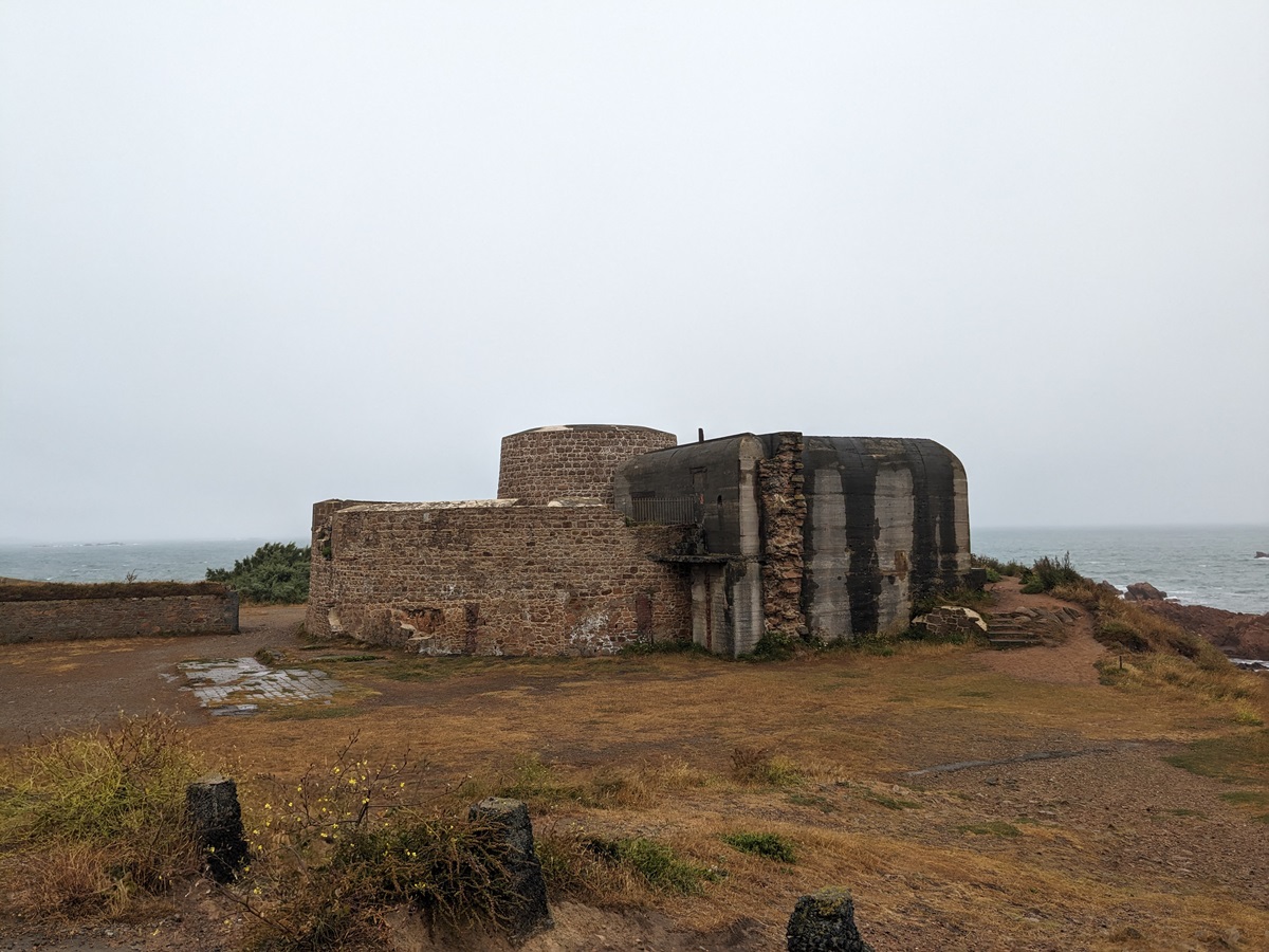
We left the tower behind and continued our walk, passing a concrete bunker embedded in the clifftop, shortly followed by the circular German gun emplacement, both part of a German Coastal Artillery Battery, the Batterie Dollmann.
We continued around the peninsula, passing the ruins of the Pleinmont Watch House, built in 1780, which was destroyed by the Germans during the Second World War because of its proximity, and therefore potential obstruction of, Batterie Dollmann.
We soon arrived at Pleinmont Point, the most westerly point of the island. Just over a mile from the point stands the thirty-six-metre-high Hanois Lighthouse, built on the largest rock off the south-western end of Guernsey. It was completed in 1862 in response to an increasing number of shipwrecks off the western coast of Guernsey.
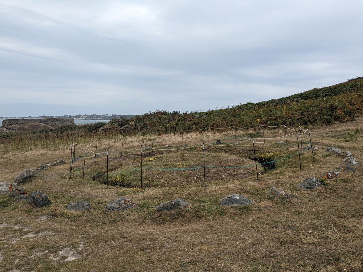
From the viewpoint, we headed downhill towards Portelet Harbour. Just before we reached sea level, we passed La Table des Pions, also known as the Fairy Ring, a circular area of grass with stones, surrounded by a shallow trench and a circle of stones. It was dug out by island officials to be used as a picnic bench whilst inspecting coastal roads and sea defences up until 1837. It is also linked to local stories about fairies, elves, and witches, hence the other name – the Fairy Ring.
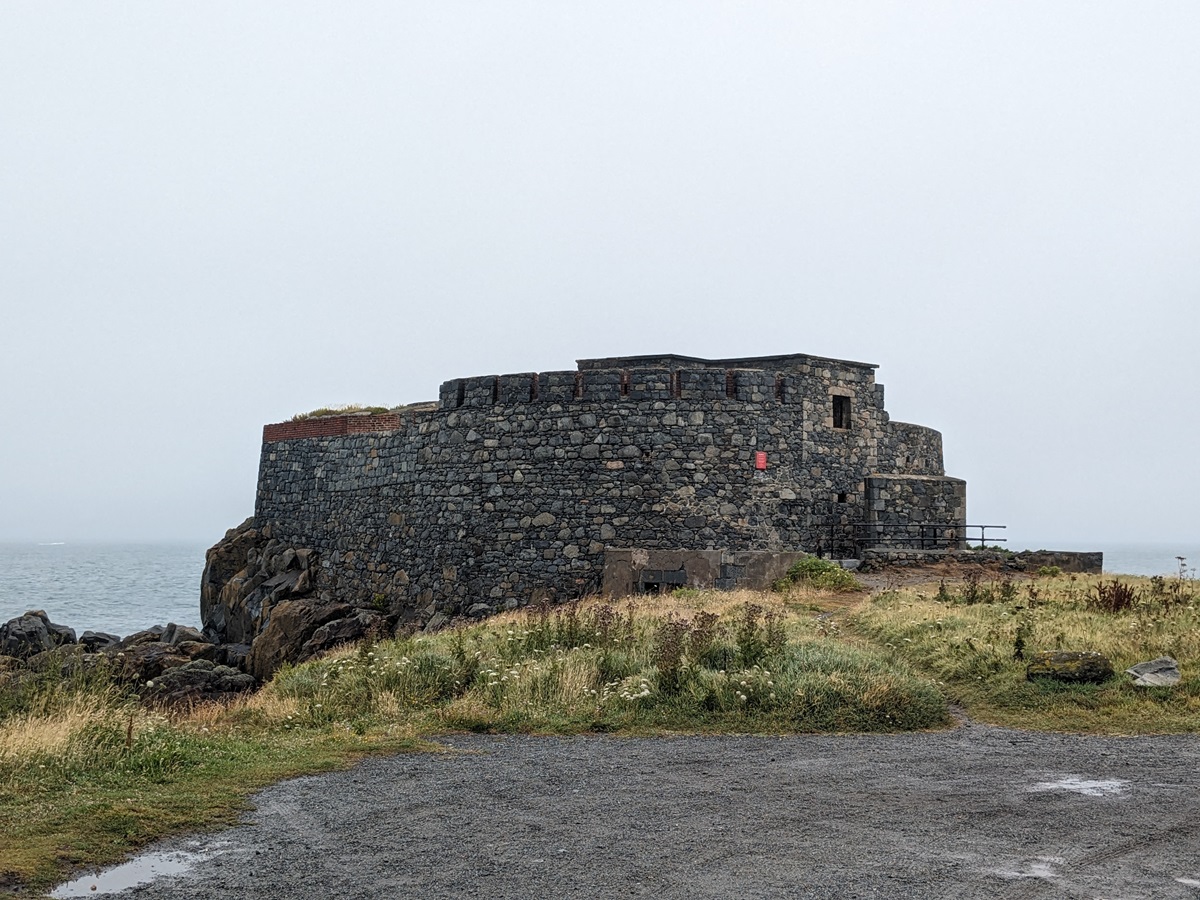
The path then followed a tarmac lane, passing Fort Pezeries, a 17th-century coastal defence fort perched on a headland and offering uninterrupted views across the sea. It was built to protect the southern part of Rocquaine Bay. Shortly after, we arrived in Portelet Harbour, where we decided to stop for lunch overlooking the sea before resuming our walk along Rocquaine Bay.
At this point, the scenery changed completely. We went from rugged coastline to long and open beaches. Following Rocquaine Bay, you have a choice of route depending on tides. As the tide had started receding, we were able to walk down the pebbly beach, carefully making our way between some seaweed as well as some puddles, as the water was still covering sections of the beach. During high tide, the only option is to follow the main road with no pavement, which at times can get very busy. Once at the top end of the bay, we followed the path round L’Eree Headland, visiting L’Eree Gun Battery and Fort Saumarez along the way. The last couple of miles of today’s walk were mostly on the paths alongside the main coastal road, occasionally running out, which resulted in us walking on the main road (obviously with caution).
Day 3: Vazon to Les Dicqs
We woke up this morning to grey skies and some heavy rain. Luckily, by the time we finished our breakfast and were ready to leave, the rain had eased off and turned into a fine drizzle.
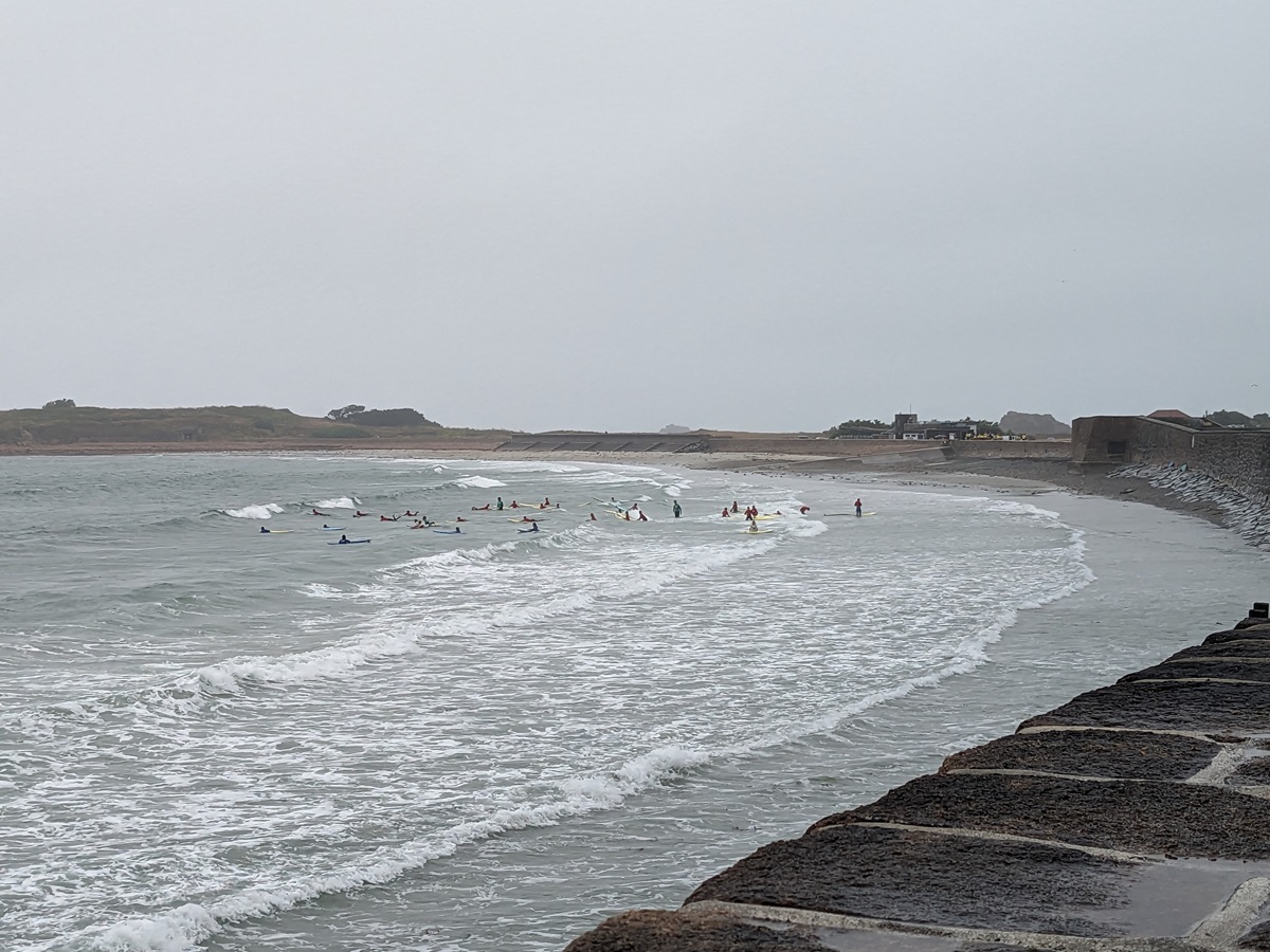
The forecast was not looking too promising, though, so we put our waterproof jackets on and set off. The first section of our walk took us down the broad promenade path, passing Loophole Tower no. 12, as well as another one of the German bunkers. Vazon Bay is popular with surfers, and due to the suitable weather conditions, we spotted a large group enjoying a surfing lesson.
The path then wandered round the headland dominated by Fort Hommet, which dates back to 1680. From there, we took an easy coastal path followed by a footpath along the side of the road, which led us into the centre of Cobo, where we decided to stop for a cuppa just as the rain started to get heavier.
From Cobo, the path took us towards Les Grandes Rocques headland with its Battery and Fort. We then skirted around the bay of Port Soif with its small but beautiful sandy beach, followed shortly after by the shingle beach of Portinfer. We passed a clay pigeon shooting range, which, when in use (this is mostly on weekends), requires you to take a shortcut bypassing the headland. The coastal path then runs parallel to the road round the pebbly Baie des Pequeries before circling round the rocky headland of Pulias, followed by the sandy bay of Baie de Port Grat.
Next, we entered Grand Havre Bay at Rousse Headland with its loophole tower (no. 11), and shortly after found ourselves outside our overnight accommodation, the Peninsula Hotel. As we arrived there just after midday and the rain was slowly starting to ease off, we decided to carry on walking a bit further and then get the bus back to Les Dicqs.
We followed the path that runs parallel to the coastal road round the bay, passing Picquerel Point, where a German bunker is embedded in a little headland, the Amarreurs Harbour, and Ladies Bay, which sit at the edge of L’Ancresse Common, partly occupied by the Royal Guernsey Golf Club, before finally arriving at the top end of the bay at Chout headland with yet another loophole tower, no. 10.
We headed down to Pembroke Bay, a delightful sandy beach that forms part of L’Ancresse Bay. We continued along L’Ancresse Common, the other side of which we passed earlier in the walk by the Grand Havre, passing several loophole towers along the way (Nos. 9, 7 & 6 – No. 8 was destroyed during World War II). Once on the other side of the bay, we circled round a small headland which houses the Nid de l’Herbe Battery and another loophole tower, no. 5.
The path then took us past a rifle range and another loophole tower (no. 4) to head out onto the long, narrow headland at one of the most northern points of the island and the top end of Fontenelle Bay. At the end of the headland stands Fort Le Marchant, built in 1680. Originally known as Fort L’Angle, it was expanded in 1805, and the new fort was named after the then Lieutenant Bailiff Eleazar Le Marchant.
We skirted round Fontenelle Bay, passing some shingle beaches along the way, and walked towards Fort Doyle. Fort Doyle stands on the north-east corner of Guernsey; it was completed in 1805 as part of a wide fortification network designed to protect the island against a French invasion. On a clear day, you get to see the islands of Herm and Jethou from here, which unfortunately wasn’t the case for us.
From here, the path headed inland slightly, passing behind the Beaucette Marina, which is in a flooded granite quarry, and shortly after we headed inland to the Le Déhus Dolmen, a prehistoric passage grave approximately 10 metres in length, which dates back to 3500 BC. It has a narrow entrance and a broad chamber with small chambers either side of the passage. One of the capstones has a remarkable carving featuring a bearded face, arms and hands, what appears to be a strung bow, and a series of symbolic designs.
We decided to finish our walk here and caught the bus back to our overnight accommodation.
Day 4: Les Dicqs to St Peter Port (or in our case Le Déhus Dolmen to St Peter Port)
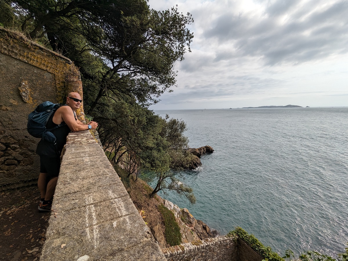
Having returned to Le Déhus Dolmen, where we finished our walk yesterday, we followed the coastal path towards Bordeaux Harbour, a picturesque harbour with fishing boats scattered along the shore.
We then proceeded towards the industrial harbour of St Sampson’s, stopping to have a look around Vale Castle along the way. From there, we were really getting close to the end. The scenery changed quite a lot, as we were now heading through the residential area around Belle Grève Bay, with St Peter Port seen in the distance.
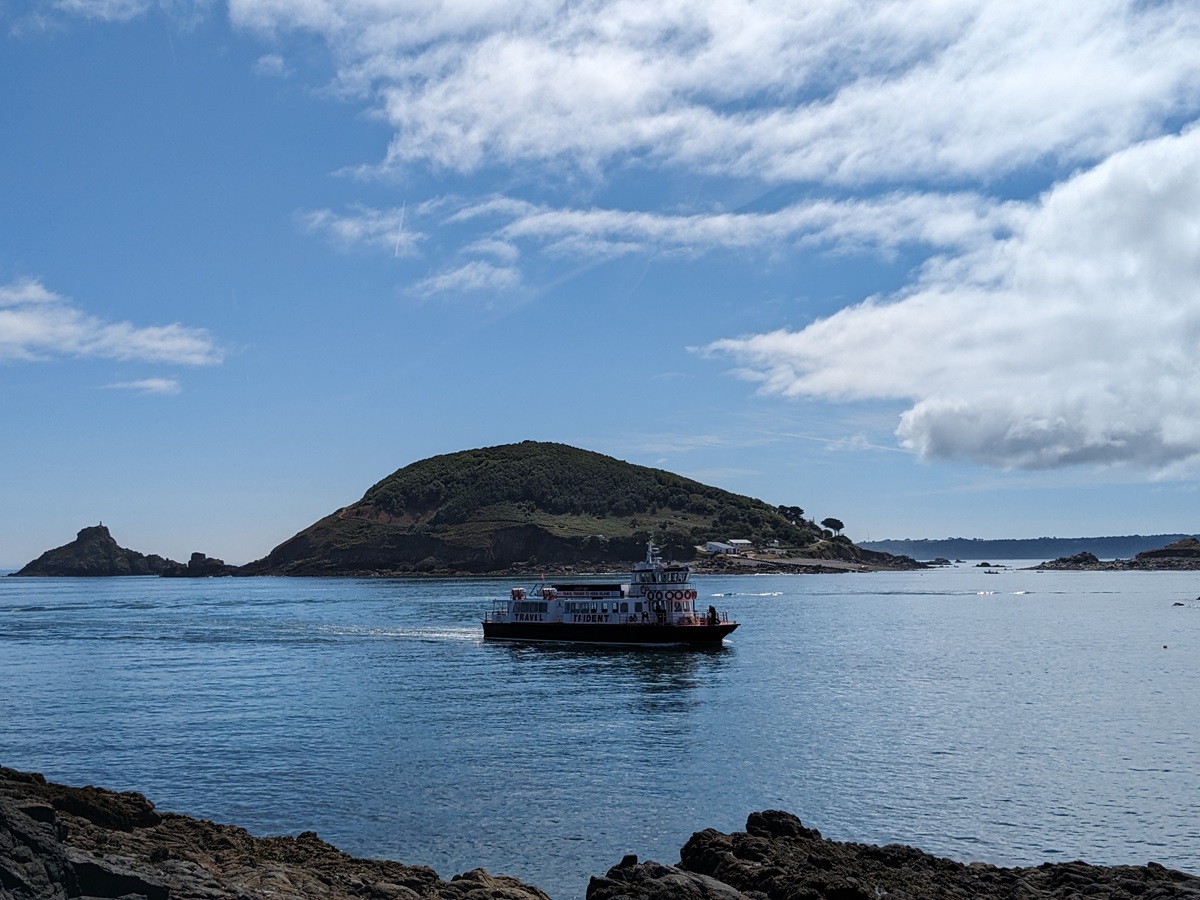
We arrived back in St Peter Port just after 11am and decided to catch a ferry across to Herm Island.
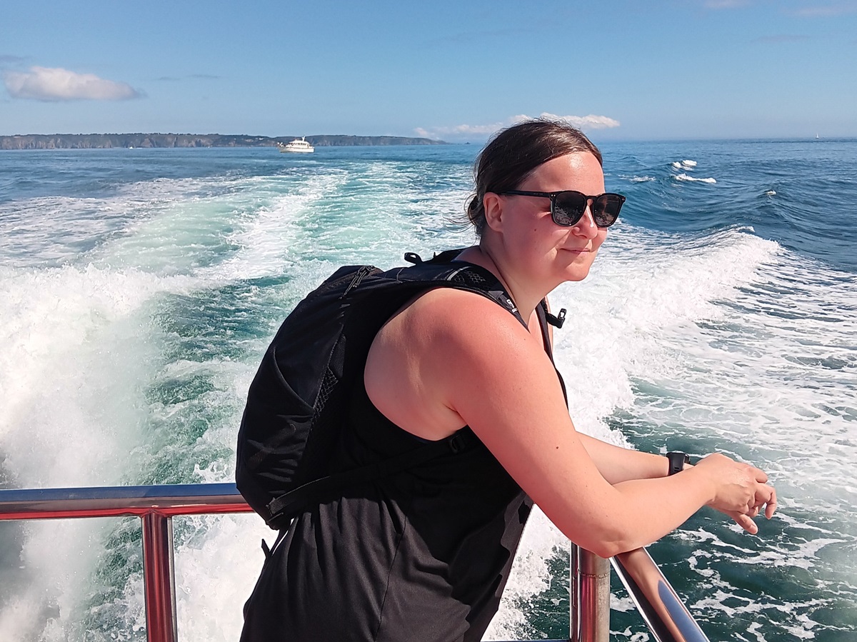
Herm is one of the smallest of the Channel Islands, located 3 miles from Guernsey. The ferry from St Peter Port takes 20 minutes, so we arrived on Herm just after midday. We decided to walk all round the island; after all, it wasn’t even a 4-mile walk.
Herm has a permanent population of around 65. Motor vehicles and bicycles are not allowed on the island, so the primary mode of transport for visitors is walking. There is only one short road on the island, which can only be used by a handful of quad-bikes and tractors used by residents.
We set off from the harbour and decided to follow the path anticlockwise round the island, as it seemed that everybody was heading in the opposite direction.
We followed the path round the southern tip of the island, with quite a few ups and downs, passing Point Sauzebourge and heading towards Puffin Bay. It was here we met a German couple and started chatting to them, as we were curious what they were looking at through their binoculars. They’ve been coming to the Channel Islands on holiday for many years, and each time they stay on Guernsey, they make sure that they visit Herm at least once due to its abundance of wildlife. They very kindly lent us their binoculars, so we could catch a sight of many puffins with their lovely orange beaks. We said our goodbyes and carried on with our walk towards Belvoir Bay.
On this section of the walk, we spotted a variety of birds, e.g., oystercatchers, cormorants, and gulls, to name a few. The eastern and southern part of the island was a complete contrast to where we had just come from. This part of the island is quite flat, with sandy Shell Beach taking up most of the north-east coast. Shell Beach is definitely one of the most popular places on the island, with a lot of people sunbathing and swimming round that bit of the island. We decided not to stop there, as it was a bit too busy for us, and carried on walking round the northern tip of the island, full of wildflowers, before arriving at Fisherman’s Bay. We decided to dip our toes in the sea here; after all, it was probably going to be our last chance to do it, but even in the middle of July, the water was freezing cold.
We had a lovely lunch at the local Mermaid Tavern before exploring the centre of the island. There are some lovely stone houses in the middle of the island, some occupied by the locals, others used as holiday lets. There is also a small chapel of St Tugual’s, dating back to the 11th century. Overall, we had a lovely afternoon on the island, exploring its stunning sites – from white sandy beaches and turquoise waters to clifftop paths and traditional stone buildings. On the way back to Guernsey, our boat skipper spotted some seals on the nearby rocks and slowed the boat down, so we caught a sight of two grey seals basking in the afternoon sun – a great end to our Channel Island adventure!
Summary
I was positively surprised by the scenery along the Guernsey Coastal Path; no two days were ever the same. It varied from dramatic cliff paths to quiet wooded trails, open headlands, long beaches, and historic sites tucked into nearly every corner.
This walk would appeal to anyone looking for a quieter walk in nature, as on most days we would hardly meet anybody on our walk.
I would definitely recommend adding an extra day or two at the end of your holiday to allow time to explore some of the smaller Channel Islands. Herm was definitely worth a visit, so I’m glad we managed to alter our walking days slightly to allow us an afternoon visit to the island.
Ready to walk the Guernsey Coastal Path?
We offer two itineraries on the Guernsey Coastal Path making a clockwise circuit over four or five days beginning and ending in the island’s capital, St Peter Port. Email us at [email protected] or call 017687 72335 to speak to one of our walking holiday experts, and book your 2026 Channel Island adventure.