Northern England offers an incredible variety of walking holidays, from dramatic coastlines and rolling countryside to historic trails that reveal traces of the past.
Whether you’re drawn to the rugged beauty of the North York Moors and the Yorkshire Dales, the sweeping beaches and castles of the Northumberland coast, or the challenge of classic long-distance routes such as the Coast to Coast and the Pennine Way, each route offers its own rewards.
Explore moorland and farmland, follow winding valleys, or walk in the footsteps of Roman legions along Hadrian’s Wall – wherever you choose, you’ll discover landscapes shaped by history, and full of distinctive northern character.

Cleveland Way
Experience two contrasting landscapes on this route, from the rugged, heather-clad moorland to the dramatic, cliff-top coastline, each offering breathtaking views.
Marvel at the medieval ruins of Helmsley Castle and Rievaulx Abbey.
Enjoy breathtaking views from the dramatic Sutton Bank escarpment.
Summit Roseberry Topping, the Yorkshire Matterhorn, for a rewarding panorama.
Follow high sea cliffs from Saltburn to Filey, with spectacular coastal views.
Explore Whitby’s historic harbour and the atmospheric ruins of Whitby Abbey.
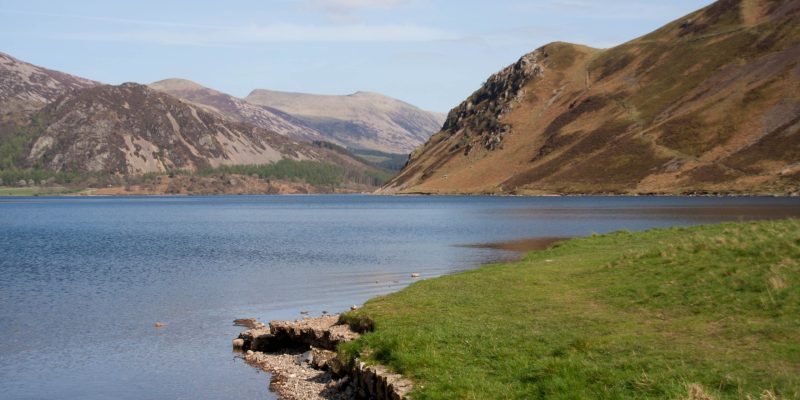
Coast to Coast Path
A breathtaking cross-section of the North’s countryside, this trail takes you through valleys and mountains, over windswept moorland and along coastal footpaths.
Follow in the footsteps of Alfred Wainwright on England’s most famous long-distance trail.
Cross three national parks – the Lake District, Yorkshire Dales, and North York Moors.
Enjoy welcoming villages with charming pubs and traditional tearooms.
Discover centuries of history, from ancient stone circles to Norman castles and abbeys.
Enjoy the challenge of crossing Kidsty Pike, the highest point on the Coast to Coast.
Dales High Way
A glorious journey over the magnificent high country of the Yorkshire Dales and the imposing Howgill range revealing stunning views every step of the way.
Explore the village of Saltaire, a designated UNESCO World Heritage Site.
Discover prehistoric rock carvings and a Bronze Age stone circle on Ilkley Moor.
Walk over Ingleborough, one of the magnificent Yorkshire Three peaks.
Traverse the length of the Howgill Fells in a tremendous six mile ridge walk.
Return to the start on the iconic Settle to Carlisle railway line.
Dales Way
A peaceful, riverside walk through Yorkshire’s beautiful countryside, passing through scenic landscapes and charming picture postcard villages.
Walk alongside the tranquil waters of the River Wharfe and River Dee.
Explore classic Dales landscapes, with dry stone walls and wildflower-filled meadows.
Wander through charming villages and character filled market towns.
Spot an array of birdlife, from dippers and wagtails to skylarks and meadow pipits.
Finish on the shores of Lake Windermere, England’s largest lake.
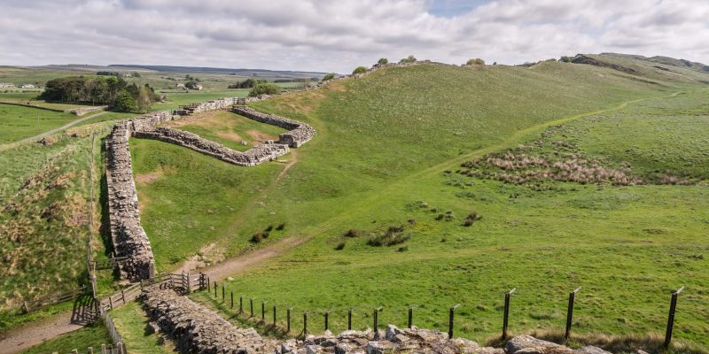
Hadrian’s Wall Path
Follow the iconic Roman wall across the northern countryside, meandering through rolling moorland and lush meadows, where history and nature intertwine.
Follow the most extensive Roman remains in the world.
Experience wildlife sightings, including red squirrels, deer, and a variety of birdlife.
An easy to follow trail with well-trodden paths and clear waymarking.
Explore historic sites such as Chesters, Housesteads, Vindolanda, and Birdoswald.
Explore the breathtaking Solway Coast, a haven for birdwatchers.
Herriot Way
A charming route across wildflower meadows and past centuries-old limestone barns and dry-stone walls, showcasing the beauty of Yorkshire’s rural landscape.
See the stunning parts of the Yorkshire Dales described by James Herriot.
Enjoy a mix of landscapes, from gentle riverside paths to heather-clad moorland.
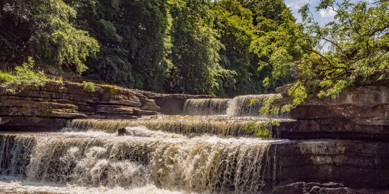
Visit Aysgarth Falls, the impressive triple-drop waterfall.
Walk through Swaledale, with its wildflower meadows and iconic limestone barns.
Visit the home of Wensleydale Cheese in the market town of Hawes.
Lady Anne’s Way
From the rugged, windswept fells to the tranquil valleys, this route is a journey through stunning natural beauty and fascinating historic sites.
Explore castles, churches, and monuments linked to Lady Anne’s legacy.
Walk through the dramatic valleys of Wensleydale and Mallerstang.
Enjoy the peaceful charm of the Eden Valley, with its scenic riverside trails.
Stroll through unspoilt villages and historic market towns.
End your journey at the impressive Brougham Castle.
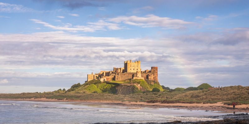
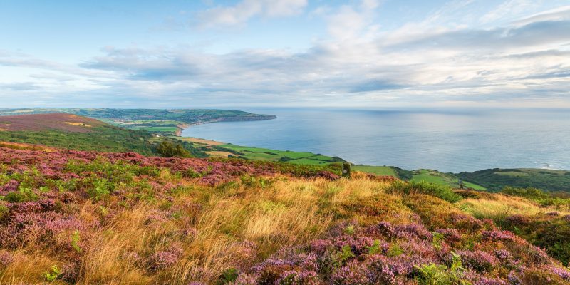
Northumberland Coast Path
Experience this dramatic coastline, rich in history and wildlife, with stunning sea views and the peacefulness of a less-travelled route.
A string of dramatic castles along the coast punctuate your walk.
Enjoy gentle, easy walking on well-marked trails with stunning scenery at every turn.
Wander through rolling dunes, saltmarshes, and coastal wildflower meadows.
Enjoy splendid views out to Coquet Island and the Farne Islands.
Take in the historic charm of Berwick-upon-Tweed, with its Elizabethan town walls.
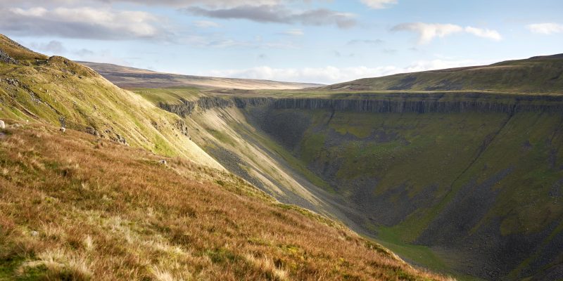
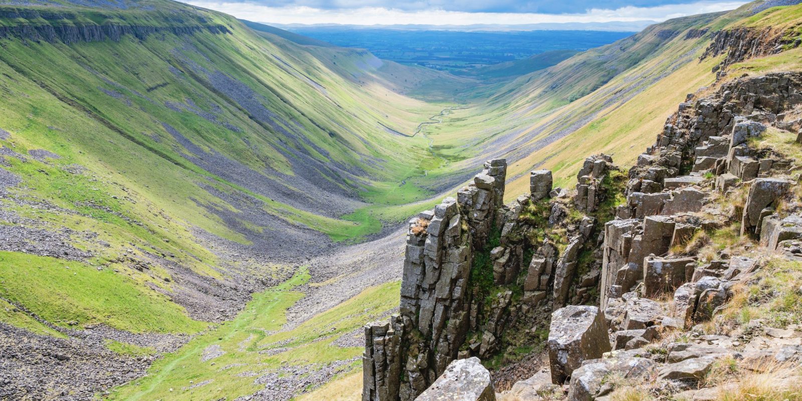
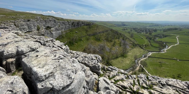
Pennine Way
A magnificent hike traversing the wild and beautiful upland landscapes of the Pennines, with some of the most stunning panoramas in the country.
Enjoy the challenge of Britain’s oldest and most iconic National Trail.
Visit Kinder Scout, Bleaklow and Black Hill, some of the finest walking in the Dark Peak.
Marvel at High Cup Nick, a magnificent U shaped example of glacial erosion.
Explore the impressive Malham Cove and Watlowes dry valley.
Walk along the best preserved section of Hadrian’s Wall.
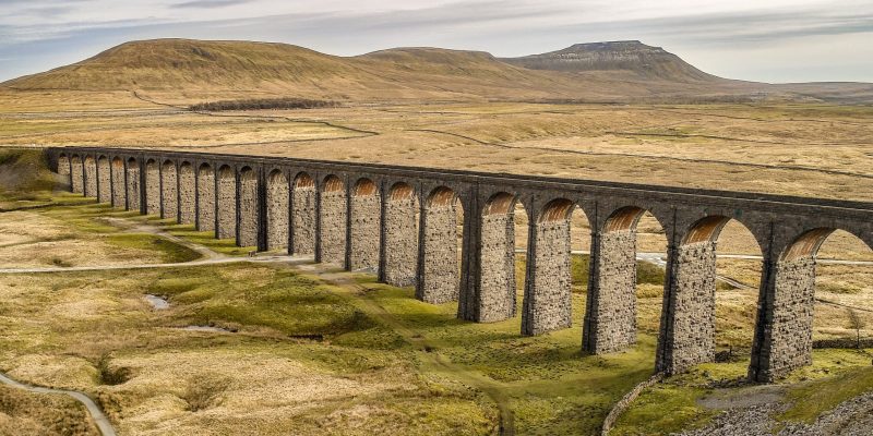
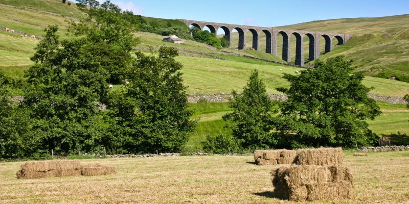
Settle to Carlisle Way
Experience the limestone valleys of the Yorkshire Dales before heading into quiet Cumbrian farmlands, enjoying peaceful, rural landscapes and beautiful views.
Follow the route of one of Britain’s most scenic rail journeys.
Wind your way between the iconic Yorkshire Three Peaks.
Marvel at Ribblehead Viaduct and Blea Moor Tunnel.
Traverse the limestone country of the Yorkshire Dales.
Discover Long Meg and her Daughters stone circle.
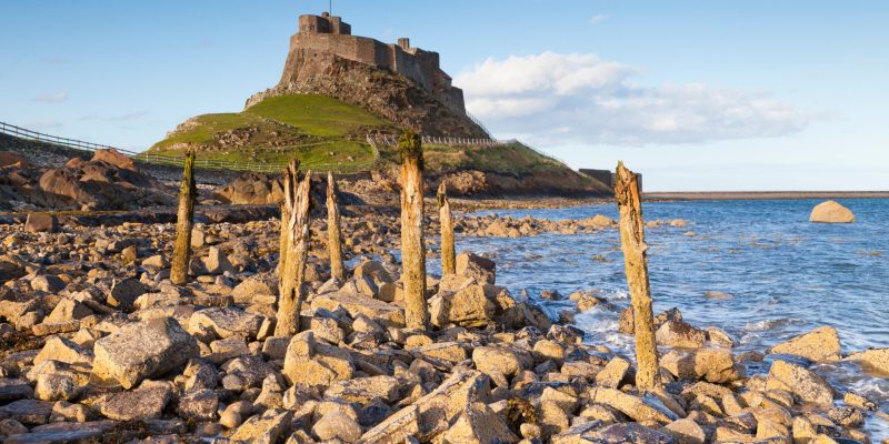
St Oswald’s Way
Enjoy spectacular coastal walking, then journey inland to meet the historic Hadrian’s Wall, a perfect blend of both coastal and cultural highlights.
A great route linking the Northumberland Coast with Hadrian’s Wall.
Start on Holy Island, with its castle, ruined priory, and seal colony.
Enjoy the dramatic Northumberland coastline, from Lindisfarne to Warkworth.
Step back in time and discover Neolithic rock art, Roman sites and medieval castles.
Spot seals, dolphins, red squirrels, and rare butterflies in their natural habitats.
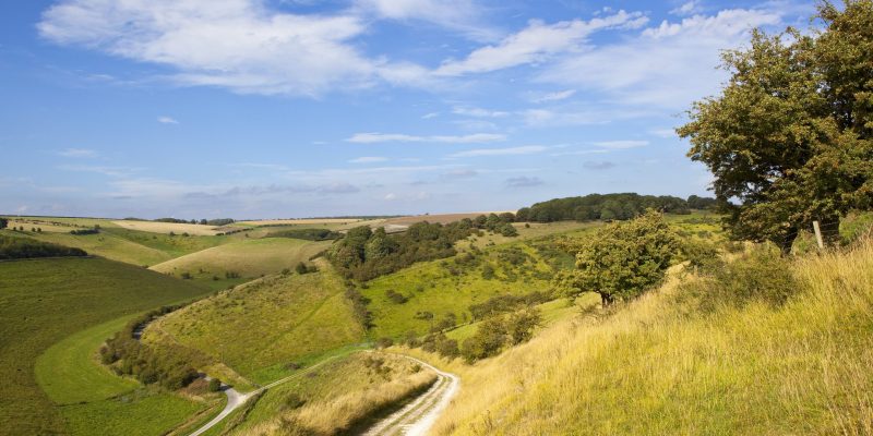
Yorkshire Wolds Way
A route defined by its striking dry valleys, carved after the Ice Age, this walk offers quiet, undulating landscapes and sweeping views of the Wolds’ rolling hills.
Enjoy gentle trails and good paths through an unspoilt rural landscape.
Experience rolling chalk hills and the unique dry valleys shaped after the Ice Age.
Marvel at the mighty Humber Bridge, once the world’s longest single-span bridge.
Spot Red Kites and enjoy the rich wildlife that thrives in the Wolds’ tranquil valleys.
Escape the crowds, slow down, and enjoy nature at its most peaceful.