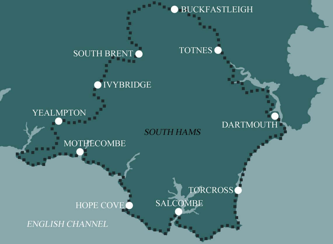
South Hams Way
Our 10 day option begins with a gentler pace, enjoying 4 shorter days across the moors before following the same pattern as the 8 day itinerary along the South West Coast Path and through the Dart Valley.
Itinerary
| Day | Itinerary | Miles | Km |
|---|---|---|---|
| Day 1 | Travel to Totnes for your first nights accommodation | ||
| Day 2 | Totnes to Buckfastleigh | 7 | 11 |
| Day 3 | Buckfastleigh to South Brent | 9 | 14 |
| Day 4 | South Brent to Ivybridge then transfer to back to South Brent | 7 | 11 |
| Day 5 | Transfer back to Ivybridge then walk to Yealmpton | 9 | 14 |
| Day 6 | Yealmpton to Mothecombe then transfer back to Yealmpton | 13 | 21 |
| Day 7 | Transfer to Kingston, walk to Hope Cove then transfer to Salcombe | 11 | 18 |
| Day 8 | Transfer back to Hope Cove then walk to Salcombe | 8 | 13 |
| Day 9 | Salcombe to Torcross then transfer to Dartmouth | 13 | 21 |
| Day 10 | Transfer back to Torcross then walk to Dartmouth | 11 | 18 |
| Day 11 | Dartmouth to Totnes | 14 | 23 |
| Day 12 | Depart from Totnes after breakfast |
Prices
| Accommodation, map & guidebook only | £1460 |
| with Luggage Transport | £1610 |
Other Options |
|
| Extra Nights (per night) | £104 |
| Single Supplement (per night) | £75 |
| Solo Luggage Supplement (per day) | £15 |
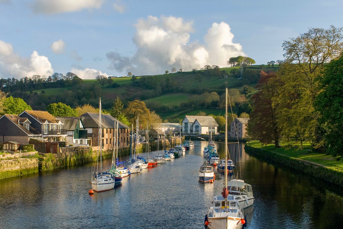
Totnes to Buckfastleigh
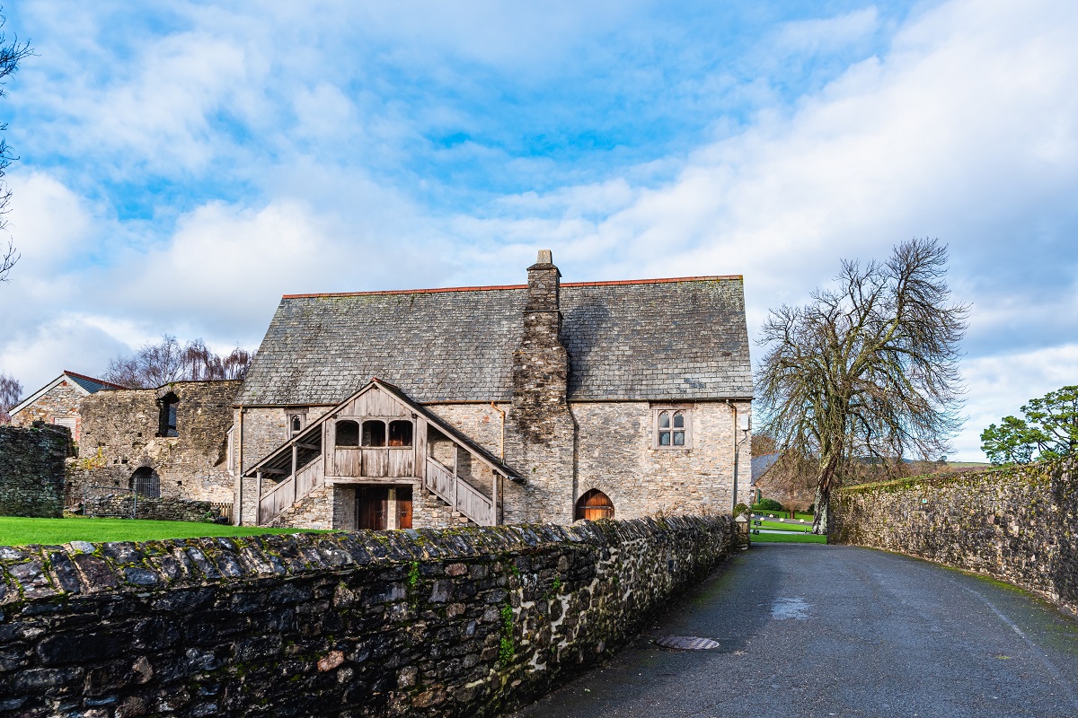
Leaving the historic market town of Totnes behind, the South Hams Way sets out along the River Dart, where the faint rumble of trains from the South Devon Steam Railway adds a touch of nostalgia to the opening miles. Soon the route carries you into the Dartington Estate, a landscape steeped in history and creativity, where medieval architecture mingles with modern-day arts, gardens, and deer-park views.
From here, the trail dips into North Wood, a shady stretch alive with birdsong, before rejoining lanes that lead across the River Dart once more at picturesque Staverton Bridge. The neighbouring heritage railway station offers a timely pause, with the chance of tea and cake served from a converted buffet car.
The path continues through fields and green lanes, gradually climbing to deliver wide-open views across the Dart Valley and out towards the distant line of Dartmoor. A final woodland descent leads you to the old stone arches of Austin’s Bridge, and from here it’s a gentle riverside stroll into the lively little town of Buckfastleigh, best known for its abbey, tonic wine, and warm West Country welcome.
Buckfastleigh to South Brent
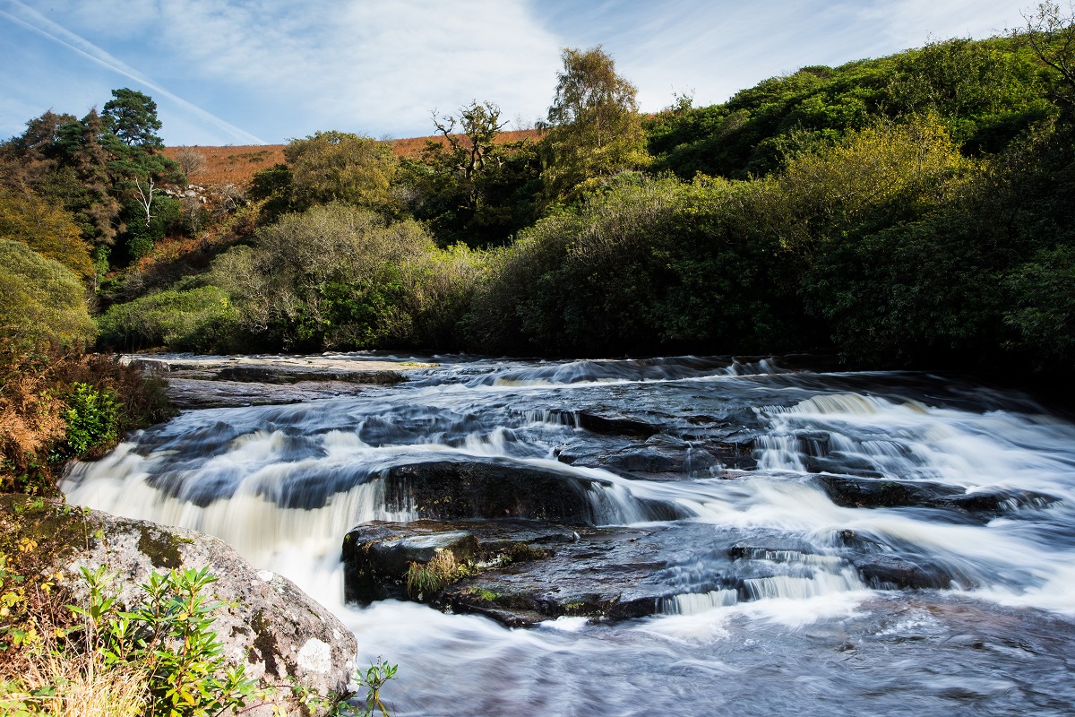
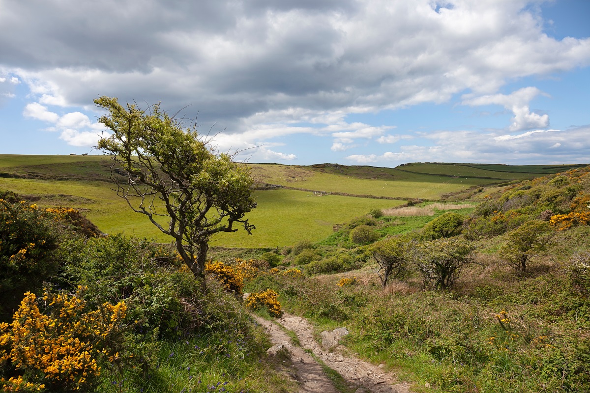
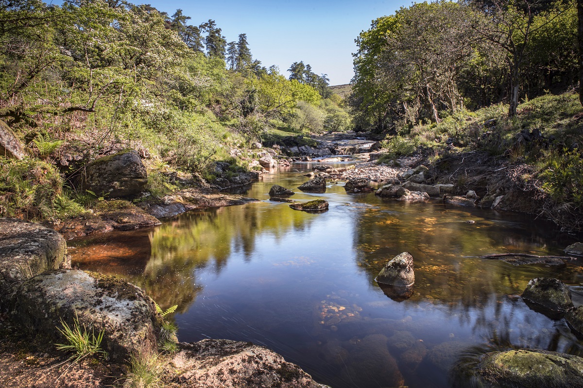
Leaving Buckfastleigh behind, the path weaves its way through quiet lanes and fields before striking out towards the wild edge of Dartmoor. Early on, the route threads through shady woodland beside the Dean Burn, with the stream reappearing later in the walk beneath a graceful old clapper bridge. From here, you begin to climb, rewarded with sweeping views back over South Devon’s rolling countryside and ahead to the brooding slopes of the moor.
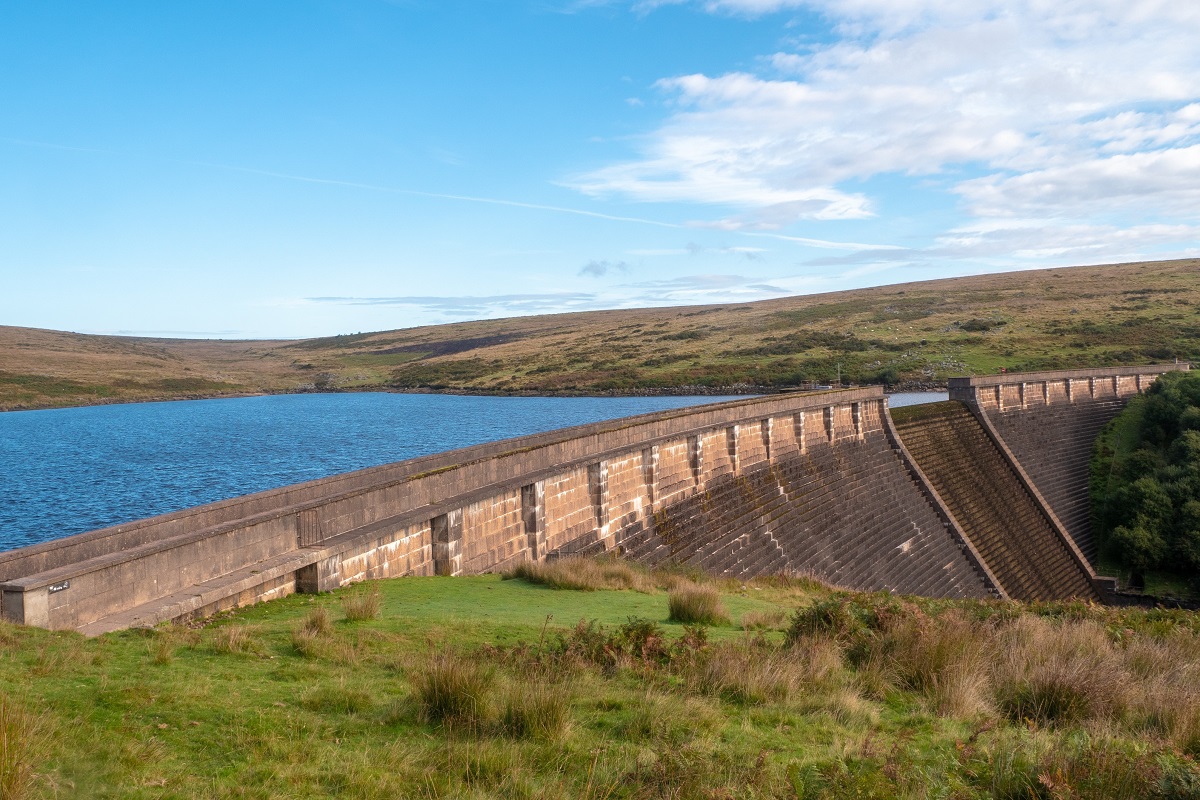
Soon the trail reaches Water Oak Corner, although there are no longer any old oaks here, instead replaced by conifers and a mixture of native trees, and continues across open ground with fine views of the Avon Reservoir glinting in the valley below. A green track carries you down past the reservoir dam and into the deep-sided Avon Valley, where the ruins at Shipley Bridge recall the area’s quarrying past.
The final miles follow quiet paths and lanes through scattered hamlets such as Didworthy and Lutton, before a gentle descent leads you into the welcoming village of South Brent, with Dartmoor now firmly at your back.
South Brent to Ivybridge
From South Brent, the South Hams Way meanders through lanes and along riverside paths, climbing gradually toward Ugborough Beacon, offering 360° views of open moorland to the north and the South Hams countryside to the south. Along the way, you’ll pass intriguing historic features, including the Neolithic chambered tomb at Cuckoo Ball and the site of Moorhaven, a former asylum now repurposed into a striking residential area.
The route then follows the Redlake Tramway, a relic of the clay works that once powered the local economy, before descending toward the town of Ivybridge. Here, the River Erme winds through the streets, past landmarks such as the 16th-century hump-backed bridge that gives the town its name, and the former Stowford Paper Mill, which shaped the community for centuries. A welcoming mix of historic buildings and modern facilities signals the end of the day’s walk, but do take time to explore.
Ivybridge to Yealmpton
Leaving Ivybridge behind, the South Hams Way follows the Erme Plym Trail, tracing the River Erme through leafy parkland and quiet tracks before breaking out into open fields. The route threads its way past the crooked spire of Ermington’s church, with an optional detour into the village for refreshments, before rejoining the riverbank. Crossing Sequers Bridge, you enter the grand estate lands of Flete, where glimpses of the castle appear across the rolling parkland.
From here, the trail winds along woodland edges and field paths, offering a mix of rural calm and sweeping views back over the valley. The walking is varied but never too taxing, with a steady rhythm of lanes, stiles and meadows. Passing the hamlet of Dunstone, the path dips into woodland once more before emerging alongside the River Yealm. Here the way curves gently toward Yealmpton, a lively South Hams village with shops, pubs and good transport links – a lovely end to this rewarding stage of the journey.
Yealmpton to Mothecombe
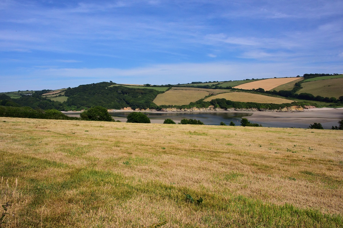
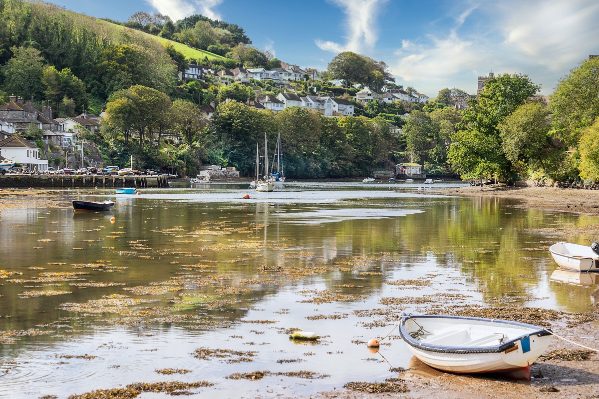
Bidding farewell to Yealmpton, the trail initially follows quiet lanes and riverside paths along the River Yealm, weaving through woodland and open fields. The route rises and falls over gentle hills, with occasional glimpses of Dartmoor on the horizon and Kit Hill in the distance. Passing through the historic estate of Membland, you’ll encounter fine parkland and evocative remnants of Devon’s past, before descending toward the tidal creeks at Newton and Noss, where the river widens and the walking feels closer to the sea.
From here, the trail climbs again onto the headland, entering the National Trust’s The Warren and offering spectacular coastal views across the Mewstone, Rame Head, and on a clear day, even Eddystone Lighthouse far offshore. Following the South West Coast Path along cliff-top tracks, the route passes historic ruins, beaches, and caravan parks, with options for gentler deviations where needed. The day ends at Mothecombe, where a café beside the car park provides a welcome chance to relax and enjoy the dramatic South Devon coastline.
Kingston to Hope Cove
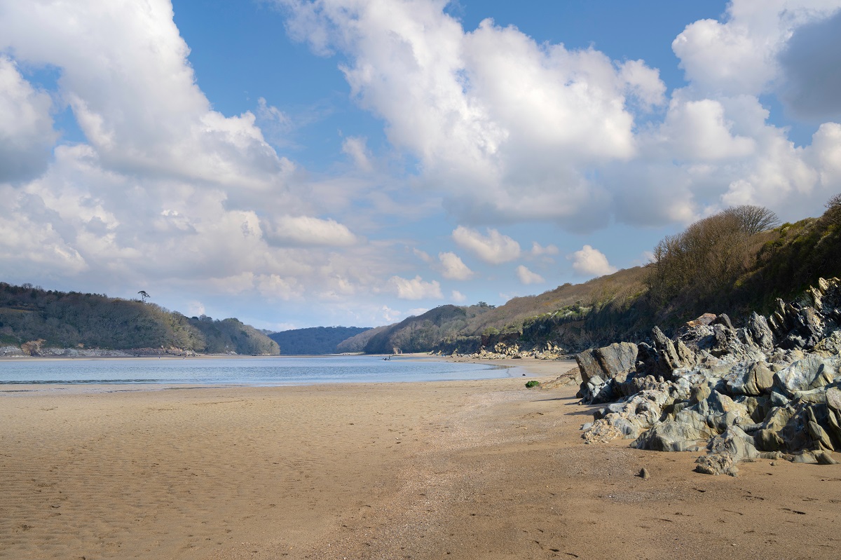
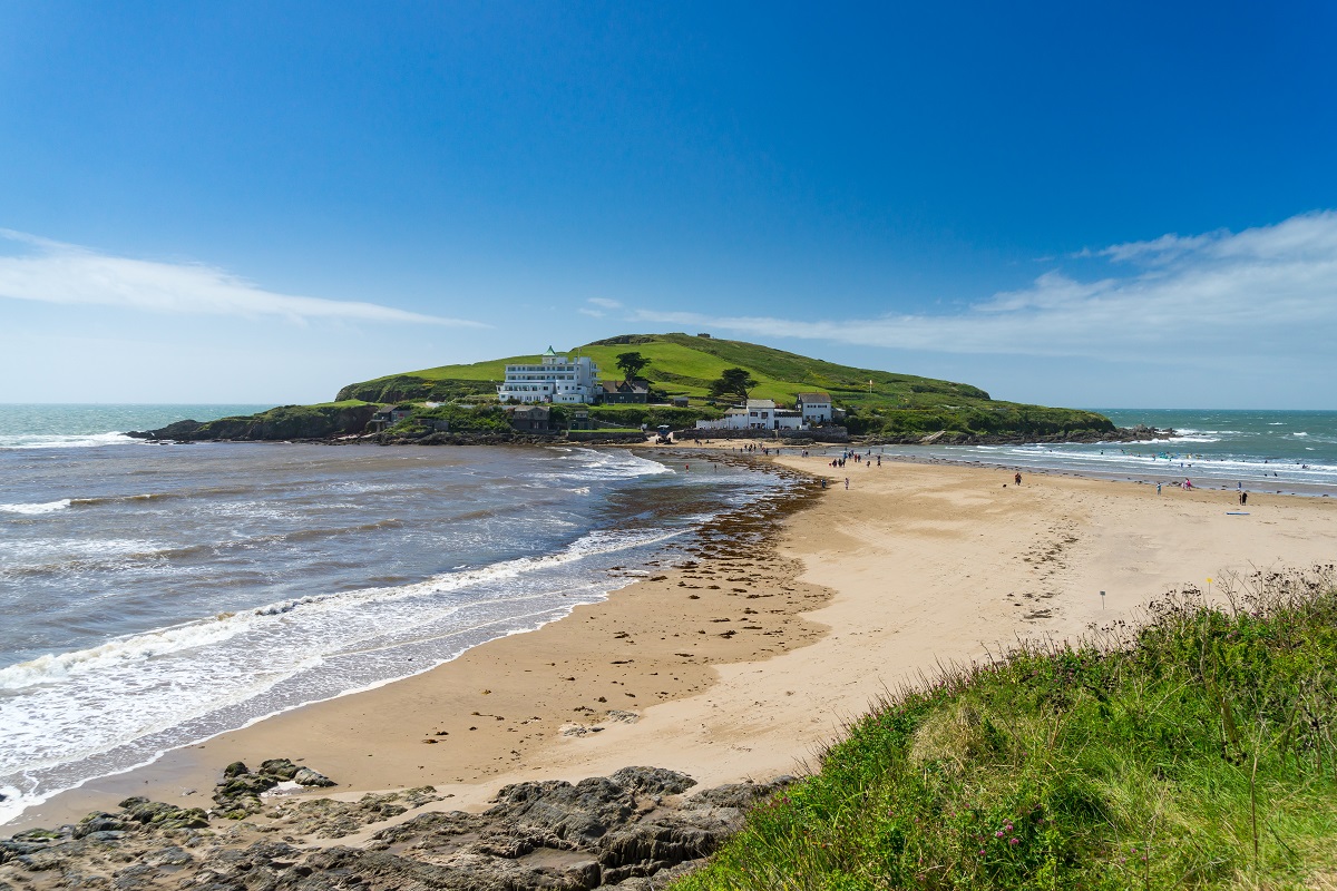
This is one of the most varied and rewarding stretches of the South Hams Way, rich in sandy bays, dramatic headlands, and timeless coastal villages. Having walked the short distance from Kingston to reach the coast at Wonwell, the path winds east, curving around secluded beaches at Westcombe and Ayrmer before reaching the small community of Challaborough. Ahead lies the unmistakable shape of Burgh Island, home to its famous Art Deco hotel and sea tractor, which trundles through the surf at high tide.
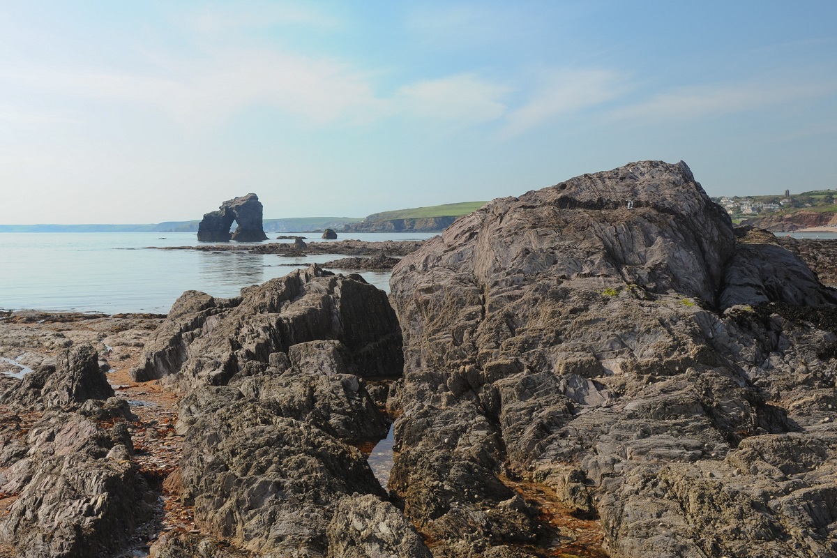
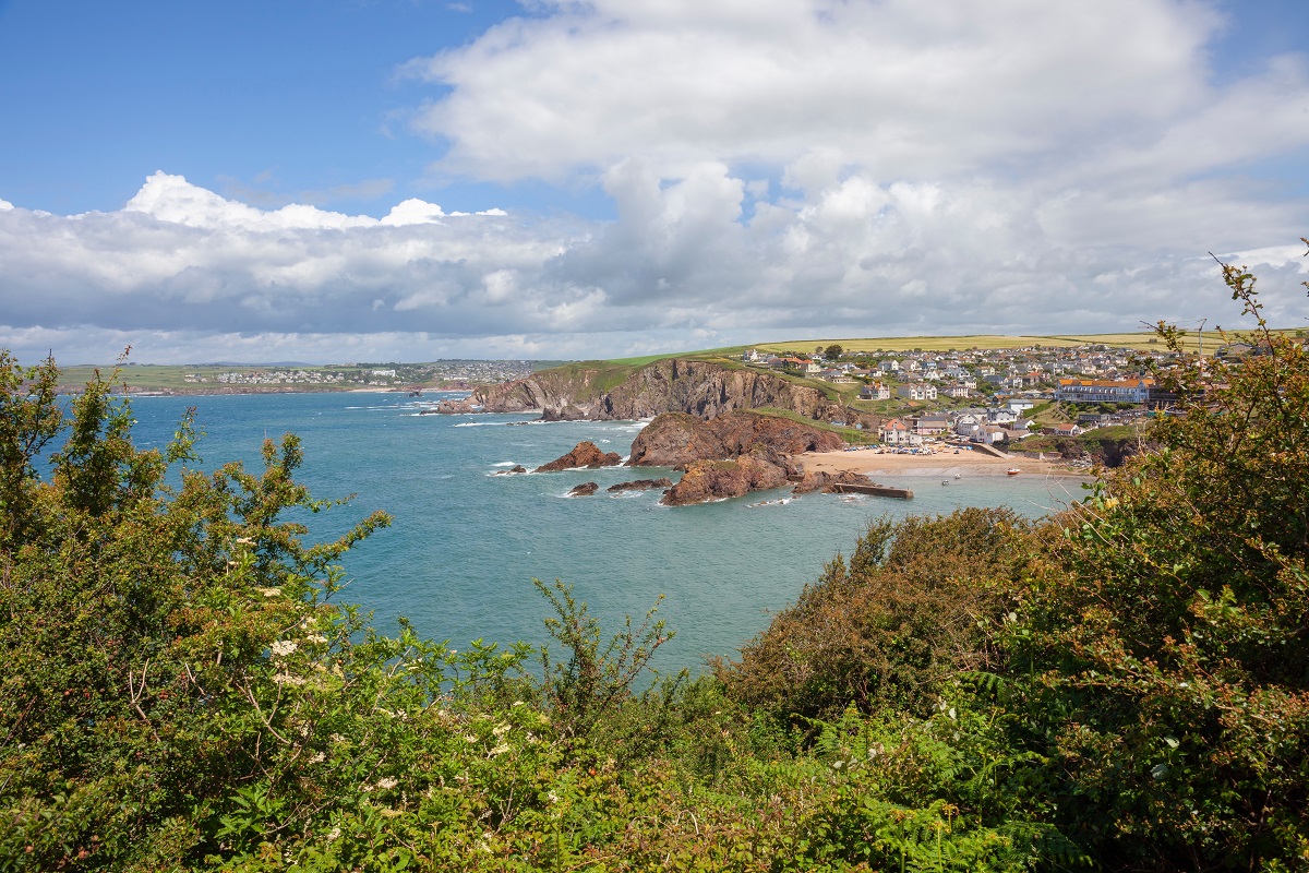
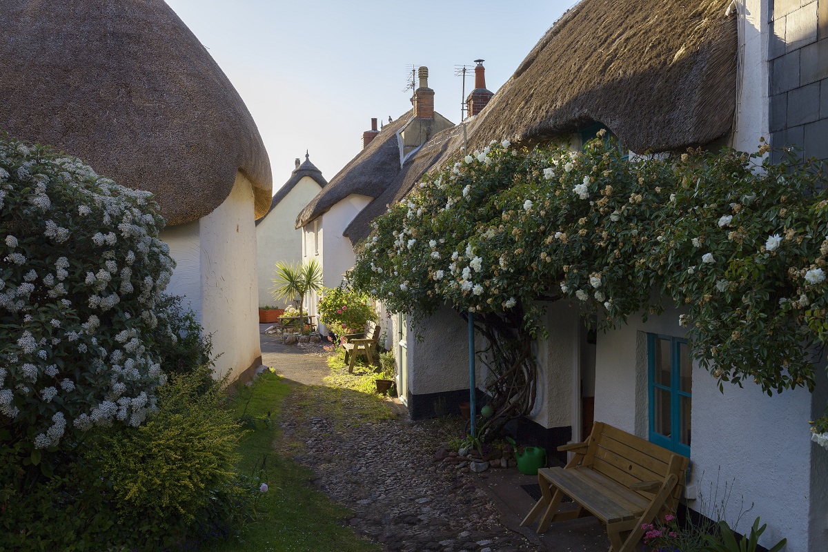
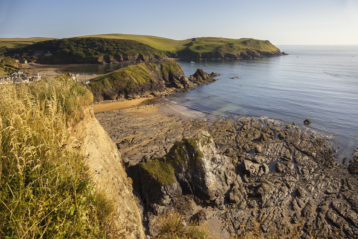
The route continues into Bigbury-on-Sea and across the Avon Estuary on the seasonal ferry. Once across, the coast path climbs above Bantham and the golden sweep of South Milton Sands, with Thurlestone Rock and the golf links marking the way. The final stretch follows easy cliff-top paths with constant sea views, before descending into the twin coves of Hope Cove, a once-thriving fishing village now famed for its charm, sandy beach, and picture-perfect thatched cottages.
Hope Cove to Salcombe
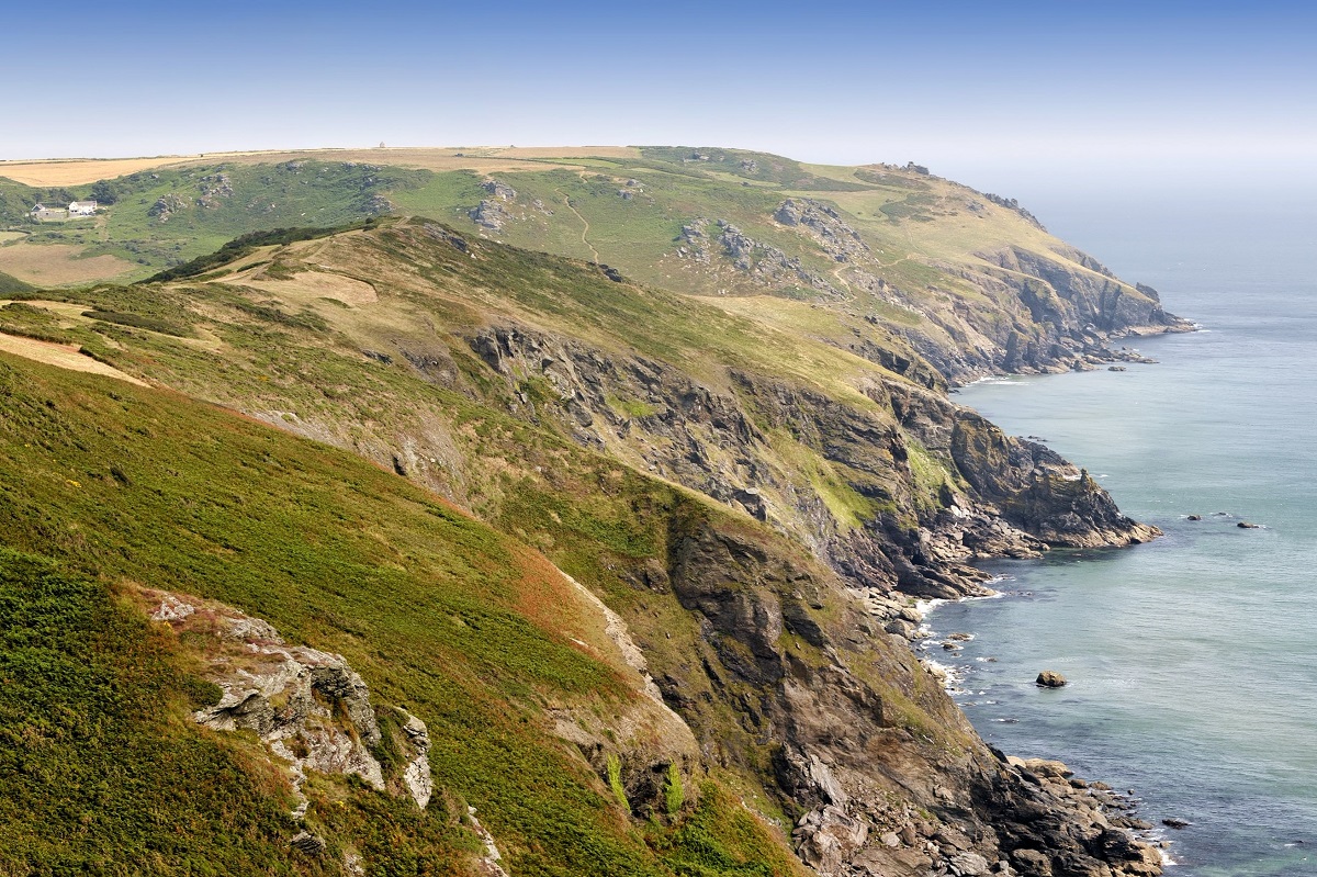
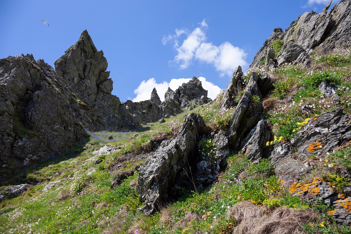
Leaving Hope Cove, the South Hams Way climbs onto Bolt Tail, where an Iron Age fort once watched over the sea. The headland gives way to the wide, open plateau of Bolberry Down, a National Trust haven of sweeping coastal views and accessible trails. From here the path dips steeply to Soar Mill Cove, a sandy notch in the cliffs, before pressing on along a dramatic rollercoaster of rocky paths towards Bolt Head.
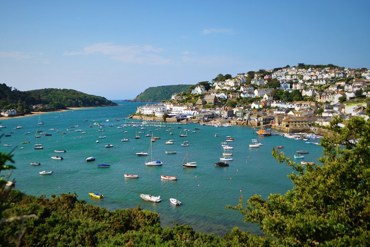
This stretch is exhilarating and exposed in places, but the rewards are huge: endless sea views, soaring cliffs, and the hidden beauty of Starehole Bay. Rounding the headland, the first views of Salcombe and its estuary appear – a glittering scene framed by wooded hillsides. A detour here leads to Overbeck’s, the eccentric house and gardens of the National Trust.
The route continues past the sandy arcs of South Sands and North Sands before following Cliff Road into Salcombe itself, a lively harbour town brimming with cafes, pubs, boutiques, and maritime heritage.
Salcombe to Torcross
After the ferry ride across to East Portlemouth, the South Hams Way heads out past the sandy curve of Mill Bay and on towards Gara Rock, a headland where sweeping sea views begin to set the tone for this rugged stretch. Beyond Rickham Sand, the path narrows and clings to the cliffs en route to Prawle Point, the most southerly tip of Devon.
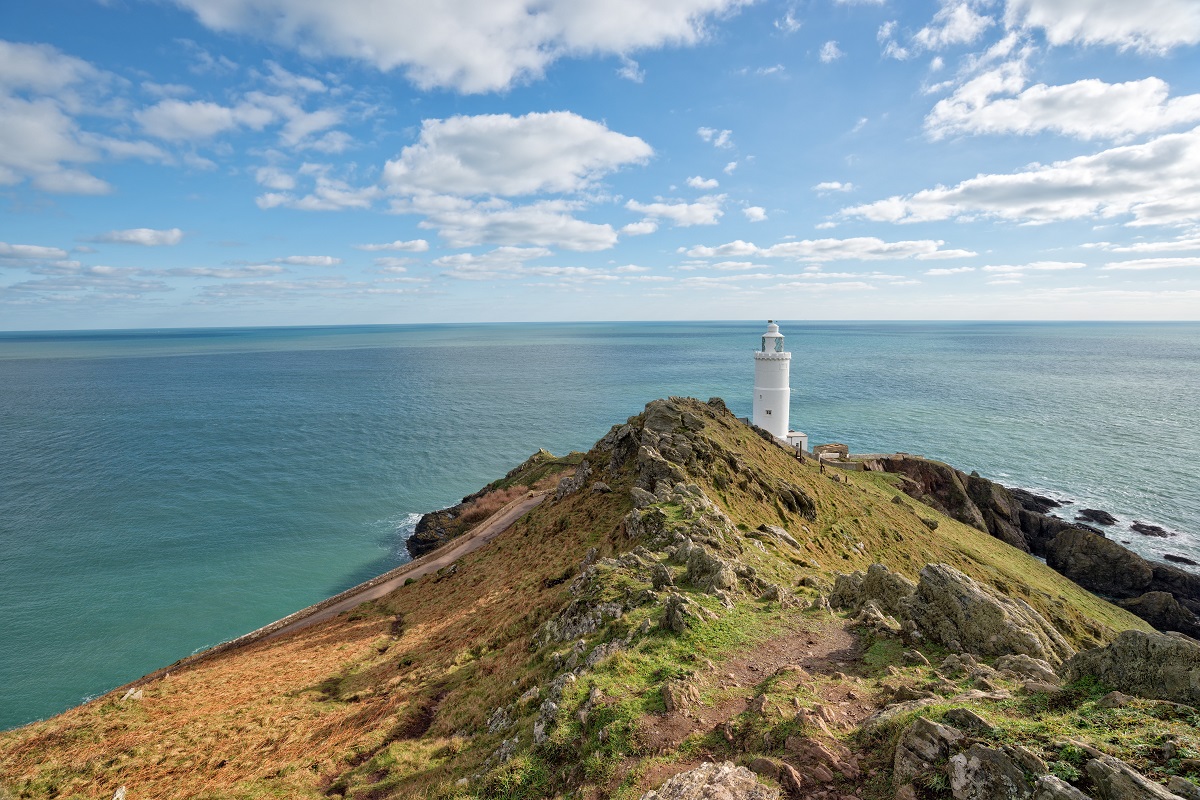
From here, the route winds past hidden coves and rocky beaches – Horsley Cove, Lannacombe, and Great Mattiscombe Sand – where you may be lucky enough to spot seals basking on the rocks. Climbing again, the white tower of Start Point Lighthouse comes into view, standing sentinel above Start Bay. A short diversion leads down to the lighthouse itself, open on certain days for tours.
Heading north, the path passes the site of the lost village of Hallsands, claimed by the sea in 1917. A poignant plaque tells the story of the community swept away by storm and human intervention. Further on lies Beesands, with its line of seafront cottages and heavy sea defences, a reminder of the coastline’s constant battle with erosion.
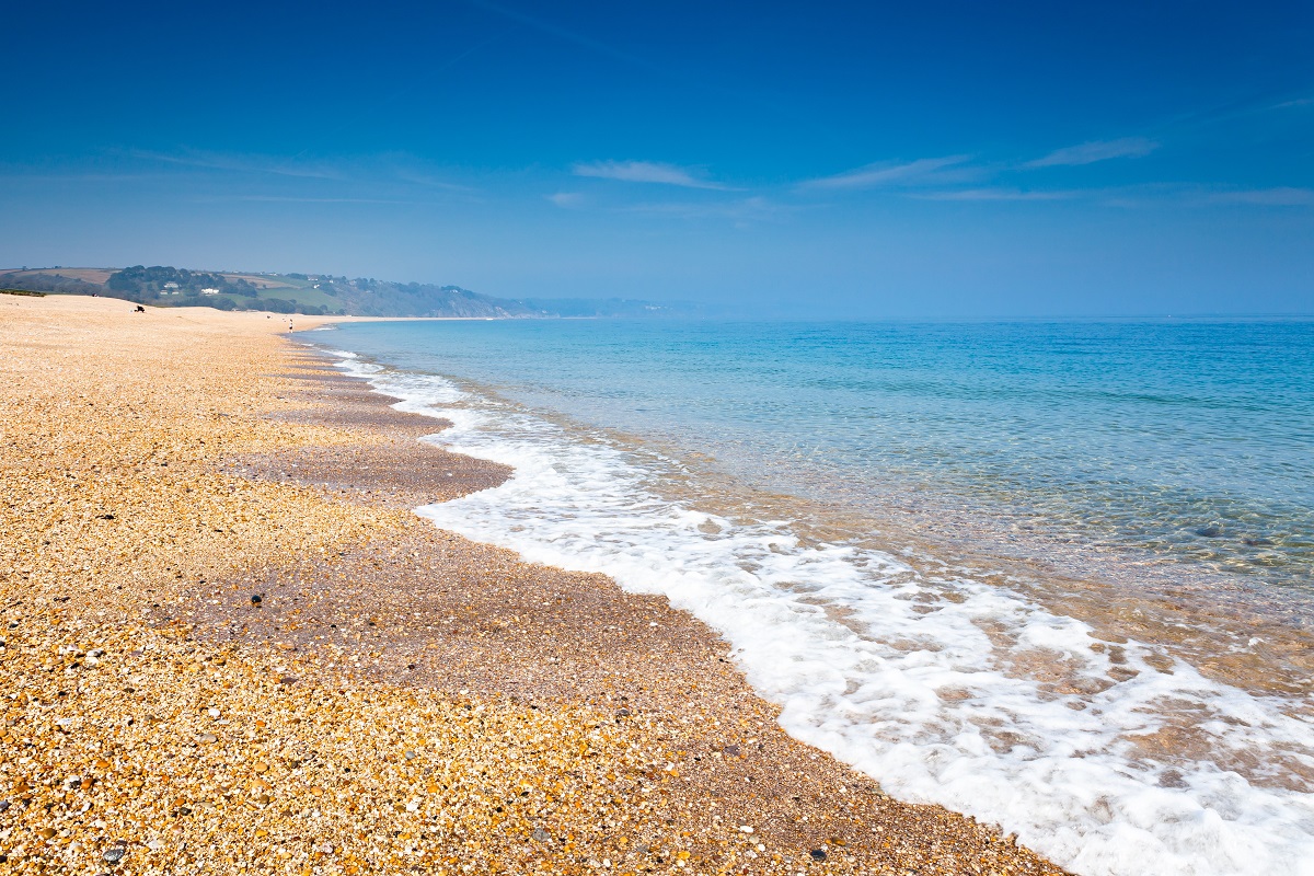
The final descent zigzags towards Torcross, overlooking the great sweep of Slapton Sands and the freshwater lagoon of Slapton Ley. Here, a Sherman tank salvaged from the sea stands as a memorial to the hundreds of US servicemen who lost their lives during Exercise Tiger, the ill-fated D-Day rehearsal of 1944.
Torcross to Dartmouth
Leaving Torcross, the path follows the narrow strip of land between the freshwater lake of Slapton Ley and the sea, part of the unique Slapton Line. It’s a gentle and fascinating start, with birdlife all around and the ever-present hush of waves beyond the shingle ridge. Beyond the reserve, the route climbs steadily, offering sweeping views back along Start Bay, with the distant flash of Start Point Lighthouse.
Through the village of Strete, the path returns to open countryside, winding above coves and fields before descending towards the sheltered curve of Blackpool Sands, a perfect spot for a swim or coffee stop. From here, the route rises again to Stoke Fleming, a pretty village with a welcoming pub and church overlooking the coast.
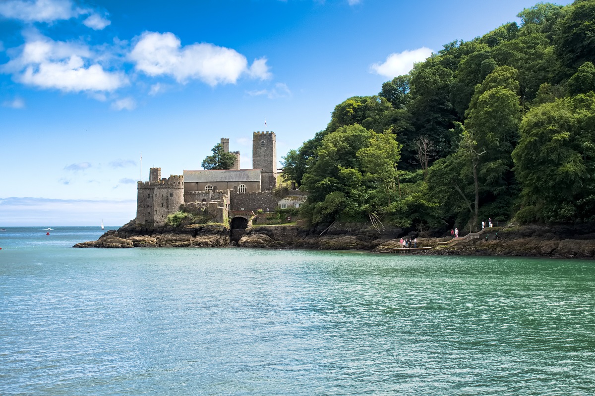
The final miles follow rolling farmland and wooded slopes to Little Dartmouth and on towards the estuary. The path ends on a high, descending through trees to historic Dartmouth Castle and the harbour below, where colourful houses line the water and ferries bustle across the Dart. From here it’s an easy stroll to the town centre with its wealth of shops, cafés and restaurants.
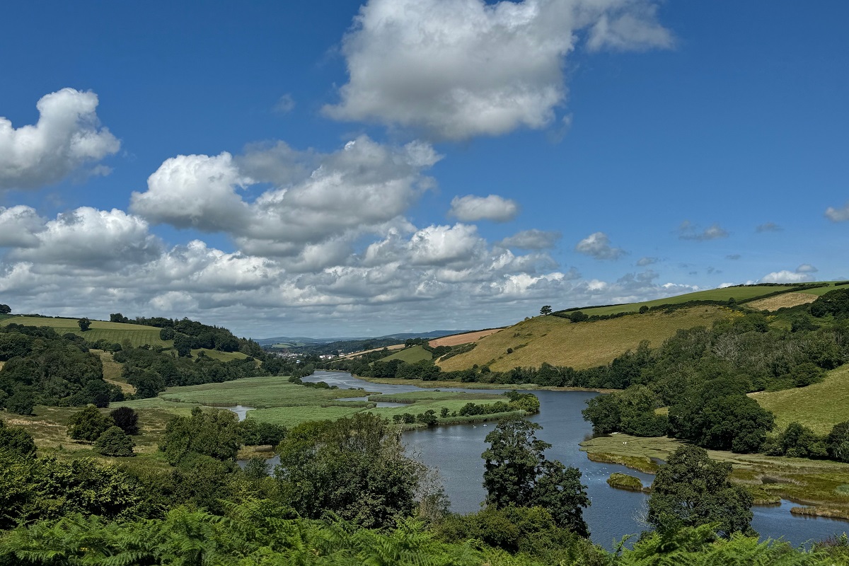
Dartmouth to Totnes
Climbing out of Dartmouth past St Clement’s Church, the route soon leaves the bustle behind, dipping into peaceful woodland along Old Mill Creek. Following quiet tracks through the Raleigh Estate, the path weaves between trees and open fields with glimpses of the River Dart glittering below. The views widen as you climb, taking in Noss Marina, the Daymark, and even distant Dartmoor.
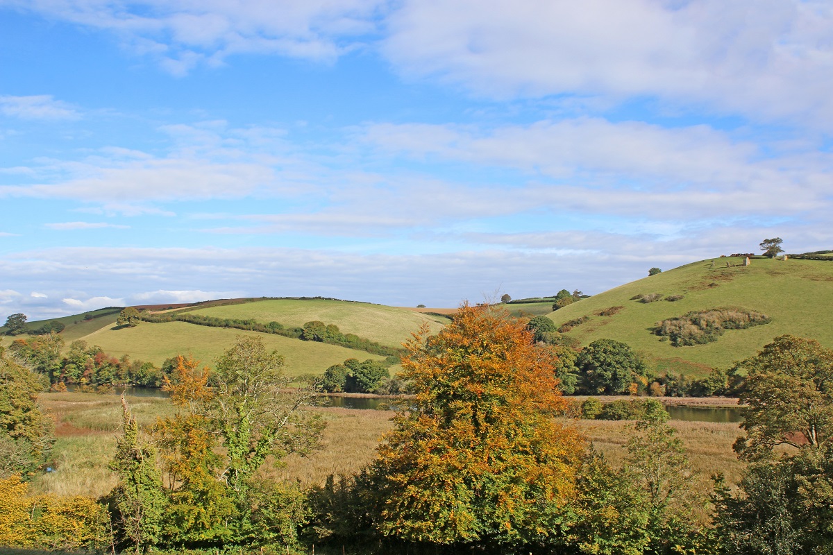
Beyond the rolling farmland, the way descends towards the riverside village of Dittisham, one of the loveliest spots on the Dart. From here, the trail meanders inland through deep lanes, green valleys, and the pretty village of Cornworthy before reaching the tranquil banks of Bow Creek – alive with herons, swans, and the occasional kingfisher.
A gentle climb brings you to Ashprington, where the Durant Arms and St David’s Church mark the heart of the village. From here, the path follows the Dart valley opposite the Sharpham Estate, offering sweeping views of its vineyards and river bends, before arriving in Totnes, a lively market town crowned by its Norman castle, a fitting finale to this varied and rewarding journey.
The South Hams Way is a hugely rewarding trail created by the South Hams Ramblers, utilising existing public footpaths, bridleways and lanes, including a 50 mile stretch of the South West Coast Path. It is not without its challenges, especially on the moors and particularly in poor weather. For your safety, and to gain the greatest enjoyment from your walk, it is crucial that you are competent in using a map and compass, and that you adhere to the advice in the route guides.
Terrain: A combination of open moorland, deep green valleys, riverside paths, native woodland, country lanes, and coastal paths.
What’s it like underfoot? Either side of Totnes, from Dartmouth through to Buckfastleigh, the trail follows good footpaths through woodland and fields, along tracks and country lanes, all of which can be quite muddy after heavy rain. There is also some road walking.
Dartmoor, is a rugged landscape dotted by striking granite tors. High rainfall, combined with thin acidic soil, has led to the formation of vast peatlands over the centuries, and the way through is occasionally pathless. Following a dry spell you’ll have a nice springy surface to stride out on.
The South Devon coastline has generally good paths and tracks, although again, a few sections can get muddy after heavy rain.
How Much Up & Down? Much of the route is a mix of moderate ups and downs. However, there are some sections, especially as the route crosses open moorland on Dartmoor that include more demanding ascents and descents. Similarly, the South Devon coastline has more ascent and descent than you might think, although no section is very steep for very long.
On the opening stretch from Totnes through to Buckfastleigh the estimated ascent is just 600 feet (185m). Over Dartmoor and down to the coast the estimated daily ascent ranges from 950 feet (290m) to 1,200 feet (365m). The coastline is more varied with estimated daily ascents ranging from 1,000 feet (305m) to 1,800 feet (550m). The estimated ascent through the Dart valley to Totnes is 1,800 feet (550m).
Signposting & Navigation: Please Note: There isn’t a traditional guidebook for the trail, however, detailed route guides – which are the copyright of South Hams Ramblers – can be downloaded from their website for your personal use.
The South Hams Way follows existing public footpaths, bridleways, and lanes, generally marked with standard Public Footpath signs. You’ll also spot occasional South Hams Way markers to reassure you you’re on course. Note that there are no markers across the open moorland of Dartmoor National Park, and only limited South Hams Way signage along the South West Coast Path – there, simply follow the acorn waymarks.
Although specific rights of way are clearly marked on maps, navigating on the ground can be more challenging. Be sure to follow the directions in the route guides carefully, especially if bad weather arises. When walking the moorland sections, it is crucial that you are competent with a map and compass.
Weather: The southwest benefits from a relatively mild climate with Devon experiencing some of the highest average year-round temperatures in the country. However, Devon’s position leaves it exposed to frequent Atlantic weather systems, driven by prevailing south-westerly winds, which bring heavy rain to the coasts and moorlands. Fingers crossed you will experience warm, dry weather throughout your holiday and enjoy dry paths and tremendous views, but you must be prepared because the weather can change quickly, especially on moorland and over high ground. Good clothing, comfortable footwear and reliable waterproofs are essential.
|
All Holidays
|
|
| Accommodation | Overnight Bed and Breakfast accommodation in selected hotels, farmhouses, village inns, guest houses and family B&Bs. Cooked or Continental breakfast. |
| Link to Detailed Route Guides | There isn’t a traditional guidebook for the trail, however, detailed route guides – which are the copyright of South Hams Ramblers – can be downloaded from their website for your personal use. |
| Information of Services Along the Route | A comprehensive Service Info sheet, including services such as cash points, banks, post offices, village shops, inns, cafes and taxis. |
| Maps | Two (1:25,000) Ordnance Survey Explorer maps, including mobile download, covering the South Hams Way route. |
| Personal Itinerary | A personal itinerary setting out each overnight stop, including large scale maps of each accommodation, to ensure you find it easily. |
| Emergency Telephone Support | If you get in to difficulties during your holiday, we are always available to help, even out of office hours. |
|
Options
|
|
| Luggage Transport | We will transfer your luggage between each overnight stop – if you leave your luggage at the accommodation when you set off in the morning, it will be moved on to your next B&B. You only need to carry a small day sack with the clothes and provisions you require during the day’s walk. |
| Packed Lunches |
We are unable to pre book packed lunches on this route. However, some accommodations will be happy to prepare a packed lunch if requested on arrival. |
| Off Road Parking | If you are travelling by car we can usually arrange off road parking for the duration of your trip. (There may be a small charge for this). |
| Arrangement of return transport | We can also arrange your transfer back to your car, (or advise you when public transport is a better option)! |
|
What’s not Included
|
|
| Evening Meals | Your evening meal isn’t included in the package, but we include full details and recommendations for each evening in your itinerary. You will be within walking distance of a pub and/or restaurant each evening. Allow about £30.00 per night. |
| Transport to the Start & Away from the Finish | Have a look at the ‘Travel Info’ tab above for suggestions. If you’re still struggling, get in touch and we’ll help you sort it out. |
| Travel Insurance | Even if you are based in the UK travel insurance is worth having. |
Good accommodation and friendly hosts are an essential part of any holiday. We understand this and go out of our way to find the best. We put a great deal of effort into hand picking our accommodation and matching it to individual customer requirements. As well as visiting the accommodation ourselves, we ask all our customers to complete a short evaluation on each night’s accommodation, which then gives us an insight into the day-to-day operation and lets us spot any potential issues before they become a problem.
We use a variety of accommodation. Over the course of your trip you might stay in a village inn, a bed and breakfast in a converted barn, a Victorian guest house, or on a working farm. In selecting the accommodation we look for helpful, friendly hosts with good quality, characterful accommodation close to the trail. Occasionally we may use a chain hotel.
We are happy to book single rooms on our holidays but cannot normally book more than two for any one group. Single room bookings include a supplement.
Here are some examples of the accommodation we use on the South Hams Way:
 With its delightful south facing walled garden, The Old Forge offers a tranquil retreat in picturesque Totnes. With ten stylish ensuite rooms – many opening onto patios or terraces – it’s the perfect place to unwind after a day’s exploring. Enjoy a leisurely à la carte breakfast, afternoon tea, or a locally brewed ale in the sunshine. Visit their website
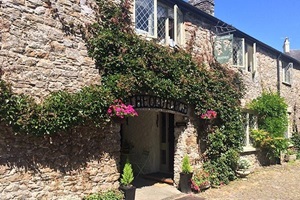
 Dating back to 1547, this former corn mill now welcomes guests as a charming country hotel on the edge of Dartmoor. Family-run and beautifully refurbished, Furzeleigh Mill at Buckfastleigh offers ten bright ensuite rooms, a fine dining restaurant, and a sun-soaked terrace – perfect for enjoying locally sourced dishes or a tipple at one of their lively themed evenings. Visit their website
 Nestled in the charming village of Yealmpton, the Rose & Crown is a welcoming pub with a touch of elegance. Cosy nooks, deep sofas, and a roaring fire create a homely atmosphere inside, while the walled garden provides a sun-drenched spot for al fresco dining or enjoying an award-winning beer as the day fades in the South Hams countryside. Visit their website
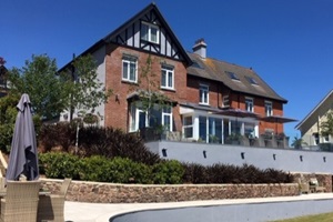 Just a short stroll from Dartmouth’s bustling heart, the Dartmouth Boutique B&B offers a tranquil retreat with some of the town’s most stunning views. Guests enjoy comfortable rooms, peaceful surroundings, and thoughtful touches that make every stay relaxing, while the gentle chiming of church bells and occasional steam train add a touch of local character. Visit their website
General travel information for the South Hams Way will be in your holiday pack.
Detailed instructions on getting to your first night’s accommodation by car, or on foot from the nearest train or bus station, will also be included in the holiday pack on individual accommodation maps.
To view train times please visit trainline where you can also purchase tickets in advance. For information on bus timetables please visit traveline
Getting to Totnes:
By Air: The nearest International Airports to the trail are Bristol and London Heathrow. Exeter Airport is also convenient, offering direct flights from a number of UK and European destinations.
By Public Transport: Totnes Railway Station is located on the main line between Plymouth and London Paddington, with regular services also connecting to Exeter, Bristol and beyond. The station is a short walk from the town centre and well served by local bus routes.
By Road: Totnes lies on the A385 between Paignton and the A38 Devon Expressway. Leave the M5 motorway at Junction 31, just after Exeter, and follow signs for the A38 Plymouth. Take the exit for the A385 to Totnes.
Getting Back:
As this is a circular route you will be walking back to your starting location so you can depart by the same means you arrived.
Totnes
Totnes is a vibrant market town brimming with history and character. Wander its medieval streets, explore the independent shops and galleries, or visit the iconic Norman castle perched above the town. Food lovers can enjoy the lively café culture and local produce markets, while those seeking a touch of culture can drop into the museum or soak up the creative energy that has long made Totnes a hub for artists and makers.
Salcombe
Take a break from the trail in Salcombe and enjoy everything this lively seaside town has to offer. Kayaking, paddle boarding and sailing are all available, or you can swim in the clear waters around the estuary and beaches. Away from the water, you could visit Overbecks Garden, explore the maritime museum, browse the town’s art galleries or call in at the local gin distillery. With some great places to eat and plenty of beaches to choose from, Salcombe makes an ideal place to slow the pace and enjoy a day off from walking.
Dartmouth
Dartmouth is an enchanting town, situated as you’d expect, on the mouth of the River Dart. In addition to being a watersports playground, Dartmouth has plenty of history and heritage and a visit to Dartmouth Castle is a must. As is a visit to Agatha Christie’s Greenway National Trust Holiday Home. The town also has a museum, art galleries, a host of independent shops and lots of lovely places to eat.