West Highland Way
Milngavie to Fort William in 9 Days Walking Code: WH10
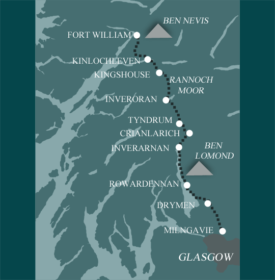
We offer 4 itineraries on the West Highland Way. Walk from the Lowlands into the heart of the Highlands, following the shores of Loch Lomond, crossing the wild expanse of Rannoch Moor, and passing the dramatic peaks of Glen Coe. With options ranging from a 6 day challenge to a more relaxed 9 day itinerary, you can choose the pace that best allows you to take in the stunning scenery, rich history, and remote beauty of Scotland’s most famous long-distance trail.
If you want to walk the whole of the West Highland Way and enjoy the landscape at a more gradual pace, then this 9 day itinerary would be a good choice.
Due to minimum night restrictions or availability issues we may not be able to book you at the Kingshouse Hotel. When we are unable to book the Kingshouse Hotel we would book two nights in Kinlochleven with a transfer to and from Kingshouse. Please note if you choose to include a rest day in Kingshouse and we are able to book this we may have to charge a supplement to stay here.
| Miles | Km | ||
|---|---|---|---|
| Day 1 | Travel to Milngavie for your first nights accommodation | ||
| Day 2 | Milngavie to Drymen | 12 | 19 |
| Day 3 | Drymen to Balmaha | 6 | 10 |
| Day 4 | Balmaha to Rowardennan | 8 | 12 |
| Day 5 | Rowardennan to Inverarnan | 14 | 23 |
| Day 6 | Inverarnan to Tyndrum | 13 | 21 |
| Day 7 | Tyndrum to Inveroran | 9 | 14 |
| Day 8 | Inveroran to Kingshouse | 10 | 16 |
| Day 9 | Kingshouse to Kinlochleven | 9 | 14 |
| Day 10 | Kinlochleven to Fort William | 14 | 23 |
| Day 11 | Depart from Fort William after breakfast |
Milngavie to Drymen
The Way starts in Milngavie, a suburb of Glasgow. It travels across rolling hills and lowland plains. This is an easy pleasant walk along the valleys of Blane and Endrick with good views of the hills.
Drymen to Rowardennan
The Way continues with a mixture of good woodland paths, moderate gradients on Conic Hill and hillside tracks. The approach to Loch Lomond is very picturesque.
Rowardennan to Crianlarich
Today is mainly rugged walking over loch side rocks and tree roots with some scrambling. This can be a wild and demanding section of the Way, especially north of Inversnaid.
Crianlarich to Inveroran
With typical highland walking in glens and over low passes with moderate ascents and descents, on mainly well surfaced paths and tracks. There are many fine mountain views to be enjoyed today.
Inveroran to Kinlochleven
A moderate to hard day with amazing scenery. The terrain is mainly good underfoot but it is highly exposed and can be difficult in bad weather – be prepared!
Kinlochleven to Fort William
Starting with a steep climb out of Kinlochleven followed by rough paths in Nevis Forest, your final day finishes with a gentle descent into Fort William.
Moderate to Challenging
Thousands of regular walkers complete the WHW every year – but remember this is a challenging route passing through increasingly remote and mountainous terrain. There are some longer days too. This is a route for experienced walkers.
Terrain: Varied – lowland meadows, foothills, loch sides, remote moorland, and high mountain passes – it has it all!
What’s it like underfoot? The route is generally well maintained but there are sections where the going is rougher, and others where it can get muddy. The side of Loch Lomond is infamous for its difficult tree roots.
How Much Up & Down? Not too much considering where you are! Over 4000m of ascent in total, with climbs of 300 - 500m on most days. The 2 biggest climbs – 500m up the Devils’ Staircase, and 700m out of Kinlochleven, are saved for the final 2 days.
Signposting: Good.
Navigation: Signposting is good and the route follows well defined paths, so no particular difficulties. But there are sections of remote wilderness (Rannoch Moor), and higher mountain terrain (where you may be in the mist on a bad day) so you need to be able to navigate – these aren’t places you want to get lost.
Weather: Some people complete the whole route in fine weather, but most will encounter at least some rain, and possibly hill fog on the higher ground. Early or late in the season hail or snow are possibilities. Good clothing and waterproofs absolutely essential, even if you end up not needing them too often.
|
All Holidays
|
|
| Accommodation | Overnight Bed and Breakfast accommodation in selected hotels, farmhouses, village inns, guest houses and family B&Bs. Cooked or Continental breakfast. |
| Guidebook | A detailed guidebook with route information, maps, photos and background information. |
| Information of Services Along the Route | A comprehensive Service Info sheet, including services such as cash points, banks, post offices, village shops, inns, cafes and taxis. |
| Maps | A waterproof (1:40,000) Harvey Map covering the whole route. |
| Personal Itinerary | A personal itinerary setting out each overnight stop, including large scale maps of each accommodation, to ensure you find it easily. |
| Emergency Telephone Support | If you get in to difficulties during your holiday, we are always available to help, even out of office hours. |
|
Options
|
|
| Luggage Transport | We will transfer your luggage between each overnight stop – if you leave your luggage at the accommodation when you set off in the morning, it will be moved on to your next B&B. You only need to carry a small day sack with the clothes and provisions you require during the day’s walk. |
| Packed Lunches |
Provided for each day’s walking and recommended on this holiday as there will not always be a handy shop or cafe on the route. |
| Off Road Parking | If you are travelling by car we can usually arrange off road parking for the duration of your trip. (There may be a small charge for this). |
| Arrangement of return transport | We can also arrange your transfer back to your car, (or advise you when public transport is a better option)! |
|
What’s not Included
|
|
| Evening Meals | Your evening meal isn’t included in the package, but we include full details and recommendations for each evening meal in your itinerary. You will normally be within walking distance of a pub and/or restaurant, or where there is good food available at the accommodation, we’ll book that for you. Allow about £30.00 per night. |
| Transport to the Start & Away from the Finish | Have a look at the ‘Travel Info’ tab above for suggestions. If you’re still struggling, get in touch and we’ll help you sort it out. |
| Travel Insurance | Even if you are based in the UK travel insurance is worth having. |
Good accommodation and friendly hosts are an essential part of any holiday. We understand this and go out of our way to find the best. We put a great deal of effort into hand picking our accommodation and matching it to individual customer requirements. As well as visiting the accommodation ourselves, we ask all our customers to complete a short evaluation on each night’s accommodation, which then gives us an insight into the day-to-day operation and lets us spot any potential issues before they become a problem.
We use a variety of accommodation. Over the course of your trip you might stay in a village inn, a bed and breakfast in a converted barn, a Victorian guest house, or on a working farm. In selecting the accommodation we look for helpful, friendly hosts with good quality, characterful accommodation close to the trail. Occasionally we may use a chain hotel.
We always try to arrange en suite accommodation, i.e. rooms with their own bathrooms for each night of your stay. However, in some of the more remote locations accommodation is limited and occasionally we may have to book rooms with shared bathrooms for one or two nights of your holiday, (especially if the booking is made at short notice), but we will always let you know if this is likely to be the case.
We are happy to book single rooms on our holidays but cannot normally book more than two for any one group. Single room bookings include a supplement.
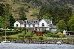
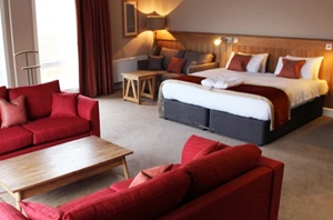
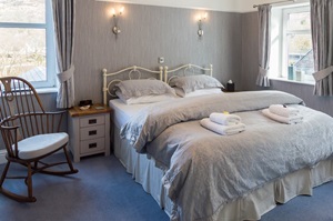
Here are some examples of the accommodation we use on the West Highland Way:
 Ashbank Bed and Breakfast, hosted by Mhairi and Tommy, is located in the picturesque village of Drymen, within Loch Lomond & The Trossachs National Park. As the first stop on the West Highland Way, Ashbank offers warm Scottish hospitality, a restful night’s sleep, and access to the idyllic Loch Lomond. Visit their website
 Nestled on the northern banks of Loch Lomond, the Ardlui Hotel provides a tranquil retreat in the heart of The Loch Lomond and Trossachs National Park. Owned by the Squires family since 1959, this popular hotel exudes a homely atmosphere, and as a Whisky Ambassador hotel, offers an extensive selection of Scottish whiskies. Visit their website
 Set against the dramatic backdrop of Glencoe, the Kingshouse Hotel offers a warm Highland welcome to adventurers and sightseers alike. As a much anticipated resting spot on the West Highland Way, it caters to avid walkers with comfortable beds, hearty locally-sourced meals, and an array of beers and single malts. Visit their website
 Allt na Leven, a family-run guest house in the heart of Kinlochleven, offers a welcoming stay in a beautifully renovated property. Backing onto the River Leven and surrounded by mountain views, it’s close to the local pubs, and restaurants. A prime stop on the West Highland Way, it’s also near The Ice Factor, Europe’s largest indoor ice climbing wall. Visit their website
General travel information on the West Highland Way area will be in your holiday pack including train and bus timetables where available.
Detailed instructions on getting to your first night’s accommodation by car, or on foot from the nearest train or bus station, will also be included in the holiday pack on individual accommodation maps.
To view train times please visit trainline where you can also purchase tickets in advance. For information on bus timetables please visit traveline
If you require secure car parking whilst walking this route, please contact us for information.
Getting to Milngavie:
By Air: The nearest international airport is Glasgow (GLA). There is a regular shuttle bus into Glasgow city centre (approx 25 mins). Glasgow to Milngavie is 7 miles, you can either: take a taxi from Glasgow city centre; travel by train directly to Milngavie, this takes 25 minutes; or travel by bus, which takes 40 minutes.
By Public Transport: Milngavie has a railway station. Most services will pass through Glasgow.
By Road: Milngavie is 7 miles north of Glasgow. For Glasgow, travel on the M6 north followed by the A74 (M). From Glasgow, follow the A81 direct to Milngavie.
Returning from Fort William:
By Public Transport: Fort William has a railway station. Most services will pass through Glasgow (GLA).
By Road: Head for either Glasgow (107 miles) or Edinburgh (136 miles) depending on the direction of your final destination.
Tyndrum
Today's village earns much of its living by providing goods, services and accommodation to passing travellers, mostly motorists heading up or down the busy A85 and A82 trunk roads. In doing so, Tyndrum is carrying on a long tradition. The village's origins date back to the days when droves of highland cattle from the north and west passed through en route to markets in central Scotland bringing lots of tired, hungry and thirsty drovers with them.
This is a good location for a “rest day” in order to travel along the picturesque West Highland Train Line to visit Oban – a coastal resort with a difference - the town and its bay are virtually land-locked, giving it a sheltered setting. For memorable views walk up Oban Hill to McCaig's Tower or take a walk to Ganavan Sands and relax on the beach.
Fort William
Fort William is the capital of the West Highlands, situated at the head of Loch Linnhe. It’s not the prettiest of towns, but there are a good number of shops, and some good outdoor stores to browse around or buy new gear. A lot of people take an extra day here to climb Ben Nevis – Britain’s highest mountain (1344m / 4409ft). It’s a long day, and the weather can be harsh, so make sure you are fit and prepared!
| Prices | GBP (£) |
|---|---|
| Accommodation, map & guidebook only | £1266 |
| with Luggage Transport | £1365 |
| with Packed Lunches | £1369 |
| with Luggage & Lunches | £1462 |
Other Options |
|
| Extra Nights (per night) | £95 |
| Single Supplement (per night) | £69 |
| Solo Luggage Supplement (per day) | £0 |
