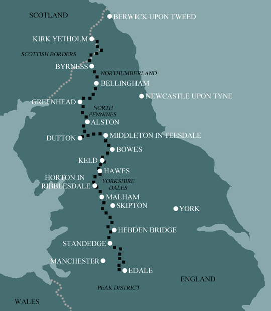
Pennine Way
Our 21 day walk is a much more manageable itinerary than the previous three. More than half the days are less than 15 miles. There does of course remain the 20 mile day from Middleton-in-Teesdale to Dufton, and the final 4 days of the walk, in the northern section, are each 15 miles or more, and this can’t be avoided. So there are still some tough days to prepare for.
Itinerary
| Day | Itinerary | Miles | Km |
|---|---|---|---|
| Day 1 | Travel to Edale for your first nights accommodation | ||
| Day 2 | Edale to Torside then transfer to Glossop | 15 | 24 |
| Day 3 | Transfer back to Torside, walk to Standedge then transfer to Delph | 13 | 21 |
| Day 4 | Transfer back to Standedge then walk to Hebden Bridge | 15 | 24 |
| Day 5 | Hebden Bridge to Haworth | 13 | 21 |
| Day 6 | Haworth to Ickornshaw then transfer to Skipton | 8 | 13 |
| Day 7 | Transfer back to Ickornshaw then walk to Gargrave | 11 | 18 |
| Day 8 | Gargrave to Malham | 7 | 11 |
| Day 9 | Malham to Horton in Ribblesdale | 15 | 24 |
| Day 10 | Horton in Ribblesdale to Hawes | 14 | 23 |
| Day 11 | Hawes to Keld | 13 | 21 |
| Day 12 | Keld to Bowes | 13 | 21 |
| Day 13 | Bowes to Middleton-in-Teesdale | 12 | 19 |
| Day 14 | Middleton-in-Teesdale to Dufton then transfer to Appleby | 20 | 32 |
| Day 15 | Transfer back to Dufton then walk to Garrigill | 15 | 24 |
| Day 16 | Garrigill to Slaggyford | 9 | 14 |
| Day 17 | Slaggyford to Greenhead | 12 | 19 |
| Day 18 | Greenhead to Twice Brewed | 7 | 11 |
| Day 19 | Twice Brewed to Bellingham | 15 | 24 |
| Day 20 | Bellingham to Byrness | 15 | 24 |
| Day 21 | Byrness to Trows Farm then transfer back to Byrness | 15 | 24 |
| Day 22 | Transfer back to Trows Farm then walk to Kirk Yetholm | 16 | 26 |
| Day 23 | Depart from Kirk Yetholm after breakfast |
Prices
| Accommodation, map & guidebook only | £2510 |
| with Luggage Transport | £3245 |
| with Packed Lunches | £2762 |
| with Luggage & Lunches | £3467 |
Other Options |
|
| Extra Nights (per night) | £104 |
| Single Supplement (per night) | £70 |
| Solo Luggage Supplement (per day) | £17 |
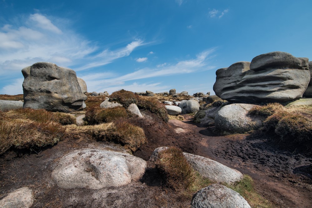
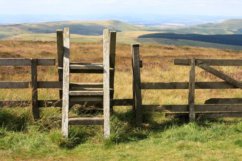
Edale to Torside
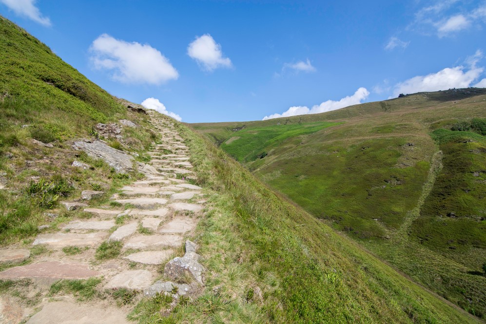
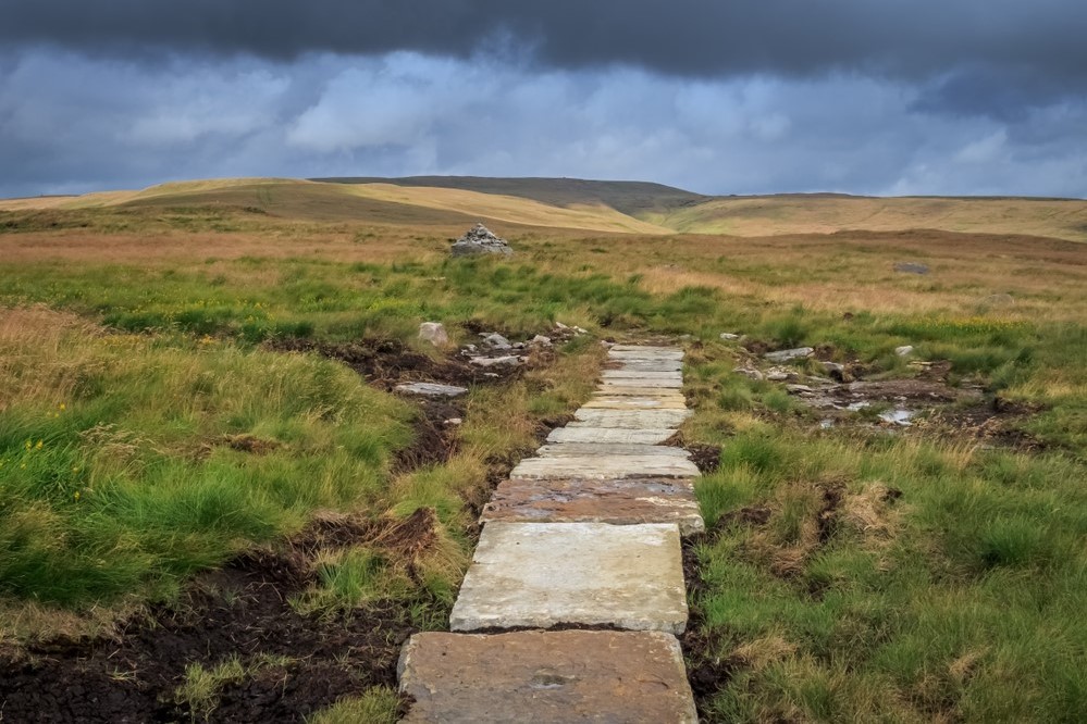
Thanks to the use of stone slabs, reclaimed from demolished cotton mills, the days of wading knee deep through peat bog are mercifully a thing of the past. Laid over the worst of the bogs to prevent erosion, the slabs provide walkers with a firm dry path as well as a handy navigational aid.
Leaving Edale the path soon brings you to the charming bridge at the foot of Jacob’s Ladder and the first steep climb on the Pennine Way, to the soaring Edale Rocks. Here begins the classic edge walk around Kinder Scout, skirting the impressive gritstone outcrops to reach the iconic Kinder Downfall. Fingers crossed, you may be treated to the waterfall being blown upwards as the wind whistles up the valley onto the plateau.
The path crosses the A57 at Snake Pass and so begins a long and steady ascent of Bleaklow following a winding course between walls of peat, occasionally opening to an expanse of delightful cotton grass. This is a joy to walk in good weather, less so in poor weather when it can prove an uneasy test of navigation.
Bleaklow head is adorned with an impressive cairn and a stake marks the nominal summit. A stone guide post points the way off Bleaklow towards the predominantly downhill trail to Clough Edge and on to Torside by the the B6105 road.
Torside to Standedge
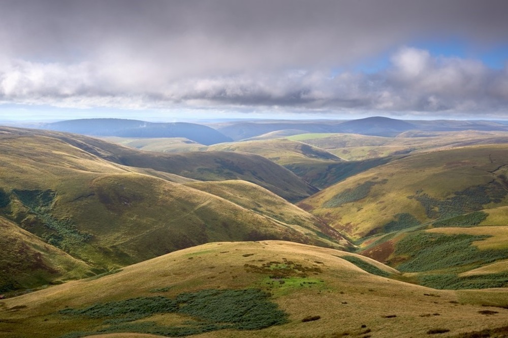
A combination of remote moorland and reservoir access roads, expansive views and an abundance of hills, dominate this section of the Pennine Way.
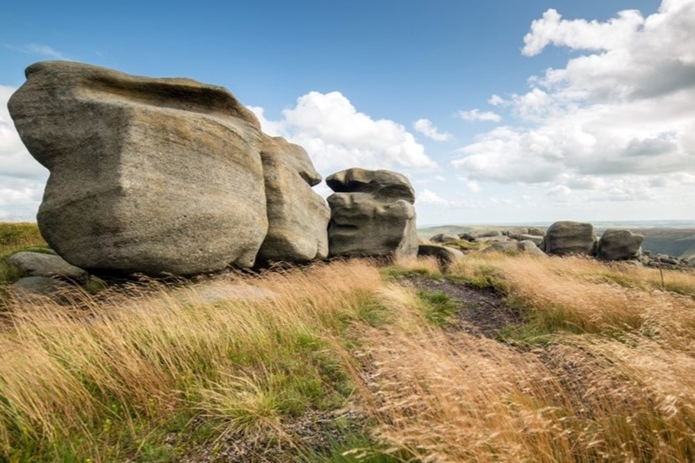
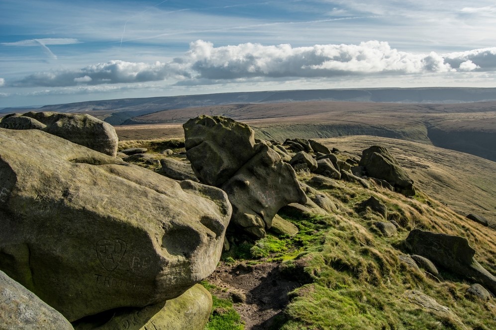
From Torside a series of short climbs lead to the gritstone outcrops of Ladder Rocks. Nearly half the ascent on this leg is achieved in the first three miles or so, however the reward for your efforts, weather permitting, is splendid and far reaching views. Care is needed here, as this is one of the only exposed sections on the Pennine Way, with a steep drop down to the right.
The high-level path then drops to meet Crowden Great Brook before a steady climb to the now transformed Black Hill. Gone is the barren, black wasteland of peat bog, replaced with a green and lush carpet thanks to much replanting and sheep control.
Descending Black Hill look out for the magnificent spire of Emley Moor Mast off in the distance as well as the much closer Holme Moss Mast across the moor, before meeting the A635.
Beyond Wessenden Head and the Wessenden reservoirs a lovely moorland track leads between Swellands and Black Moss reservoirs and down to Redbrook Reservoir and your destination, the A62 at Standedge Cutting.
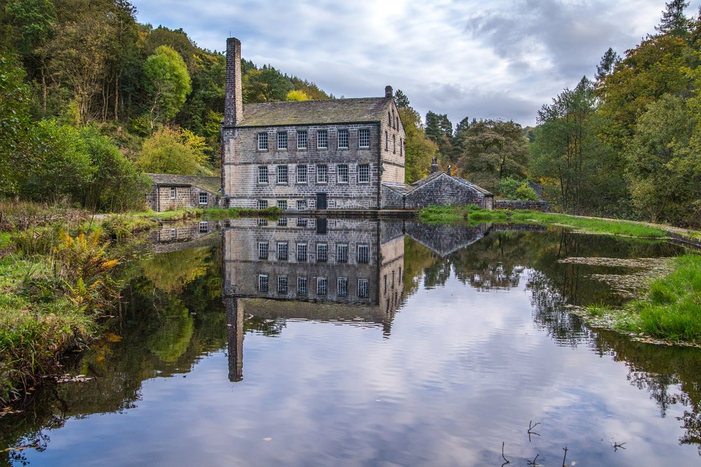
Standedge to Hebden Bridge
Four road crossings punctuate this stretch of the Pennine Way. The sense of remoteness experienced so far all but disappears for a time as the conurbations of Lancashire and Yorkshire force the Pennine Way into a narrow corridor. However, the walk planners have worked hard to avoid urban walking, ensuring this section still delivers some scenic highpoints.
The path is joined for a while by the Oldham Way before they part ahead of the A640 road between Huddersfield and Oldham. The airy path across White Hill is interrupted first by the A672, then the soaring arch of the 65 feet high bridge across the M62 Trans Pennine Motorway, arguably the most remarkable motorway crossing of any footpath in the country, thanks in no small part to the foresight of the Transport Minister at the time, Ernest Marples, himself a keen walker.
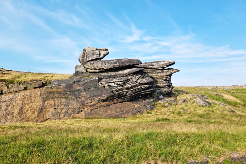
The route through the peaty expanse of Redmires benefits from slabs ensuring the climb up to Blackstone Edge with its trig point is now much easier. A modern concrete guide marker stands in contrast to the ancient Aiggin Stone nearby, which has been guiding travellers for over 600 years. The road you join for a few short yards is thought to be older still, possibly dating back to Roman times. The A58 road marks the end of the moorland scenery.
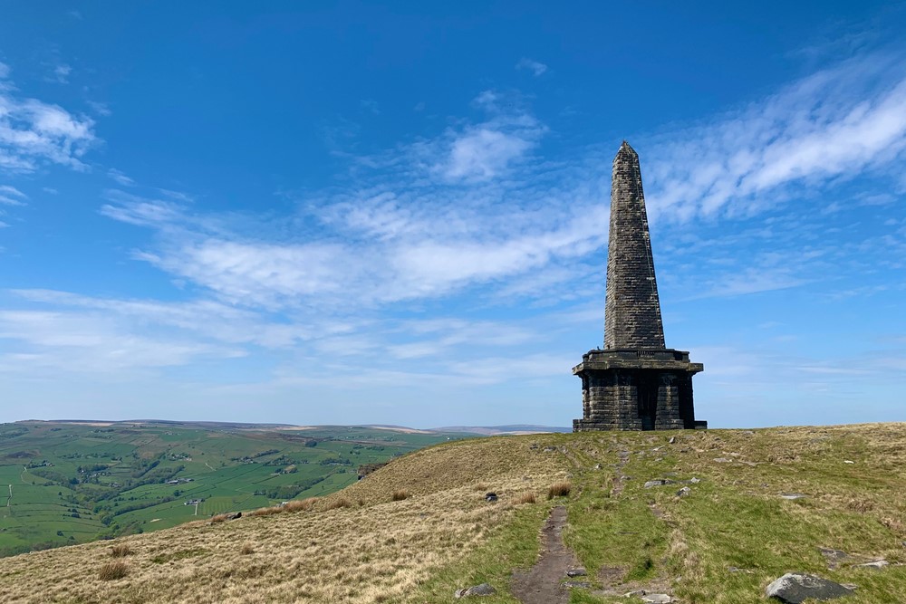
A wide gravel track now guides you by three reservoirs before the impressive stone monolith Stoodley Pike comes into view over the delightful Coldwell Hill. From Stoodley Pike the path falls steadily in places, from the open moor, through fields to join Callis Wood and on into Hebden Bridge.
Hebden Bridge to Ickornshaw
This stretch of the Pennine Way begins with one of the toughest ascents of the entire walk, an energy sapping 1000 feet climb in the first two miles as the path ascends through Mytholm passing the charmingly named Badger Fields Farm. The reward for your efforts is a varied scenery of pretty lanes, steps, passages and fields as you make your way out onto the open expanse of Hepstonstall Moor.
The path then drops down to the popular beauty spot at Graining Water. The following few miles are spent on reservoir access roads or gravel paths beside them, passing two of the three Walshaw Dean reservoirs before climbing the moorland path up Withins Height to the old farmhouse of Top Withins, famously associated with Emily Brontë’s Wuthering Heights.
An overnight stay in Haworth will break up this stretch and provide an opportunity to visit the Brontë Waterfalls and spend some time sightseeing in this wonderful village. If pressing on with the Pennine Way the path skirts round Ponden Reservoir before another long ascent onto and over the heather-clad Ickornshaw Moor, and down through fields into the village of Ickornshaw off the A6068 road.
Ickornshaw to Malham
Another section where the hard work comes early with almost all of the ascent achieved in the first four miles. This stretch also sees a change in the landscape as the dark gritstone and black peat of the Peak District gives way to the light grey limestone and green grass of the Yorkshire Dales.
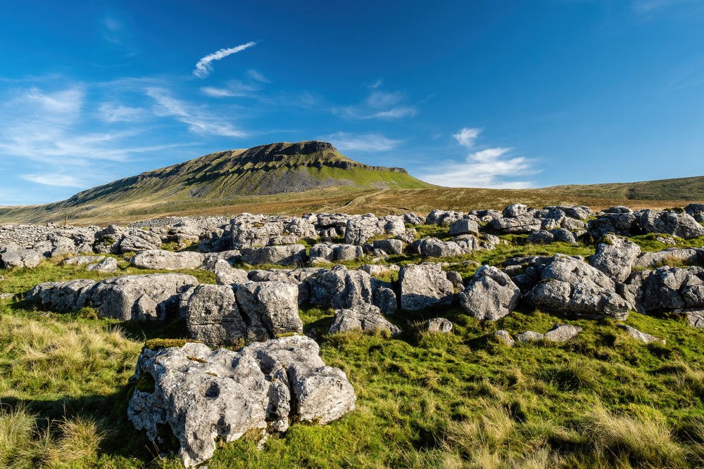
Leaving Ickornshaw the path makes a short, steep climb up Cowling Hill, followed by a second up and over into Lothersdale, with its very striking chimney. Leaving the village the Pennine Way heads through fields and begins the climb up to Elslack Moor and the highpoint of this stretch, the trig point at Pinhaw Beacon. The reward for the climb is superb views all around. On a clear day you may be able to pick out Pen-y-ghent, which you’ll be walking over on the final section of your holiday.
The remainder of the section is mainly low level, through meadows, as you transition from one landscape to the next. The path passes through Thornton-in-Craven before an easy walk over Langber Hill to meet the Leeds-Liverpool canal for a time. Then it’s off through lush green fields and over the modest Scaleber Hill and into the quaint village of Gargrave, considered by Pennine Way walkers as the gateway to the Dales.
Leaving Gargrave the path climbs steadily onto Eshton Moor before dropping to cross the River Aire for a second time, having previously done so in Gargrave. The Way remains with the Aire almost all the way to the tourist hotspot of Malham on the edge of limestone country.
Malham to Horton in Ribblesdale
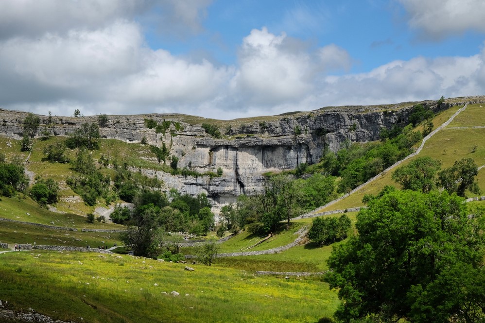
The final stretch of the southern section of the Pennine Way includes two challenging climbs and some of the most dramatic scenery to date, including one of the highlights of the entire walk, the iconic limestone amphitheatre of Malham Cove. Interestingly enough, scaling the steps beside the magnificent Cove doesn’t count as one of the two challenging climbs, but it may well have you stopping, hands on hips, at least once or twice, as will the climb out of Watlowes, the impressive dry valley beyond.
Next comes Malham Tarn; it seems rather strange to have a prominent body of water in such porous limestone country. The tarn is a haven for waterfowl and is incredibly popular with birdwatchers. Leaving the tarn the path heads to Tennant Gill Farm before starting the 900 feet ascent of the first of the challenging climbs, Fountain Fell.
Reaching the wall at the top of the climb, you’ll enjoy your first view of your next target, the second of the two climbs, Pen-y-ghent, one of the Yorkshire Three Peaks. Leaving Fountains Fell you journey along a lovely lane which provides a magnificent vista of the stepped profile of Pen-y-ghent. The thought of the 600 feet climb can at first feel a little daunting, however once you begin to tackle it, although a bit of a challenge, is actually much easier than you might think. The view from the summit, with its trig point and shelter, is simply sublime.
All that remains now is the well-trodden path down to Horton-in-Ribblesdale and the completion of the southern section of the Pennine Way.
Horton in Ribblesdale to Hawes
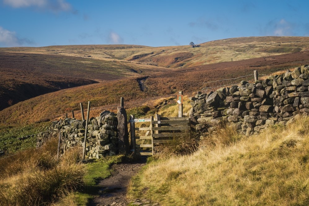
The central section of the Pennine Way begins with a climb out of the village along the narrow Harbour Scar Lane, one of several walled packhorse trails on this opening section. These stony tracks were used for centuries as thoroughfares over the dramatic limestone moors.
Where there is limestone there are pot holes, with Sell Gill Holes being a fine example as the water from Sell Gill Beck suddenly disappears off into the ground.
The landscape around here, characterised by limestone scars, ravines and dried river beds is known as ‘Karst’, a geographical term derived from Slovenia. One such ravine, Ling Gill, protects significant native tree species. Beyond Ling Gill Bridge the trail heads out onto the open expanse of Cam Fell with the reward of fine views to each of the Yorkshire Three Peaks as well as Ribblehead Viaduct.
Next comes Oughtershaw Side where the trail joins West Cam Road above the luscious green valley of Snaizeholme. Surrounded by hills and a huge sky the path unravels easily and the moorland walking down into Hawes is both easy and enjoyable.
Hawes to Keld
With the limestone of the southern Dales behind, the trail will, for a time at least, return to the peat landscapes navigated on the early sections of the southern stretch of the Way, but not before an enjoyable stroll through Wensleydale, out of Hawes. Here you will cross hay meadows that in early summer will be brimming with wildflowers.
If you’re walking following a spell of heavy rain you may be tempted to visit the impressive Hardraw Force, access is through the Green Dragon Inn at Hardraw. This little detour is a temporary distraction from the reality of what lies ahead, the 4.5 mile ascent of Great Shunner Fell. Standing at 2349 feet this is Yorkshire’s third highest mountain.
The walk off Great Shunner Fell down into the village of Thwaite is fairly gentle, and greatly appreciated ahead of the next climb, out of the village, up the steep slopes of Kisdon Hill. The path around Kisdon to the head of Swaledale is marvelous, and provides stunning views into Swinner Gill and onto East Stonedale Moor. All too soon you arrive in Keld.
Keld to Middleton-in-Teesdale
Leaving Keld the trail heads in the direction of the Tan Hill Inn, which at 1732 feet above sea level is Britain’s highest public house. Initially the path runs along a narrow lane between walls, similar to the walk out of Horton, before opening to a wide, peat cushioned path skirting Stonesdale Moor.
After Tan Hill the trail drops down to cross Sleightholme Moor which has the potential to be the wettest stretch of the Way so far. Following prolonged rain the peaty path can become saturated leaving you with little choice but to leap across the peat groughs in an effort to keep your boots dry. Good luck!
Beyond Sleightholme Farm the trail splits in two, later to rejoin at Baldersdale.
The direct route heads over Wytham Moor, dropping down to meet the natural stone span of God’s Bridge before passing beneath the A66 trunk road via an incredibly helpful subway. Here begins a steady ascent out of Stainmore Gap, before taking an undulating course over Cotherstone Moor to Baldersdale enjoying tremendous views ahead to Lunedale and the hills beyond Weardale.
The Bowes Loop, as the name suggests, visits the town of Bowes. Although it adds a good 4 miles to the overall length of the trail, it does have the advantage of accommodating a fairly comfortable 13 mile day from Keld, followed by an equally comfortable 12 miles on to Middleton-in-Teesdale. The direct route links Keld and Middleton-in-Teesdale in one really quite demanding 21 mile day.
The Bowes Loop also benefits from a somewhat drier path, avoiding Cotherstone Moor. The rock formations at Goldsborough provide additional interest to this section of the trail.
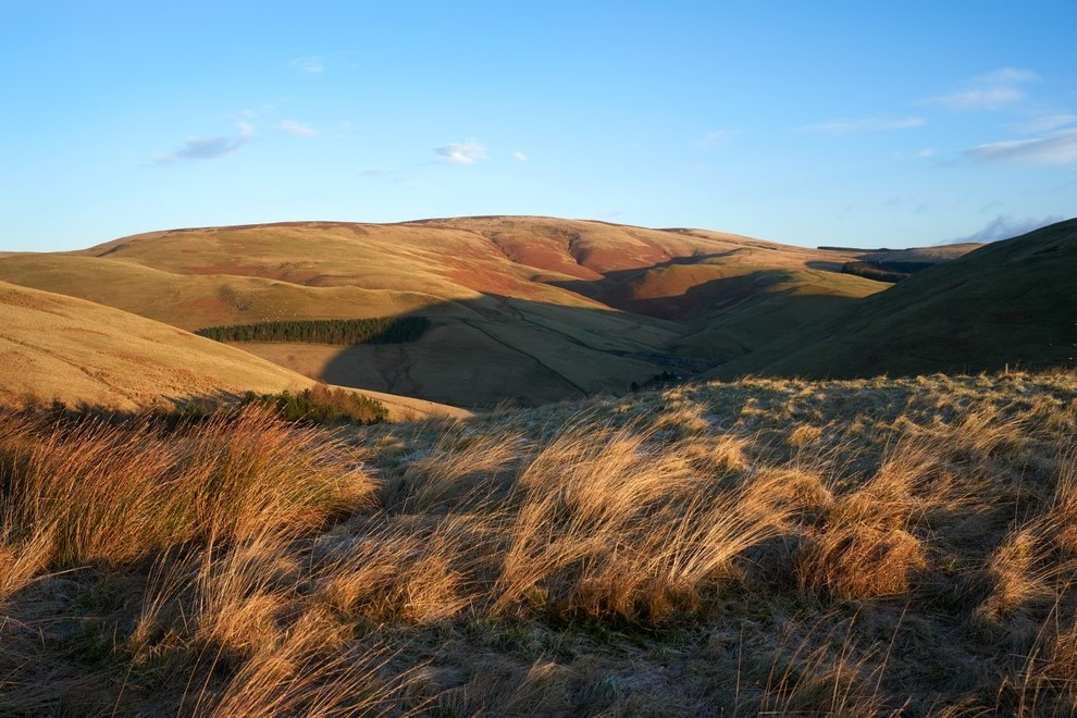
Returning to a single trail at Baldersdale the Way passes between Balderhead Reservoir and Blackton Reservoir and soon after, between Selset Reservoir and Grassholme Reservoir. You’re now at the halfway point on the Pennine Way, but there’s still work to be done to reach Middleton-in-Teesdale which lies 7 miles and nearly 10,000 feet of ascent away over Mickleton Moor and Harter Fell.
Middleton-in-Teesdale to Dufton
This is arguably the most impressive stretch of the Pennine Way, culminating in one of the finest sights in England. Furthermore, if you like waterfalls, you’re going to thoroughly enjoy this section of the trail. Given that the Pennine Way is a linear south to north walk, this section is also a bit of an oddity as it finishes further south than it begins!
Following the Tees the trail leads to Low Force, an impressive double waterfall. Beyond Low Force the river becomes both wider and faster, spilling over a spectacular 70 feet drop at the magnificent High Force. The trail then winds its way between rising cliffs at Cronkley Scar and Falcon Clints to reach the huge waterfall of Cauldron Snout, fed by Cow Green Reservoir.
Beyond the reservoir the Way briefly follows the access road to the isolated farmstead of Birkdale, before breaking out on the open moors again by Rasp Hill with its long-abandoned mine workings.
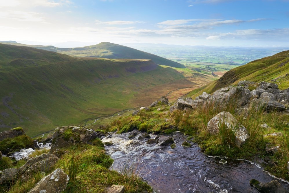
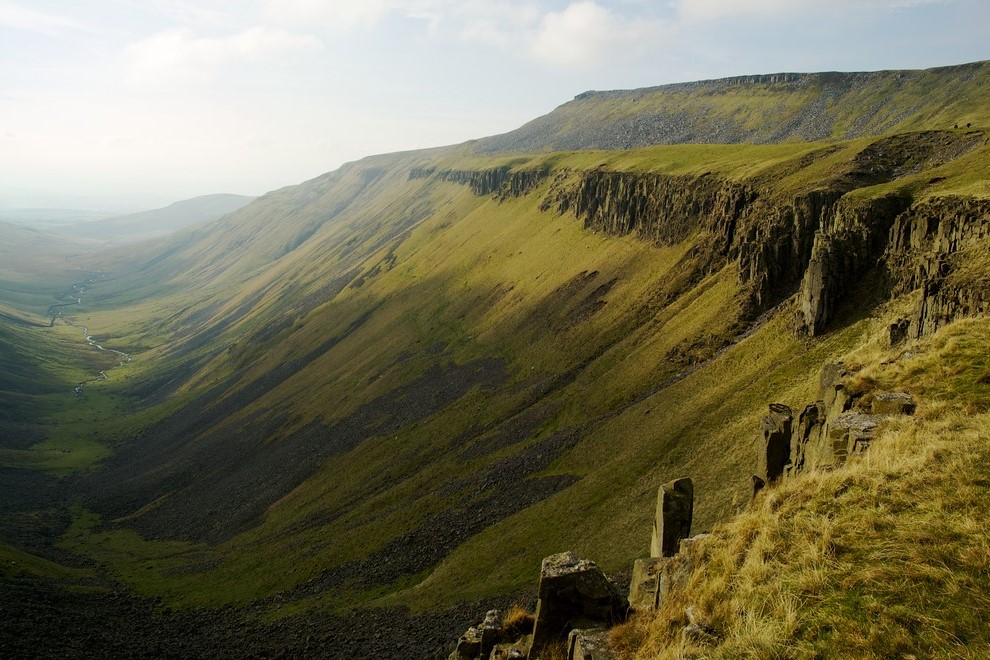
The walk through the open valley of Maize Beck is a delightful experience, yet it pales in comparison to the true highlight of the day, and perhaps the entire Pennine Way; High Cup Nick. Suddenly, a breathtaking sight unfolds as the land drops away before you, revealing a classic U-shaped example of glacial erosion. The valley’s sides are a mix of hard rock, jumbled scree and shimmering rivulets. This remarkable scooped-out bowl exemplifies glacial erosion in all its splendor, a genuine feast for the eyes. Take your time to savour the view in the knowledge that Dufton lies just 4 easy miles away along an old miner’s track.
Dufton to Alston
The main challenge on this section of the trail is scaling Cross Fell. At 2930 feet above sea level it’s the highest point on the Pennine Way. Starting out from Dufton at a mere 600 feet, be ready for a considerable climb. Ensure you’re well-prepared, this is a proper mountain walk. It deserves to be taken seriously.
The official route skirts the edge of Dufton, taking a narrow path between fields on the outskirts of the village. However, many walkers prefer using the unofficial route through the village and along a quiet lane until both paths merge near Coatsyke Farm. From there, a track leads to the ruins of Halsteads and the final gate to open country.
The ascent begins gently, but the gradient increases significantly after crossing the ladder stile over the last access wall.
Over the next couple of miles, as you ascend Knock Fell, you’ll cover almost 1500 feet of the total ascent on this section. Weather permitting, the white dome of the radar station on Great Dun Fell will be your next target, however, in misty conditions, do refer to your map and compass at regular intervals to find the route off Knock Fell.
After two more ascents and a few additional miles, you’ll reach the summit of Cross Fell, the roof of the Pennines, where hopefully a breathtaking panorama awaits. Descending from the summit may not be obvious in mist, so again ensure you refer to your map and compass.
Once safely down to Garrigill all that remains are a final few miles along the river to Alston.
Alston to Greenhead
This stretch of the trail marks the end of the Pennine Chain and the steady transition to the Southern Upland range beyond Hadrian’s Wall. Although less demanding than the previous leg, it still serves up a few challenges.
The first settlement encountered is the tiny hamlet of Slaggyford, nestled beneath Williamston Common. Soon after comes Burnstones Farm where the Pennine Way joins the Maiden Way, an old Roman Road that served Hadrian’s Wall.
Enjoy the firm footing here, because once you pass Greenriggs Farm and reach Blenkinsopp Common things become a little more of a challenge as you enter what could prove to be wettest stretch of your Pennine Way experience. Even after months of drought the likelihood is you will still end up with wet feet here.
The final squelchy challenge of the day is Black Hill. The one crossed in the early part of the southern section of the trail had been tamed with slabs, this Black Hill hasn’t.
Eventually a good track leads to the A69 where after a careful crossing you will walk down into Greenhead village and the completion of the central section of the Pennine Way.
Greenhead to Bellingham
Expect things to be a little busier for a time, especially at weekends and in high season. The early part of the northern section of the Pennine Way is along the best preserved stretch of Hadrian’s Wall and it attracts tens of thousands of visitors every year. It won’t have felt this busy since Hawes or Malham. The Wall follows the edge of the escarpment ensuring you have plenty of short steep climbs to contend with. Walltown Crags marks the first good section of Wall and this is followed a few miles on by the faint outline of Great Chesters Fort.
At Rapishaw Gap, the trail breaks from Hadrian’s Wall and heads north between Greenlee Lough and Broomlee Lough up into the forest. With luck, your way through the trees will be dry and springy, however after heavy rain, forestry paths can prove a muddy affair.
Emerging from the trees to cross Haughton Common you will, on a clear day at least, be rewarded with a view of the Cheviot Hills.
Your next focus is the radio transmitter station above Shitlington Crag, which can be seen from several miles away. The way there is through a delightful combination of meadows, farmland and quiet country lanes, ahead of a short scramble up a rocky escarpment and a final walk across fields.
Having reached the mast, all that remains is a descent through rough pasture to reach the roadside and a short stroll into Bellingham.
Bellingham to Byrness
This is a relatively comfortable stretch ahead of the difficult final push over the Cheviots Hills. Luscious green meadows, heather-clad moorland, forest trails and riverside paths combine to make this a thoroughly enjoyable section of the Pennine Way.
First up is a climb out of the village and into the green fields around Blakelaw Farm before giving way to rough pasture by Abbey Rigg. Then it’s on to heather-clad heather moorland where the narrow track demands walking in single file for a time.
The pleasantly named Deer Play provides fine views, and these in turn are surpassed by those from nearby Whitley Pike and again from the path around Padon Hill.
A steep climb onto Brownrigg Head is followed by the likelihood of a muddy tramp for a short time on the edge of Redesdale Forest, before reaching the forestry road and a much welcomed firm surface for the next three miles.
If you’re finding the firmer ground hard going you can rest a while at the picnic benches at Blakehopeburnhaugh, before a final stretch of woodland alongside the River Rede down to Byrness village.
Byrness to Kirk Yetholm
The traverse of the Cheviot Hills begins with a steep climb up between trees to the airy summit of Byrness Hill. Take time to savour the stunning views before heading over Saughy Crag towards Houx Hill where some greatly appreciated slabs help you cross the previously horrendous bog. Then it’s on over Ravens Knowe to reach the anonymous grassy lumps that are the remains of the Roman Camp at Chew Green.
The slabs are intermittent along the length of the Cheviot ridge. In addition to helping keep your feet dry they also act as a handy navigational aid in poor weather.
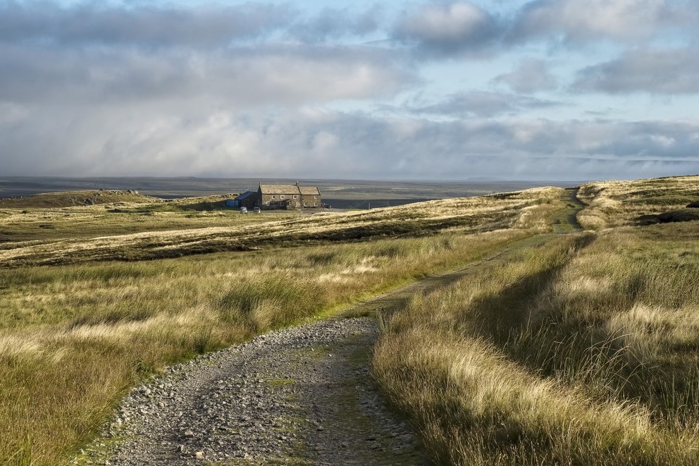
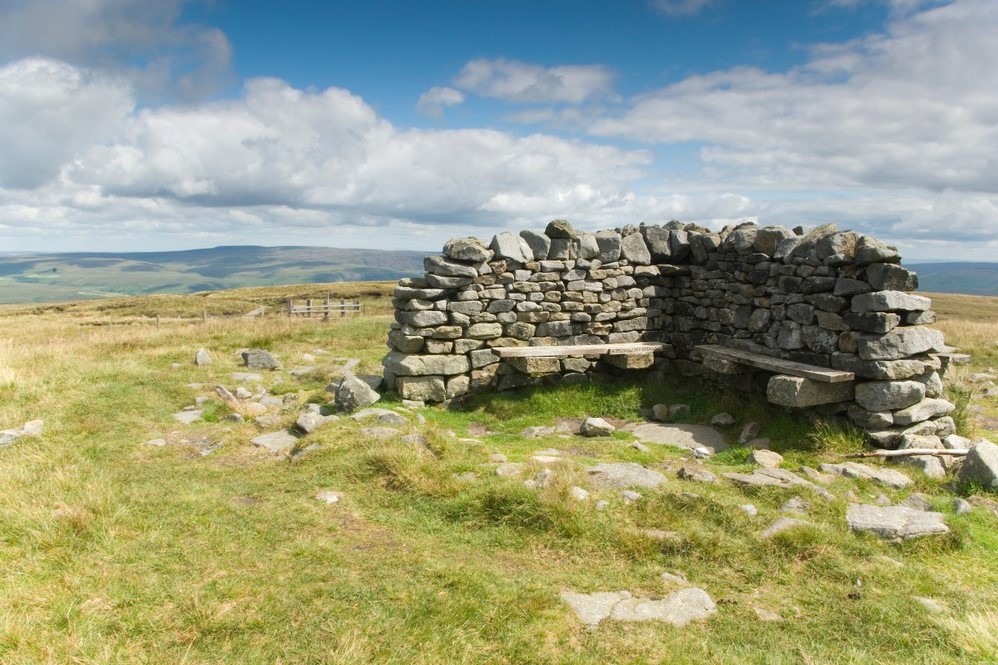
The relentless up and down of the Cheviot ridge can take its toll. Poor weather makes things harder still, therefore it’s reassuring to know there are a couple refuge huts where you can take shelter and rest your legs. The first of these is at the foot of Lamb Hill, about eight miles into the walk.
The trail continues along the Scotland England border with long ascent followed by long descent and so on. Thankfully the trig point on Windy Gyle marks the point to leave the Cheviot ridge for now and descend to Trows Farm to be transferred back to Byrness for the evening.
Back onto Windy Gyle the following morning, the first task is the climb up King’s Seat and along to the foot of The Cheviot. The optional walk onto The Cheviot summit is well worth the effort if you have it in your legs. Should you do so, take heart from the fact that soon after returning to the official Way there is another refuge hut in which to sit and take a breather. You might need it as next up is the steepest ascent of the day, up to The Schil.
Beyond The Schil the rollercoaster trail continues over Black Hag and White Law before mercifully dropping down into Kirk Yetholm and the end of the Pennine Way, which you will no doubt testify as being Britain’s most challenging National Trail.
All but seasoned walkers will find the Pennine Way to be a challenging walk at times, particularly so when crossing the highest of the Pennine hills where low cloud and high winds can hamper progress. There are some consistently lengthy days, often over remote moorland and hill country with a number of stiff climbs thrown in for good measure. Some walkers may feel very isolated traversing the Cheviot Hills. However, well prepared walkers with experience using a map and compass, will relish the task in hand and find the experience of walking Britain’s oldest National Trail hugely enjoyable and enormously rewarding.
Terrain: A combination of heather-clad moorland, slabbed in places, as well as a number of prominent hills, some with long ascents, others with steep climbs. Also limestone pavement, pastures, forestry, stony tracks and gravel access roads.
What’s it like underfoot? Thanks to the use of stone slabs the days of wading knee deep through peat bog on the first few southern sections are a thing of the past. Laid over the worst of the bogs to prevent erosion, the slabs provide walkers with a firm dry path as well as a handy navigational aid. Beyond the Bleaklow and Black Hill area just described, it’s just as you’d expect over any heather-clad moorland. Sections of gravel access roads by the many reservoirs are of course firmer under foot as is the limestone pavement in the Dales, albeit a little rougher going.
The central section doesn’t benefit from the stone slabs found on the early part of the southern stretch, therefore when crossing moorland there is some pretty wet ground to navigate in places. Things are initially drier under foot walking the last of the limestone pavement in the Dales and the routes on and off the higher hills are firm enough.
In the main the northern section is much drier than the central. The early part of the walk along Hadrian’s Wall is well trodden and firm under foot. Forestry paths are known for cutting up easily, so be prepared for muddy boots on those sections. After a dry spell the heather-clad moors will feel springy underfoot, after heavy rain expect a squelchy time of it. The large grassy hills of the Cheviots make for better walking with some of the wetter areas benefiting from stone slabs.
How Much Up & Down? A considerable amount. Although the moorland tends to be undulating rather than hilly, there are a number of tough climbs as well as some long, steady ascents to take into consideration. There are a couple of challenging climbs in the Dales, most notably 900 feet (275m) of ascent onto Fountains Fell and soon after a 600 feet (180m) climb onto Pen-y-ghent, one of the Yorkshire Three Peaks. There is also the matter of Cross Fell. At 2,930 feet (895m) above sea level it’s the highest point on the Pennine Way. Starting out from Dufton at a mere 600 feet (180m), be ready for a considerable climb. The Hadrian’s Wall stretch comprises a number of steep little climbs. Approaching the Cheviots there are gradual climbs through forestry and over the open moorland too. The final two days over the Cheviot Hills will see you tackle over 5,000 feet (1,525m) of ascent on an undulating traverse.
Signposting: Sign posts will usually include the words Pennine Way, along with the National Trail acorn symbol. Occasionally, posts will have the initials PW carved or painted onto them. There may also be markers for other routes such as the Pennine Bridleway, Dales High Way, Dales Way or Herriot Way. Take time to ensure you are following the correct markers.
Navigation: Providing you familiarise yourself with the route beforehand and you refer to your guidebook and map at regular intervals, as well as carry a compass and know how to use it, it should be really straightforward.
The guidebook is incredibly detailed and we supply two 1:40k Harvey Maps clearly showing the whole route. As a note of caution there are a number of other routes crossing paths with the Pennine Way and at times sharing paths. Take time to ensure you are following the correct markers. Refer to your guidebook and map at regular intervals, especially during poor weather. Moorland can quickly become bleak and featureless in low cloud. The Cheviots will feel very remote and navigational errors can be unsettling until resolved.
Weather: Fingers crossed you will experience dry, warm weather throughout your holiday and enjoy dry paths and tremendous views, but you must be prepared because the weather can change quickly, especially on moorland and over high ground. Cross Fell, the highest point on the Pennine Way is prone to high winds. Other than a few refuge shelters there is no escape from the elements on the Cheviot Hills. Good clothing, comfortable footwear and reliable waterproofs are essential. It is important you carry plenty of water on warm days.
You may have to wait to be transferred from the moors into the nearby town or village for the evening. There will be little or no shelter while you wait. Ensure you have appropriate layers with you as you can otherwise quickly become cold when standing around.
|
All Holidays
|
|
| Accommodation | Overnight Bed and Breakfast accommodation in selected hotels, farmhouses, village inns, guest houses and family B&Bs. Cooked or Continental breakfast. |
| Guidebook | A detailed guidebook with route information, maps, photos and background information. |
| Information of Services Along the Route | A comprehensive Service Info sheet, including services such as cash points, banks, post offices, village shops, inns, cafes and taxis. |
| Maps | Two waterproof (1:40,000) Harvey Maps covering the whole of the Pennine Way. |
| Personal Itinerary | A personal itinerary setting out each overnight stop, including large scale maps of each accommodation, to ensure you find it easily. |
| Emergency Telephone Support | If you get in to difficulties during your holiday, we are always available to help, even out of office hours. |
|
Options
|
|
| Luggage Transport | We will transfer your luggage between each overnight stop – if you leave your luggage at the accommodation when you set off in the morning, it will be moved on to your next B&B. You only need to carry a small day sack with the clothes and provisions you require during the day’s walk. |
| Packed Lunches |
Provided for each day’s walking where offered by your host. |
| Off Road Parking | If you are travelling by car we can usually arrange off road parking for the duration of your trip. (There may be a small charge for this). |
| Arrangement of return transport | We can also arrange your transfer back to your car, (or advise you when public transport is a better option)! |
|
What’s not Included
|
|
| Evening Meals | Your evening meal isn’t included in the package, but we include full details and recommendations for each evening meal in your itinerary. You will normally be within walking distance of a pub and/or restaurant, or where there is good food available at the accommodation, we’ll book that for you. Allow about £30.00 per night. |
| Transport to the Start & Away from the Finish | Have a look at the “Travel Info” tab above for suggestions. If you’re still struggling, get in touch and we’ll help you sort it out. |
| Travel Insurance | Even if you are based in the UK travel insurance is worth having. |
Good accommodation and friendly hosts are an essential part of any holiday. We understand this and go out of our way to find the best. We put a great deal of effort into hand picking our accommodation and matching it to individual customer requirements. As well as visiting the accommodation ourselves, we ask all our customers to complete a short evaluation on each night’s accommodation, which then gives us an insight into the day-to-day operation and lets us spot any potential issues before they become a problem.
In selecting the accommodation we look for helpful, friendly hosts with good quality, characterful accommodation close to the trail. We use a variety of accommodation on the Pennine Way. Over the course of your trip you might stay in a village inn, a bed and breakfast in a converted barn, a Victorian guest house, or on a working farm. Occasionally we may use a chain hotel. In more remote locations you will have the opportunity to dine with your hosts and alongside fellow walkers.
We always try to arrange en suite accommodation, i.e. rooms with their own bathrooms for each night of your stay. However, in some of the more remote locations accommodation is limited and occasionally we may have to book rooms with shared bathrooms for one or two nights of your holiday, (especially if the booking is made at short notice), but we will always let you know if this is likely to be the case.
We are happy to book single rooms on our holidays but cannot normally book more than two for any one group. Single room bookings include a supplement.
Here are some of examples of the accommodation we use on the Pennine Way:
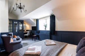
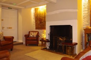
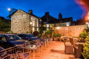 Situated in the delightful Saddleworth village of Delph is The Old Bell Inn, an 18 bedroomed, four star AA and Visit England accredited Inn. This splendid 18th century listed Coaching House is rich in history and has been thoughtfully transformed to reflect a blend of traditional old English warmth with contemporary luxury. Visit their website
 In the charming village of Haworth Josie and Brendan welcome you to their stunning guesthouse. Thoughtfully renovated; celebrating the past but with a nod to the future, Weavers of Haworth offers a stylish and snug place to stay in the heart of Haworth. An ideal location from which to explore Brontë country. Visit their website
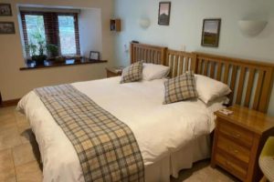
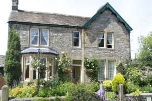 Located in the picturesque village of Malham is River House, a charming property dating back to 1664. River House has 8 individually decorated bedrooms, with lovely homely touches. Alex and Ann have been welcoming walkers for almost 20 years and setting them up for the day ahead with a delicious Yorkshire Dales Aga cooked breakfast. Visit their website
 Marco and Jillian are your hosts at Broad Croft House B&B in Horton in Ribblesdale. Their cosy, family-run Bed and Breakfast has a stunning view of Pen-y-ghent, one of the Yorkshire Three Peaks. Comfortable rooms, beautifully decorated, and a spacious garden make Broad Croft the perfect place for a relaxing stay. Visit their website
 Andrew assures you of a warm welcome at Brunswick House in Middleton in Teesdale. You will enjoy a relaxed homely environment whilst receiving a professional standard of hotel service and customer care. This delightful house boasts Georgian fireplaces and exposed beams whilst incorporating all modern conveniences. Visit their website
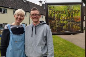 Laura and Oli are your hosts at Forest View Walkers Inn at Byrness. You will spend two nights at this ‘special place in the forest’ enjoying their delicious home cooked food in a friendly communal setting. Staying at Forrest View splits the lengthy Cheviots section over two days with Oli picking you up from, and dropping you back on, the trail. Visit their website
General travel information for the Pennine Way will be in your holiday pack.
Detailed instructions on getting to your first night’s accommodation by car, or on foot from the nearest train or bus station, will also be included in the holiday pack on individual accommodation maps.
To view train times please visit trainline where you can also purchase tickets in advance. For information on bus timetables please visit traveline
Getting to Edale:
By Air: The nearest International Airport to the trail is Manchester. Trains run between Manchester Airport and Edale, changing at Manchester Piccadilly.
By Public Transport: There is a train station in Edale. Edale is located on the Hope Valley Line from Manchester to Sheffield. The average travel time from the centre of Manchester or Sheffield to Edale is about 40 minutes.
By Road: Edale is approximately 50 minutes from the M1 junction 29 (Chesterfield), 40 minutes from the M60 motorway and 60 minutes from the M6 junction 14 (Stafford).
Returning from Kirk Yetholm:
By Public Transport: The nearest railway station to Kirk Yetholm is Berwick Upon Tweed, which is on the Main East Coast Line from Edinburgh to London Kings Cross, and also has convenient stops at Newcastle, York and Doncaster.
By Road: Kirk Yetholm is located just off the B6352 near to the Scotland England border, approximately 30 minutes east of the A68 linking Jedburgh and Newcastle, and 20 minutes west of the A697 linking Coldstream and Wooler.
Hebden Bridge
Hebden Bridge is a picturesque town with plenty to see and do. It is renowned not only for its stunning natural scenery, but also its historic architecture and vibrant cultural scene, making it a popular destination. The town is home to a thriving arts and music scene, with numerous galleries, performance spaces, and festivals throughout the year. Hebden Bridge also boasts a number independent shops and a variety of unique boutiques, cafes, and restaurants. The town has a laid-back, bohemian vibe that appeals to many visitors.
Haworth
The charming village of Haworth is probably most famous for being the former home of the Brontë sisters, authors of some of the most iconic novels in English literature, making it a popular destination for literary enthusiasts from around the world. The village is steeped in history and has preserved much of its original character. Visitors can explore the Bronte Parsonage Museum, which contains exhibits on the lives and works of the Bronte sisters, as well as other historical landmarks such as the Haworth Church and the Keighley and Worth Valley Railway, a 5-mile-long heritage railway line.
Skipton
With its beautiful and well preserved medieval castles, cobbled streets and its location on the southern edge of the Yorkshire Dales National Park, Skipton is a nice place to spend an extra day. It is a friendly small town with a market four days a week, you can explore the castle or take a boat trip on the canal.
Malham
A half day exploring Janet’s Foss and Gordale Scar is top of the list of things to do when visiting Malham.
Walking the Pennine Way you will of course scale the steps beside the magnificent Malham Cove before heading through Watlowes dry valley and rounding Malham Tarn, however also consider spending a little time at the Cove on your rest day, unhurried, allowing you to push on with the walking the following day.
Horton in Ribblesdale
Having scaled Pen-y-ghent when walking from Malham into Horton in Ribblesdale, why not add an additional day to ascend one of the other iconic Yorkshire Three Peaks. Choose from Ingleborough or Whernside, or indeed both?
Ingleborough is easily accessible from Horton in Ribblesdale, while a ten minute train ride round to the Ribblehead will have you best positioned for Whernside, or an Ingleborough and Whernside combination.
Hawes
Hawes is a bustling market town, lying in the heart of the Yorkshire Dales National Park and surrounded by spectacular scenery. With many craft workshops, antique and speciality shops and restaurants on offer, it’s the perfect place to spend a well-earned rest day. This picturesque town is home to the famous Wensleydale Cheese and the renowned Dales country side museum.