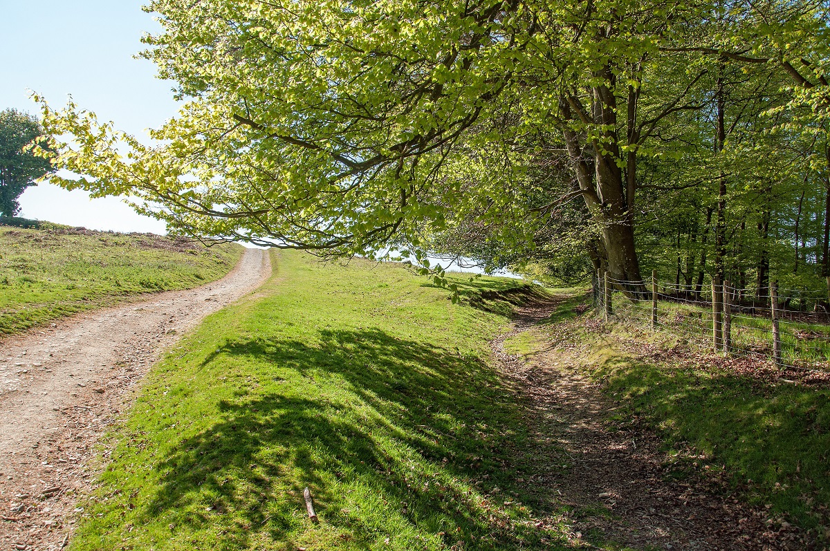
Offa’s Dyke Path
Stronger walkers will enjoy this 13 day itinerary, which maintains a steady pace across the length of the trail. With several longer stages, including a demanding 18 mile day between Welshpool and Candy, it is well suited to those comfortable with consecutive full days in the hills.
Itinerary
| Day | Itinerary | Miles | Km |
|---|---|---|---|
| Day 1 | Travel to Chepstow for your first nights accommodation | ||
| Day 2 | Chepstow to Redbrook then transfer to Monmouth | 15 | 24 |
| Day 3 | Transfer back to Redbrook, walk to White Castle then transfer to Llangattock Lingoed | 14 | 23 |
| Day 4 | Transfer back to White Castle then walk to Longtown | 13 | 21 |
| Day 5 | Longtown to Hay-on-Wye | 13 | 21 |
| Day 6 | Hay-on-Wye to Kington | 15 | 24 |
| Day 7 | Kington to Knighton | 14 | 23 |
| Day 8 | Knighton to Cwm | 14 | 23 |
| Day 9 | Cwm to Welshpool | 14 | 23 |
| Day 10 | Welshpool to Candy | 18 | 29 |
| Day 11 | Candy to Llangollen | 16 | 26 |
| Day 12 | Llangollen to Clwyd Gate then transfer to Llanferres | 15 | 24 |
| Day 13 | Transfer back to Clwyd Gate then walk to Bodfari | 12 | 19 |
| Day 14 | Bodfari to Prestatyn | 12 | 19 |
| Day 15 | Depart from Prestatyn after breakfast |
Prices
| Accommodation, map & guidebook only | £1695 |
| with Luggage Transport | £1890 |
| with Packed Lunches | £1851 |
| with Luggage & Lunches | £2035 |
Other Options |
|
| Extra Nights (per night) | £104 |
| Single Supplement (per night) | £70 |
| Solo Luggage Supplement (per day) | £15 |
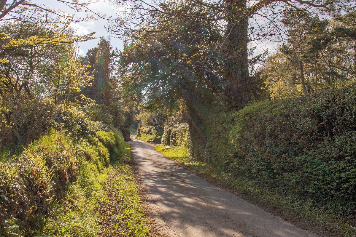
Chepstow to Redbrook
The opening 1.5 miles from Sedbury Cliffs to the edge of Chepstow offer a gentle introduction to what is a truly superb long-distance walk, and are best seen as a brief prelude to the landscapes that lie ahead.
Beginning at the southern end of the route means you are immediately walking alongside Offa’s Dyke itself, unlike at the northern end where signs of the Dyke do not appear until much later at Castle Mill.
In these first few miles, the trail gives you an early taste of the ancient earthwork, leading through fields and past Buttington Tump before briefly passing through the outskirts of Chepstow. It’s worth keeping a close eye on your guidebook and it’s detailed maps, as well as the acorn waymarkers on lamp posts and gates, as this initial section can be easy to miss if you are not paying attention.
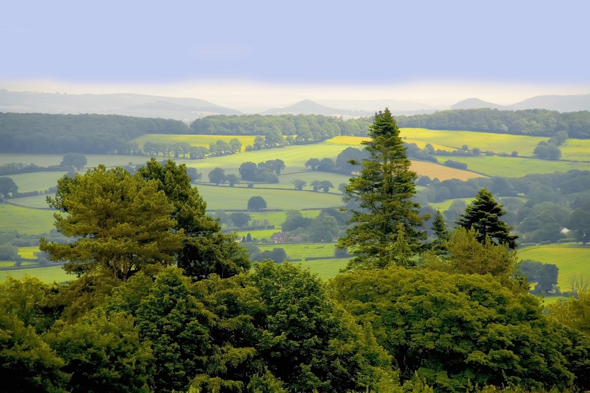
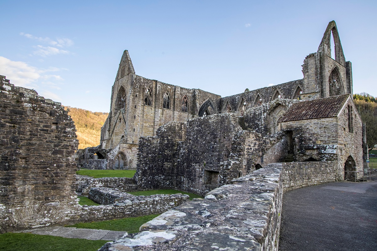
Once beyond Chepstow and its surroundings, the route soon begins to reveal more of its character. The section onwards to Monmouth makes for a rewarding day’s walk, though many walkers choose to ease into the trail by dividing it into two stages. Tintern is an excellent option for an overnight stop. While it may feel like an early pause, it can be a wise choice, allowing your legs to settle into the rhythm of the walk and leaving you well prepared for the longer and more demanding days still to come.
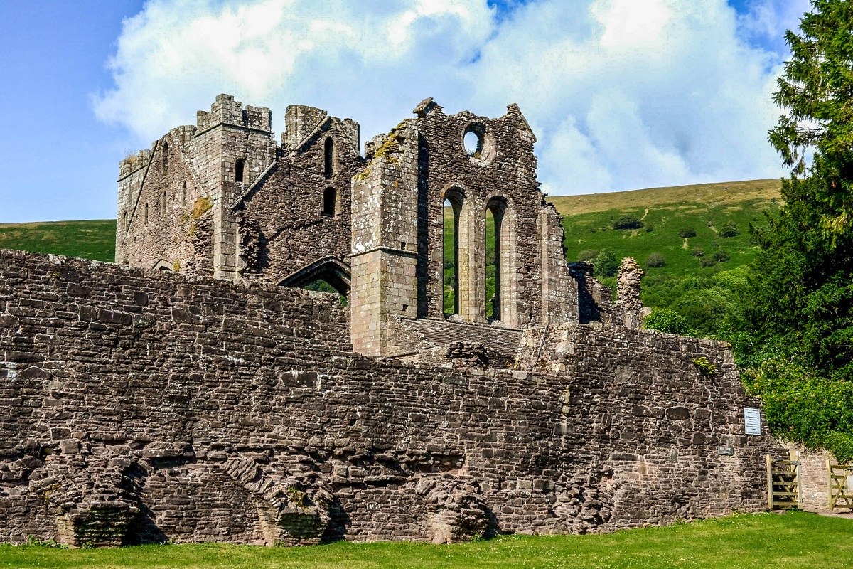
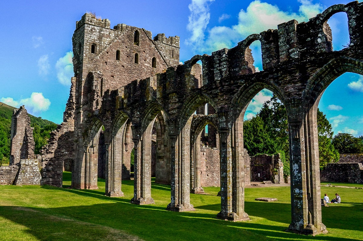
Those walking into Tintern are rewarded with the magnificent riverside ruins of Tintern Abbey, one of the standout highlights of the early stages of the walk. For those continuing directly on to Redbrook, the Abbey still makes a memorable appearance, offering an enticing glimpse through the trees from the path high above the River Wye.
Redbrook to White Castle
This section leads through gently undulating countryside, with the land gradually rising towards the Black Mountains. Leaving Monmouth and the River Wye behind, the path begins to reveal a quieter, more rural character as it meanders northwards.
The route follows Watery Lane, passing the edge of a housing estate before opening out into pleasant fields that lead on to King’s Wood, a mixed woodland of broadleaved trees and conifers. Depending on the day, you may hear the sounds of forestry work nearby, adding to the sense of this being a working landscape as well as a beautiful one.
Emerging from the trees, the path passes The Hendre before continuing across more fields to Abbey Bridge. This is the most visible reminder of the former Cistercian abbey of Grace Dieu, founded in 1226 by John of Monmouth and later destroyed during the reign of Henry VIII. Although no visible remains survive, it is easy to imagine the importance this site once held. Just before reaching the bridge, keep an eye out for the rare White Park cattle, a distinctive and memorable sight along the way.
A few fields beyond the bridge, the route rejoins the River Trothy, which accompanies you as far as Llanvihangel-Ystern-Llewern. The small church of St Michael is one of the many charming churches found along Offa’s Dyke Path, adding another layer of history to the walk.
From here, cider apple orchards and the B4233 guide you onwards to Llantilio Crossenny and ultimately to White Castle.
White Castle to Hay-on-Wye
Leaving White Castle behind, the route continues through peaceful border countryside towards the charming village of Llangattock Lingoed, where a small cluster of houses, a welcoming pub and the whitewashed church of St Cadoc make for a delightful point along the way.
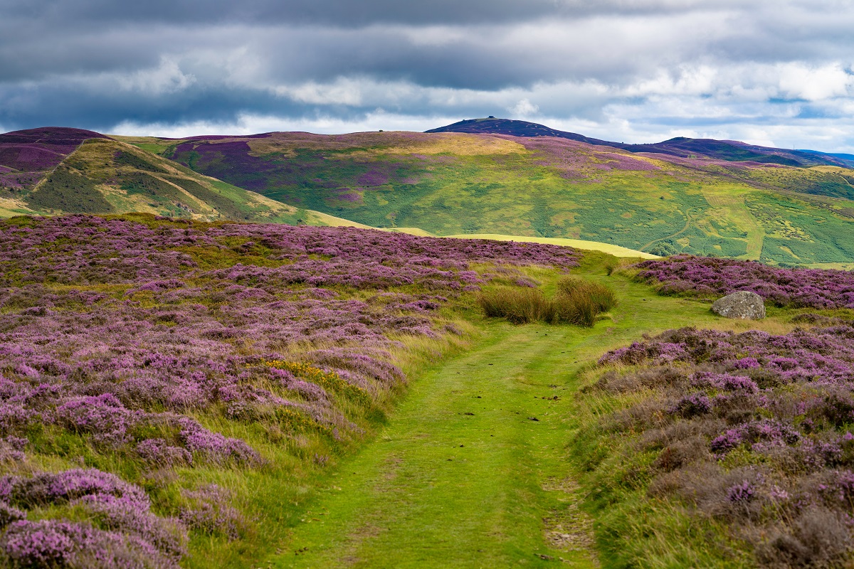
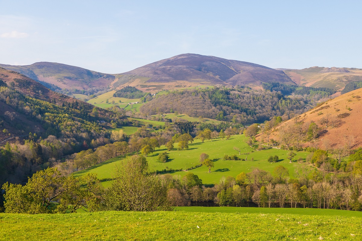
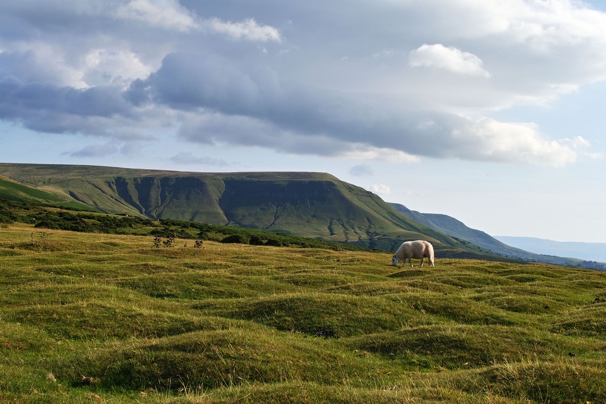
From here, the trail continues towards Pandy before beginning its ascent onto the long spine of the Hatterall Ridge and the highest point of Offa’s Dyke Path at 2,360 feet (713m). This is one of the most memorable sections of the entire route, combining a wonderful sense of journey with some of the finest scenery on the trail.
Rather than tackling the ridge in a single push, we break this section with an overnight stay in Longtown. This is a lovely way to experience the landscape, allowing time to enjoy the dramatic setting of the Black Mountains and to fully appreciate the ridge walk without feeling rushed. Splitting the stage here turns it into one of the true highlights of the trail, giving you the chance to savour both the ascent and the wide-open views.
The route initially leaves the A465 through fields and quiet lanes before climbing steadily towards Hatterall Hill. Once on the ridge, the walking is generally good underfoot, with sections supported by substantial flagstones laid as part of an erosion-control programme by the Brecon Beacons National Park Authority.
With clear weather, this stretch offers some of the grandest walking on Offa’s Dyke Path, with sweeping views across the border country and a wonderful sense of space and elevation. The descent from Hay Bluff is particularly memorable, leading you gradually down towards the valley and onwards across moorland and farmland to the book town of Hay-on-Wye.
Hay-on-Wye to Kington
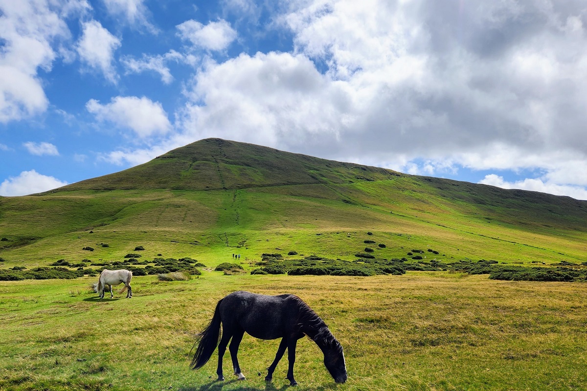
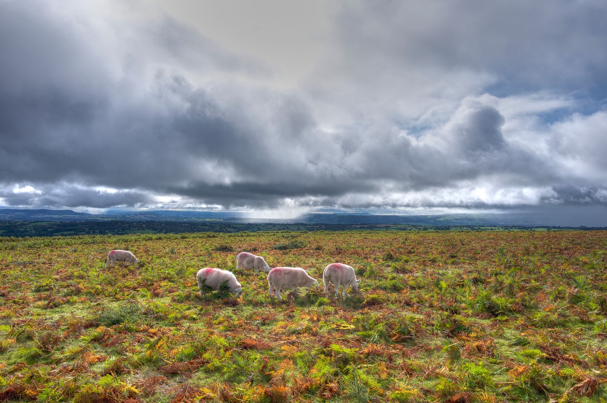
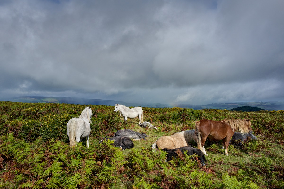
This stage includes another strong contender for the finest section of the entire trail: the crossing of Hergest Ridge, an open common grazed by sheep and wild ponies. From the ridge, there are wonderful views across the Shropshire Hills, while behind you the outline of Hay Bluff and the Black Mountains gradually fades into the distance.
Underfoot, the walking here is a pleasure, with soft springy turf that has been grazed by sheep for centuries. The ridge has long been shaped by the farming traditions of the area, and in late summer you may see cut bracken baled in the fields, used locally as bedding for livestock.
Before reaching the ridge and on to Kington, the route first draws you onwards through ten memorable miles to the small village of Gladestry. Leaving Hay-on-Wye and the River Wye behind once more, the path passes through Bettws Dingle, a shaded wooded glen that offers a lovely contrast to the open country still to come.
A short section of road walking leads to Newchurch before the trail rises over Disgwylfa Hill, where fantastic panoramic views begin to open out. From here, more open countryside leads you to Gladestry, the southern gateway to Hergest Ridge and the onward route to Kington.
This is a section to enjoy at a leisurely pace, taking time to appreciate the ever-changing views and the sense of space that makes this stretch so memorable.
Kington to Knighton
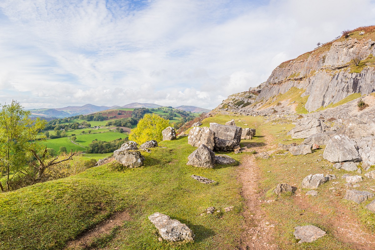
This section fits comfortably into a day’s walking and offers some truly marvellous stretches of the trail. Between Kington and Knighton, the route passes through wonderfully open country with minimal habitation, giving you long periods where it feels as though you have the landscape – and the Dyke itself – entirely to yourself. Several impressive sections of Offa’s Dyke are visible along the way, in places standing high and distinct with its accompanying ditch clearly defined.
Leaving Kington, the open hilltops soon begin to beckon, though first the route passes close to Kington Golf Club, the highest 18-hole golf course in England. The clubhouse is known for being welcoming to walkers and can make a handy stop for refreshments or any last-minute waterproof essentials.
Beyond Rushock Hill, the scenery becomes wonderfully varied, with bracken and gorse, open heathland and pockets of woodland combining to create a constantly changing landscape. It is a section full of atmosphere, often accompanied only by the wind, and the sight of soaring buzzards, with the occasional red kite adding to the sense of wildness.
Further switchbacks and gently rolling farmland follow, with several enjoyable stretches walking directly alongside the Dyke. Dolley Green may be little more than a point on the map, but it lies close to the attractive town of Presteigne, which is well worth a short detour if time allows.
The route then crosses Furrow Hill and Hawthorn Hill, both offering fine, airy walking and uplifting views, before continuing through farmland and onwards towards the final descent into Knighton, where another memorable day on the trail comes to a close.
Knighton to Cwm
This stage includes the well-known series of undulations known as The Switchbacks, a memorable sequence of ascents and descents that adds both variety and drama to the day’s walking.
The route begins by following the River Teme before climbing steadily onto Panpunton Hill. Here, a cairn stands in honour of the early pioneers of Offa’s Dyke Path, offering a lovely opportunity to pause and reflect on those who helped establish this remarkable long-distance trail. From the top, there are fine views back over Knighton and the surrounding border landscape.
Even broader views unfold from the next rise, Cwm-Sanaham, while the trail continues with particularly enjoyable walking across Llanfair Hill. At 1,417 feet (432m), this is the highest point on the Dyke itself, though the trail reaches an even greater elevation earlier in the Black Mountains.
A worthwhile nearby diversion for strong walkers is the secluded Clun, a charming small town around three miles from the route. Closer to the path itself, the beautiful chapel of St John the Baptist Church, Churchtown sits in a peaceful valley and makes a particularly memorable point along the walk. Its exquisite biblical wall texts and tranquil setting offer a welcome moment of stillness amid the day’s changing terrain.
The trail then crosses the east–west track of the Kerry Ridgeway, around four miles west of the attractive town of Bishop’s Castle. From here, it is only a short distance onwards to Cwm, bringing another rewarding stage of the walk to its close.
Cwm to Welshpool
This section remains faithful to the line of the Dyke, crossing Brompton Crossroads and the Plain of Montgomery before climbing to the summit of Beacon Ring. Once the site of an Iron Age hill-fort, the hilltop is now marked by beech trees and transmitter masts, though it still carries a strong sense of history. In earlier times, beacon fires would have been lit here, giving the hill its evocative name.
Along the way, there is the option of a worthwhile detour to the attractive town of Montgomery, which is well worth including if time allows. Even if remaining on the main route, there are lovely views across to the town and the ruins of Montgomery Castle.
After the more demanding terrain of the previous stage, the walking here feels more relaxed, with the trail tracing hedgerows and small copses through the quiet countryside of the River Camlad. The low-lying meadows along the river are typical of this stage, creating a peaceful and gently pastoral character, with good views across the surrounding landscape.
The route passes through the villages of Forden and Kingswood before continuing into the wooded grounds of the Leighton Estate, where distinctive monkey puzzle trees add an unexpected touch of interest.
From here, the path climbs to Beacon Ring before descending gradually through more fields and pasture to Buttington, from where the route turns towards Welshpool.
Welshpool to Llanymynech
This stage offers one of the gentler sections of Offa’s Dyke Path, making it a wonderfully relaxed and enjoyable experience. The route begins through fields beside the River Severn before crossing the busy A483 and reaching the Montgomery Canal, which is followed from the cantilever bridge as far as Pool Quay.
Both the river and canal bring a strong sense of the area’s history. The Severn was once navigable as far as Pool Quay, with vessels of up to 30 tons carrying goods onwards to Worcester and Gloucester. The nearby canal adds another layer of industrial heritage to the landscape.
The path soon returns to the River Severn, following the top of the Tit-y-mynach Embankment for around four miles.
This is peaceful walking across farmland, with the ever-changing movement of the river providing a constant companion. There is something particularly enjoyable about watching the Severn’s swirling eddies as it twists its way through the valley, while the surrounding countryside offers a gentler contrast to some of the more upland sections of the route.
Keep an eye out for the occasional welcoming table and chairs – and perhaps even cake – which can make for a memorable pause along the way. Birdlife is another highlight of this stage, with the chance to spot a variety of species along the riverbanks and, if you’re lucky, hear the distinctive call of curlews across the fields. Views eastwards to the tree-covered Breidden Hills add further interest.
As the Severn continues northwards towards Shrewsbury, the route keeps faithful to the line of the Dyke, continuing as far as Four Crosses before passing beneath the A483 and rejoining the canal. This final stretch is full of quiet charm, with swan nests and the attractively restored Carreghofa Locks making a particularly pleasant landmark before the short onward walk to Llanymynech.
Llanymynech to Chirk
Leaving Llanymynech, the path climbs through woodland to the limestone crags and former quarries of Llanymynech Rocks Nature Reserve. This is a particularly attractive section of the walk, noted for its butterflies in summer and for its far-reaching views across the Severn Plain to the Breidden Hills.
Soon you reach the broad, plateau-like summit of Llanymynech Hill, before a lovely wooded stroll beside the golf course leads gently down towards Perth-y-waen. From here, the route continues by road to Nant Mawr before climbing steadily onto Moelydd, where on a clear day there are rewarding views westwards towards Snowdonia.
The trail then descends to Trefonen before rejoining the line of the Dyke. From here, the walk continues through the Morda Valley, past the pretty hamlet of Ty’n-y-Coed, over open common land and through Racecourse Wood to Racecourse Common.
Beyond the common comes a particularly memorable stretch, as the path once again follows the line of Offa’s Dyke itself. Crossing Baker’s Hill and the shoulder of Selattyn Hill, the route continues through wonderfully quiet countryside to Craignant, before following the Dyke for one final time – at points beside it and at others directly along its crest.
The steep descent to Castle Mill is especially rewarding, with spectacular views of Chirk Castle unfolding ahead. There is a real sense of achievement here, knowing you have walked the full length of this great ancient earthwork, even though the trail itself continues a little further.
For walkers on our longer itineraries, this is where the route leaves the path for the evening, heading east into Chirk for an overnight stay.
Chirk to Llangollen
Returning to Castle Mill, the trail leaves the delightful River Ceiriog behind and begins to climb away from the valley through mixed woodland and farmland. Along the way, it passes the ‘garden gate’ of Chirk Castle, which in summer offers access to the castle grounds and is well worth taking advantage of if time allows.
At Ty’n-y-groes, the route joins the road for a while. Although the Dyke itself is no longer directly underfoot, it remains close by for much of this section, running discreetly alongside the line of trees to the east before finally disappearing near the A5.
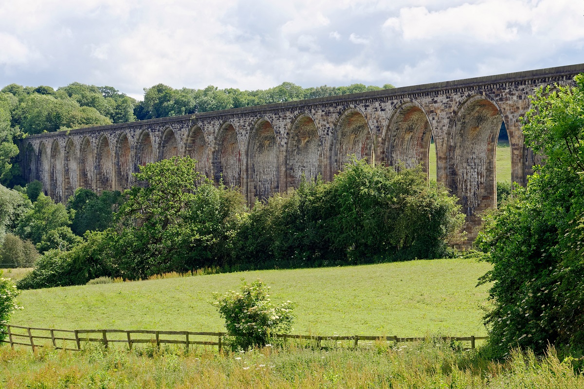
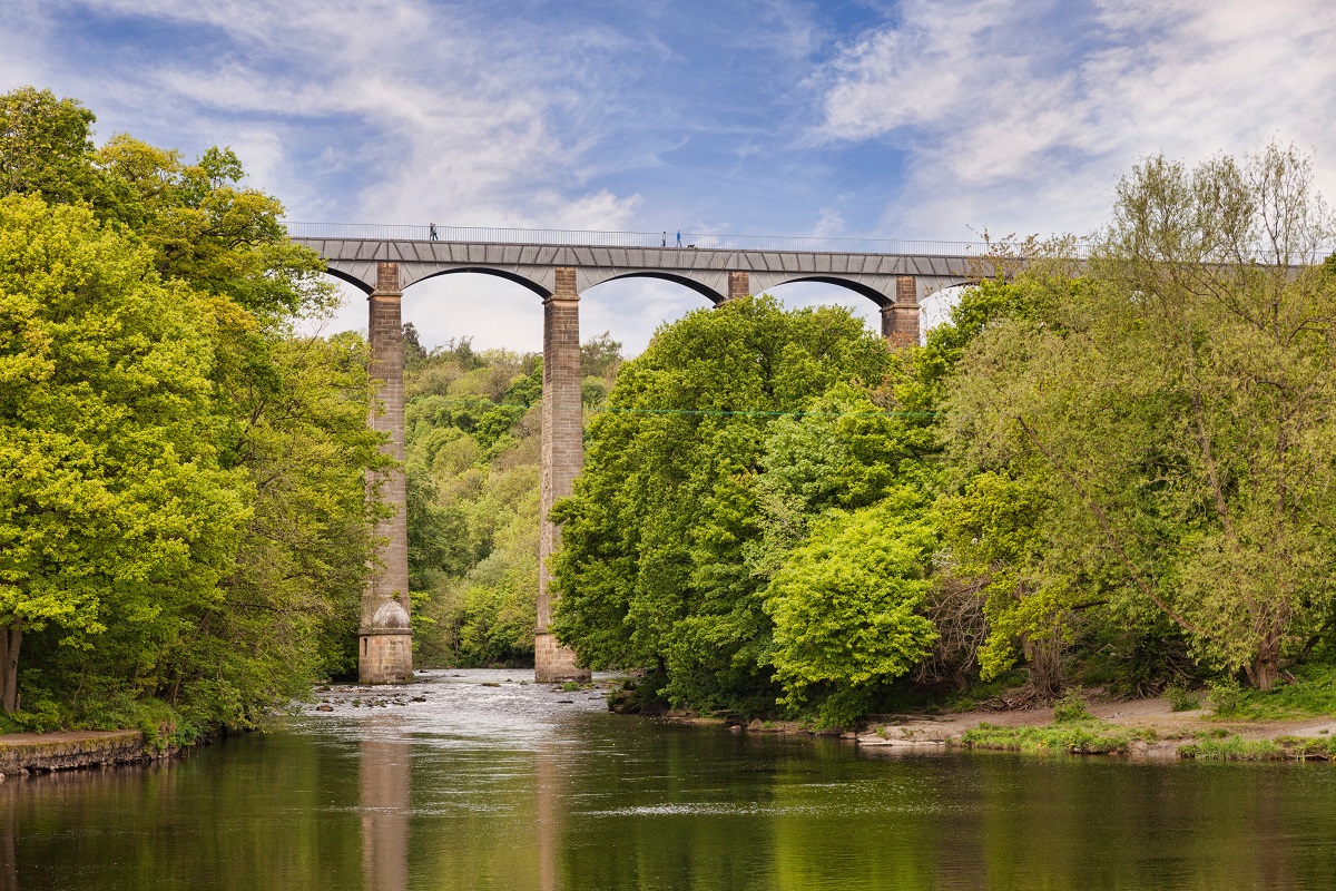
At Irish Bridge, where the B5605 crosses the canal, the path joins the Llangollen Canal and follows it towards the village of Froncysyllte. While the official route continues by road towards the old bridge over the River Dee and briefly on towards Trevor, many walkers choose the far more memorable alternative of crossing Pontcysyllte Aqueduct.
Designed by Thomas Telford, this extraordinary aqueduct is one of the true highlights of the entire walk. Striding high above the Dee Valley, it offers an unforgettable crossing and a real sense of occasion as you continue northwards.
The two routes rejoin on the canal towpath before climbing together through Trevor Hall Wood, where the shaded woodland brings a lovely sense of contrast after the openness of the aqueduct and valley views. Emerging from the trees, you arrive on Panorama Walk, where the scenery opens out once more.
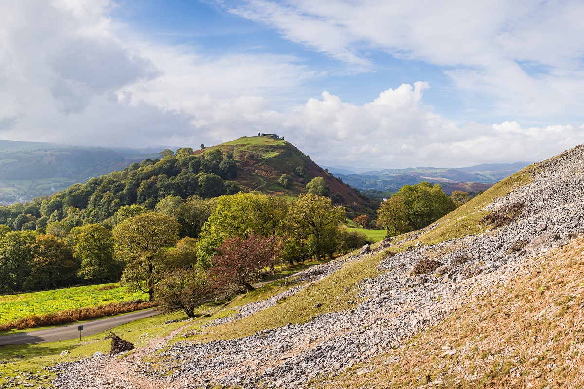
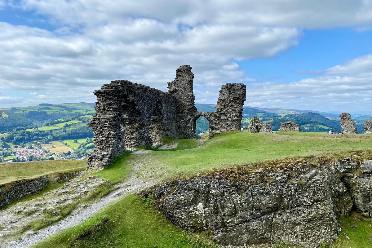
From here, the route continues with limestone crags and scree slopes close by, while Castell Dinas Brân and Trefor Rocks provide magnificent views ahead. A footpath then leads into Llangollen, a wonderfully atmospheric town and a fitting place to pause on the journey.
Llangollen to Llanferres
Leaving Llangollen, the path skirts the slopes below Castell Dinas Brân before traversing the screes beneath the dramatic Eglwyseg Rocks. This striking limestone escarpment is a well-known haunt for hawks and ravens, and a popular area for climbers, adding a real sense of drama to the day’s opening miles.
The route then reaches World’s End, a wonderfully evocative spot whose name feels every bit as memorable as its setting. From here, the path climbs steadily towards Minera, crossing open moorland where railway sleepers help guide the way across the wetter ground.
Ahead, Llandegla Forest comes into view. The forest offers a lovely change of atmosphere, with quiet woodland paths, mossy undergrowth and criss-crossing bridleways creating a peaceful interlude before the trail descends once more into open farmland.
Shortly afterwards, the route reaches the attractive village of Llandegla. Leaving beside the church of St Tegla, after whom the village is named, the path continues through water meadows alongside the River Alun, a particularly gentle and pastoral stretch.
Fields and a short section of road then lead onwards as the hills begin to rise once again. The route follows a track and path to the west of Moel y Plâs, 1,443 feet (440m), before arriving at the peaceful village of Llanarmon-yn-Iâl.
From here, the trail contours around the broad shoulders of Moel Llanfair, 1,466 feet (447m), and Moel Gyw, 1,531 feet (467m) before descending through fields to Clwyd Gate and on to Llanferres.
Llanferres to Bodfari
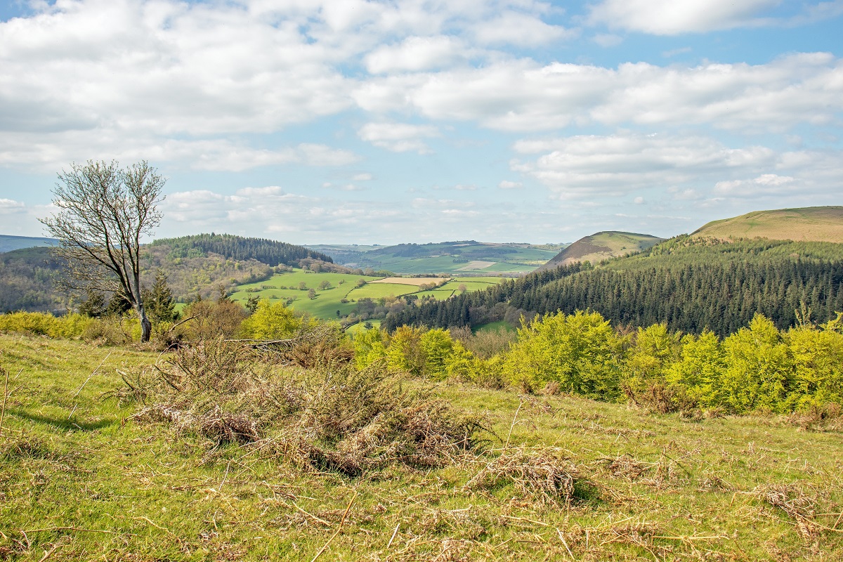
This is one of the most memorable stages of the walk, crossing the northern reaches of the Clwydian Hills and offering a wonderful day of ridge walking and far-reaching views.
Leaving Llanferres and rejoining the trail, there is the option of taking a footpath to the summit of Foel Fenli, 1,676 feet (511m), while the official Offa’s Dyke Path contours its western shoulder. Either way, the route then descends to Bwlch Penbarra before climbing the magnificent Moel Famau, 1,820 feet (555m).
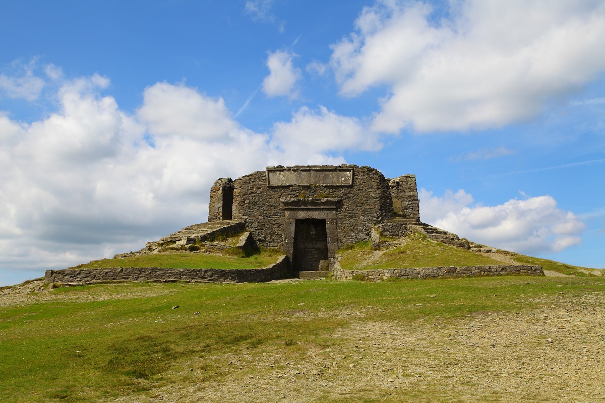
Known as the ‘mother mountain’, Moel Famau is the highest point in the range and lies within a protected National Landscape. Its summit is crowned by the striking remains of the Jubilee Tower, originally built in 1810 to mark the jubilee of George III. The tower makes a dramatic landmark and often provides welcome shelter for walkers.
The views from here are exceptional. While earlier stages may offer the occasional glimpse of the Irish Sea, from this point the coastline and the wind turbines near Prestatyn are clearly visible, bringing a real sense that the northern end of the trail is drawing ever closer.
From the summit, the ridge walk continues over Moel Dywyll, 1,550 feet (472m), and Moel Llys-y-Coed, 1,524 feet (465m),with the undulating landscape adding both variety and drama to the day.
The route then passes close to the striking conical hill of Moel Arthur, 1,496 feet (456m), crowned by an Iron Age hill-fort that is well worth a short detour if time allows. Beyond this, the trail rises to Pen-y-Cloddiau, 1,442 feet (440m), another historic hill-fort with a broad summit and the clear remains of ancient earthworks.
The final hill of the day is Moel-y-Parc, 1,306 feet (398m), easily recognised by the radio mast that has been a constant point on the skyline for much of the stage. The route crosses its shoulder before descending out of the hills to Bodfari, bringing a superb day of upland walking to a close.
Bodfari to Prestatyn
This final stage begins by contouring Moel y Gaer before reaching the scattered hamlet of Sodom. From here, a steady and rewarding climb leads up to the wind turbine on Cefn Du, with increasingly expansive views opening out as you gain height.
The route then crosses the western shoulder of Moel Marn-Efa, 949 feet (290m), before descending to the road near St Beuno’s Church. Rough grazed fields and the familiar stiles of the route then lead onwards to the footbridge over the busy A55 and into Rhuallt.
And so begins the final eight miles of the trail. Field paths, woodland, quiet lanes, heathland and open countryside all feature here, offering a fitting summary of the varied landscapes that have accompanied you throughout the journey.
For much of this stage, Prestatyn and the Irish Sea remain in sight ahead, creating a wonderful sense of anticipation as the end of the walk draws ever closer. Rather than heading directly for the coast, the trail first curves east of Mynydd y Cwm and crosses Marian Ffrith, 787 feet (240m), before traversing the slopes of Bryn Prestatyn Hillside, a gorse and bracken-covered escarpment with fine views not only to your destination and the sea, but also westwards towards Snowdonia.
The descent into Prestatyn is a long and memorable one. Once out of the trees and past the distinctive Roman helmet sculpture, the route follows the edge of the town onto the High Street, over the railway bridge, and finally down to the sea.
It is a wonderfully satisfying finish, bringing you from the border hills to the North Wales coast and marking the completion of an extraordinary long-distance journey.
Offa’s Dyke Path is one of Britain’s most rewarding long-distance walks, following the historic border between Wales and England through a wonderfully varied landscape of river valleys, rolling farmland, open moorland and dramatic ridge walking. It is more demanding than some National Trails, with several longer hill days and a number of sustained ascents and descents, particularly in the Black Mountains, around Knighton’s Switchbacks, and across the Clwydian Range.
Daily distances typically average around 13 to 14 miles, with some longer stages of up to 16 miles and one day reaching around 18 miles, so a good level of walking fitness is recommended. For your safety, and to gain the greatest enjoyment from your walk, it is important to follow the advice in your guidebook and be prepared for both changing terrain and variable weather conditions.
Terrain: A varied mixture of riverside paths, woodland tracks, farmland footpaths, grassy hill trails, moorland paths, ridgeline walking, quiet country lanes and occasional short urban sections through towns and villages.
What’s it like underfoot? Much of the route follows well-established footpaths, grassy field tracks and clearly defined long-distance trail paths. In upland areas, particularly on exposed ridges such as Hatterall Ridge and the Clwydian Hills, the going is generally good but can be rougher and more uneven in places. Some sections cross open moorland where paths may be stony, grassy or occasionally boggy after wet weather, with sleepers or flagstones assisting on certain stretches.
Across farmland, paths can become muddy following prolonged rain, and the route includes numerous gates and stiles throughout.
How Much Up & Down? Offa’s Dyke Path involves a considerable amount of ascent and descent overall, and this is one of the key factors that makes it such a rewarding long-distance walk. Across the full route, walkers can expect a total ascent of approximately 32,800 feet (10,000m), with around 14,700 feet (4,480m) on the southern section and 18,100 feet (5,520m) on the northern section.
The southern half includes the route’s highest point on Hatterall Ridge, reaching 2,306 feet (703m), where the sweeping views across the Black Mountains make the climb more than worthwhile. The northern section is equally memorable, with the magnificent crossing of the Clwydian Hills and the ascent of Moel Famau at 1,820 feet (555m), one of the most dramatic viewpoints on the entire trail.
While some stages, particularly around the River Severn and the Montgomery plain, offer gentler walking, several days involve sustained climbs and repeated ascents and descents. Notable more demanding stretches include the ridge walking in the Black Mountains, the Switchbacks north of Knighton, and the series of hill crossings through the Clwydian Range.
With daily distances typically around 13 to 14 miles, and some longer stages extending to 16 or even 18 miles, it is best approached with a good level of walking fitness and a readiness for regular hill walking.
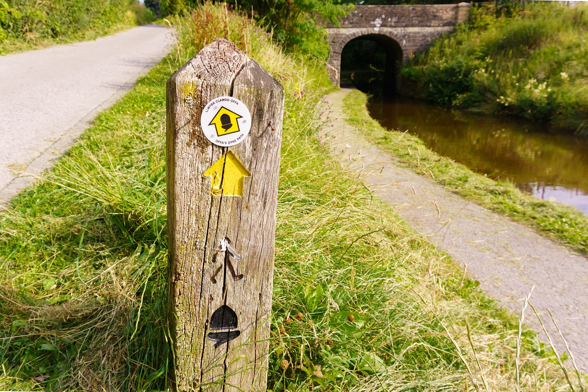
Signposting & Navigation: Offa’s Dyke Path is generally well waymarked with the familiar acorn symbols used on National Trails, and in many places the line of the Dyke itself provides a helpful visual guide.
That said, care is needed in certain areas, particularly where the route crosses open farmland, woodland junctions, or passes through towns and villages where signage can occasionally be less obvious. Referring to your map and guidebook at regular intervals is strongly recommended.
Weather: The route crosses several exposed upland areas where weather conditions can change quickly. Wind, rain and low cloud can make ridge sections feel more demanding, particularly on Hatterall Ridge and in the Clwydian Hills.
Walkers should come prepared with suitable waterproof clothing, sturdy footwear and extra layers, even in the summer months. Wet conditions can make grassy descents and farmland paths more slippery underfoot.
|
All Holidays
|
|
| Accommodation | Overnight Bed and Breakfast accommodation in selected hotels, farmhouses, village inns, guest houses and family B&Bs. Cooked or Continental breakfast. |
| Guidebook | A detailed guidebook with route information, maps, photos and background information. |
| Information of Services Along the Route | A comprehensive Service Info sheet, including services such as cash points, banks, post offices, village shops, inns, cafes and taxis. |
| Maps | A waterproof (1:40,000) Harvey Map covering the whole of the Offa’s Dyke Path. |
| Personal Itinerary | A personal itinerary setting out each overnight stop, including large scale maps of each accommodation, to ensure you find it easily. |
| Emergency Telephone Support | If you get in to difficulties during your holiday, we are always available to help, even out of office hours. |
|
Options
|
|
| Luggage Transport | We will transfer your luggage between each overnight stop – if you leave your luggage at the accommodation when you set off in the morning, it will be moved on to your next B&B. You only need to carry a small day sack with the clothes and provisions you require during the day’s walk. |
| Packed Lunches |
Provided for each day’s walking and recommended on this holiday as there will not always be a handy shop or cafe on the route. |
| Off Road Parking | If you are travelling by car we can usually arrange off road parking for the duration of your trip. (There may be a small charge for this). |
| Arrangement of return transport | We can also arrange your transfer back to your car, (or advise you when public transport is a better option)! |
|
What’s not Included
|
|
| Evening Meals | Your evening meal isn’t included in the package, but we include full details and recommendations for each evening in your itinerary. You will be within walking distance of a pub and/or restaurant each evening. Allow about £30.00 per night. |
| Transport to the Start & Away from the Finish | Have a look at the ‘Travel Info’ tab above for suggestions. If you’re still struggling, get in touch and we’ll help you sort it out. |
| Travel Insurance | Even if you are based in the UK travel insurance is worth having. |
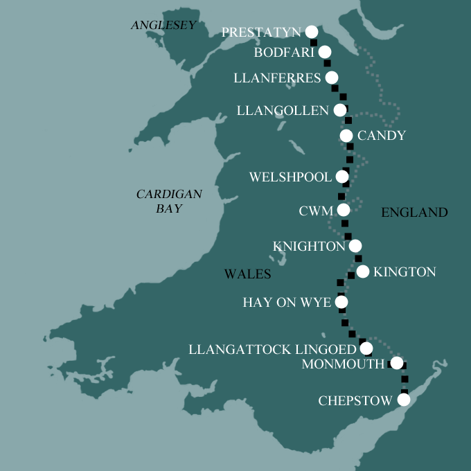
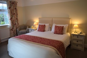
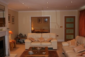
Good accommodation and friendly hosts are an essential part of any holiday. We understand this and go out of our way to find the best. We put a great deal of effort into hand picking our accommodation and matching it to individual customer requirements. As well as visiting the accommodation ourselves, we ask all our customers to complete a short evaluation on each night’s accommodation, which then gives us an insight into the day-to-day operation and lets us spot any potential issues before they become a problem.
We use a variety of accommodation on the Offa’s Dyke Path including family run bed and breakfast, village inns and small characterful country hotels.
We are happy to book single rooms on our holidays but cannot normally book more than two for any one group. Single room bookings include a supplement.
Here are some examples of the accommodation we use on the Offa’s Dyke Path:
 Nestled in the heart of the Wye Valley, the Wye Valley Hotel offers a warm and characterful stay beside the River Wye and just moments from the ruins of Tintern Abbey. Comfortable en-suite rooms sit above a cosy bar with open fires, quiet reading corners, and a sunny south-facing terrace, creating a wonderfully relaxed atmosphere after a day on the trail. Freshly prepared meals make good use of local produce, while the surrounding valley scenery – once admired by J. M. W. Turner and William Wordsworth – provides an unforgettable backdrop to your stay. Visit their website
 Set on the hillside above Monmouth with lovely views across the surrounding countryside, Torlands Bed and Breakfast offers a stylish and comfortable stay just a short distance from the town centre. Bright, airy en-suite rooms combine modern comforts with a relaxed atmosphere, while the residents’ lounge and sunny terrace provide peaceful spaces to unwind after a day on the trail. Generous cooked breakfasts help set you up for the day ahead, and the quiet location makes Torlands a particularly restful base for exploring both Monmouth and the Wye Valley. Visit their website
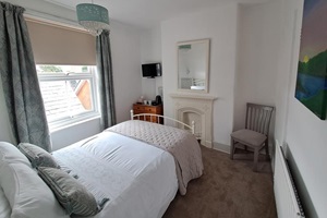
 Blending contemporary comfort with the character of a long-established town inn, The Red Lion Bed and Breakfast in Knighton offers a welcoming stay in the heart of the Welsh Marches. Once remembered locally as “the best pub in town”, the building still carries a sense of warmth and history, now reimagined as a relaxed and stylish B&B for walkers exploring Offa’s Dyke Path. Individually decorated en-suite rooms, named after the Princes of Powys and Wales, provide a comfortable and restful base, perfectly placed for discovering the rolling hills and border landscapes surrounding Knighton. Visit their website
 Tucked away on a quiet residential street close to the River Dee and the Llangollen Pavilion, Squirrels Guesthouse offers a cosy and welcoming stay in the heart of one of North Wales’ most atmospheric walking towns. Set within a charming Victorian house, its comfortable rooms provide a peaceful retreat after a day on the trail, while freshly cooked breakfasts featuring locally sourced produce help set you up for the miles ahead. With Llangollen’s independent cafés and historic attractions all close at hand, Squirrels makes an excellent base for enjoying both the path and the town itself. Visit their website
General travel information for Offa’s Dyke Path will be in your holiday pack.
Detailed instructions on getting to your first night’s accommodation by car, or on foot from the nearest train or bus station, will also be included in the holiday pack on individual accommodation maps.
To view train times please visit trainline where you can also purchase tickets in advance. For information on bus timetables please visit traveline
Getting to Chepstow:
By Air: The nearest international airports are Bristol and Cardiff, both offering a wide range of UK and European connections. For a greater choice of long-haul flights, London Heathrow is also easily accessible, with onward rail connections to Chepstow via London Paddington and Newport.
By Public Transport: Chepstow Railway Station lies on the line between Newport and Gloucester, with connections to Bristol, Cardiff and beyond. Although not on a main intercity line, it is well connected via Newport, where frequent services run to London Paddington and other major destinations. The station is a short walk from the town centre.
By Road: Chepstow is easily accessed via the M48 motorway. From the west (Wales), leave the M4 at Junction 23 onto the M48 eastbound, exiting at Junction 2 before the Severn Bridge. From the east (England), leave the M5 at Junction 15 to join the M4 westbound, then branch onto the M48 westbound to cross the original Severn Bridge. From either direction, leave the M48 at Junction 2 and follow the A466 directly into the town centre.
Returning from Prestatyn:
By Public Transport: Prestatyn Railway Station lies on the North Wales Coast Line, with direct services from Chester, Manchester, and London Euston, as well as regular connections along the North Wales coast. The station is located close to the town centre and within easy reach of local facilities.
By Road: Prestatyn is easily accessed via the A55 North Wales Expressway, which runs along the coast between Holyhead and Chester. From the east, follow the A55 westbound and leave at Junction 31, then follow signs for Prestatyn. From the west, follow the A55 eastbound and exit at Junction 31, again following signs into the town centre.
Chepstow
Set at the meeting point of the River Wye and the Severn Estuary, Chepstow is a wonderful place to spend time before your walk. The imposing Chepstow Castle, perched high above the river, is one of the oldest surviving stone castles in Britain and well worth exploring. The town itself has a relaxed charm, with independent shops, riverside walks and a good choice of cafés and restaurants.
Hay-on-Wye
Famous for its literary heritage, Hay-on-Wye is a delightful place to linger. Known as the ‘town of books’, its streets are lined with independent bookshops, galleries and cosy cafés, making it perfect for an unhurried wander. The town also hosts the renowned Hay Festival each year. Beyond the shops, the River Wye offers peaceful walking, while the surrounding countryside provides the chance for shorter circular walks.
Knighton
Sitting right on the border, Knighton is closely tied to the story of the trail and a natural place to pause. The Offa’s Dyke Centre offers a fascinating introduction to the history of the Dyke and the landscapes you’ve been walking through. The town itself is small but welcoming, with a handful of cafés and pubs, and a relaxed pace that makes it easy to recharge.
Welshpool
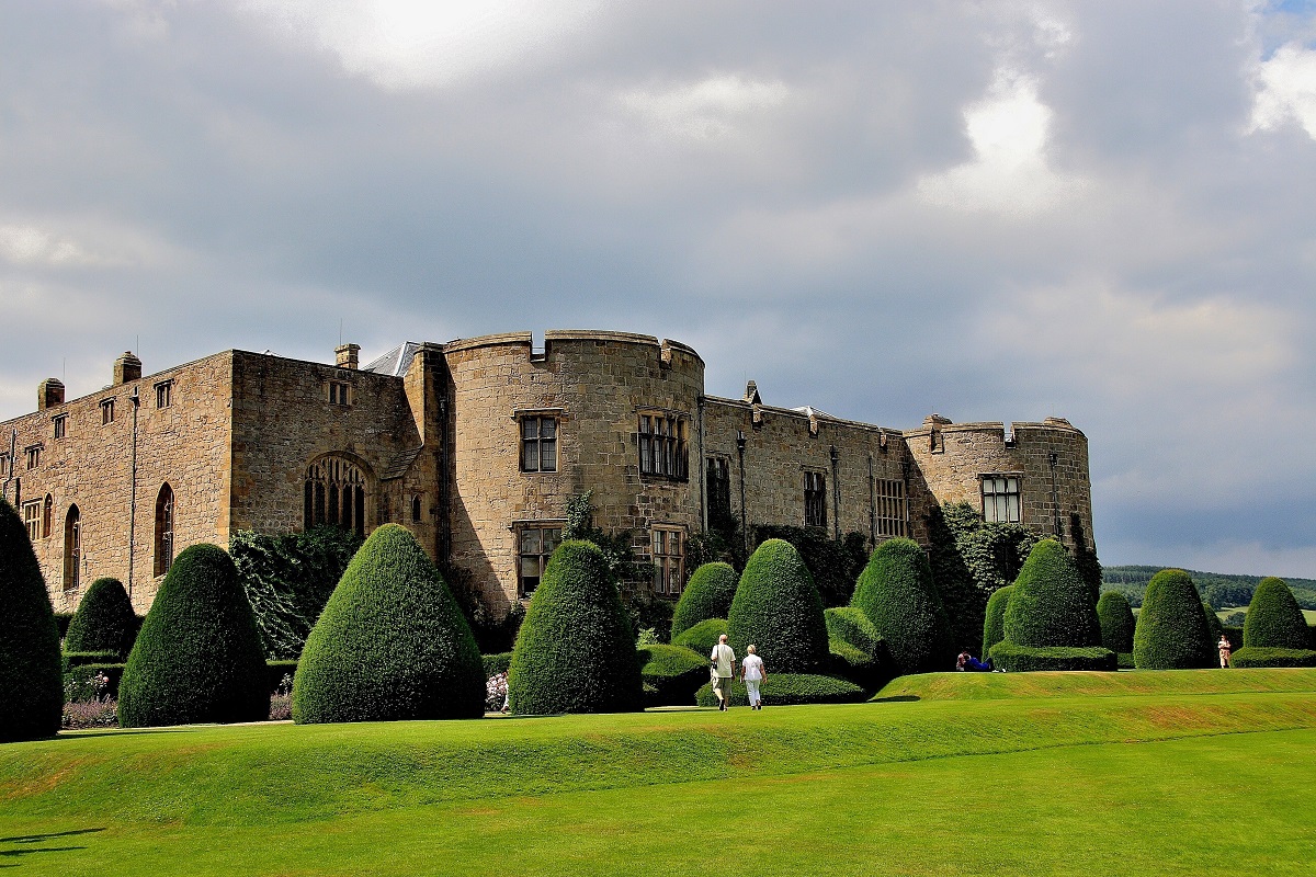
With its mix of history and green open space, Welshpool offers a pleasant change of pace. A visit to Powis Castle is a highlight, with its impressive interiors and beautifully kept terraced gardens. For something a little different, the Welshpool and Llanfair Light Railway provides a nostalgic journey into the surrounding countryside. Back in town, there are plenty of places to relax over a meal or simply enjoy a slower day.
Llangollen
Set in the beautiful Dee Valley, Llangollen is one of the liveliest and most scenic stops on the route. The town offers a great mix of independent shops, cafés and riverside walks, while the surrounding landscape provides plenty of opportunities for further exploration. You might take a ride on the Llangollen Railway, stroll along the canal, or simply enjoy the views beneath Castell Dinas Brân. It’s an easy place to spend a full day without straying far.
Prestatyn
At the northern end of the trail, Prestatyn offers a relaxed seaside setting in which to celebrate your journey. Its long sandy beach is perfect for a gentle stroll or simply unwinding after your walk, while the promenade invites you to linger a little longer by the sea. With a good range of cafés, pubs and restaurants, it’s an ideal place to reflect on your journey.