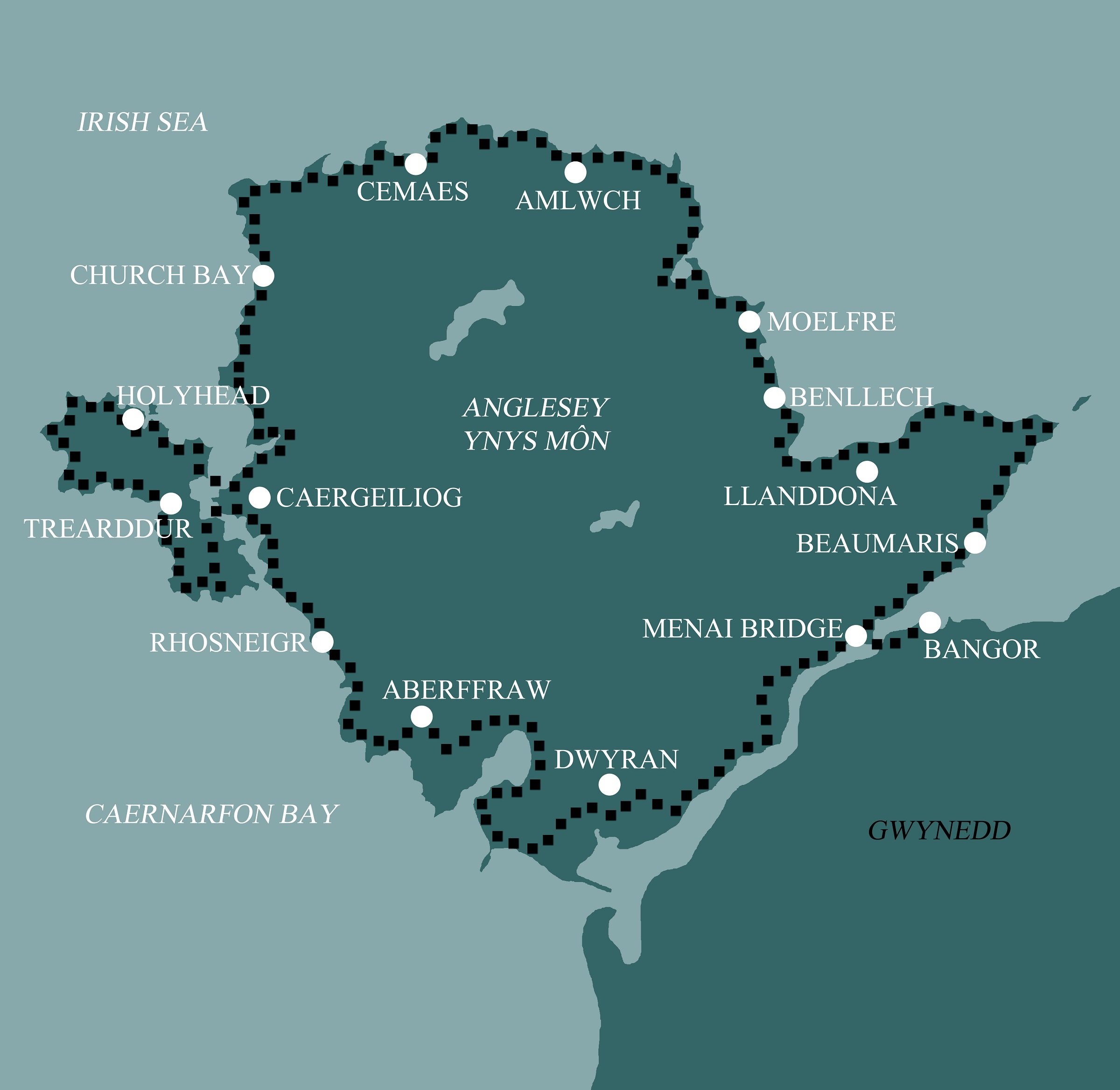
Isle of Anglesey Coastal Path North: Bangor to Holyhead
This 5 day option begins more gently along the Menai Strait before building into longer coastal stages around the island’s varied northern shore.
Itinerary
| Day | Itinerary | Miles | Km |
|---|---|---|---|
| Day 1 | Travel to Bangor for your first nights accommodation | ||
| Day 2 | Bangor to Beaumaris | 8 | 13 |
| Day 3 | Beaumaris to Benllech | 16 | 26 |
| Day 4 | Benllech to Amlwch | 16 | 26 |
| Day 5 | Amlwch to Church Bay then transfer to Holyhead | 19 | 31 |
| Day 6 | Transfer back to Church Bay then walk to Holyhead | 13 | 21 |
| Day 7 | Depart from Holyhead after breakfast |
Prices
| Accommodation, map & guidebook only | £839 |
| with Luggage Transport | £924 |
| with Packed Lunches | £899 |
| with Luggage & Lunches | £979 |
Other Options |
|
| Extra Nights (per night) | £104 |
| Single Supplement (per night) | £85 |
| Solo Luggage Supplement (per day) | £17 |
Bangor to Llanddona
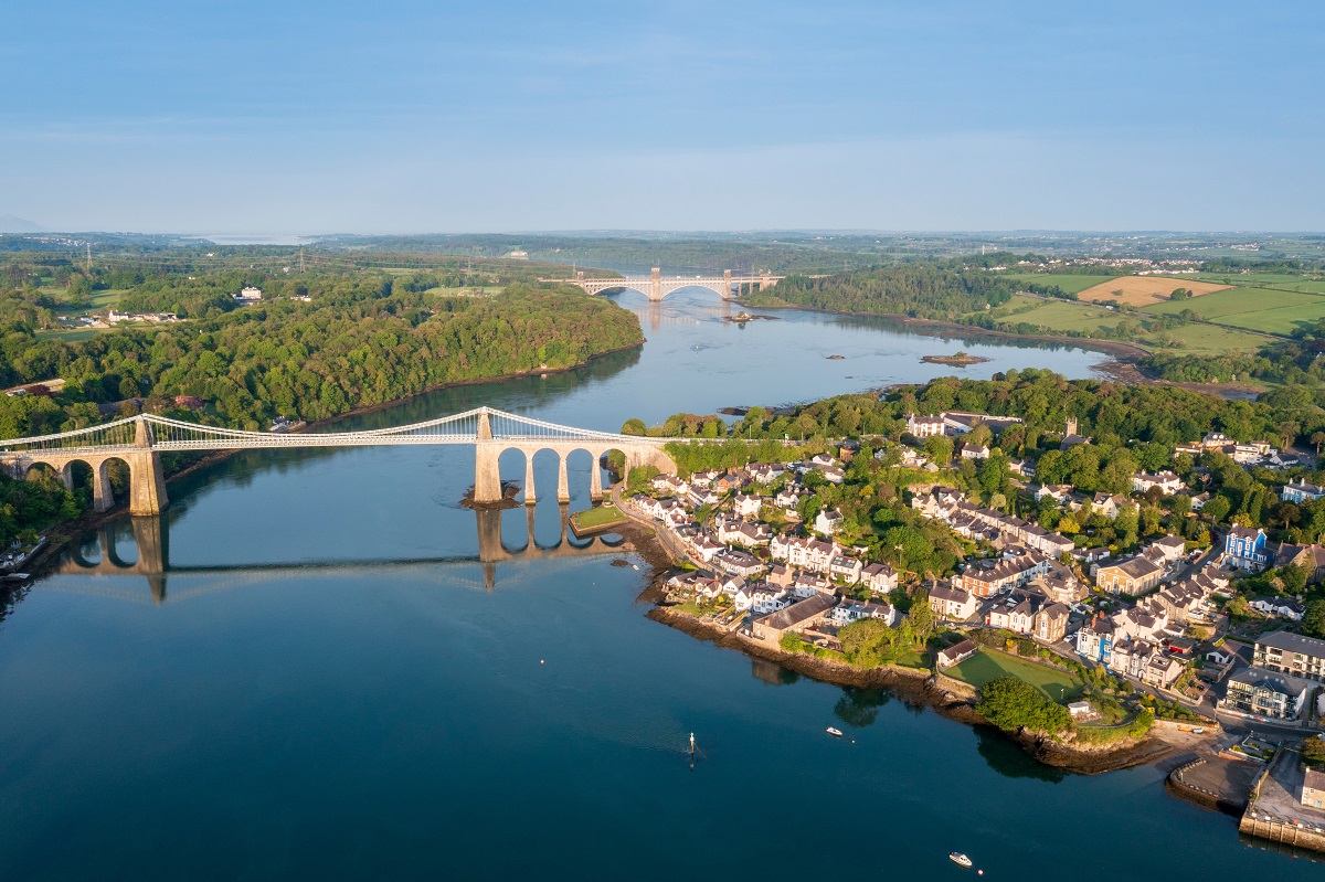
The opening miles follow the wooded shoreline of the Menai Strait before crossing the iconic Menai Suspension Bridge into the town of Menai Bridge, often regarded as the entrance to Anglesey. A short but unavoidable roadside stretch is soon replaced by a peaceful, higher-level lane through Llandegfan, offering expansive views back across the Strait to Bangor and inland toward the peaks of Snowdonia. The route then drops steeply for a few miles into the charming town of Beaumaris.
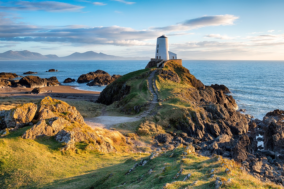
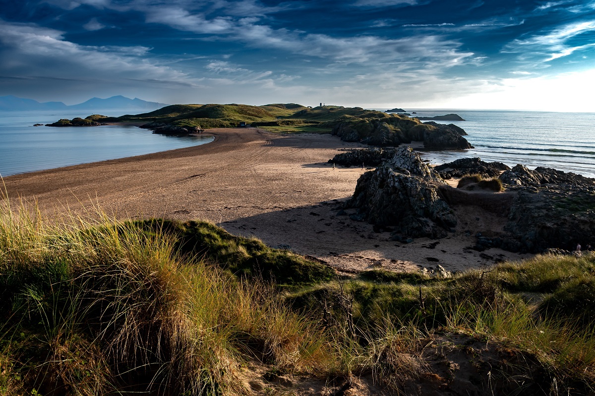
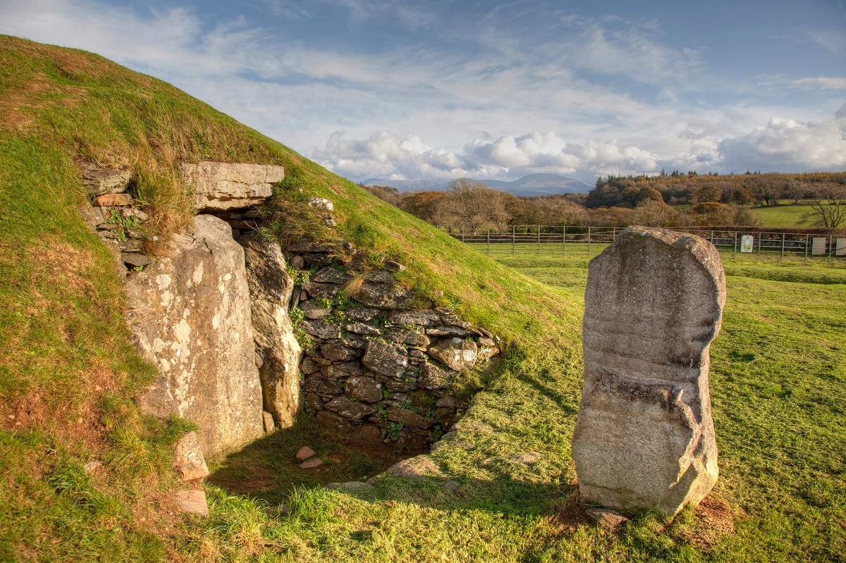
Leaving Beaumaris, the walk to Penmon combines quiet country lanes with sections along the foreshore, accompanied by broad views over the Lafan Sands toward the mountains of Snowdonia. Penmon marks both the eastern extremity of Anglesey and the point where the Menai Strait meets the open sea, and beyond here the landscape takes on a noticeably different character. Turning inland, paths across fields and quiet lanes rise to the limestone plateau of Bwrdd Arthur, home to an Iron Age hillfort and extensive panoramas. A gentle descent then leads back to the coast and the wide expanse of Llanddona Beach.
Llanddona to Amlwch
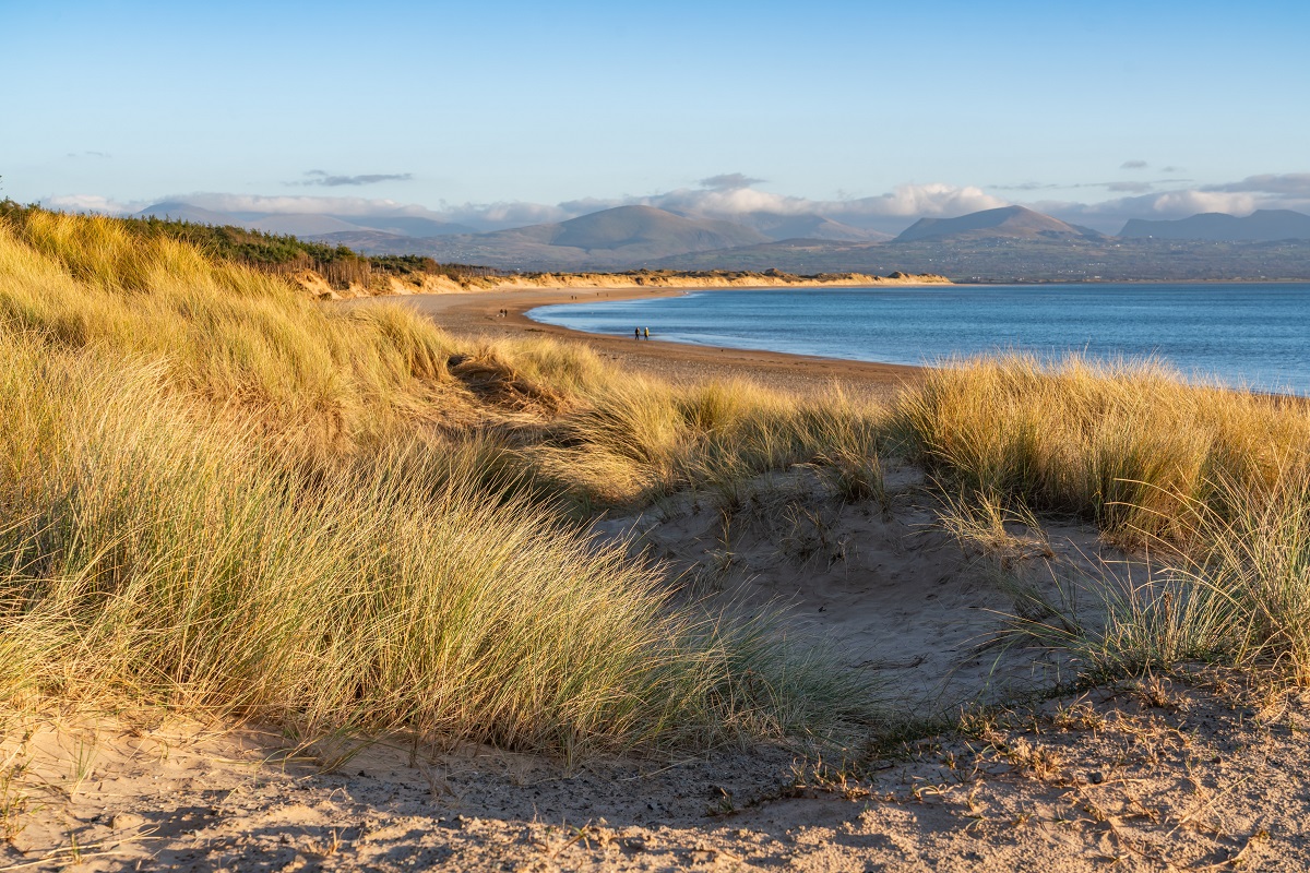
Although relatively short and straightforward, the stretch from Llanddona to Moelfre offers plenty of variety. The route curves around the shoreline of Red Wharf Bay, passing the small settlement, also known as Red Wharf Bay, and continuing to the seaside resort of Benllech. Beyond Benllech, the path climbs gently to follow a line of striking limestone cliffs, where well-maintained paths run alongside the thick hedgerows that often shelter this section. At Traeth Bychan the route descends once more to the shore, continuing at a lower level to reach the attractive village of Moelfre.
From Moelfre to the Dulas Estuary the terrain remains mostly level, with the route passing a series of fine beaches including Traeth Lligwy and Traeth yr Ora, before reaching the distinctive tidal landscape of Traeth Dulas. Beyond the estuary, the trail follows a more remote and undeveloped coastline, briefly heading inland to skirt the Llysdulas Estate before turning north toward Point Lynas. After the rocky inlet at Porth Eilian, the path continues along low, heather-covered cliffs to arrive at the narrow harbour of Amlwch Port.
Amlwch to Church Bay
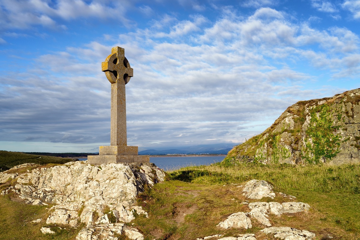
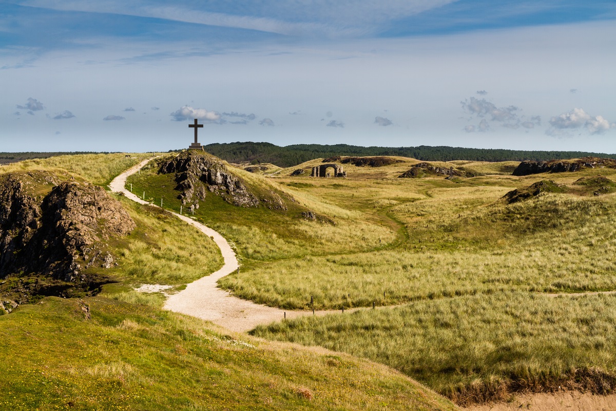
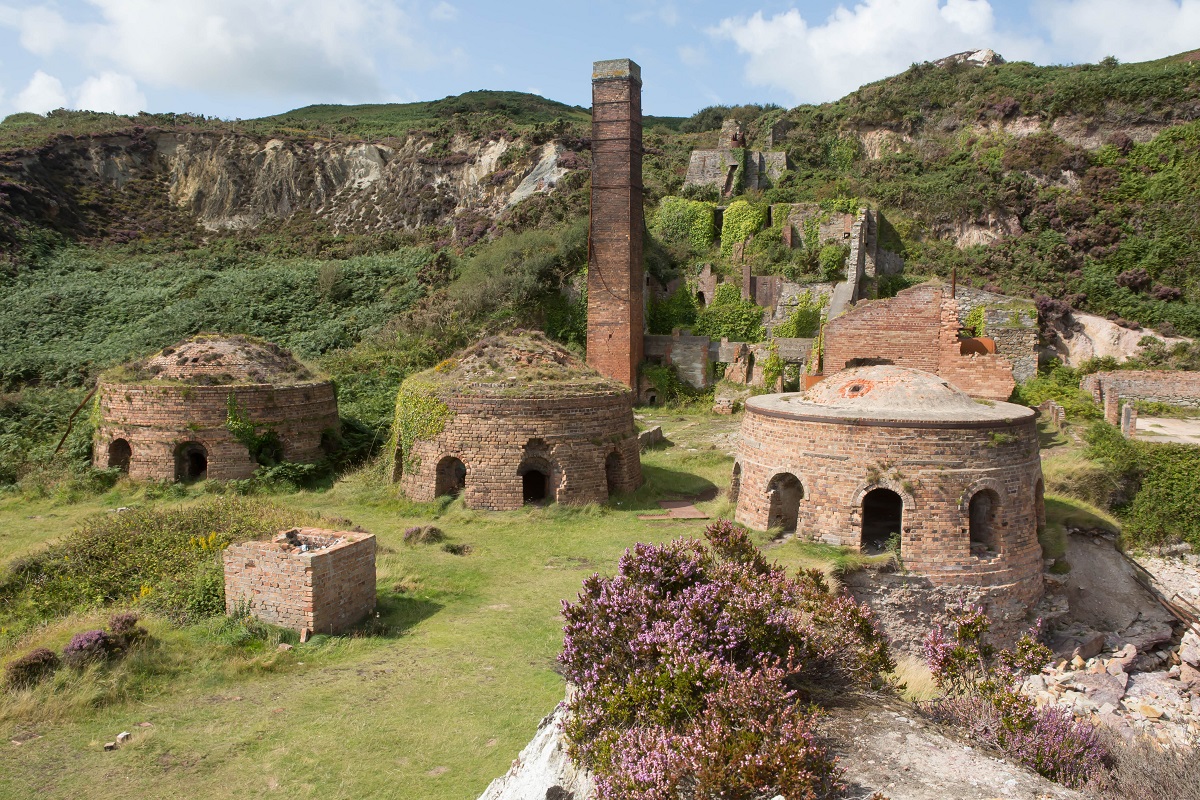
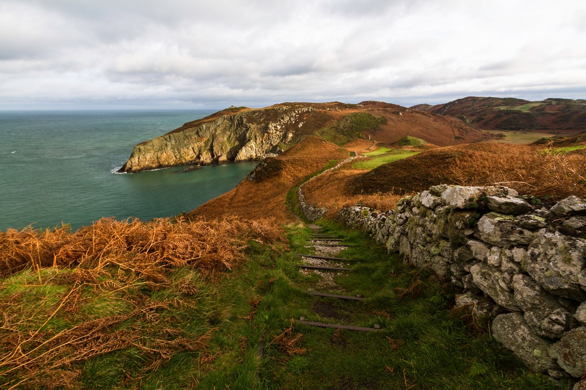
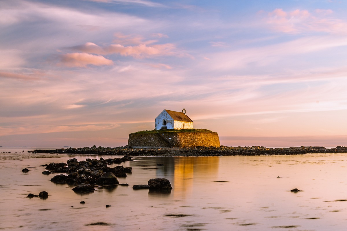
Leaving the immediate surroundings of Amlwch, the coastline quickly becomes wilder and more rugged. A stretch across low rocky cliffs leads to the small settlement of Bull Bay, a quiet cluster of houses set above a tiny shingle beach. Beyond Bull Bay lies the broad, rocky inlet of Porth Wen, notable for its abandoned brickworks and striking sea arch, while a little further on stands Llanlleiana Head, the northernmost point in Wales. The dramatic scenery continues toward the small cliff-top church of Llanbadrig, perched above the sea and overlooking the sheltered bay at Cemaes.
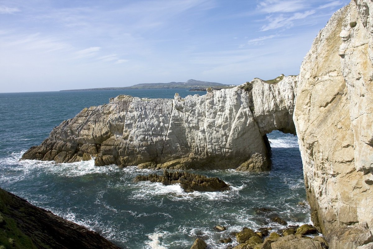
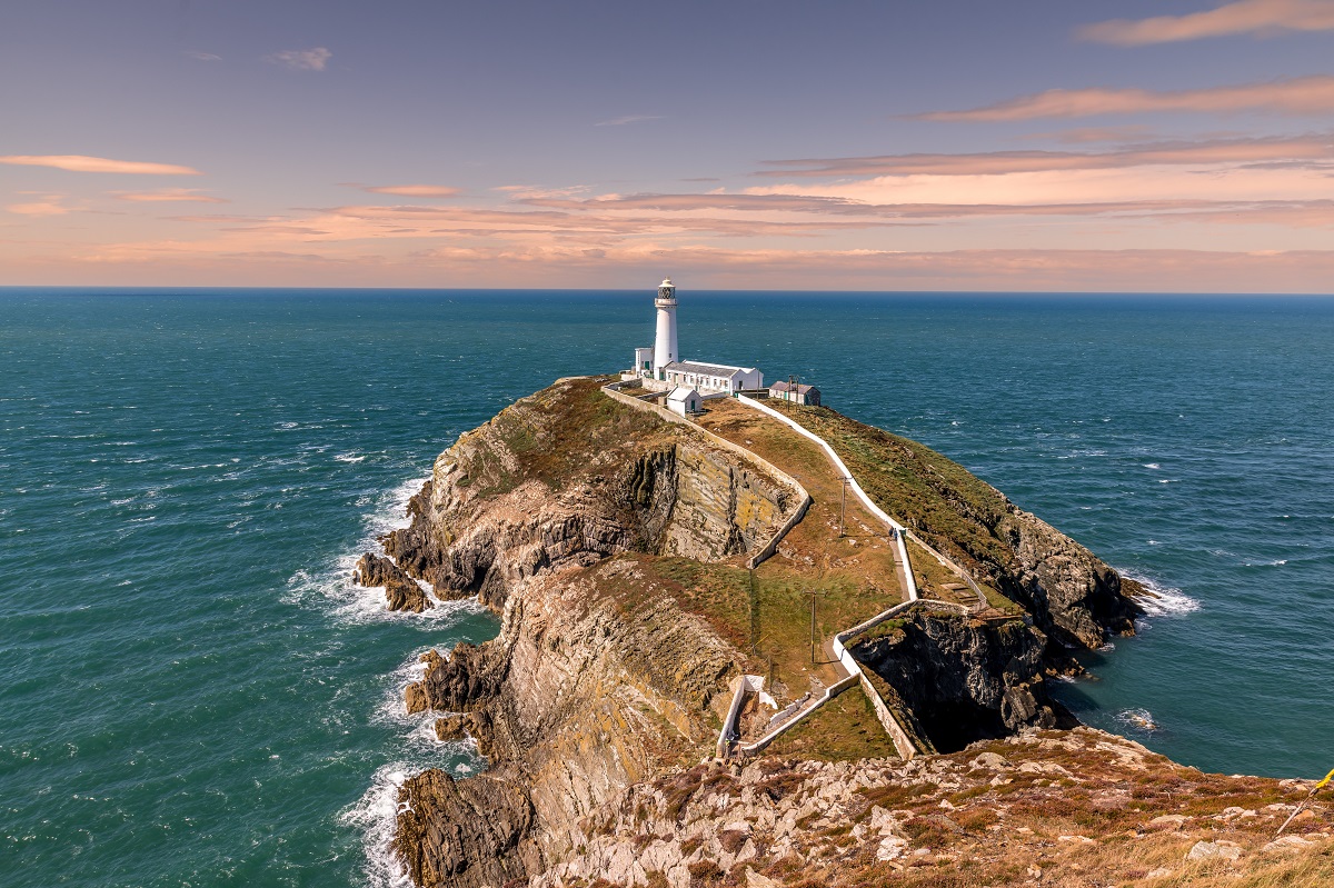
Beyond Cemaes begins one of the island’s most remote coastal sections, curving around Carmel Head. Much of this landscape is owned by the National Trust and remains largely unspoilt, although the presence of Wylfa Nuclear Power Station provides a striking contrast along the way. Once past Wylfa, the path returns to a beautiful stretch of rocky shoreline, with expansive views out to The Skerries and across the water toward Holy Island. The high cliffs between Carmel Head and Church Bay are interrupted only by the small island of Ynys y Fydlyn, known for its dramatic sea arch and hidden cove, before the route continues on to Church Bay.
Church Bay to Holyhead
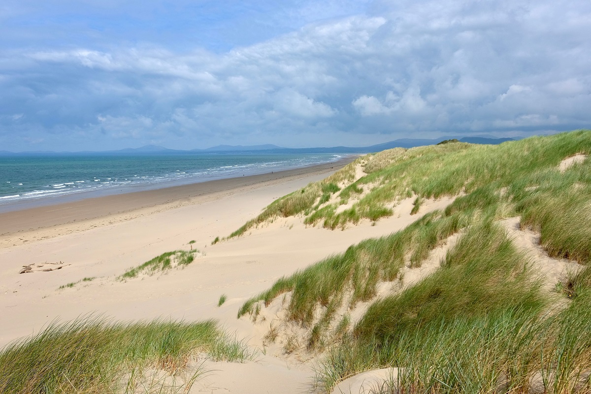
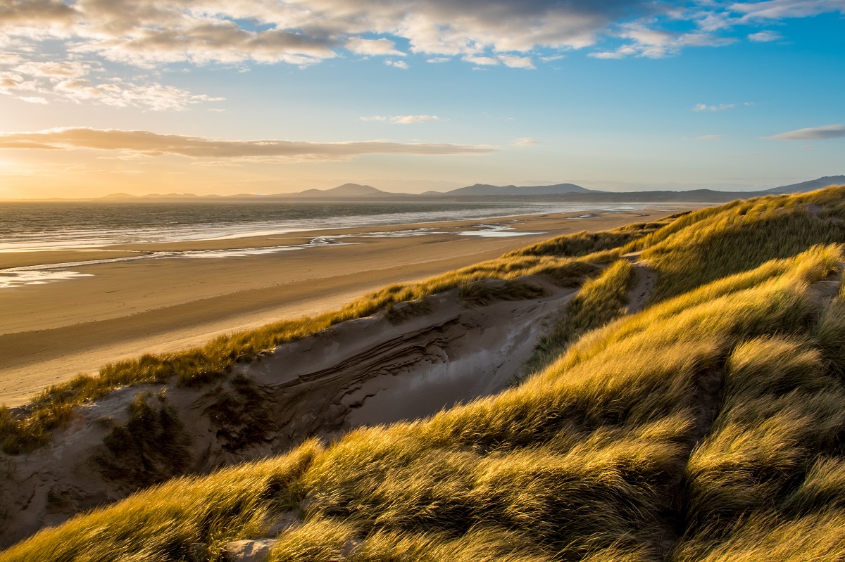
This is a relatively level section, passing several sandy beaches, with the coastal path occasionally turning inland to follow farmland just behind the shore. The route then follows the sheltered banks of the Afon Alaw to reach a modern footbridge, an area often rich in birdlife. Beyond the estuary, the path continues across the long Stanley embankment before joining a sheltered trail that winds around low cliffs and through the woodland of Penrhos Coastal Park. The final mile or so becomes more urban in character as the route approaches Holyhead.
The Isle of Anglesey Coastal Path is a varied and highly rewarding long-distance trail that follows the island’s entire shoreline along established coastal paths, field tracks, minor lanes and occasional beach sections. Overall, the route is best described as Moderate, with well-defined paths and generally low-level terrain, although some rugged stretches of cliff-top walking and exposure to strong coastal winds can occasionally make walking feel more demanding.
Some shorter itineraries include longer daily distances in order to complete sections within fewer days, and these individual itineraries may therefore be graded Moderate to challenging to reflect the increased daily mileage rather than any significant increase in technical difficulty. Similarly the longest itineraries are considered Easy to Moderate.
Regardless of the individual itinerary – for your safety, and to gain the greatest enjoyment from your walk, it is important to follow the advice provided in your guidebook and be prepared for changeable coastal weather conditions.
Terrain: A mixture of cliff-top coastal paths, sandy beaches, rocky shoreline, farmland paths, dunes, saltmarsh, quiet country lanes and occasional short urban sections through coastal towns and villages.
What’s it like underfoot? Much of the trail follows well-defined coastal paths and grassy field tracks that are generally straightforward underfoot. Some sections across farmland or low-lying coastal areas can become muddy after prolonged rain, while beach walking may include stretches of sand or shingle. In a few areas, particularly along rocky sections of coastline, the path can be uneven and require more careful footing, although there are no sustained technical difficulties.
How Much Up & Down? Although Anglesey is not mountainous, the coastal nature of the route means there are regular short ascents and descents as the path rises and falls around headlands, coves and cliffs. Some sections, particularly around Holyhead Mountain and parts of the northern coastline, involve more sustained climbing, while other areas such as estuaries, dunes and low-lying farmland are largely level. Overall daily ascent is typically moderate, with occasional more demanding days where the route follows higher cliff lines.
Signposting & Navigation: The Isle of Anglesey Coastal Path is generally well waymarked with dedicated coastal path signage – a circular blue logo featuring a white flying tern, and is often paired with the Wales Coast Path sign – a white shell with a dragon’s tail on a blue background. In most places the route is clear and straightforward to follow, though extra care may be needed where paths cross open farmland, beaches, or low-lying coastal areas where waymarks may be less frequent. As with all long-distance walks, regularly referring to your map and guidebook is recommended.
Weather: Anglesey enjoys a relatively mild maritime climate, but its coastal setting means it is exposed to changing weather conditions throughout the year. Strong winds can make some exposed cliff-top sections feel more challenging, and rain can make grassy paths slippery underfoot. Walkers should be prepared for rapidly changing conditions and ensure they carry suitable clothing, including waterproofs and windproof layers, even during the summer months.
|
All Holidays
|
|
| Accommodation | Overnight Bed and Breakfast accommodation in selected hotels, farmhouses, village inns, guest houses and family B&Bs. Cooked or Continental breakfast. |
| Guidebook | A detailed guidebook with route information, maps, photos and background information. |
| Information of Services Along the Route | A comprehensive Service Info sheet, including services such as cash points, banks, post offices, village shops, inns, cafes and taxis. |
| Maps | Two (1:25,000) Ordnance Survey Explorer maps, including mobile download, covering the Isle of Anglesey Coastal Path route. |
| Personal Itinerary | A personal itinerary setting out each overnight stop, including large scale maps of each accommodation, to ensure you find it easily. |
| Emergency Telephone Support | If you get in to difficulties during your holiday, we are always available to help, even out of office hours. |
|
Options
|
|
| Luggage Transport | We will transfer your luggage between each overnight stop – if you leave your luggage at the accommodation when you set off in the morning, it will be moved on to your next B&B. You only need to carry a small day sack with the clothes and provisions you require during the day’s walk. |
| Packed Lunches |
Provided for each day’s walking and recommended on this holiday as there will not always be a handy shop or cafe on the route. |
| Off Road Parking | If you are travelling by car we can usually arrange off road parking for the duration of your trip. (There may be a small charge for this). |
| Arrangement of return transport | We can also arrange your transfer back to your car, (or advise you when public transport is a better option)! |
|
What’s not Included
|
|
| Evening Meals | Your evening meal isn’t included in the package, but we include full details and recommendations for each evening in your itinerary. You will be within walking distance of a pub and/or restaurant each evening. Allow about £30.00 per night. |
| Transport to the Start & Away from the Finish | Have a look at the ‘Travel Info’ tab above for suggestions. If you’re still struggling, get in touch and we’ll help you sort it out. |
| Travel Insurance | Even if you are based in the UK travel insurance is worth having. |
Good accommodation and friendly hosts are an essential part of any holiday. We understand this and go out of our way to find the best. We put a great deal of effort into hand picking our accommodation and matching it to individual customer requirements. As well as visiting the accommodation ourselves, we ask all our customers to complete a short evaluation on each night’s accommodation, which then gives us an insight into the day-to-day operation and lets us spot any potential issues before they become a problem.
We use a variety of accommodation on the Isle of Anglesey Coastal Path including family run bed and breakfast, village inns and small characterful country hotels.
We are happy to book single rooms on our holidays but cannot normally book more than two for any one group. Single room bookings include a supplement.
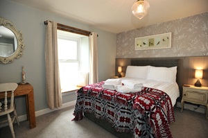
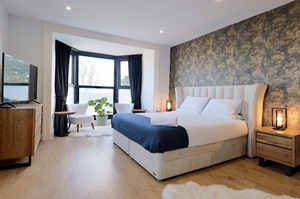
Here are some examples of the accommodation we use on the Isle of Anglesey Coastal Path:
 Perched above the shoreline with sweeping views across Benllech Beach and Red Wharf Bay, Sea View Guest House offers a wonderfully relaxing coastal stay. Beautifully renovated rooms look out to the sea, while the conservatory lounge, terrace seating, and welcoming honesty bar provide perfect spaces to unwind after a day exploring the Anglesey coast. Visit their website
 Stylish, contemporary, and full of character, Tall Trees Hotel in Amlwch offers a refreshingly modern stay on Anglesey’s north coast. Individually designed rooms combine bold décor with thoughtful comforts, while their beautiful restaurant delivers creative, confidently prepared dishes in a relaxed yet refined setting – an inviting base for exploring the island’s rugged coastal landscapes. Visit their website
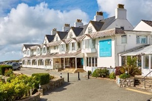 Set right beside the beach, Trearddur Bay Hotel offers sea views, comfortable rooms, and a wonderfully relaxed coastal atmosphere – with many bedrooms overlooking the bay. Guests can enjoy seasonal dishes in The Bay Restaurant, classic pub favourites in the Inn at the Bay, or a sunny drink in the garden bar – all just steps from the sand. Visit their website
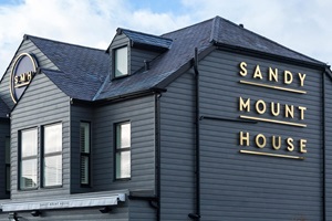 Overlooking the sweeping sands of Rhosneigr, Sandy Mount House blends contemporary beach-house style with a warm, relaxed welcome. Stylish rooms offer calming coastal comfort, while the lively restaurant and bar showcase seasonal Welsh produce, craft drinks, and cosy fireside corners -creating a welcoming seaside hub where guests can settle in and savour the rhythm of village life. Visit their website
General travel information for the Isle of Anglesey Coastal Path will be in your holiday pack.
Detailed instructions on getting to your first night’s accommodation by car, or on foot from the nearest train or bus station, will also be included in the holiday pack on individual accommodation maps.
To view train times please visit trainline where you can also purchase tickets in advance. For information on bus timetables please visit traveline
Getting to Bangor:
By Air: The nearest International Airports are Manchester and Liverpool, offering a wide range of UK and European connections. For transatlantic travellers, Dublin Airport is also a popular gateway, with numerous direct long-haul flights and a convenient ferry crossing from Dublin Port to Holyhead – just 30 minutes from Bangor.
By Public Transport: Bangor Railway Station lies on the main North Wales line, with direct services from Holyhead, Llandudno Junction, Chester, and London Euston. The station is a short walk from the city centre and is well served by local bus routes.
By Road: Bangor is easily accessed via the A55 North Wales Expressway. From the east, follow signs from Chester. From the west, the A55 provides a fast link across Anglesey from Holyhead ferry port.
Returning from Holyhead:
By Public Transport: Holyhead Railway Station lies on the main North Wales line, with direct services to Chester and London Euston, and regular connections eastwards along the coast. The station is located beside the ferry terminal and just a short walk from the town centre.
By Road: Holyhead is easily accessed via the A55 North Wales Expressway, which runs the length of North Wales from Chester directly to the ferry port. The town is well signed from all major approaches.
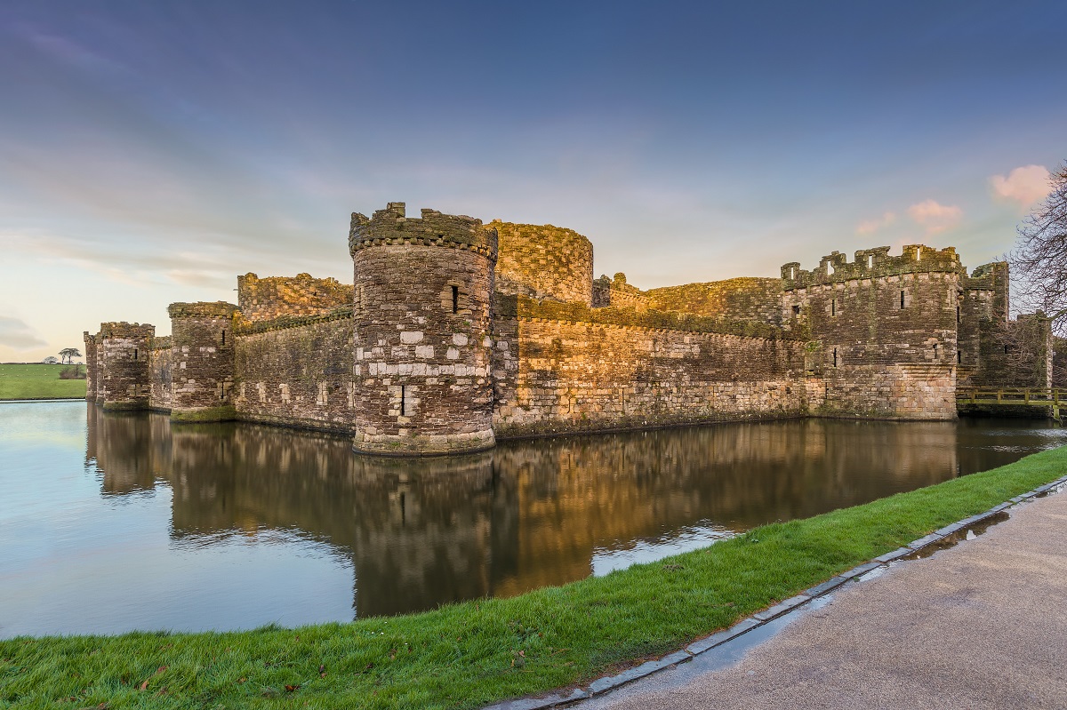
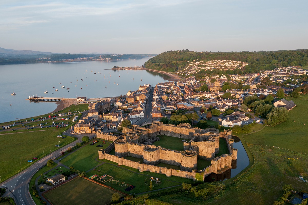
Beaumaris
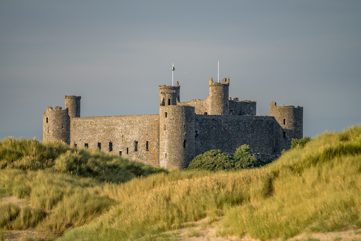
Overlooking the Menai Strait and framed by the mountains of Snowdonia beyond, Beaumaris is an appealing place to linger for a day away from the trail. The beautifully preserved 13th-century Beaumaris Castle, a UNESCO World Heritage Site, is the town’s centrepiece and well worth exploring, while the elegant seafront and Victorian pier invite a relaxed stroll with ever-changing coastal views. Boat trips depart from the pier for wildlife-spotting cruises, often with the chance to see seals or dolphins, and the town’s mix of independent shops, galleries, cafés and excellent seafood restaurants makes it easy to while away a leisurely afternoon. Whether you choose a scenic coastal wander, a castle visit, or simply a long lunch by the water, Beaumaris offers a rewarding pause along the route.
Benllech
Benllech is one of Anglesey’s most welcoming seaside villages and an inviting place to spend time away from the trail. Its wide, sandy beach is perfect for a relaxed stroll, a paddle in the shallows, or simply sitting back to enjoy the expansive coastal views. For those feeling a little more active, the bay is well suited to swimming, kayaking and paddleboarding. Back in the village, a good selection of cafés, pubs and local eateries provides plenty of opportunity to refuel, making Benllech an easy place to slow the pace and savour a classic day by the sea.
Amlwch
Amlwch is a town shaped by its maritime and industrial past, offering a fascinating contrast to the quieter rural stretches of the island. A visit to the dramatic copper mining landscape at Parys Mountain reveals a strikingly colourful terrain and tells the story of the industry that once made Amlwch one of the world’s leading copper ports. Down at the harbour, you can stroll along the quayside, watch fishing boats come and go, or simply enjoy the sea air before settling into one of the town’s cafés or pubs. With its distinctive history and rugged coastal setting, Amlwch provides an interesting and memorable place to pause and explore.
Holyhead
Holyhead is a lively harbour town with a rich maritime heritage and plenty to explore away from the trail. You can discover the maritime museum at Newry Beach, housed in Wales’ oldest lifeboat station, or stroll around the busy harbour where Irish Sea ferries and fishing boats create a constant buzz of activity. In the heart of the town centre, you can visit the ancient Roman fort remains of Caer Gybi, which enclose St Cybi’s Church and hint at the area’s long strategic importance. With a good choice of cafés, pubs and restaurants, Holyhead is an ideal place to enjoy a relaxed day by the sea while discovering a more historic and industrious side of Anglesey’s coastline.