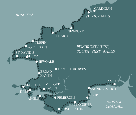
Pembrokeshire Coast Path
Most people spend 15 or 17 days on the Pembrokeshire Coast Path. These options give the average fit walker enough time to enjoy the route but still provide a significant challenge and a sense of achievement (or relief) at the end! With the 15 days walking itinerary set out below, the mileages are more evenly distributed but don’t forget about the extra miles if high tide detours are required.
Note on detours: When the firing range between Bosherton and Angle is open, a 1.5 mile (2.5 km) detour is required.
When walking between Milford Haven and Dale, should you reach Sandy Haven at high tide, a 4 mile (6.5 km) detour is required. Similarly should you reach the Gann Estuary at high tide, a 2.5 mile ( 4 km) detour is required.
Itinerary
| Day | Itinerary | Miles | Km |
|---|---|---|---|
| Day 1 | Travel to Tenby for your first nights accommodation | ||
| Day 2 | Transfer to Amroth then walk to Manorbier | 18 | 29 |
| Day 3 | Manorbier to Bosherston | 10 | 16 |
| Day 4 | Bosherston to Angle then transfer to Pembroke | 17 | 27 |
| Day 5 | Transfer back to Angle then walk to Pembroke | 12 | 19 |
| Day 6 | Pembroke to Milford Haven | 13 | 21 |
| Day 7 | Milford Haven to Dale then transfer to Milford Haven | 10 | 16 |
| Day 8 | Transfer back to Dale then walk to Marloes | 8 | 13 |
| Day 9 | Marloes to Broad Haven | 13 | 21 |
| Day 10 | Broad Haven to Solva | 12 | 19 |
| Day 11 | Solva to Whitesands Bay then bus transfer to St David’s | 13 | 21 |
| Day 12 | Bus transfer back to Whitesands Bay then walk to Abercastle | 14 | 23 |
| Day 13 | Abercastle to Strumble Head then transfer to Fishguard | 9 | 14 |
| Day 14 | Transfer back to Strumble Head then walk to Fishguard | 9 | 14 |
| Day 15 | Fishguard to Newport | 11 | 18 |
| Day 16 | Newport to St Dogmaels | 16 | 26 |
| Day 17 | Depart from St Dogmaels after breakfast |
Prices
| Accommodation, map & guidebook only | £2025 |
| with Luggage Transport | £2280 |
| with Packed Lunches | £2205 |
| with Luggage & Lunches | £2446 |
Other Options |
|
| Extra Nights (per night) | £104 |
| Single Supplement (per night) | £70 |
| Solo Luggage Supplement (per day) | £13 |
Amroth to Angle
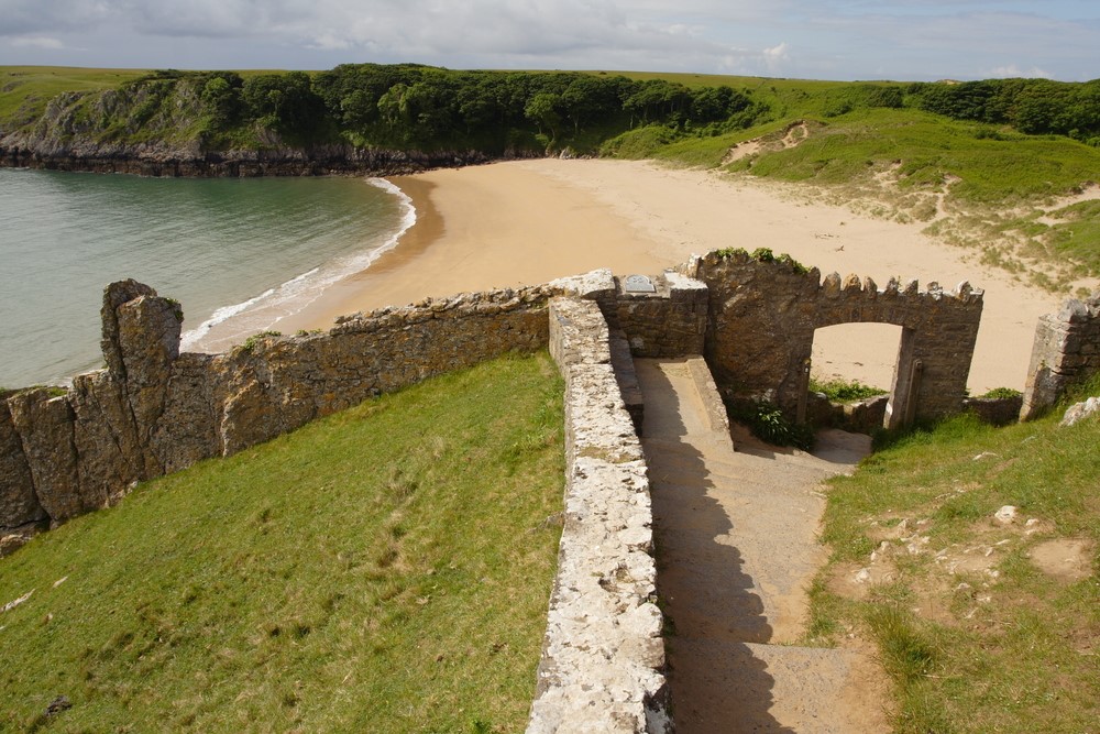
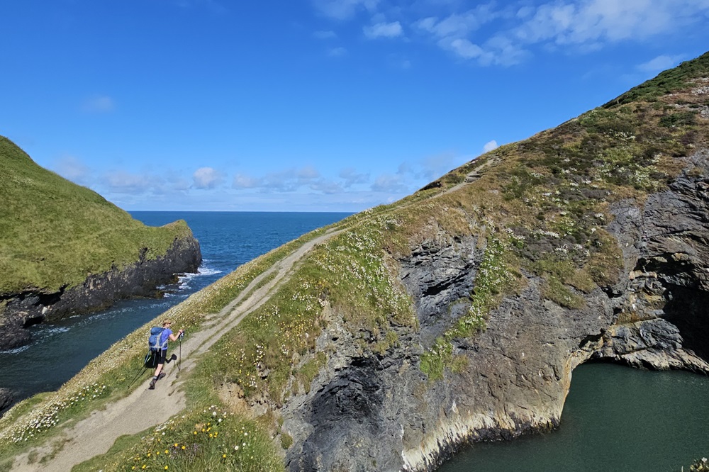
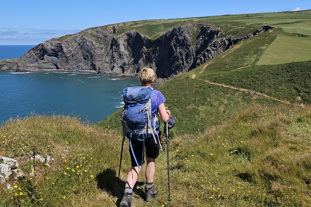
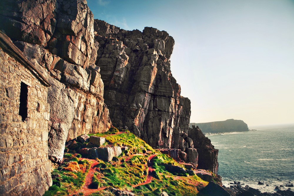
The beautiful beaches and tourist attractions around Tenby make this the busiest section of the whole route with superb views of Caldey Island, and the coasts of The Gower and Exmoor. This section really typifies why this coast is worthy of National Park status. It contains Barafundle beach which was recently voted one of the top ten beaches in the world! It also fringes the famous Lily Ponds at Bosherston which are a National Nature reserve. The path is quite undulating, but you’re never far from a beach or village pub. Also included is possibly the flattest section of the trail much of which is restricted because of military use. Despite being a firing range, this ranks as one of Britain’s most important wildlife sanctuaries and is protected by some of Europe’s strongest designations. This final part of this section is very rugged and once away from Angle village it is deliberately managed to retain a ‘remote and challenging ‘ experience. The entire stretch is coastal – no roads, no houses, few stiles and no amenities at all.
Angle to Dale
Due to its shelter from coastal winds this stretch includes many sections of woodland. Care must be taken to check the tide tables in two locations to avoid long detours on roads. Unfortunately a large part of this section is not within the National Park due to the proximity of industry associated with the haven. It is however still a very interesting walk rich in history, environmental and agricultural interest. The historic town of Pembroke and its castle are well worth a visit.
Dale to Solva
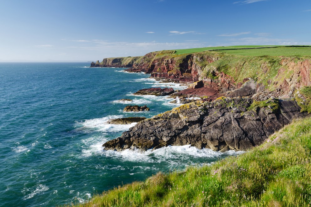
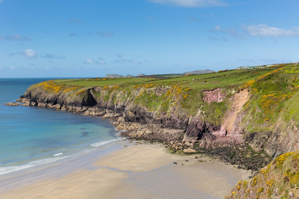
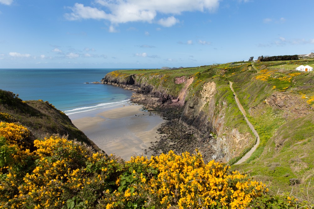
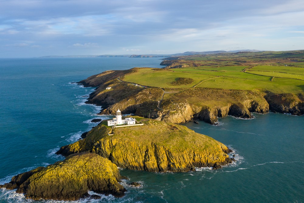
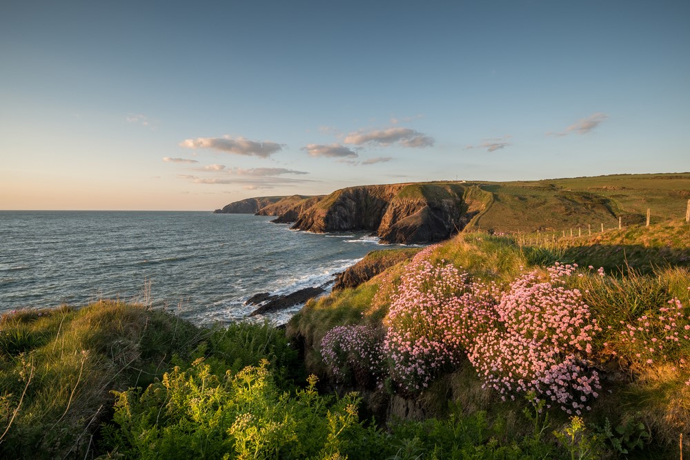
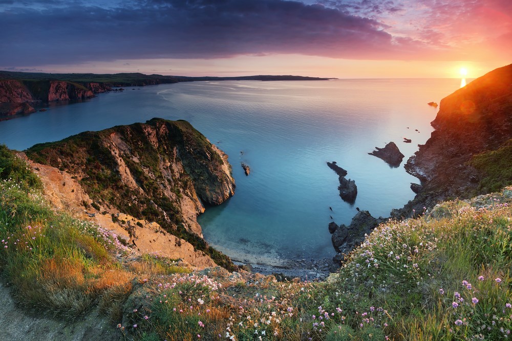
This section takes you around the Dale Peninsula which is a walk of contrasts starting in the gentle, pastoral and, in places, wooded shelter of the Milford Haven waterway and ending on the wild and treeless Atlantic coast with spectacular views of the rugged offshore islands of Skomer, Skokholm and Grassholm. The path then continues to change again as you reach strikingly red low cliffs and coastal slopes and cliff tops rich in wild flowers. In places the red of the Old Red Sandstone is brightly streaked with yellow algae. The pretty village of Solva is well worth a visit due to its situation on an old glacial water melt channel.
Solva to Porthgain
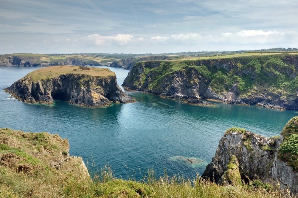
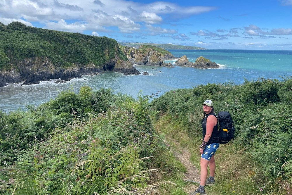
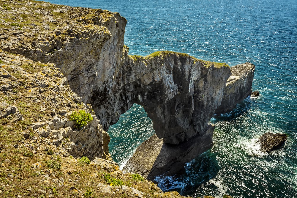
A must on this section is to visit the smallest city in Britain – St David’s and it’s beautiful cathedral. Make time to linger on the wild and rocky peninsular of St David’s Head which abounds with archaeology and has views across to Ramsey Island. Keep an eye out too for seals in the rocky coves below the path and gannets diving for fish out to sea; you may be lucky enough to see the grey dorsal fins of porpoises hunting for fish beneath the gannets. The section between Whitesands and Abereiddi feels wild and remote with hardly a building to be seen making the cafe at Whitesands or the refreshment van at Abereiddi a welcome sight for the weary walker! This is an exhilarating and in places rugged section of path above high cliffs and beneath the dramatic craggy volcanic outcrops of Pen Beri, Carn Lleithyr and Carn Llidi.
Porthgain to Fishguard
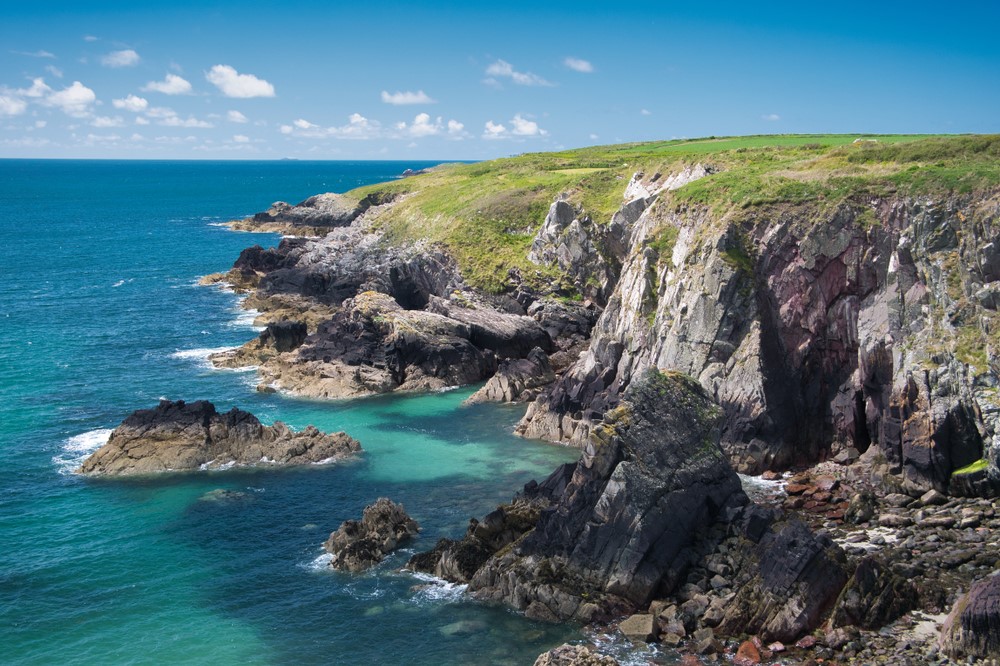
There are plenty of dramatic sheer cliffs on this section where coastal erosion is an obvious process. Every year Pembrokeshire is a little smaller than the year before and the route of the Coast Path has to be continually reviewed to ensure safety. Mostly 30 to 70m high, the cliffs are of volcanic origin – gently rounded cliffs where the rock is strong and hard, sheer where there are weak strata. There are infrequent steep hills with rocky outcrops and loose volcanic stone where heather and gorse abound in a dramatic blaze of colour in August.
Fishguard to St Dogmaels
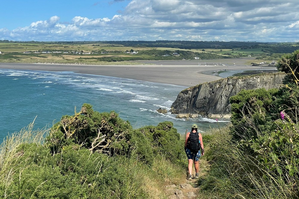
The cliffs on the section from Fishguard to Newport are lower, mostly at around 40m. Although Pen Dinas rises to 142m, the level valley path (also National Trail) avoids this. Hills up from and down to the little beaches are steep but well spread out. Newport Town to St Dogmaels is the most challenging section of the Coast Path, 15.5 miles long with frequent very steep hills. There are no services between Newport Sands and Poppit. Walkers should ensure that they are properly prepared with adequate food, drink and clothing along this remote section.
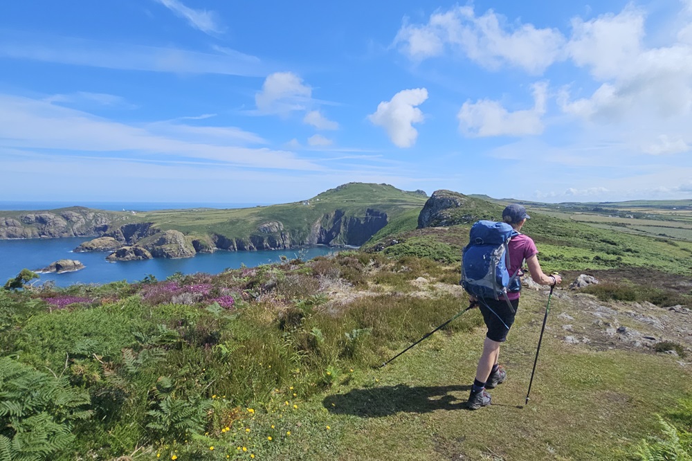
This is not a technically difficult walk and should be easy to tackle for most reasonably fit people. The paths are good, and there are no major route finding challenges. This central section includes a short urban section at the beginning, followed by cliftops and sandy beaches.
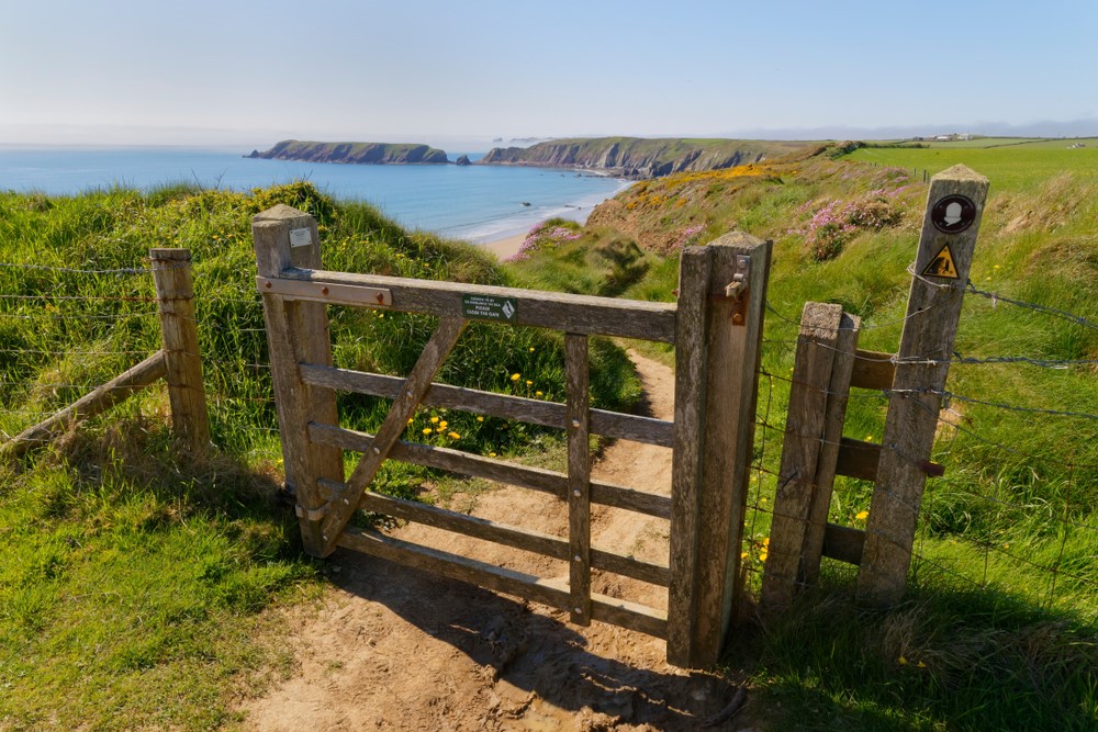
Terrain: A coastal path mainly through farmland and moorland on the cliff tops, with stretches along sandy beaches.
What’s it like underfoot? Generally good paths and tracks, although a few sections can get muddy after heavy rain.
How Much Up & Down? More than you’d think! Although you never reach more than 200m above sea level (and most of the time not more than 100m) there are many short steep sections. Most days involve ascents of 200-500m, although no section is very steep for very long.
Signposting: Good – the path is well waymarked.
Navigation: Pretty straightforward – good signposting, and generally well defined tracks.
Weather: You may be lucky enough to encounter warm, dry weather over the whole route and enjoy dry paths and tremendous views, but you must be prepared because the weather can change quickly. Good clothing including comfortable footwear and reliable waterproofs are essential.
|
All Holidays
|
|
| Accommodation | Overnight Bed and Breakfast accommodation in selected hotels, farmhouses, village inns, guest houses and family B&Bs. Cooked or Continental breakfast. |
| Guidebook | A detailed guidebook with route information, maps, photos and background information. |
| Information of Services Along the Route | A comprehensive Service Info sheet, including services such as cash points, banks, post offices, village shops, inns, cafes and taxis. |
| Maps | A waterproof (1:40,000) Harvey Map covering the whole route. |
| Personal Itinerary | A personal itinerary setting out each overnight stop, including large scale maps of each accommodation, to ensure you find it easily. |
| Emergency Telephone Support | If you get in to difficulties during your holiday, we are always available to help, even out of office hours. |
|
Options
|
|
| Luggage Transport | We will transfer your luggage between each overnight stop if you leave your luggage at the accommodation when you set off in the morning, it will be moved on to your next B&B. You only need to carry a small day sack with the clothes and provisions you require during the day’s walk. |
| Packed Lunches |
Provided for each day’s walking and recommended on this holiday as there will not always be a handy shop or cafe on the route. |
| Off Road Parking | If you are travelling by car we can usually arrange off road parking for the duration of your trip. (There may be a small charge for this). |
| Arrangement of return transport | We can also arrange your transfer back to your car, (or advise you when public transport is a better option)! |
|
What’s not Included
|
|
| Evening Meals | Your evening meal isn’t included in the package, but we include full details and recommendations for each evening meal in your itinerary. You will normally be within walking distance of a pub and/or restaurant, or where there is good food available at the accommodation, we’ll book that for you. Allow about £30.00 per night. |
| Transport to the Start & Away from the Finish | Have a look at the ‘Travel Info’ tab above for suggestions. If you’re still struggling, get in touch and we’ll help you sort it out. |
| Travel Insurance | Even if you are based in the UK travel insurance is worth having. |
Good accommodation and friendly hosts are an essential part of any holiday. We understand this and go out of our way to find the best. We put a great deal of effort into hand picking our accommodation and matching it to individual customer requirements. As well as visiting the accommodation ourselves, we ask all our customers to complete a short evaluation on each night’s accommodation, which then gives us an insight into the day-to-day operation and lets us spot any potential issues before they become a problem.
We use a variety of accommodation. Over the course of your trip you might stay in a village inn, a bed and breakfast in a converted barn, a Victorian guest house, or on a working farm. In selecting the accommodation we look for helpful, friendly hosts with good quality, characterful accommodation close to the trail. Occasionally we may use a chain hotel.
We always try to arrange en suite accommodation, i.e. rooms with their own bathrooms for each night of your stay. However, in some of the more remote locations accommodation is limited and occasionally we may have to book rooms with shared bathrooms for one or two nights of your holiday, (especially if the booking is made at short notice), but we will always let you know if this is likely to be the case.
We are happy to book single rooms on our holidays but cannot normally book more than two for any one group. Single room bookings include a supplement.
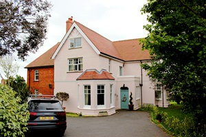
Here are some examples of the accommodation we use on the Pembrokeshire Coast Path:
 Richard and Sarah, Monti the Mongrel and Oscar the chocolate Labrador welcome you to St Katherine’s House bed and breakfast on the coast of Pembrokeshire. This is the perfect place if you’re looking forward to a break away from it all and especially so if birds, sea creatures, flora, fauna, breathtaking geology and natural history are your thing. Visit their website
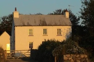 Garn Isaf in Abercastle, hosted by the welcoming Anne, offers modern en suite accommodation in a charming 16th-century homestead. Nestled in Pembrokeshire National Park, just minutes from the Coastal Path, it’s perfect for exploring Abercastle Harbour, nearby St Davids, and local landmarks like the legendary Carreg Sampson. Visit their website
 The award winning Manor Town House, hosted by Chris and Helen, offers boutique-style accommodation with stunning sea views over Fishguard Bay. Relax in elegant rooms or enjoy savouring the Preseli Hills and beyond from the private garden terrace. Centrally located, it’s perfect for exploring this lovely area. Visit their website
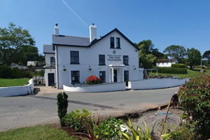 The Teifi Waterside Hotel & Restaurant in St Dogmaels, led by Manager Llyr and his dedicated team, offers stunning views of the Welsh coast and exceptional hospitality. Enjoy fresh, locally sourced dishes prepared in their new state-of-the-art kitchen and served in their recently extended restaurant, ensuring a truly memorable experience. Visit their website
General travel information for the Pembrokeshire Coast route will be in your holiday pack including train and bus timetables where available.
Detailed instructions on getting to your first night’s accommodation by car, or on foot from the nearest train or bus station, will also be included in the holiday pack on individual accommodation maps.
To view train times please visit trainline where you can also purchase tickets in advance. For information on bus timetables please visit traveline
If you require secure car parking whilst walking this route, please contact us for information.
Getting to Tenby:
By Air: The nearest airports are Cardiff and Bristol – International airports are London, Birmingham and Manchester. You can then travel by public transport to Tenby.
By Public Transport: Tenby Railway Station is located on the Pembroke Dock branch line with regular services to Swansea, where there are onward connections to Cardiff, London, and destinations across the UK rail network.
By Road: Tenby is located on the A478. From the A40 trunk road (Carmarthen), turn on to the A477 at St Clears (signed Pembroke Dock). Follow the A477 to the Kilgetty Roundabout then turn on to the A478 signed Tenby.
Returning from St Dogmaels:
By Public Transport: The nearest mainline railway station to St Dogmaels is Haverfordwest. Haverfordwest Railway Station is located on the West Wales line with regular services to Carmarthen and connections onward to Swansea, Cardiff, London, and other destinations across Wales and the UK. Travel by bus or taxi from St Dogmaels to Haverfordwest.
By Road: St Dogmaels is located just off the A487, on the opposite bank of the River Teifi from Cardigan. The A487 runs along the coast from Aberystwyth to Fishguard, and from Carmarthen (A40) you can follow the A484 direct to Cardigan.
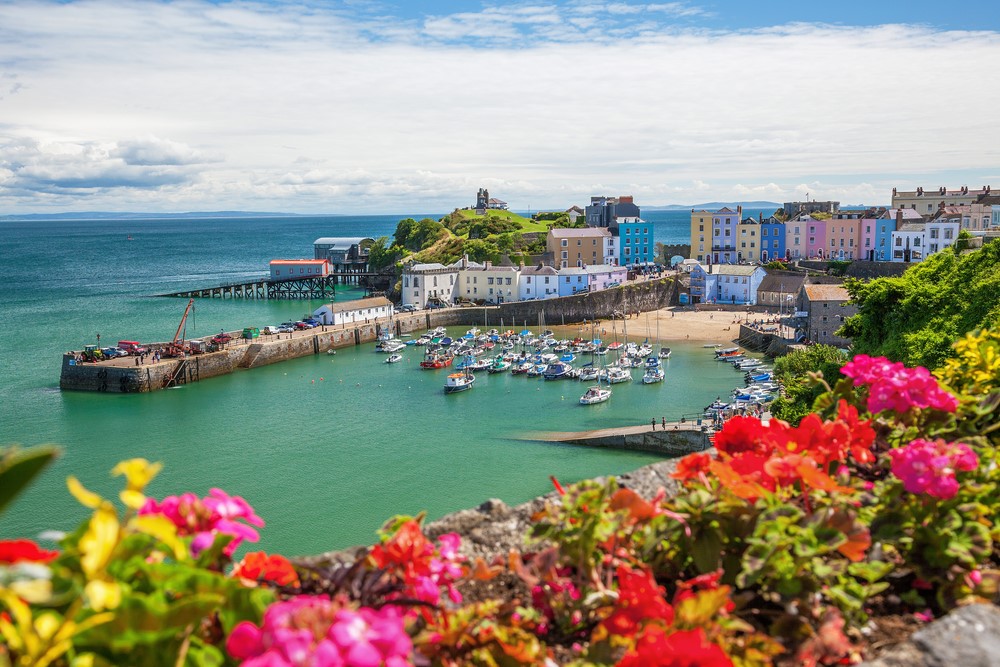
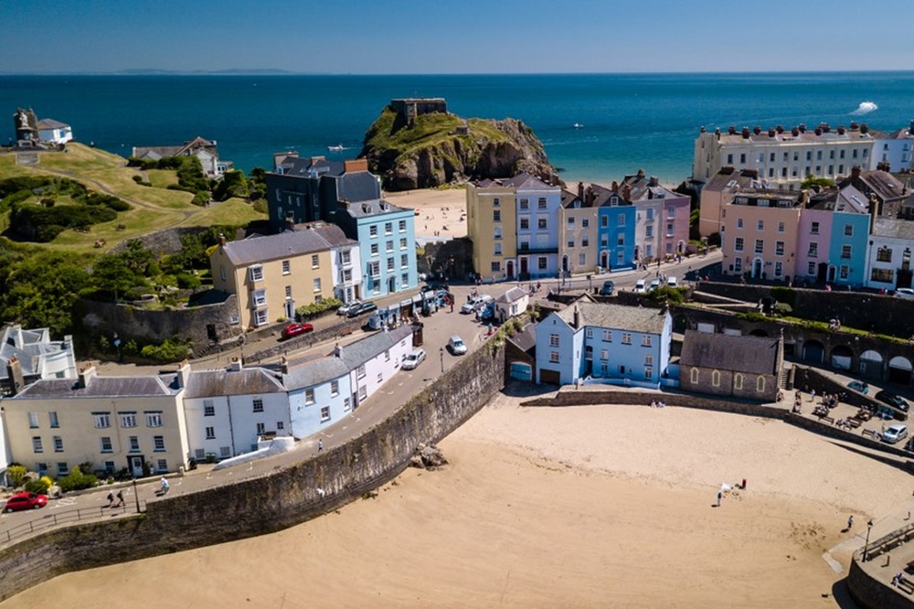
Tenby
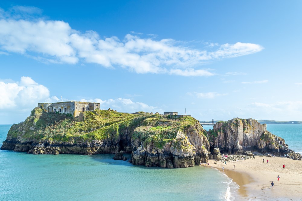
Although only just into the start of the route, this typical British seaside resort with a certain charm and sophistication is well worth spending some extra time in. Colourful houses perch above the harbour and South Beach while the well preserved mediaeval town walls hide a maze of crooked streets. From here Caldey Island is clearly visible just to the south. Monks have been on the island for around 1500 years and about 20 monks live there now. Boat trips are available from Tenby and there is plenty to see on the island – unfortunately tours of the monastery are only available for men.
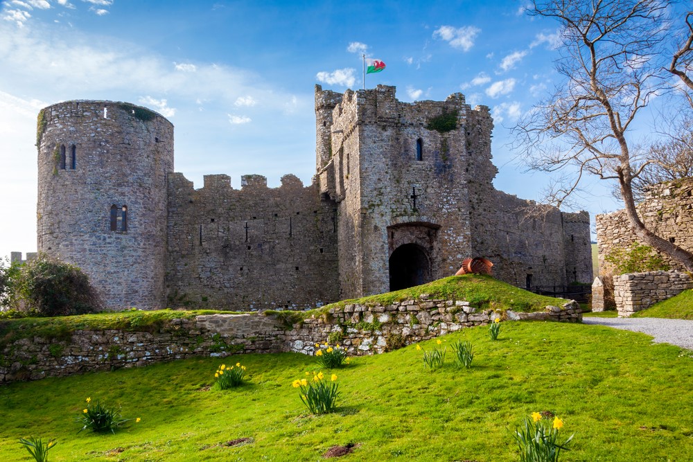
Pembroke
Pembroke is the birthplace of Henry VII and is steeped in history. The 900 year old castle is the focal point of the town, standing guard over the river and well worth a visit. The town itself was fortified and walled, and sections of these walls are still visible. Visitors can take the popular town trail and there is also a daily indoor market and numerous small craft, gift and specialist shops.
Marloes
To the west of the Marloes Peninsula are the islands of Skomer, Skokholm & Grassholm which are brought to life by the thousands of sea birds which breed on the sheer cliffs. All the islands can be visited by boat from Martin’s Haven and guided walks are available on Skomer and Skokholm.
Solva
Solva is probably the prettiest village on the path. The lower village is a line of painted houses tucked below the steep hillside that leads to the little harbour. The claustrophobic nature of this part is due to its situation. It sits on an old glacial melt water channel formed some 10,000 years ago at the end of the last ice age.
Fishguard/Goodwick
Standing on an imposing headland commanding superb views of the bay, Fishguard is the main shopping centre of north Pembrokeshire with two small supermarkets and family-run shops and businesses. The area is famous as the location of ‘The Last Invasion of Britain’ when in 1797 French troops landed nearby. Local heroine Jemima Nicholas captured many of the invaders single handed and the Frenchmen later negotiated their surrender at the Royal Oak inn and laid down their arms on Goodwick Sands.