Tara’s Coast to Coast – Lakes and Mountains
I’m really excited to be walking the Coast to Coast and sharing this with you! A lot has happened since this trip was booked last year and I’m really happy to be back out on the trail and supporting our hard working accommodation hosts and other service providers. Part one of my story features what’s known as the Lakes and Mountains stage of the Coast to Coast. In part two I’ll be sharing my story from the Dales and Moors.
Day 1: St Bees to Ennerdale Bridge
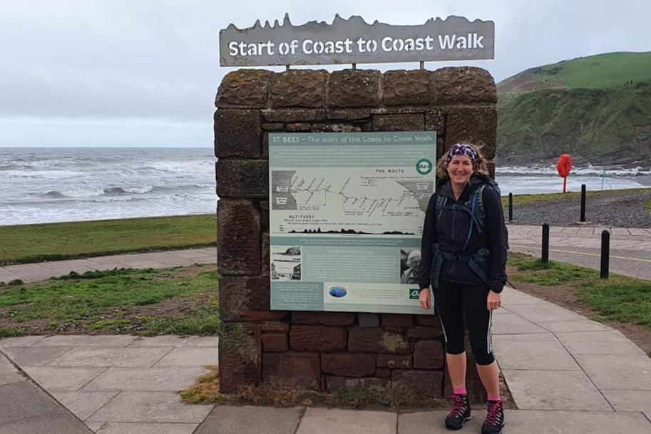
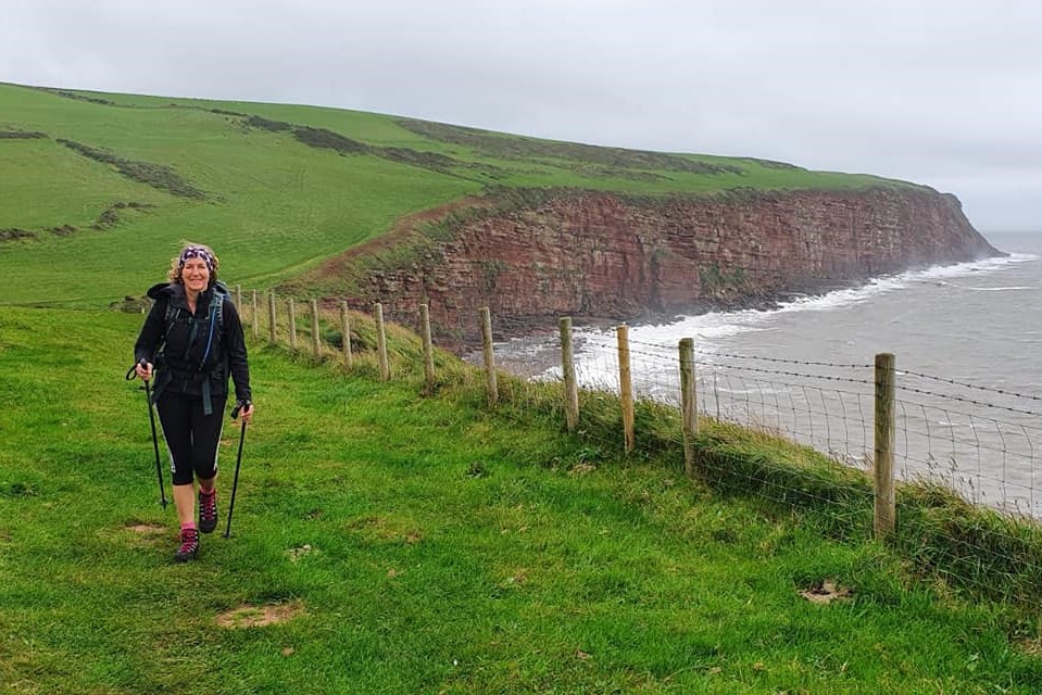
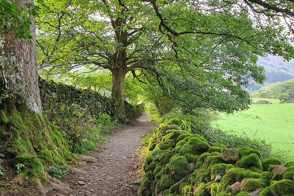
It is traditional at the start of the Coast to Coast to either dip your boots in the sea or pick up a pebble to carry to Robin Hood’s Bay. Or both. With pebbles selected and boots dipped we made our way up on to the red sandstone cliffs to begin our 190 miles across England. We are walking 14 days, most of them being around 15 miles, the same as today. Although the route heads east, the first few miles head north up the coast and around St Bees Head. After a few miles the trail turns inland using tracks, lanes and many fields, and passing through some small Cumbrian villages with mining history, to reach the first of many Lakeland fells, Dent Fell.
Dent Fell is about 350 metres /1148 feet in height, so it’s a comparatively small fell but it has a great view. Well at least it does when it is not shrouded in cloud as it was today. So sorry, there’s no summit picture but at least it hasn’t rained. After the summit the path quickly descends through forest trails to meet a lovely route through a dale alongside a stream called Nannycatch Beck. This is followed all the way to meet the road to Ennerdale, then it is downhill to the village and the end of day one.
Day 2: Ennerdale Bridge to Rosthwaite
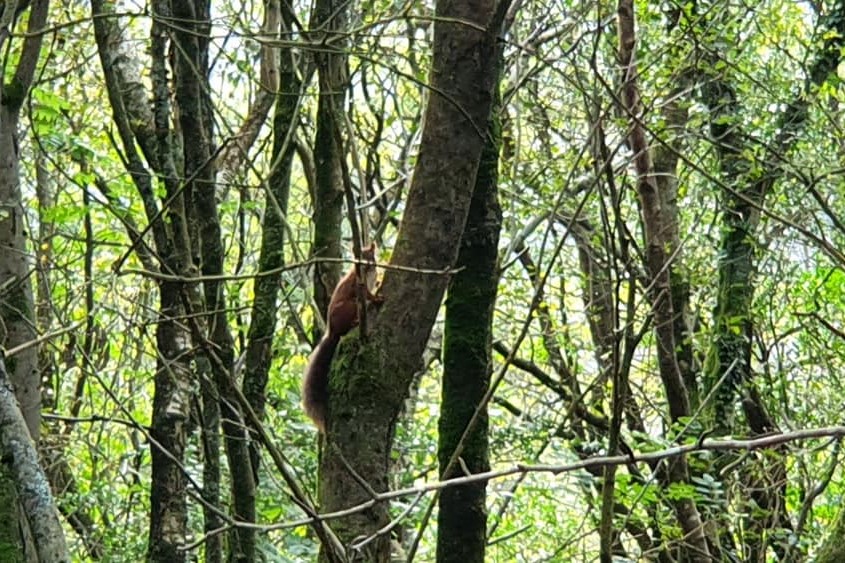
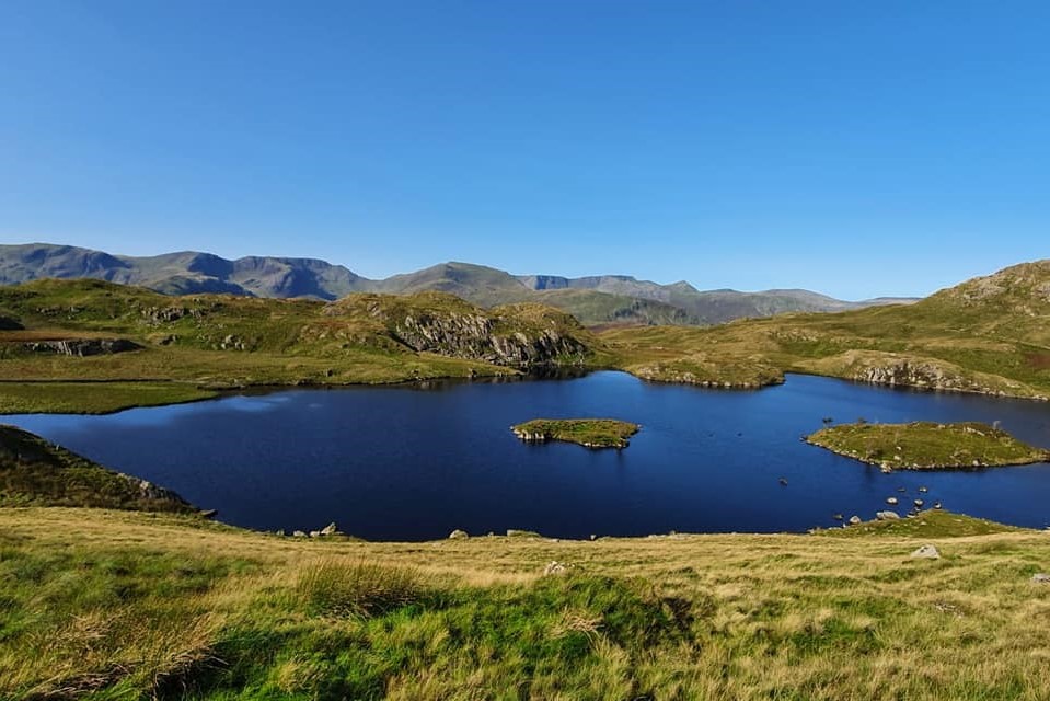
What a fabulous day it was today, obviously helped by the amazing weather! The 15 mile day started with a short road walk to the shoreline of Ennerdale Water. On this stretch we saw two adorable red squirrels and one stayed still long enough for me to take a picture for you.
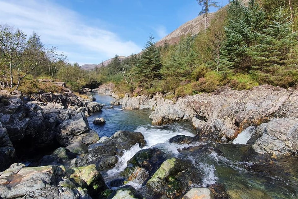
Ennerdale looked beautiful today in the sun and we had a lovely walk on the southern path. After the end of the lake we stayed on the southern side of the river Liza. Ordinarily the path would cross the river here but there is some forestry work going on. The river is rocky so the water is clear and creates lovely sparkling pools. We crossed it a little further on and joined the track leading to the remote and well known Black Sail Youth Hostel. Most of the walk today to this point was gently undulating. I knew that we had to climb Loft Beck and hadn’t been looking forward to this section as the guidebook says this is a heat trap in warm weather. It was, but it didn’t take too long to climb the steep 350 metres.
At the top of Loft Beck we joined a prominent path called Moses Trod. This used to be an old slate road used to transport slate from nearby Honister Slate Mine, the next target on the path and a great place for refreshments before the last few miles to Rosthwaite. Honister sell “coast to coasters” a little slate souvenir of your trip. Suitably refreshed we picked up the downhill path from Honister to Rosthwaite and our hotel for this evening. I have a suntan again, not what I was expecting from an autumn Coast to Coast but I’m not complaining one bit.
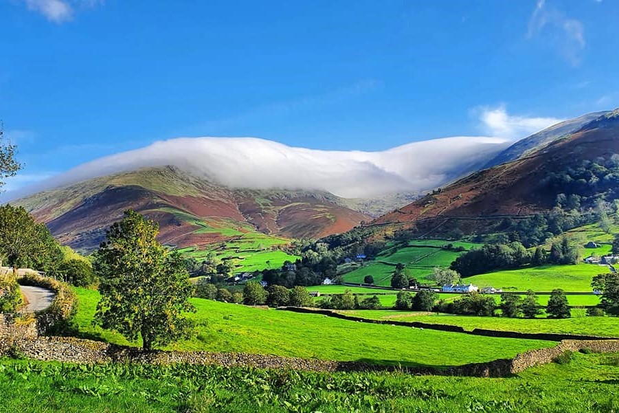
Day 3: Rosthwaite to Grasmere
Amazing weather again for day three of our walk. We started from Rosthwaite on a bridleway leading to our first climb of the day, a couple of miles up Greenup Gill. The scenery here is fabulous with the sounds of waterfalls accompanying us. Although its uphill it’s not really steep. Soon after leaving the waterfalls behind, the path arrives at a vast bowl carved by glaciers. This is filled with moraines, rock debris deposited by the glaciers, creating an unusual landscape.
Standing guard over this feature is Lining Crag which the path now heads towards. This is the steepest part of the day. It requires some scrambling but it’s not difficult and we are soon at the top.
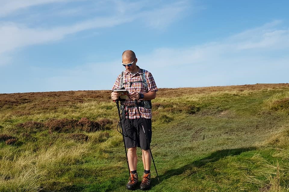
Above Lining Crag is a boggy area leading on to Greenup Edge where many people go wrong, particularly when the visibility is poor. We’ve been up here before so we knew where to go and the best way around the boggy bits. A map and compass would be needed on misty days.
A rocky path runs down to Far Easdale head and from there main path is straight down to Grasmere but there is a high level alternative. As today was a shorter day at 9 miles we opted to take the higher level route, not much longer in distance but adding some time and difficulty. This takes in the three fells of Calf Crag, Gibson Knott and Helm Crag. For anyone ticking off Wainwrights that’s three more for you! The summit rocks of Helm Crag are a well known landmark, easily recognisable by anyone driving over Dunmail Raise and known as the Howitzer. It’s a popular day walk up from Grasmere so we passed a few people here.
After a very hot walk over all three summits we picked up the path downhill to picturesque Grasmere for tea and cake. Many of our customers choose a rest day here but we are carrying on tomorrow.
Day 4: Grasmere to Patterdale
We had a leisurely start to the day today, only walking a few metres from the hotel before our first coffee stop in Grasmere! We knew today was going to be relatively easy at 9 miles with one fairly steady climb so we didn’t need to rush off. With the prospect of a couple of more difficult days coming next, we opted to stick with the original route rather than taking one of the higher level options of Helvellyn or St Sunday Crag.
The day started with a short road walk out of Grasmere. From here we could see the first half of todays route capped with cloud. We headed uphill towards Grisedale Hause on a fairly well made, rocky path which ascends comfortably. The cloud was burning off but more cloud rolled in as we reached the top and this stayed with us for the afternoon. We passed by Grisedale Tarn at the top. I have been here in the sun before but in the cloud it was quite moody looking today.
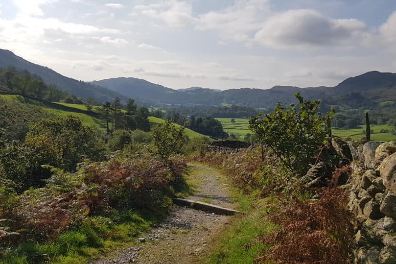
With all the climbing done, the second half of the day was a gradual descent into Patterdale, again on a stony path, with Helvellyn on the left and St Sunday Crag on the right. The path eventually arrives in the village but, as we are staying half a mile away in Glenridding tonight, we took a side excursion so we would not have a road walk. Instead we enjoyed a fellside walk via Lanty’s Tarn and a quiet route into Glenridding.
Tomorrow morning we will walk back to Patterdale to continue to Shap, our last day in the Lake District before moving on to Yorkshire. It’s 16 miles tomorrow and our highest day, over Kidsty Pike at 780m. The weather forecast is great and my legs and feet are fine!
Day 5: Patterdale to Shap
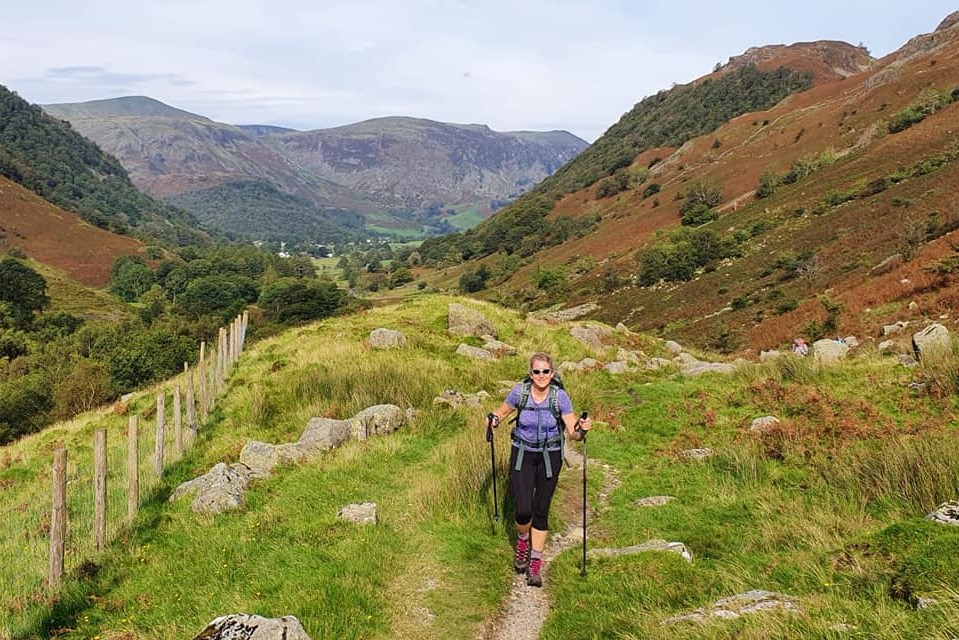
Another gorgeous day, we could not have dared to hope we would get such good weather for today’s walk. Most of the effort today was in the first half. It started with a hot climb out of Patterdale on the southern slopes of Place Fell, on a stony track, steady at first then continuing more steeply uphill to Boredale Hause. Here we turned onto another path leading to Angle Tarn which just pops into view around a corner. It was sparkling in the sun today as it was a perfect walking day, clear blue sky, slight breeze, although a little warm at times. The views were amazing and after leaving Angle Tarn we could just make out the deer in Martindale.
The next part of the trail was an undulating path, boggy at times, leading to The Knott and on to the sharp summit of Kidsty Pike, the highest point of the Coast to Coast. It’s not the highest fell in the area though as that title belongs to High Street, looking imposing viewed from Kidsty Pike. High Street once carried a Roman road, however the Romans may not have been the original route finders as some archaeological finds suggest there was a trade route here 2000 years before the Romans.
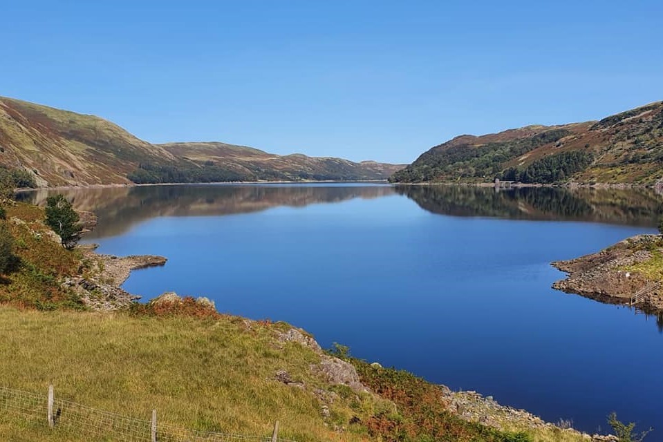
After Kidsty Pike the walk today entered its easier phase. After the descent down to Haweswater, steep and quite a scramble in places, we joined the path for the long walk alongside the reservoir. I was lulled into a false sense of security here as I was expecting this to be fairly flat and it wasn’t! The path is not on the waters edge, rather on the lower slopes of the surrounding fells, so there was plenty more up and down before it levelled out closer to the end. The reservoir is about 4 miles long, ending at Burnbanks where the path leads on for a few more miles over farm fields via Shap Abbey to Shap.
Dinner tonight was fish and chips from award-winning Shap Chippy, eaten outside tonight’s accommodation on the picnic benches which were still in the sun.
Today was 16.5 miles and tomorrow is even longer at 21 miles from Shap to Kirkby Stephen. Tomorrow we should notice a difference in the scenery as we leave the Lakes behind and head for the Yorkshire Dales.
Day 6: Shap to Kirkby Stephen
Well that was a long walk today, nearly 21 miles, and although one of the guidebooks suggests it is a “recovery day” I’m not sure my feet would agree. The terrain was certainly easier with no summit to get over today, but that also means no big downhill in the afternoon! It was a more rolling day today over fields and moorland.
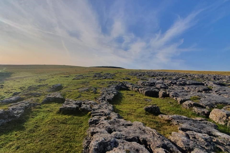
We began by crossing the railway and the motorway to leave Shap behind and enter the Yorkshire Dales National Park. The first part of the day was spent traversing the vast Crosby Ravensworth Fell and heading towards Orton. You can choose to split this day into two shorter days at Orton if you’d prefer. As we had no need to go into Orton we took the by-passing route crossing fields, then over upland areas of limestone and a short road walk to Sunbiggin Tarn.
Moorland walking followed as we headed over Crosby Garrett Fell and Smardale Fell, then finally pastureland for the last few miles into Kirkby Stephen. The Lakeland landscapes have been replaced and the views ahead are now the Howgills and the Pennines. Nine Standards Rigg, where we head tomorrow, is clearly visible on the skyline. I bumped into Mickledore customers Jane and Adrian in the pub this evening and they tell me they are having a great time. They started their walk before us but had a rest day and shorter walking days so we have caught them up. They split this section in two so today they walked from Orton and have been taking things at a more leisurely pace. They are enjoying the accommodations we have chosen for them and also the food! I know they are reading my updates so good luck and enjoy the rest of the walk, it was great to meet you!
I hope you’ve all enjoyed my Lakes and Mountains journey from St Bees to Kirkby Stephen and that you’ll join me over the Dales and Moors as I walk to Robin Hood’s Bay. For more information on the Coast to Coast email us [email protected]. or to speak to one of our walking holiday experts, call 017687 7233