Seven Days on the North Devon Coast
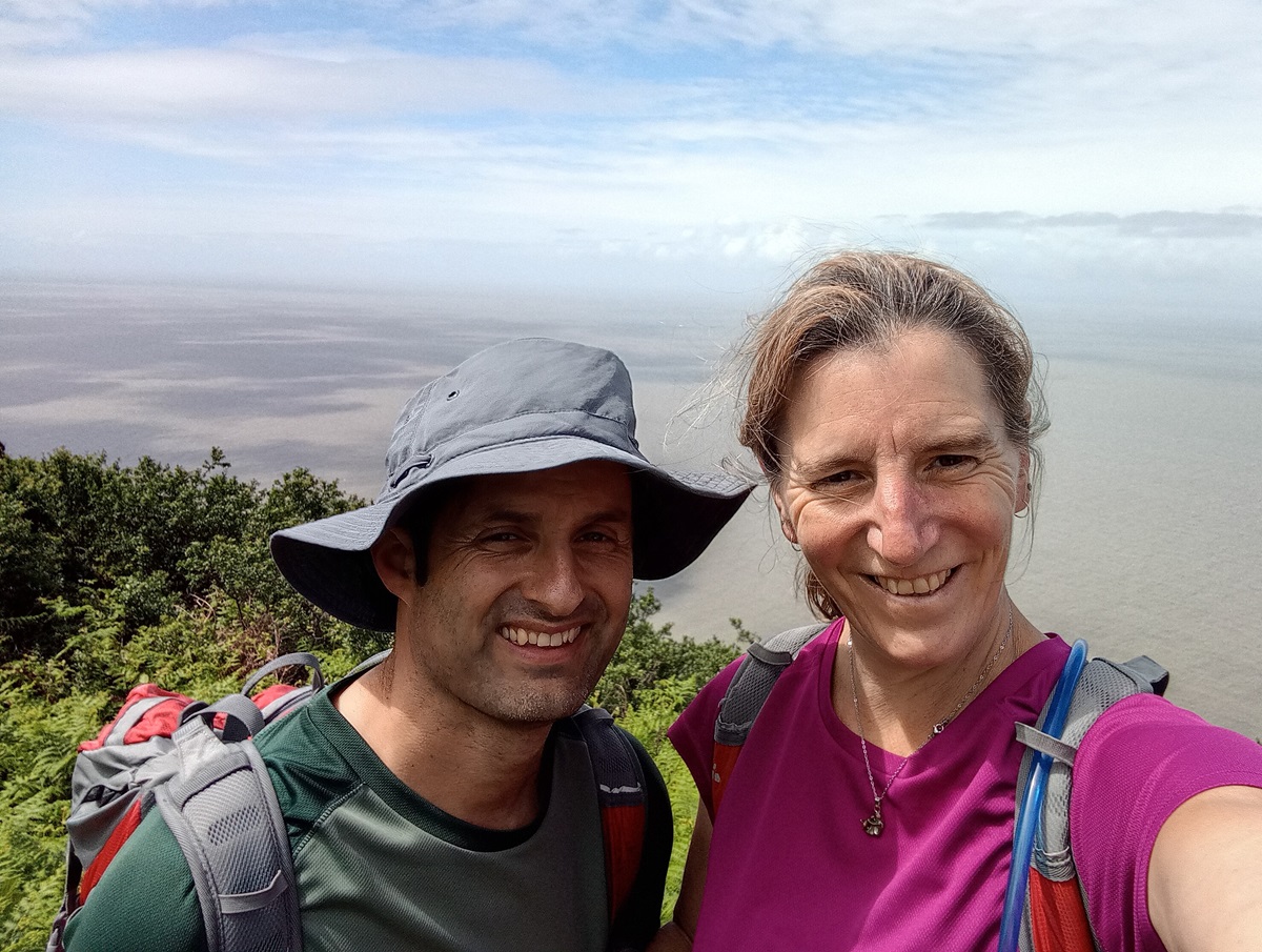
This year, for my familiarisation trip with Mickledore, we decided to tackle the very first section of the South West Coast Path. Having fallen in love with Exmoor on last year’s Two Moors Way trip, and being a huge fan of coastal walking, this was a wonderful opportunity to combine both while getting to know the route, and meet some of the amazing accommodation and service providers that help make our walking holidays so special.
Stretching 88 miles from Minehead to Westward Ho!, the North Devon section of the South West Coast Path brings together wild moorland and towering cliffs, secret coves and stunning beaches. I was brought up listening to Mark Wallington’s 500 Mile Walkies, so I was eager to follow in the footsteps (or pawprints) of Boogie as he chased his endless plastic bags!
Getting to Minehead all the way from Cumbria was remarkably easy, using a combination of trains and buses, my husband Matt and I found ourselves dipping our toes in the sea by early afternoon. This gave us plenty of time to find the official start of the trail for the following morning, avoid the urban sprawl of Butlin’s, and instead while away the afternoon watching the steam trains of the West Somerset Railway. It is thanks to this railway that Minehead was put on the map, becoming the popular seaside resort it remains today. Originally developed in 1862 to transport iron ore, the line from Taunton to Watchet was extended to Minehead in 1874, transforming the town’s economy and lifestyle. Although it closed in 1971, the line reopened as a heritage railway in 1976.
Day 1: Minehead to Porlock
We were up bright and early this morning, eager to get going, and a quick peep out of the window confirmed it was dry at least – albeit overcast – perfect walking weather!
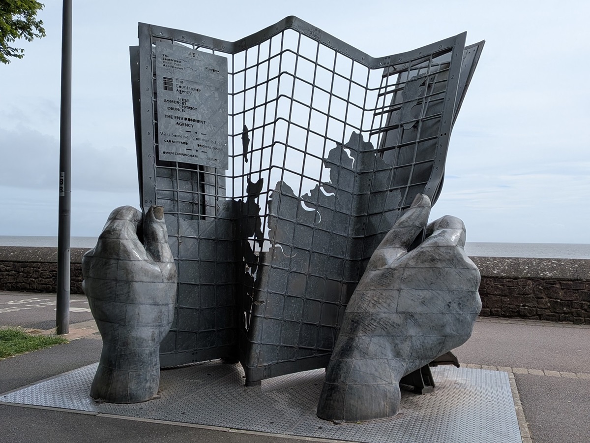
We headed down to the seafront and followed the seashells of the Minehead Maritime Trail, which focuses on the town’s maritime history alongside local myths and legends. Having located the infamous Hands and Map sculpture, the true starting point of the whole South West Coast Path, and after a quick photo call, we were off!
Away from the seafront, the wide, clear trail quickly rises through mature woodland towards the top of North Hill. Before too much height is gained, there is an option to divert to see the remains of Burgundy Chapel (clearly signposted), which adds just over a mile. We opted not to take this route as we didn’t fancy either retracing our steps to the main trail or tackling the alternative option of a very steep uphill pull to rejoin it further on.
Once at the top of North Hill, the trail splits in two, with an acorn signpost guiding you to the right. In the guidebook this is described as “the rugged alternative”, but it is a clear path that appears to be favoured by many walkers. This beautiful, easy-to-follow route winds its way along the clifftops amongst abundant foxgloves, bracken and heather, with sneaky views across to Wales (apparently! It was too hazy for us to see). It rejoins the main trail at Hurlstone Point, a beautiful vantage point for lunch.
For the brave, there is a path down the front of Hurlstone Point, but it is a little exposed and steep. Alternatively, the main trail drops down through the combe before turning towards Bossington.
Crossing the little footbridge, we had our breath taken away by this gorgeous hamlet: a tiny cluster of beautiful thatched cottages, many with homemade wares displayed in honesty boxes outside their doorways. All too soon, the trail led us out to Sparkhayes Saltmarsh, a wide, flat valley so different from what we had spent the morning walking through.
Between the saltmarsh and the sea is a natural shingle ridge, which can occasionally be breached by exceptionally high tides. Following the last major breach in 1996, the South West Coast Path was re-routed to pass around the back of the beach.
Halfway along the marsh, we diverted off the trail into Porlock, second overnight stop. As we were a little early, we took advantage of the extra time to explore the village, admiring more thatched cottages, the old church and the historic waterwheel, to name just a few highlights.
Day 2: Porlock to Lynmouth
We retraced our steps back to the saltmarsh and paused to study the WWII memorial to the 11 American airmen who lost their lives when their plane crashed in 1942, before continuing our journey to Porlock Weir. This sleepy little hamlet has a lovely seafarers’ museum. Although it consists of just one room, it’s well worth stepping back in time for 10 minutes.
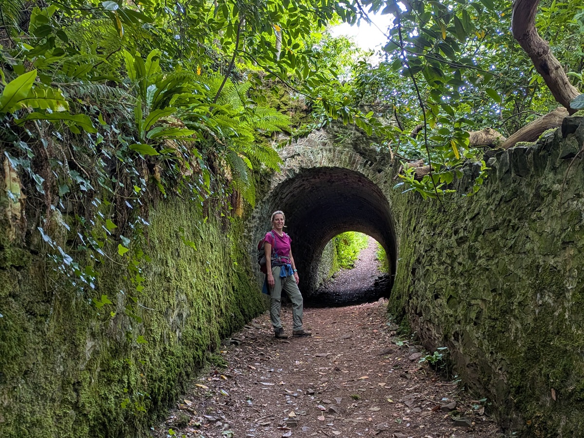
Time to set off properly today, and we headed back into mature woodland, following a trail which seemed to go uphill forever! Nothing steep, just unrelenting so early in the day’s walk! This soon brought us to Worthy Toll, a lovely ornate gate which allows access to Worthy Toll Road. Passing under a small archway, we were surprised to see tunnels and the remains of the original Ashley Combe house still standing.
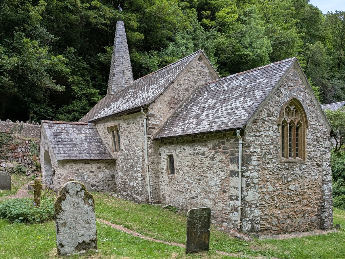
The undulating forest track then meanders through Yearnor Wood, with a cacophony of birdsong accompanying you all the way to Culbone Church, England’s smallest complete parish church. Take some time to step inside – you certainly won’t regret it. This tiny church is still used to this day, but without a tarmac road to access it, worshippers must arrive either by 4WD or on foot. No mean feat!
After leaving the church, we carried on through the woodland on wide, well-signposted tracks for the next few hours. Following a tip-off from our hosts at Porlock, we took a slight detour from the main trail, following a sign marked “The Beach” just before Home Farm. After only a 15-minute diversion, we emerged onto the delightful, deserted, pebbly Glenthorne Beach, complete with a natural waterfall – the perfect spot for lunch.
Not long afterwards, at Coscombe Linhay, we crossed the Somerset–Devon border, although there are no flags or signposts to let you know you’ve entered a new county!
We finally emerged from the tree cover at Cuddow Combe, suddenly confronted by a gate and a tarmac road. A lovely honesty fridge sat beside the gate, stocked with drinks and cakes if needed. Keeping an eye on the signposts, we only followed the road for a couple of minutes before turning off and climbing the short distance to the top of Butter Hill.
There is the option of staying on the road and traversing around the headland to visit Foreland Point Lighthouse, but our legs were weary and ice cream was calling!
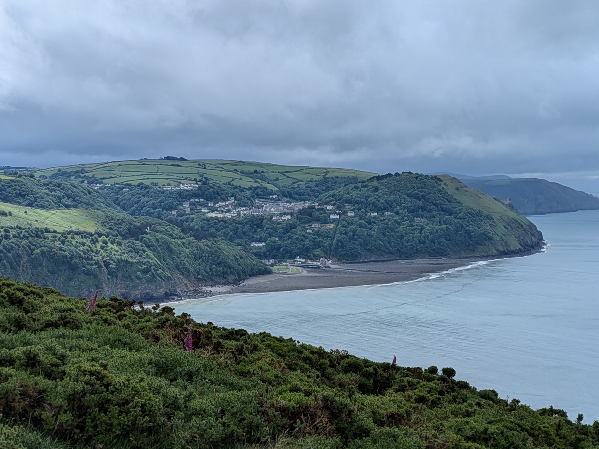
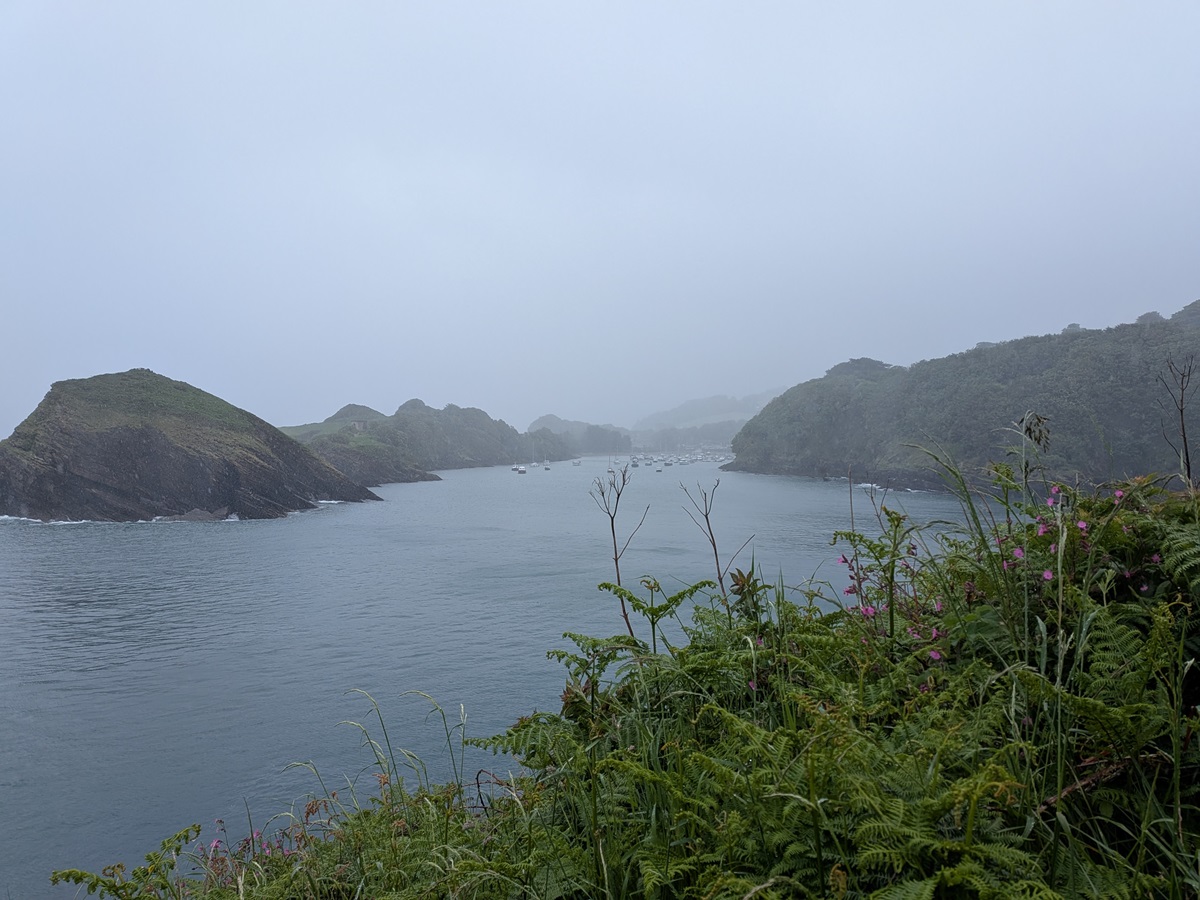
From the small church at Countisbury, we followed the narrow trail down to Lynmouth Harbour before crossing the park to the beach. There is a tiny harbour here and plenty to explore, including the excellent museum telling the story of the Lynmouth flood disaster of 1952.
It is also worth remembering the lifeboatmen of 1899, who dragged their lifeboat overland from Lynmouth to Porlock – the very distance we had walked that day – to rescue a stricken vessel because they could not launch from Lynmouth in rough seas.
Day 3: Lynmouth to Combe Martin
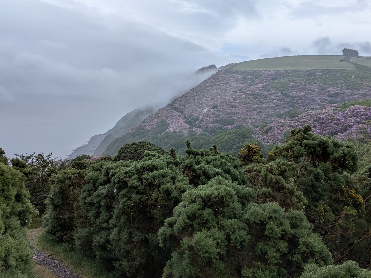
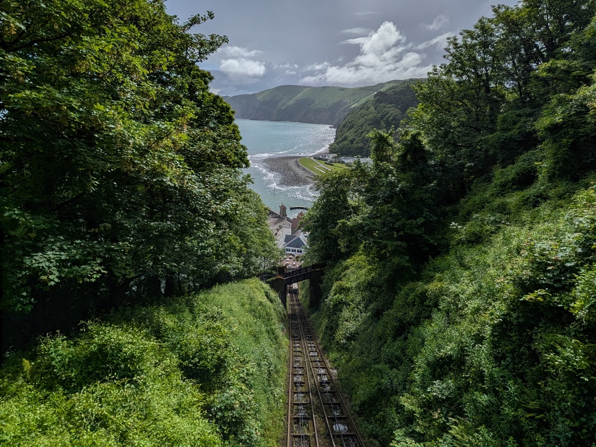
This morning started off dry, but we were soon joined by rain showers which lasted all morning. This did nothing to deter our anticipation of the day ahead, which was only slightly spoilt by the path out of Lynmouth! There is only one option, which is up, and the path zig zags its way up the same route as the cliff top railway to Lynton. You are, however, rewarded with some stunning views across Lynmouth Bay as you stop to catch your breath on one of the bridges on the way up.
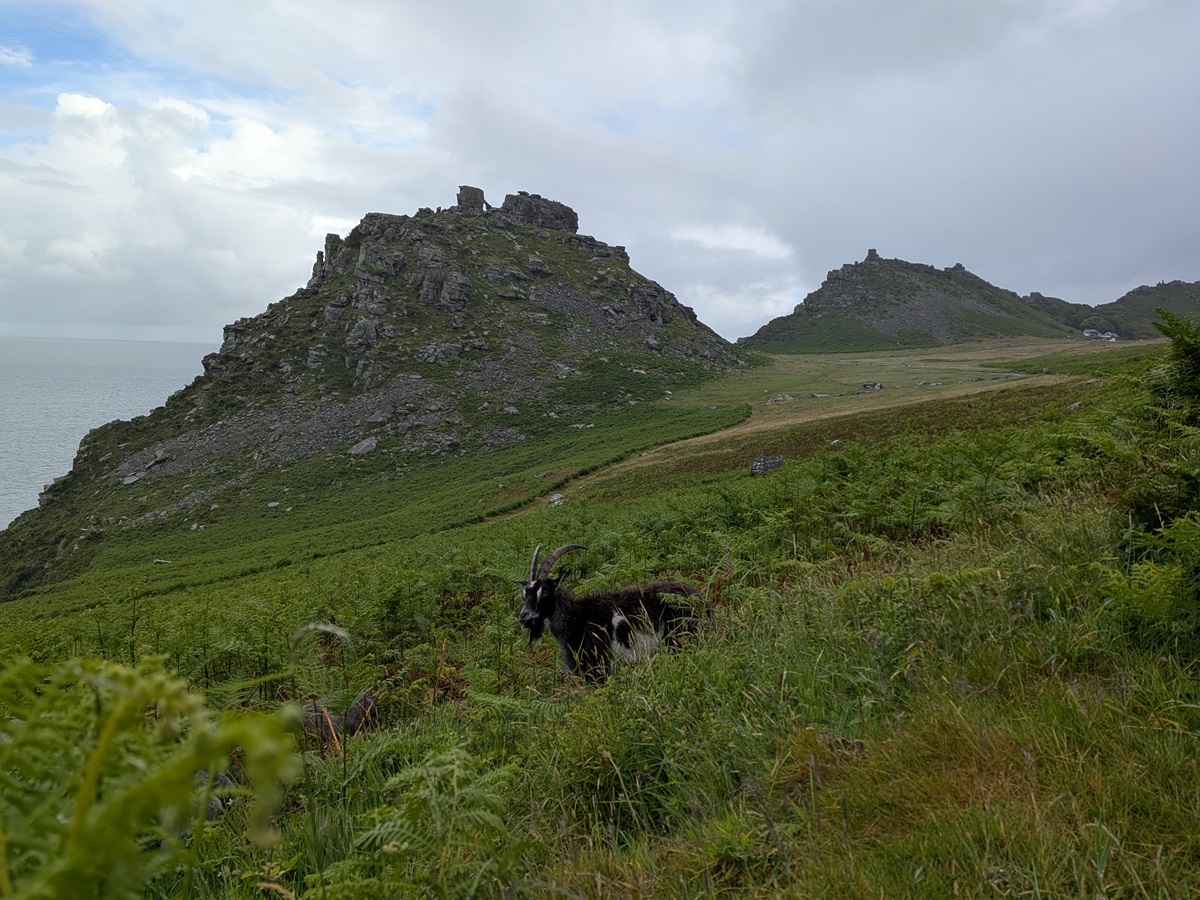
Once at the top, it is a quick stroll through woodland before you are back out on the clifftops with some (what should have been, if not for the rain!) glorious views out to sea. Not far out of Lynton, you find yourself in the Valley of Rocks, such an unexpected landscape of weathered rock formations created during the last Ice Age. We found ourselves pondering the names: Castle Rock, Devil’s Cheesewring and Ragged Jack!
Seeking shelter amongst the rocks were lots of goats! These feral creatures are known to have lived here since the 1970s, although it is believed their ancestors have been here since Neolithic times. Clearly used to human, two-legged traffic, they were not disturbed by our presence and happily kept munching away.
Leaving the Valley of Rocks (and goats) behind us, we followed a tarmac track for a short distance past Lee Abbey. Once a school for evacuated boys, this beautiful house, built in 1850, is now a Christian retreat and conference centre. Away from the tarmac track, we headed back into the woodland to find Hollow Brook Waterfall.
This lovely waterfall is not quite as impressive as you might be led to believe! Although one of the highest in the UK, dropping around 200 metres in total, it does so over a horizontal distance of around 400 metres – so nothing to get too excited about.
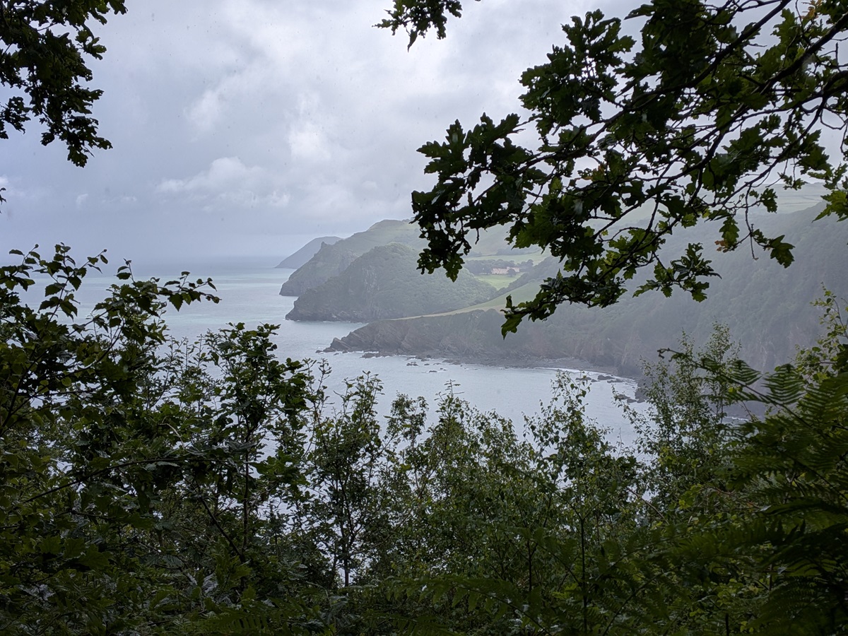
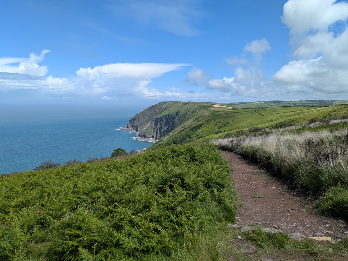
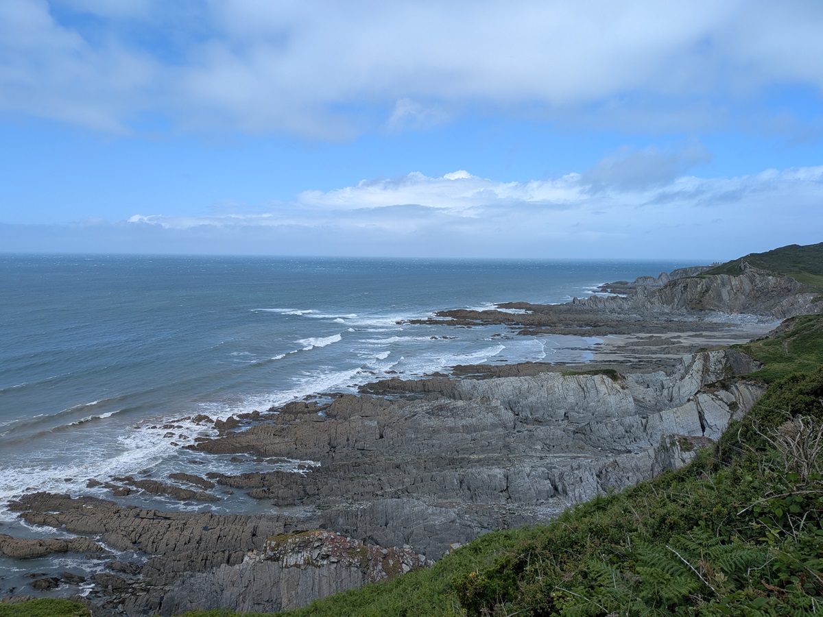
From this disappointment, my comfort level and enjoyment of the day reduced dramatically – although Matt was in his element. Leaving the waterfall, we turned towards Great Burland Rocks and, after rounding a corner, the path became much narrower for the next stretch to Highveer Point. The guidebook describes it as “a flat path”… indeed it is, but it is also very narrow and has steep drops without any fencing or my safety hedge (the hedge only needs to be ankle high – just a barrier between myself and the edge!), so it does feel very exposed. The path is perfectly safe if you take care, just not my preference. You do, however, have great views of what lies ahead, as well as stunning coastal scenery.
From Highveer Point, the path turns inland – keep an eye out for the little dog sitting and peering out at you from the heather! – before dropping back down into the valley and through the trees to eventually cross the River Heddon. Immediately afterwards, you begin a steep climb to regain the height you have just lost, but the effort is soon forgotten when you reach the vantage point of Peter Rock – the ideal place for lunch.
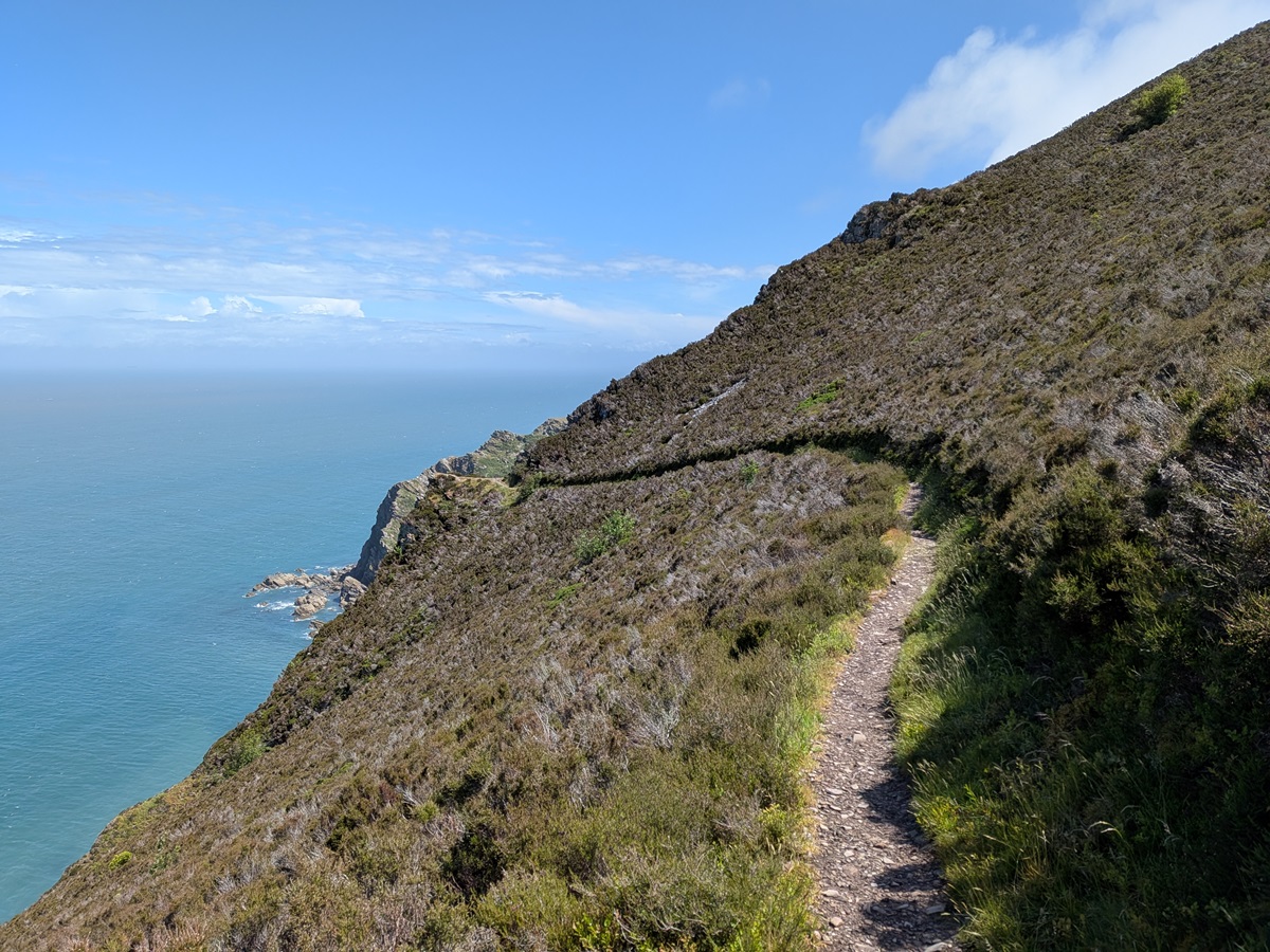
After lunch, I put my big girl pants on and reminded myself how fortunate we are to have these stunning places to walk. From Peter Rock to North Cleave, the path is once again narrow, high and exposed, but the views take your breath away. There is simply no reason to rush this section – just take your time and savour the moment.
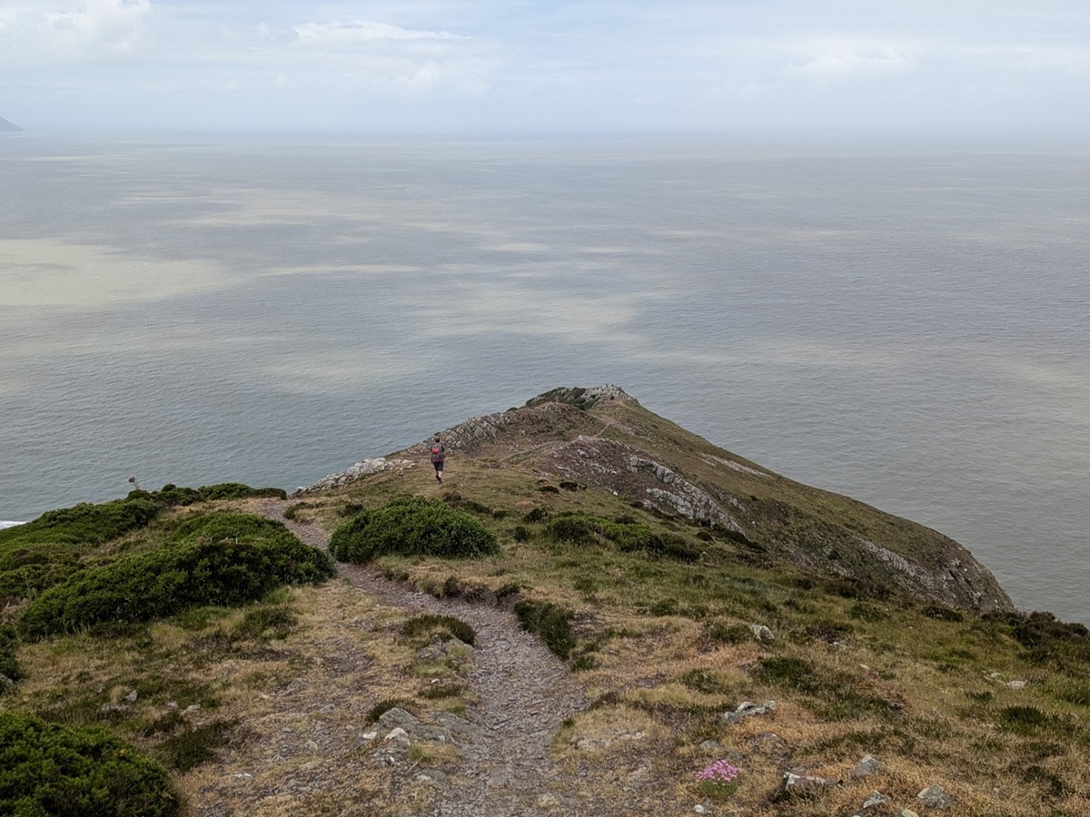
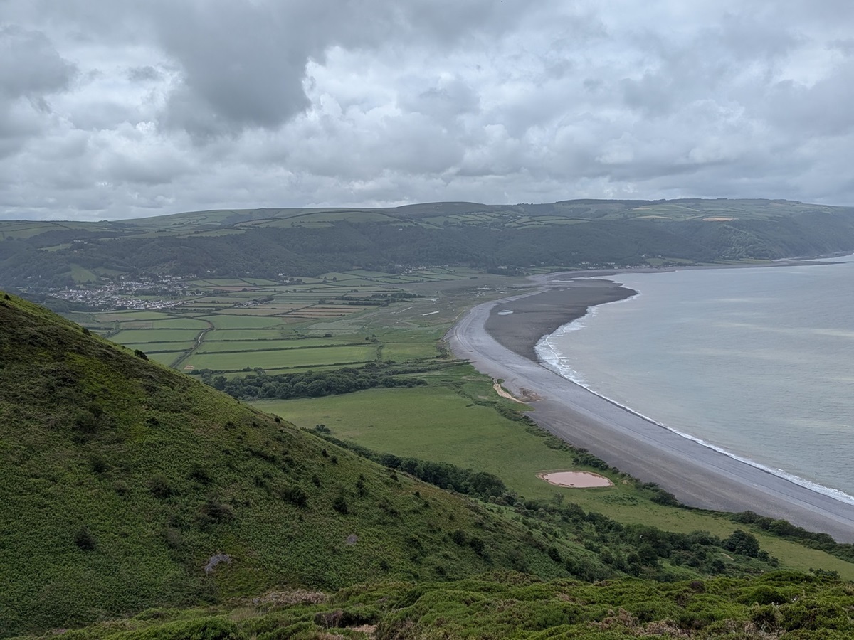
After North Cleave, the path improves and turns inland slightly, becoming a more rolling, wider affair around Holdstone Hill before dropping down to Sherrycombe, leading to the inevitable climb back up! This time, we had a target to aim for: Great Hangman. At 318m (1,043ft), it is the highest point on the South West Coast Path.
As our legs were thoroughly warmed up from all the previous ups and downs of the day, the pull up to Great Hangman was easy, even in the wind, which had picked up from nowhere. We paused at the summit to marvel at the views stretching back over where we had walked that day.
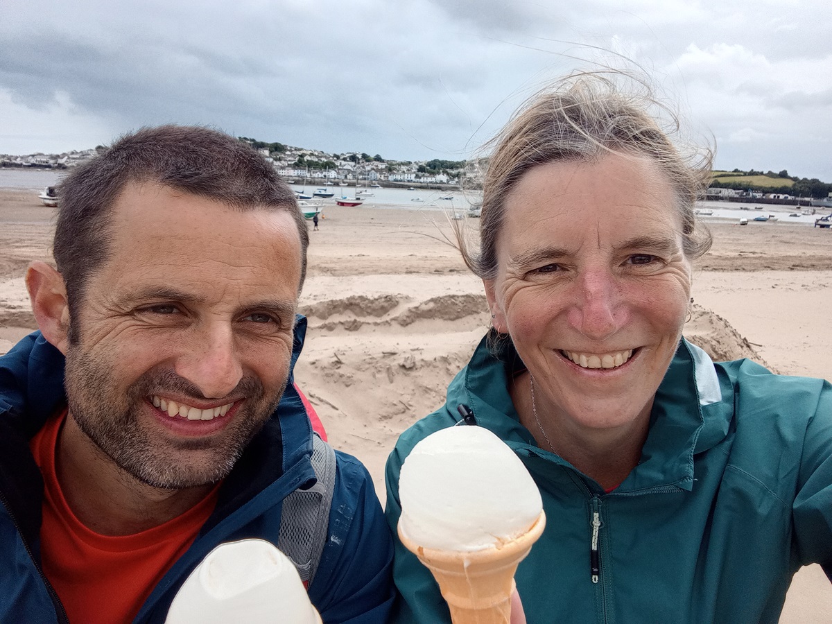
As we were nearing the end of our day, it felt rude not to take a slight detour to conquer Little Hangman too, with its lovely views into Combe Martin, our stop for the night. A gentle stroll down Lester Cliff took us into the village and to a well-deserved ice cream on the beach.
Day 4: Combe Martin to Woolacombe
This morning started wet and called for full waterproofs as we left Combe Martin. This was particularly unpleasant for several reasons. Firstly, it was quite a warm day, and we spent much of the morning walking either through very unkempt fields with long grass or alongside the road – in essence, we were getting wet from every possible direction.
However, our spirits were not dampened, and we marvelled at the mighty Watermouth Castle and its lovely little harbour. This area was integral to Operation Pluto during WWII, and information boards about the pipelines can be found along the clifftop.
Rounding Rillage Point, we should have had our first view of Lundy Island – but sadly the weather was not playing ball, so we couldn’t see that far out to sea. Instead, we continued on to the outskirts of Hele, admiring its beach, before heading up to a glorious viewpoint at Beacon Point.
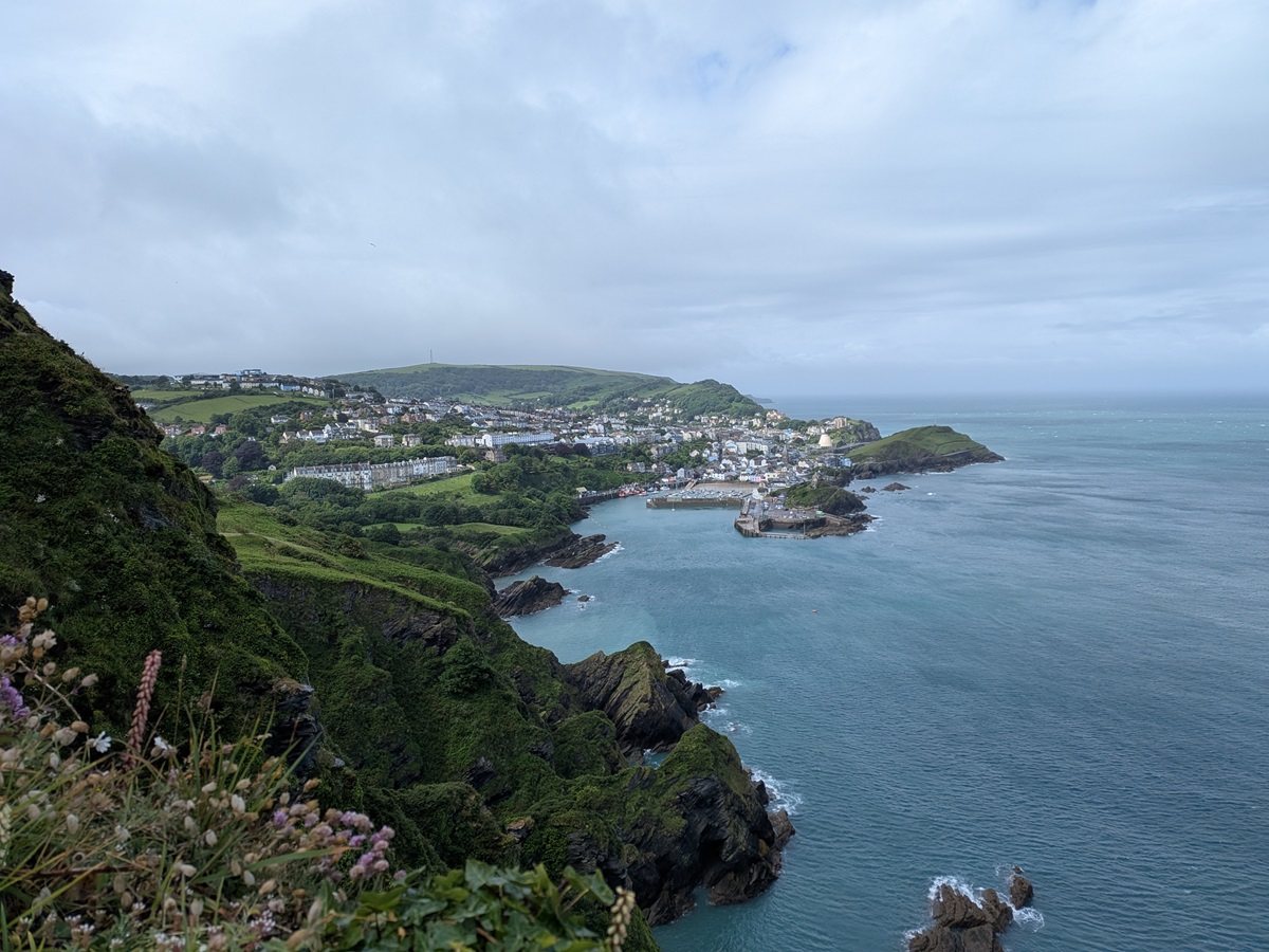
Rounding the point, we headed into Ilfracombe, a bustling seaside resort which still has a busy fishing hub. We admired the lifeboat station and then left the trail to see Damien Hirst’s infamous Verity statue. It is said to represent a modern allegory of truth and justice, but sparked controversy due to its bold design and anatomical exposure. It is definitely worth a look to form your own opinion.
Back on the trail, we said goodbye to civilisation as we navigated a wide, easy path towards Lee. We had to make a slight detour through a field, as a herd of feisty young cows had taken over the path and were stubbornly refusing to move, but they showed no interest in us as we carefully passed around them.
Dropping into Lee, this tiny hamlet is undergoing significant redevelopment, with most properties at some stage of building work. However, it is easy to see the potential of this idyllic little spot, and we paused to take in the tranquillity before the next part of the day.
It was a very steep climb out of Lee, and the reward was short lived, because as we crossed damage cliffs, the path dropped away again back to the sea, just after Pensport Rock, and we had to repeat the climb after crossing a stream. This narrow stony path was hard, but the sun was out and we took our time, knowing that what was left of our day should be stunning.
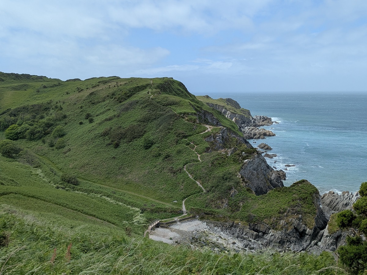
The path then gently rolled over to Bull Point, where a small lighthouse sits within its own compound. You can choose to stay at this remote location – a great idea, although I should imagine it would feel quite wild and bleak in a storm!
From Bull Point there was a significant increase in wind speed. From Bull Point to Morte Point, at Rockham Bay, the route is renowned for wildlife spotting, and we spent much of this section scanning the sea for seals.
Having seen the odd head or two popping up, it wasn’t until just before Morte Point that we had the highlight – around 30 seals hauled out on the rocks, with others playing in the surf. Attention soon turned back to the sea, and this wild headland – it is easy to see why its name translates as “Death Point”! It has claimed many a wreck over the years on the surrounding outcrops.
The wind was already blowing a hooley, and as we rounded the point we got it full in the face, needing to hold on to the rocks to help us on our way.
Once round the point, we headed for Woolacombe, legs now weary from battling the wind and what had been a tough day. One final sting in the tail was the route, which instead of following the road into Woolacombe, took us up and over a small hill and back down a valley. It only added an extra 20 minutes, but really felt like we had walked an unnecessary two long sides of an isosceles triangle!
We made it into Woolacombe and our accommodation just as the heavens opened.
Day 5: Woolacombe to Braunton
Today was a day of two halves – both in terms of weather and walking. Most of the night had been quite wild with wet and windy conditions, and this continued as we headed out this morning – it was somewhat reluctantly that we left the sanctuary of our bed and breakfast.
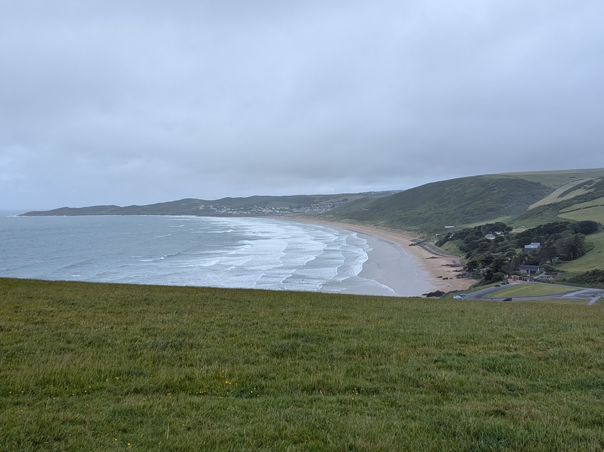
True to the forecast, the rain stopped by 11am, with a gusty wind remaining that soon dried us out. The walk this morning was stunning. The route runs parallel to the beach but is set up in the sand dunes of Woolacombe Warren, with lots of criss-crossing tributary paths running down to the beach. If the tide and weather conditions allow (we had neither in our favour), you can of course walk this entire stretch along Woolacombe Beach, which runs into Putsborough Sands. There are steps leading up from the end of the beach that rejoin the main trail.
All the way along this section you can admire Baggy Point, which you will soon be walking around. As you head out towards it, you are treated to glorious views of the vast expanse of Woolacombe Beach – simply breathtaking.
At Baggy Point itself, you will find a white mast which is a Coastguard wreck post. This was used when the seas were too rough to launch the lifeboat, acting as a way of coordinating rescues of stricken vessels. An information board explains exactly how it worked.
From here we were also supposed to have stunning views of Lundy Island – a natural haven for wildlife and wildflowers alike. Just 11 miles off the North Devon coast, the island and its surrounding waters are home to puffins, guillemots, razorbills, Sika deer, Lundy ponies, basking sharks and dolphins – just to name a few. Once a hideaway for pirates, it is now a tourist hotspot accessible by ferry or helicopter. We could just about make out the island if we squinted, but visibility wasn’t the best for island spotting.
Turning away from Baggy Point and following the coastline again, we soon arrived in Croyde. This village is little more than a smattering of houses, quickly followed by a large caravan park (mostly hidden behind a very tall hedge). The unassuming path down to the beach doesn’t give much away, until you step onto the sand itself and your breath is taken away.
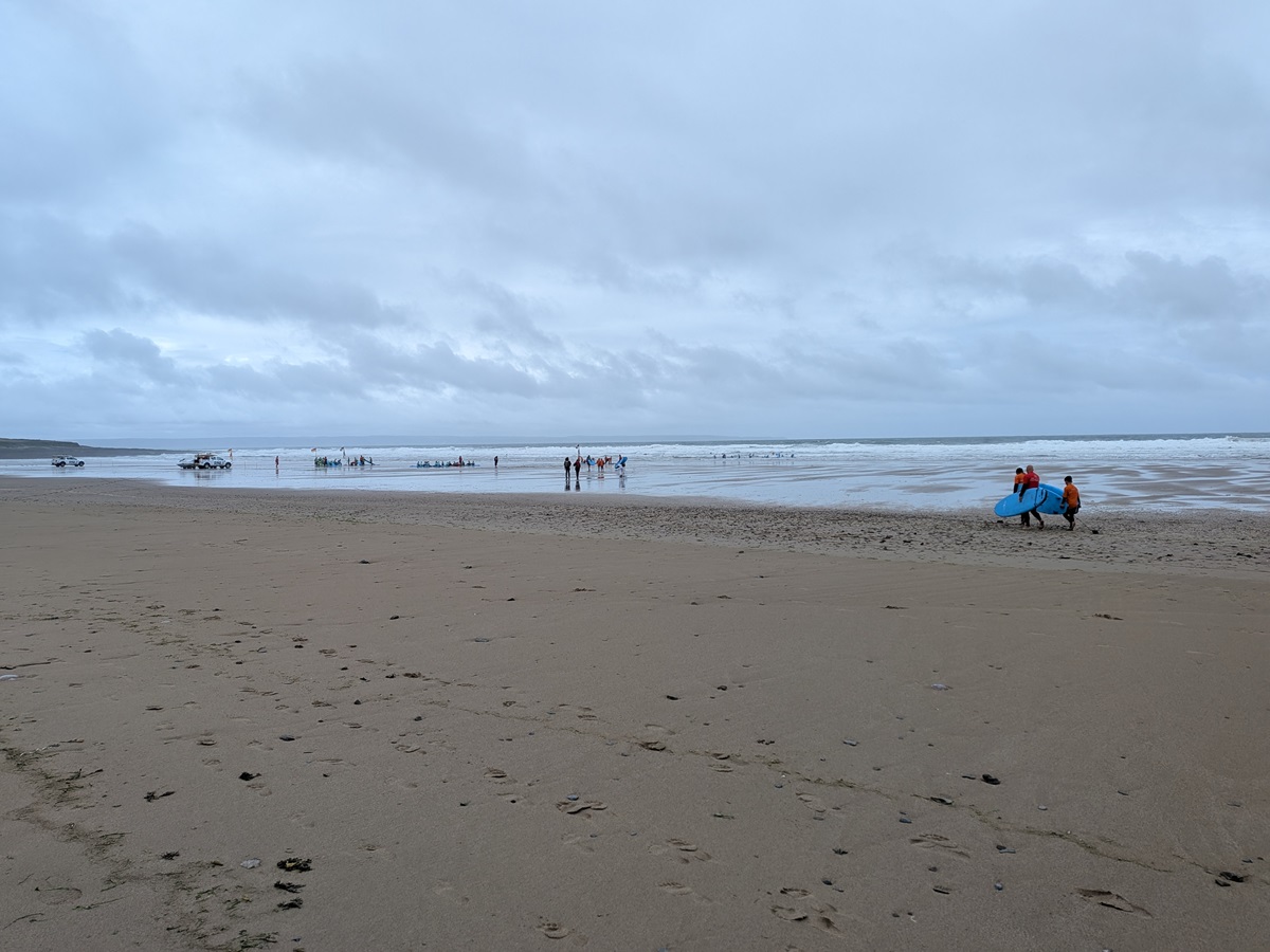
This beautiful bay is a hive of activity, with school groups taking surf lessons, others kitting up for coasteering, and beach volleyball courts just begging to be used (if only we had a ball!). The path cuts directly across the beach, so you really get to appreciate its beauty.
From the far side of the beach, a new short, section of trail is signposted. Instead of hugging the coastline, you head up and over Saunton Down (a short 10-minute climb) to rejoin the old route. This avoids crossing the main road at a fairly blind bend, so it’s a great safety improvement and takes nothing away from the walk itself.
Continuing on to Saunton Sands, we were afforded splendid views towards the dunes of Braunton Burrows, along with the vast sweep of Saunton Sands beach. We were also treated to a great display from the local kite surfers, taking full advantage of the blustery conditions.
From Saunton, the rest of the day is flat, easy walking. We meandered through the golf course that nestles behind the dunes and skirted the edge of MOD training land, where access is strictly forbidden, while enjoying this ever-changing landscape.
Braunton Burrows is part of a vast Biosphere Reserve in North Devon and within its boundaries of around 3,300 sq km there are over 60 Sites of Special Scientific Interest. Home to the largest sand dune system in England, the flora and fauna here are truly special, with over 500 species of flowering plants and 33 species of butterflies.
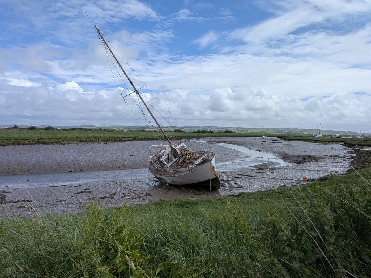
On reaching the estuary and River Taw, we turned inland and followed the River Caen upstream to Velator Bridge. We walked on a raised embankment pathway built in 1857, with the tide out and the mudflats littered with boats – some still in use, others in varying states of gentle decay.
From here we could clearly see Appledore, where we were due to spend our last night in two days’ time – a somewhat somber sight. When we eventually reached Velator Bridge, there was still time for ice cream before heading through town to find our bed and breakfast.
Day 6: Braunton to Instow
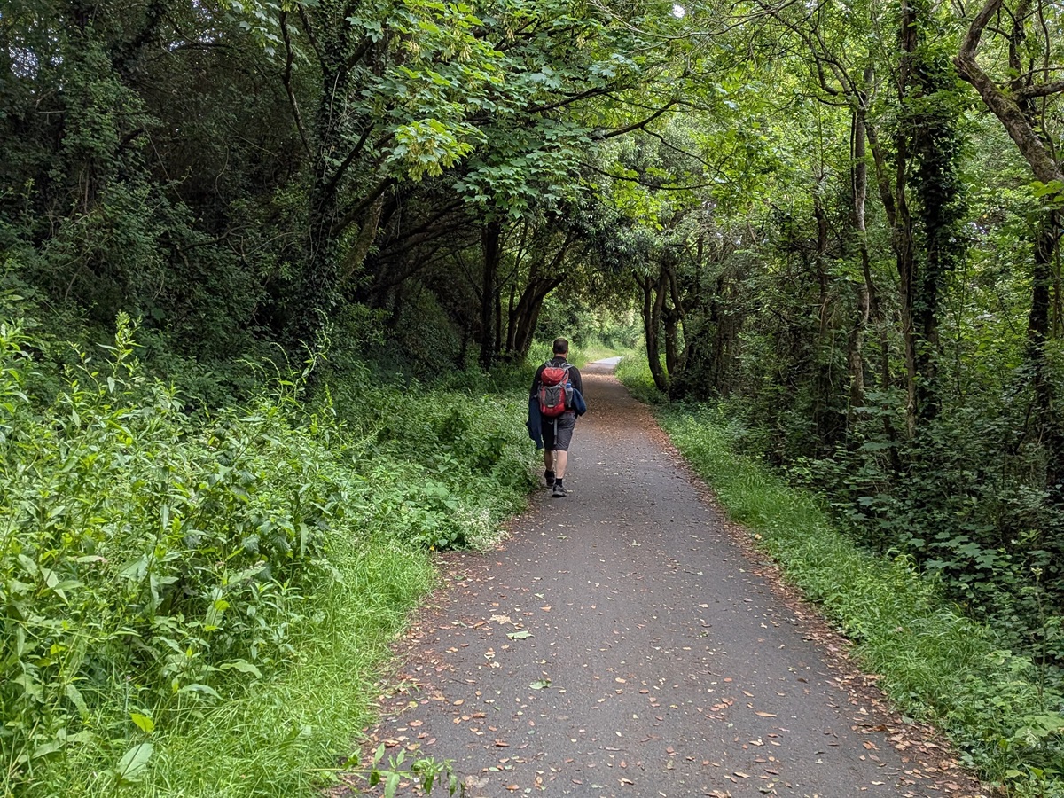
The next two days of walking are very different from what has gone before. Gone are the high cliffs and coastal views, replaced by a flat, tarmac shared pathway which is a honeypot for runners and cyclists. Not that this detracts from the route, which is still lovely. Much of these two days is spent walking along former railway lines, which is why the route is so flat and straight. The stretch from Braunton to Barnstaple follows part of the old Barnstaple to Ilfracombe line, and remnants of the original infrastructure can still be seen dotted along the path.
Leaving Braunton, the early part of the day is dominated by Chivenor Barracks, which is predominantly a marine base. You walk right along the perimeter fence, which is highly protected, and I had to be reminded by Matt not to take any pictures of the barracks or the memorial to the lost souls on the fence.
Just beyond the barracks we joined the River Taw. Here it is tidal, although it begins life some 40 miles away at Taw Head on Dartmoor. We followed the riverside all the way to Barnstaple, with clear views across the estuary to the opposite bank, where we would retrace our steps later in the day.
Nature lovers and birdwatchers will enjoy this section of the walk, as the estuary is a haven for wildlife with the chance to spot egrets, curlews and oystercatchers. We still had a stiff breeze today though, so there wasn’t much wildlife about.
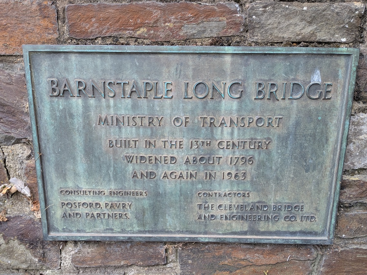
Just before Barnstaple, there is the option of taking a shortcut across the newer Taw Bridge. As we had plenty of time and were walking much faster on the flat terrain, we opted to stay on the main trail all the way into Barnstaple before crossing the river via the historic Long Bridge.
From Barnstaple, you follow the old Barnstaple to Bideford railway line, so once again the walking is straight, flat and surprisingly exposed. However, the great views across the estuary distract from the slightly more mundane walking, and we soon found ourselves at Fremington Quay.
This is a great little spot with a café (pasties and cream teas were consumed!) and a fantastic heritage centre. Fremington Quay was once the busiest port between Bristol and Land’s End, importing coal and exporting pottery and clay. The heritage centre and café are housed in a replica station, making it the perfect place to stop for a break.
Rejuvenated, we set off for the last few miles to Instow, passing Isley, East Yelland and Instow Barton Marshes, all of which form part of the estuary’s Site of Special Scientific Interest. As these marshes are covered at high tide, they don’t support nesting birds, but they provide important resting places for other species, including owls and kingfishers. East Yelland Marsh is also home to greater horseshoe bats.
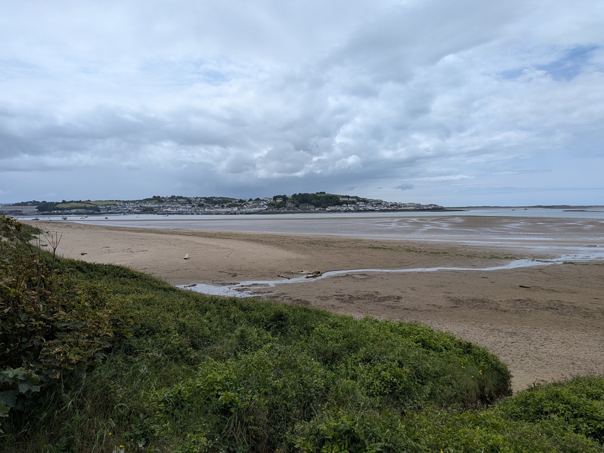
Rounding a corner from Instow Barton Marsh, we soon approached Instow, a gorgeous village sat on the estuary for the river Torridge. This has a broad expanse of wide beach which was being put to great use by numerous dog walkers. Our priority was ice cream – our hosts at Braunton had not only recommended lunch at Fremington Quay, but they also insisted we find the old landrover which has been converted into an ice cream van, selling the local Hocking’s ice cream. Hocking’s is an established brand made just across the estuary at Appledore. Ice cream located, we sat on one of the numerous benches, enjoying the lazy bob of the boats in the water as we looked across the estuary at Appledore, our final resting spot tomorrow.
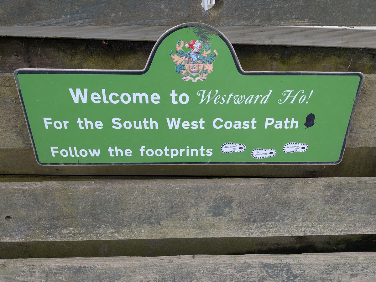
Day 7: Instow to Westward Ho!
Our final day saw another very wet start, but we weren’t going to let that spoil the end of our journey. If you really don’t want to walk today, there is the option of taking a short ferry from Instow straight across the estuary to Appledore. The ferry only runs around high tide, when the channel is navigable, so be sure to check the timetable carefully before committing to this option.
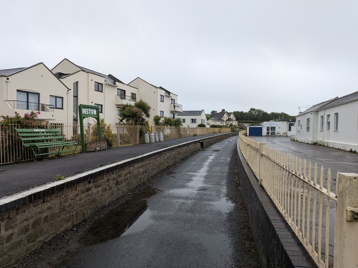
We opted to walk in the rain and, after saying a sad farewell to yet another fantastic bed and breakfast, retraced our steps to the seafront and headed for the North Devon Yacht Club at the southern end of Instow. This is also where we rejoined the railway line, following the original route from Instow to Bideford.
It is an easy tarmac path following the River Torridge, leading to East-the-Water and Bideford railway station. The original platform still remains, along with one of the original railway carriages, now home to a café and museum. Dropping down from the trail, we crossed the Long Bridge into Bideford, slightly shocked by the bustle of suburbia. It was a Saturday, so there were lots of people about, some waiting in the rain for the ferry to Lundy Island.
The meandering path takes you through the outskirts of Bideford and Northam before regaining the tranquillity of riverside fields. This is short-lived, as you soon reach the industrial edge of Appledore, with its fish factories and dockyards. There are some excellent information boards explaining the history of the shipbuilding industry, founded in 1855, and it is quite eye-opening to learn how this once-prolific and important industry has declined. If you have time, it is well worth wandering uphill to the maritime museum for an even greater insight.
We followed the path around the edge of the village, admiring the independent shops and cafés dotted along the seafront. This part of the estuary was busy with all sorts of water-based activities – sailing, rowing, jet skiing and school groups out on RIBs. It was lovely to see.
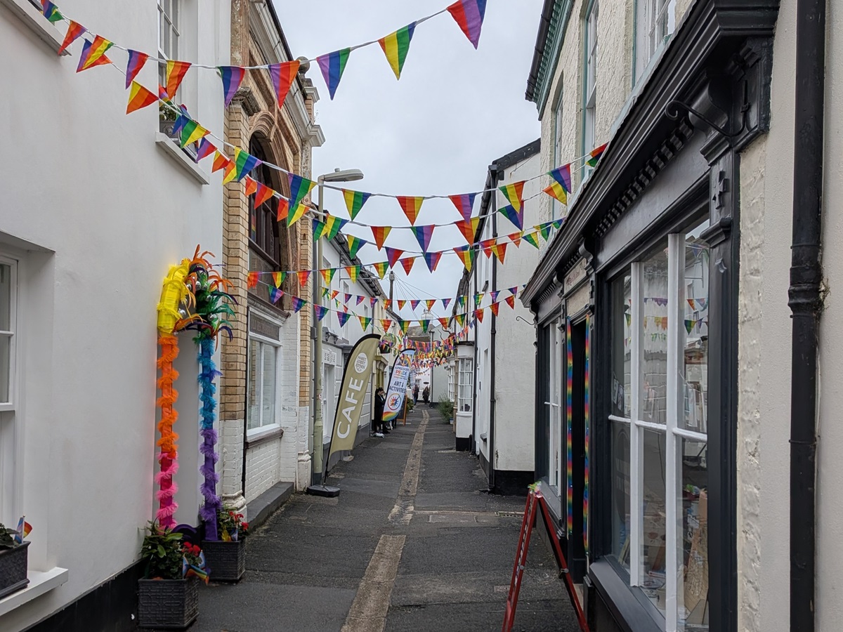
Our timing also coincided with the very first Appledore Pride parade, so the village was alive with rainbow flags, Morris dancers and people in every imaginable outfit gathering for the procession. Unfortunately, as the weather was deteriorating, we were keen to press on with the walk, knowing we would be spending the evening here, so continued towards Westward Ho!.
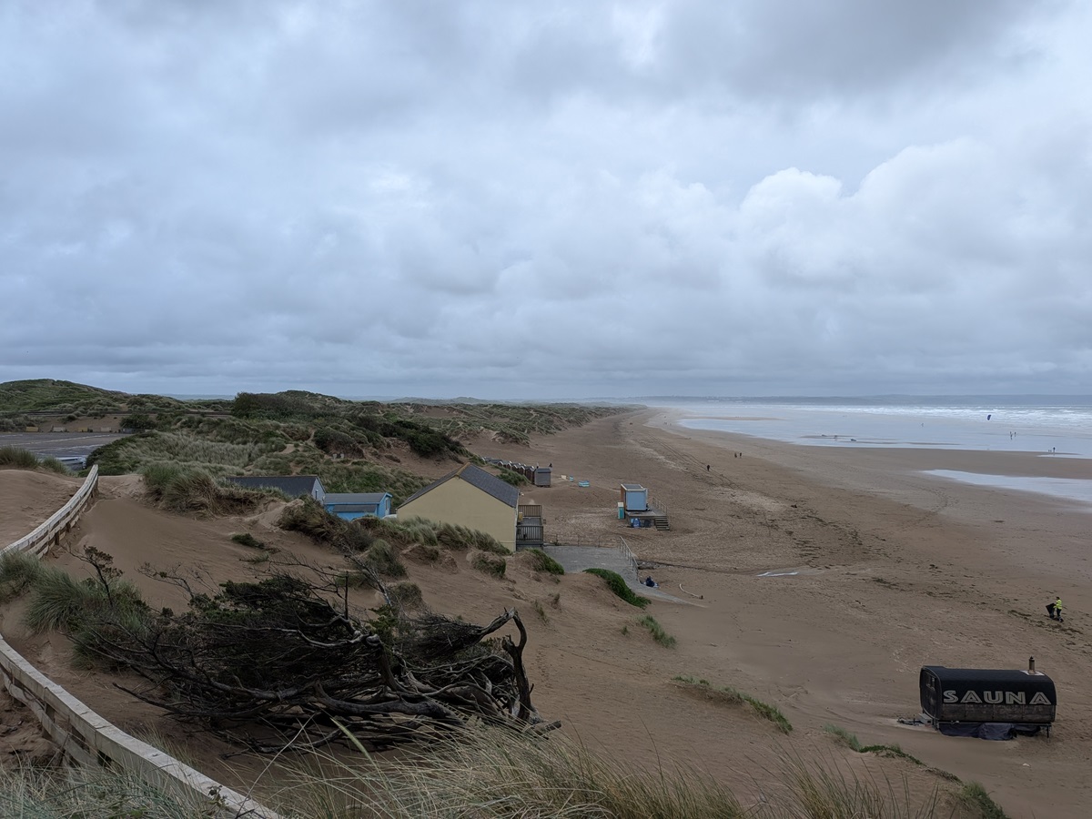
Leaving the narrow streets of Appledore behind, we reached Northam Burrows Country Park, the final leg of our journey – and what a finale!
Having found the wind again, we stopped to add another layer before tackling this exposed section. One friendly local jokingly remarked that “we’d picked a grand day for it!” To be fair, we’d escaped with relatively kind weather for most of the week … or so we thought.
The country park itself is flat, but that also means completely exposed to the elements, and by now we were experiencing very strong winds. It didn’t make for the most pleasant walking and, had we been able to lift our heads and walk along the top of the dunes, or even on the beach itself, I’m sure it would have been a stunning finale. Instead, we hunkered down behind the dunes and simply kept moving, although even that became challenging whenever we turned directly into the wind.
Rounding the top of the park, we skirted the edge of the Royal North Devon Golf Club, whose claim to fame is being the oldest links course in England. What surprised us most was the number of people actually playing on such an awful day. We felt thoroughly sandblasted by the time we reached the relative shelter of the pebble ridge separating the southern end of the park from the sea. At times we even had to walk backwards to avoid the sand blasting into our faces, so those golfers were clearly made of stern stuff!
Westward Ho! was built as a holiday destination, and it still retains that feel today. The trail keeps the seafront (which looked stunning even in the awful weather) on your right, while to the left it is immediately obvious that you’ve reached tourist territory, with amusement arcades, adventure parks, car parks and holiday apartments. Further along is the sea pool, which I’m sure would have been very tempting on a warmer day. Beyond that come the beach huts and static caravans, leading us towards the car park and the end of our walk.
As with all of these walking holidays, I always find reaching the end a little anticlimactic. It is so easy to fall into the routine of get up, walk all day, relax… and repeat. Even with the poor weather (which was forecast to continue), we still found ourselves discussing whether we should simply keep walking and what excuses we might use for not returning to work!
Incidentally, we behaved ourselves and returned home as planned, but there was plenty of conversation on the journey home about when we could come back to walk the next section. The South West Coast Path, with all the ups, downs and incredible variety we experienced in just seven days, has certainly captured our hearts and left us wanting more.
Two words of advice: Depending on your footwear preference, if you have the space and weight allowance, it is well worth packing both walking boots and lighter walking shoes. I wore my boots as far as Braunton, but knowing the remaining miles would be on firmer terrain, I switched to walking shoes. After 24 miles on tarmac, my feet were certainly grateful!
ALWAYS check yourself for ticks at the end of your walking day. After years of countryside walking, particularly in the Lake District, I have never been bitten by these little creatures – however, for three days in succession I found one (not the same one) on my calf at the end of the day. As they are painless when they bite and attach themselves, it really is important to thoroughly check yourself.
Are you inspired to follow in Sarah’s footsteps?
We offer 3 itineraries walking from Minehead to Westward Ho! on the North Devon Coast Path, with a choice of 7, 8 or 9 days. Email us at [email protected] or call us on 017687 72335 to begin planning your coastal adventure.