North Cornwall Coast Path: Westward Ho! to Padstow
Westward Ho! to Padstow in 7 Days Walking Code: CNE8
We offer 2 itineraries from Westward Ho! to Padstow. This is one of the most dramatic and rewarding sections of the South West Coast Path, with rugged headlands, secluded coves, and spectacular views along a wilder stretch of coastline.
Walking from Westward Ho! to Padstow over 7 days can be quite tough. Although the average distances are not too high, the descents and ascents can be quite challenging at times. The longest day is 15 miles with the shortest day being 9 miles.
| Miles | Km | ||
|---|---|---|---|
| Day 1 | Travel to Appledore for your first nights accommodation | ||
| Day 2 | Transfer to Westward Ho! then walk to Clovelly | 11 | 18 |
| Day 3 | Clovelly to Hartland Quay | 10 | 17 |
| Day 4 | Hartland Quay to Bude | 15 | 24 |
| Day 5 | Bude to Crackington Haven | 10 | 16 |
| Day 6 | Crackington Haven to Tintagel | 12 | 19 |
| Day 7 | Tintagel to Port Isaac then transfer to Tintagel | 9 | 14 |
| Day 8 | Transfer back to Port Isaac then walk to Padstow | 12 | 19 |
| Day 9 | Depart from Padstow after breakfast |
Westward Ho! to Clovelly
Westward Ho! is the only English place name with an exclamation mark in its title and the name came from the novel of the same name by Charles Kingsley. Upon leaving Westward Ho! you are treated with glorious views where, on a sunny day, you may spot Clovelly in the distance. After following a disused railway track that used to run inland to Bideford, the trail then heads south along the coastline where you trek upwards on to the clifftops passing Abbottsham and Green Cliff. From Peppercombe the trail changes quite suddenly as the terrain is set in a woodland environment. The trail then slopes through Sloo and Worthygate woods and then drops down into Buck’s Mills and into cobble-streeted Clovelly.
Clovelly to Hartland Quay
Clovelly is one of the loveliest villages on the South West Coastal path with its four-hundred feet of cobbled streets and its narrow cleft in the coastline of North Devon. There aren’t many cafés or places to stop on this section so it is best to stock up on supplies in Clovelly. Leaving the steep, cobbled streets of Clovelly behind the trail begins with a stroll through the woods of Gallantry Bower and onto Snaxland. If you’re a keen bird watcher you’re in for a treat when you reach Gallantry Bower, with a chance of seeing stonechats, linnets and meadow pipits. Once you leave the ancient woodland the landscape becomes less sheltered and you’re more exposed to its elements. Following on the clifftops you reach the lighthouse which marks Hartland Point. From here the trail takes a sudden Southerly turn where the trail takes you along the wildest and remotest part on the whole of the South West Coastal Path. The dramatic landscape here is an awe-inspiring experience with its waterfalls cracking into the rocky beaches of the Atlantic, the wildflowers and seabirds also contribute to this secluded and rough section on your way down into Hartland Quay.
Hartland Quay to Bude
This section starts easier than the previous day, as it eases you back along the coastline. But don’t take too much time to begin today’s walk as this part of the trail is arguably one of the hardest with its long ascents. There are roughly ten ascents and descents on this section, which can be tough at times, so remember to stock up on supplies to get you through as there aren’t many places to stop. The trail passes the outstanding waterfalls at St Catherine’s Tor and Speke’s Mill Mouth which cannot be missed. With a slow climb up towards Sandhoe Cliff you are rewarded with terrific views of this secluded area. The trail then descends the steps to the floor of the valley and you cross the border into Cornwall, the exact boundary marked by a bridge and a signpost welcoming you into ‘Kernow’. You must stop at the smallest property owned by the National Trust in the UK, which is known as Hawkers Hut. This next section gives you a real sense of isolation here and the views are beautiful – in particular the views from Higher Sharpnose Point and Steep Point. The next section is less strenuous leading you into the surfer’s paradise of Bude.
Bude to Crackington Haven
After your night in Bude your day’s walk begins along an easy grassy cliff path from the beaches of Bude. You might be lucky enough to spot grey seals from the glorious cliffs at Phillip’s Point Nature Reserve. This section provides you with wide and open views of the Atlantic from high clifftop paths. The trail then takes you over the top of Widemouth Bay (pronounced ‘Widmouth’). The path then changes and can be rough in places with a punishing ascent onto Penhalt Cliff between Foxhill Point and Dizzard Point. The path eventually winds downhill with some steep descents into Crackington Haven.
Crackington Haven to Tintagel
From the sheltered village of Crackington Haven you begin this section with some steep climbs, including the aptly named High Cliff (731ft) at the highest point and the cliff of Buckator towering over Gull Rock. After a long descent from the clifftops you arrive at the famous Pentargon high waterfall, made famous by the English author Thomas Hardy who wrote a poem from his time here called ‘Under the Waterfall’. You can usually spot some impressive birdlife on this part of the trail so look out for peregrine falcons, buzzards and kestrels. There are some beautiful rugged coves and clefts on your approach to Boscastle – a stunning fishing village filled with Cornish charm and great place to stop for a cup of tea and a Cornish scone! Over the next 5 miles you’ll leave the high cliffs behind as you are eased back along the trail, passing by the Willapark Iron Age fort which is now a National Coastwatch tower. The walking from here is not too taxing and there are plenty of places for a break, not least the sheltered Rocky Valley just before Bossiney, which has a narrow gorge for some much needed sheltered on a sunny or windy day. You then reach the end of this section in the legendary village of Tintagel. Look out for the ruins of Tintagel castle – famous for being the mythical birthplace for King Arthur.
Tintagel to Padstow
Upon leaving the fascinating village of Tintagel the path begins with an easy stroll past an old slate quarry and tin mine workings. Once you pass the attractive hamlet of Trebarwith Strand the path becomes more challenging with several ascents and descents along the coastline. After reaching the idyllic village of Port Gavern and its neighbouring village of Port Isaac the path becomes a lot less demanding. Port Isaac has sprung to fame in recent years as a filming location for the English television drama ‘Doc Martin’. From here the next 3 miles take you on a winding trail up and down the clifftops with views of Padstow in sight. Once you reach the holiday town of Polzeath you leave the clifftops behind and follow an easy footpath to Trebetherick and then onto the village of Rock. From Rock you can take the passenger ferry across to Padstow which runs very regularly. Padstow has a lot to offer the hungry walker and you’re spoilt for choice for eateries. You’re in for a treat after completing this wild and rugged part of the South West Coast Path!
Moderate
Grades - This is not a technically difficult walk and should be easy to tackle for most reasonably fit people.
Terrain - The paths are good, and there are no major route finding challenges.
What’s it like underfoot? Generally good paths and tracks, although a few sections can get muddy after heavy rain.
How much up & down? – More than you’d think! Although you never reach more than 400m above sea level (and most of the time not more than 200m) there are many short steep sections. Most days involve ascents of 200-400m metres, although no section is very steep for very long.
Signposting: Good – the path is well waymarked.
Navigation: Pretty straightforward – good signposting, and generally well defined tracks.
Weather: You may be lucky enough to encounter warm, dry weather over the whole route and enjoy dry paths and tremendous views, but you must be prepared because the weather can change quickly. Good clothing and waterproofs are essential, but don’t forget you sunhat, sunblock and shorts!
|
All Holidays
|
|
| Accommodation | Overnight Bed and Breakfast accommodation in selected hotels, farmhouses, village inns, guest houses and family B&Bs. Full English or Continental breakfast. |
| Guidebook | A detailed guidebook with route information, maps, photos and background information. |
| Information of Services Along the Route | A comprehensive Service Info sheet, including services such as cash points, banks, post offices, village shops, inns, cafes and taxis. |
| Maps | A waterproof (1:40,000) Harvey Map covering the route. |
| Personal Itinerary | A personal itinerary setting out each overnight stop, including large scale maps of each accommodation, to ensure you find it easily. |
| Emergency Telephone Support | If you get in to difficulties during your holiday, we are always available to help, even out of office hours. |
|
Options
|
|
| Luggage Transport | We will transfer your luggage between each overnight stop if you leave your luggage at the accommodation when you set off in the morning, it will be moved on to your next B&B. You only need to carry a small day sack with the clothes and provisions you require during the day’s walk. |
| Packed Lunches |
We are unable to pre book packed lunches on this route. However, some accommodations will be happy to prepare a packed lunch if requested on arrival. |
| Off Road Parking | It is not possible to leave your car for the duration of the walk, the B&B’s do not have the space to allow long term parking. Please see the public transport tab for more information on travelling to and from the route. |
|
What’s not Included
|
|
| Evening Meals | Your evening meal isn’t included in the package, but we include full details and recommendations for each evening meal in your itinerary. You will normally be within walking distance of a pub and/or restaurant, or where there is good food available at the accommodation, we’ll book that for you. Allow about £30.00 per night. |
| Transport to the Start & Away from the Finish | Have a look at the ‘Travel Info’ tab above for suggestions. If you’re still struggling, get in touch and we’ll help you sort it out. |
| Travel Insurance | Even if you are based in the UK travel insurance is worth having. |
Good accommodation and friendly hosts are an essential part of any holiday. We understand this and go out of our way to find the best. We put a great deal of effort into hand picking our accommodation and matching it to individual customer requirements. As well as visiting the accommodation ourselves, we ask all our customers to complete a short evaluation on each night’s accommodation, which then gives us an insight into the day-to-day operation and lets us spot any potential issues before they become a problem.
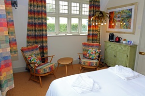
We use a variety of accommodation. Over the course of your trip you might stay in a village inn, a bed and breakfast in a converted barn, a Victorian guest house, or on a working farm. In selecting the accommodation we look for helpful, friendly hosts with good quality, characterful accommodation close to the trail. Occasionally we may use a chain hotel.
We always try to arrange en suite accommodation, i.e. rooms with their own bathrooms for each night of your stay. However, in some of the more remote locations accommodation is limited and occasionally we may have to book rooms with shared bathrooms for one or two nights of your holiday, (especially if the booking is made at short notice), but we will always let you know if this is likely to be the case.
We are happy to book single rooms on our holidays but cannot normally book more than two for any one group. Single room bookings include a supplement.
Here are some examples of the accommodation we use on the North Cornwall Coast:
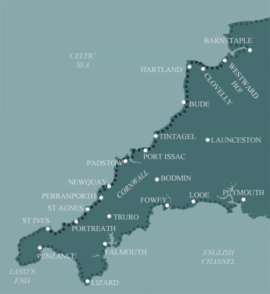
 The Wellington, a historic 16th-century coaching inn, overlooks Boscastle harbour from its charming hillside setting. This haven on Cornwall’s North Coast features 14 inviting bedrooms and a welcoming pub bar and restaurant serving delicious food and drink. Immerse yourself in Cornish history and folklore while enjoying a truly memorable escape. Visit their website
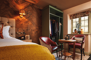
 Bosayne Guest House, an Edwardian gem in Tintagel, offers a warm welcome amid stunning coastal scenery. Just a short walk from the village and coast path, it boasts beautiful Atlantic views. Guests enjoy a cosy lounge, a charming garden, and a delicious locally sourced breakfast, all in a designated Area of Outstanding Natural Beauty. Visit their website
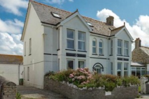
 Padstow Bed & Breakfast is perfectly positioned just a 10-minute walk from the historic Padstow harbour and its renowned dining, including Rick Stein’s and Paul Ainsworth’s restaurants. Guests enjoy two elegant en-suite rooms with super king-size beds, a spacious lounge, and a garden with outdoor seating. Visit their website
 Painters Cottage in St Ives combines modern hospitality with the charm of an historic artist’s residence. This small, friendly guest house features four en suite bedrooms, blending Arts and Crafts period details with contemporary comforts. Ideally located, it’s perfect for exploring West Cornwall’s ancient landscapes and the South West Coast Path. Visit their website
General Travel information for the South West Coastal Path will be in your holiday pack including train and bus timetables where available.
Detailed instructions on getting to your first night’s accommodation by car, or on foot from the nearest train or bus station, will also be included in the holiday pack on individual accommodation maps.
To view train times please visit trainline where you can also purchase tickets in advance. For information on bus timetables please visit traveline
Getting to Appledore:
By Air: The nearest and most convenient International Airports to the trail are any of the London Airports. Trains run hourly from London Paddington station to Barnstaple for Appledore changing at Exeter St Davids (journey time approx. 4 hours).
Alternatively, you may wish to travel via Exeter Airport (direct flights from Europe and connecting flights from several UK airports including London City, Edinburgh, Belfast and Manchester). There is an hourly shuttlebus Mon to Sat from Exeter Airport to Exeter St Davids Railway Station from where trains run regularly direct to Barnstaple for Appledore. On Sundays buses are more infrequent so you may prefer to take a taxi direct to your accommodation – the taxi desk can be found inside Arrivals (journey time approx. 1 ½ hours).
By Public Transport: The nearest railway station to Appledore is Barnstaple. Stagecoach South West bus service 21 runs between Barnstaple Railway Station and Appledore half hourly (hourly on Sundays), journey time approx. 50 minutes.
By Road: Appledore is located on the A386 just off the A39. Leave the M5 motorway just before Exeter at Junction 27 and join the A361 (signed Tiverton & Barnstaple). Stay on the A361 for approx. 35 miles through Tiverton to Barnstaple then follow signs for A39 Bideford. After crossing the bridge over the River Torridge on the outskirts of Bideford, follow signs for the A386 Appledore.
Returning from Padstow:
By Public Transport: The nearest railway stations to Padstow are Bodmin Parkway and Newquay. Plymouth Citybus service 11A runs hourly (every 2 hours on Sundays) between Padstow and Bodmin Parkway Station, journey time approx. 1 hour. First Kernow bus service A5 runs regularly between Padstow and the Great Western Hotel, Newquay (2 min walk from Newquay Railway Station), journey time approx. 1 ½ hours.
By Road: Padstow is located at the end of the A389. Leave the M5 motorway just after Exeter at Junction 31 and join the A30. Continue on the A30 until you reach Bodmin then follow signs for the A389. Stay on the A389 as it passes through Bodmin then Wadebridge (where the A389 merges with the A39 for a short distance). At Wadebridge, follow signs for Padstow.
Bude
Bude is a compact seaside town with plenty of character and a fine beach. There's a small castle and heritage centre and enough local places of interest to keep you busy.
Padstow
Padstow is famous for its scrumptious seafood restaurants and its bustling harbour. One of Padstow’s highlights is the great variety of dining options which include a selection of the famous TV chef Rick Stein’s Seafood restaurants. Padstow has a lot to offer so it is best to book an extra night here to make the most of the town.
| Prices | USD ($) |
|---|---|
| Accommodation, map & guidebook only | $1328 |
| with Luggage Transport | $1487 |
Other Options |
|
| Extra Nights (per night) | $123 |
| Single Supplement (per night) | $84 |
| Solo Luggage Supplement (per day) | $22 |