Kerry Way
Galway’s Bridge to Killarney in 8 Days Walking Code: KW9
We offer 2 itineraries on the Kerry Way, a spectacular circular route around the Iveragh Peninsula. Walk beneath the towering MacGillycuddy’s Reeks, past shimmering lakes, and along the wild Atlantic coastline, before returning to Killarney’s wooded valleys.
There are three shorter days of 8, 9 and 11 miles on this itinerary. The remaining 5 days average 19 miles per day. Although not to be undertaken lightly, the shorter days should offer enough of a respite to make a full circuit of the Kerry Way perfectly achievable and enjoyable for those with a reasonable level of fitness.
| Miles | Km | ||
|---|---|---|---|
| Day 1 | Travel to Killarney for your first nights accommodation | ||
| Day 2 | Transfer to Galway's Bridge then walk to Glencar | 17 | 27 |
| Day 3 | Glencar to Glenbeigh | 9 | 14 |
| Day 4 | Glenbeigh to Cahersiveen | 19 | 31 |
| Day 5 | Cahersiveen to Waterville | 22 | 35 |
| Day 6 | Waterville to Caherdaniel | 8 | 13 |
| Day 7 | Caherdaniel to Sneem | 11 | 18 |
| Day 8 | Sneem to Kenmare | 21 | 34 |
| Day 9 | Kenmare to Killarney | 16 | 26 |
| Day 10 | Depart from Killarney after breakfast |
Killarney to Glencar
Your Kerry Way adventure begins with a short transfer from the popular tourist destination of Killarney to Galway’s Bridge, ahead of your walk through the Black Valley and beneath McGillycuddy’s Reeks to Glencar.
Walking begins through dense oak and holly woodland, reaching a clearing around 2km in and rewarding you with marvelous views of Upper Lake and the mountains beyond. Leaving the lake behind the white tearoom, Lord Brandon’s Cottage comes into view. A gravel track and then a minor road alongside the Gearhameen River lead to the scattered community of the Black Valley.
Walking through the Black Valley you initially have the craggy Brassel Mountain (575m) above you on your right and formidable Broaghnabinnia (745m) to your left. This is stunning walking country. After around 3km the quiet tarmac road gives way to a rough track and passes conifers to the open hillside before joining a green lane and then boggy grassland to the broad saddle of Bridia Pass.
Beyond Bridia Pass the trail climbs by means of a tree lined path before dropping steeply towards the Gearhanagour Stream and alongside Lough Beg, signaling the end of the Reeks. Woodland, pasture and reclaimed grassland are crossed before reaching a quiet lane guiding you to Glencar.
Glencar to Glenbeigh
This is the easiest section on the Kerry Way. Gravel road and rough pastures lead to a minor road, eventually crossing the River Caragh. Riverbank and conifer plantations guide you passed the tiny Drombrane Lough before rising to a tremendous viewpoint over gently rolling fields to the Reeks.
A second viewpoint beyond offers fantastic views of Lough Caragh and the next major objective, the mountain, Seefin.
The trail then passes through woodland and crosses the Meelagh River before climbing and passing the old Bunglasha School and on towards Windy Gap beneath Seefin and Beanreagh..
On reaching Windy Gap, before passing through the gorge, take time to enjoy a last look at the Reeks behind. Moving on you are rewarded with the stunning vista of the Dingle peninsula as you make your way down to Glenbeigh.
Glenbeigh to Cahersiveen
The trail leaves Glenbeigh and follows the coast before joining the old coach road on the flanks of Drung Hill. The coach road is punctuated with eight gates.
After a steady climb a saddle is reached overlooking the broad Ferta valley. Here you are rewarded with fine views of the impressive Knocknadobar (690m)in the distant right.
The descent from Drung Hill is along a wide track into a plantation and across moorland dotted with peat extractions. Cahersiveen soon comes into view off in the distance beside the Valencia River.
A track across boggy moorland eventually gives way to a minor road that falls gently for around 3km to Foilmore with Knocknadobar appearing more dominant on your right.
To reach Cahersiveen you must leave the Kerry Way at Teeraha junction, following waymarkers along country lanes and minor roads. Reaching a T-junction with the Carhan Road the trail then follows a series of field boundaries and lanes to Cahersiveen.
Cahersiveen to Waterville
A series of field boundaries, lanes and minor roads connect Cahersiveen with the Kerry Way at Teeraha junction.
From Teeraha junction the trail climbs steeply up a track to the crest of the ridge leading to Coomduff (235m). Having passed close to the summit, the trail follows the ridge before descending across a boggy saddle ahead of climbing to a second top at 228m. The trail then drops steeply to cross a minor road near Coars School.
From Coars a steep climb is required to gain the height again before undulating ground carries you over a series of separate tops, the highest of which, Knockavahaun (371m), is the summit of the Way’s coastal route. Beneath lies the wide Inny valley with its patchwork of fields, moorland, woodland and scattered houses. The remainder of the day’s walk is now spread out before you. The descent is steep, down a zig zag track to a minor road leading to Mastergeehy.
Beyond Mastergeehy the trail follows a wide track along a forest edge, eventually reaching open mountainside, climbing steeply to the crest. As the route narrows this becomes an exhilarating ridge walk to the first summit, Cró na Snáthaidhe (244m). The trail then descends to a gap before rising steeply to another summit An Cnaig (208m). The panoramic view here shows Inny Sands, Ballinskelligs Bay and Lough Currane contrasting with the patchwork fields and woodlands.
Once down from the ridge the trail crosses rough fields before joining farms tracks and eventually the road leading into Waterville. Look out for the statue of Charlie Chaplin, once a frequent visitor.
Waterville to Caherdaniel
An easy day of walking with fine views of inshore islets and the Beara peninsula hills. The Kerry Way leaves Waterville along the main road before crossing the Currane River bridge and picking up a minor road for the next 2km ahead of entering fields and traversing the lower slopes of Farraniargh Mountain.
The N70 is crossed then the trail follows a track up the crest of the hill providing stunning views of Derrynane Bay and it’s islands Deenish and Scariff. The trail then descends and once again crosses the N70 into fields.
From here the route into Caherdaniel is a mix of minor roads, field edges and farm tracks. There are a number of streams to cross. It is worth detouring slightly from the trail to visit a small stone fort just ahead of Caherdaniel dating back to 600 AD.
Caherdaniel to Sneem
Leaving Caherdaniel the trail winds its way uphill on a steep track to the crest of a spur before crossing undulating ground to meet a wide track which, once upon a time, was the main Caherdaniel to Kenmare road.
The track becomes a minor road and passes the ruins of Kilcrohane Chapel before heading downhill and along a hedge-lined road crossing footbridges over the Beheghane and Gowla Rivers. Here there are great views of Eagles Hill (549m).
Beyond here the trail is back on tarmac and dropping into another valley. On the descent keep an eye out, up to your left, for an enormous grey stone wall. This is Staigue Fort. It dates from the 4th century. It’s walls are as much as 6.5m high in places. A detour to the fort would add an additional 3-4km to your day.
Moving on, the trail follows a wide track and crosses rocky and often wet moorland and on to a plantation before descending through fields to meet a minor road.
The road becomes a fenced track crossing the Bunnow River and climbing steeply to the crest of a spur, before dropping down to forest tracks and another plantation where there are stunning views across the Owreagh River to the summit of Coomcalee (650m).
Minor roads and tree lined tracks offer easy walking for the final 3km or so into Sneem.
Sneem to Kenmare
Crossing the River Sneem the trail follows a lane through woodland crossing a small stream and reaching a minor road. For the next 2km the trail undulates through Parknasilla Wood and the adjacent moorland. Grassy tracks and gravel roads then lead to Tahilla.
Beyond Tahilla a narrow lake is passed and the trail widens through woodland before rising to cross a moorland saddle before dropping to meet a minor road. The road becomes a gravel track crossing boggy ground to reach another saddle. Heading downhill through woodland onto a vehicle track the trail leads to Blackwater Bridge.
Beyond Blackwater Bridge the trail meanders through oak woodland. Further on, from the flanks of Lacka Hill, superb views open up of the Kenmare River and the Beara peninsula.
Plantations, boggy track, grassy slopes and open moorland all feature as you make your way towards Gortamullin (205m). Passing beneath the summit you are rewarded with stunning views over the Kenmare estuary and the many mountains to the north.
From here there is a straightforward descent into Kenmare.
Kenmare to Killarney
The Old Killarney Road leaves Kenmare rising steeply across the eastern flank of Strickeen Hill to reach a saddle with a view of your next objective, another Windy Gap. Approaching Windy Gap you are treated to fine views of Peaken Mountain (555m) and Knockanaguish (509m).
Beyond Windy Gap a series of half a dozen streams are crossed as you make your towards the junction for Galway’s Bridge and the Black Valley.
Continuing on through Esknamucky Glen the trail progresses through woodland, and then across a wide, flat valley, before a broad track takes you across the slopes of Torc Mountain. From here the trail heads into woodland before descending to Torc Waterfall.
Beyond Torc Waterfall the trail passes through a tunnel beneath the road and follows a path signposted Muckross House, beyond which is Muckross Abbey. From here the Way journeys by Castlelough Bay and finally becomes a footpath running parallel to the N70 leading into Killarney.
Moderate to Challenging
The Kerry Way is a challenging walk which at times traverses exposed ridges and wild moorland. It deserves to be taken seriously. Due to the distances between locations, walking the trail involves some lengthy days, often between 19 and 22 miles on a mixture of tarmac road, green roads, forest tracks and moorland.
Should you need to shorten your day, a network of bus services serve all parts of the peninsula, most shadowing the trail along the N70/N71 Ring of Kerry road. Not all services run on all days.
Terrain: Around 35% of the route is on tarmac road, albeit incredibly scenic and predominantly along quiet lanes with little traffic. The remainder of the trail follows historic old roads, farm and forest tracks as well as paths through fields and over moorland.
What’s it like underfoot? Walking on tarmac can prove hard going and take its toll on the joints. Following periods of rain farm tracks and moorland paths can be boggy, sometimes extremely so. You should be prepared for all of the above.
How Much Up & Down? Fairly frequent minor ups and downs as you cross ridges and spurs. The highest point on the trail is the summit of Knockavahaun at a relatively modest 371m.
Signposting: Generally good. Black posts show a yellow walker icon and an arrow head. Occasionally at junctions there will be paint markings on rocks. Finger posts may vary with some showing ‘Kerry Way’ while others show ‘Slí Uíbh Ráthaigh’, Irish for the Iveragh Way.
Navigation: On the trail refer to your guidebook and maps at regular intervals. If in doubt at any stage, retrace your steps to your last known location and take direction from your maps and guidebook.
Weather: You may be lucky enough to encounter warm, dry weather over the whole route and enjoy dry paths and tremendous views, however the reality is the weather on the peninsula is unpredictable and frequently changeable. It is not uncommon to encounter weather typical of all four season in a single day. Be prepared. Good clothing, effective waterproofs and comfortable, waterproof footwear are essential.
|
All Holidays
|
|
| Accommodation | Overnight Bed and Breakfast accommodation in selected hotels, farmhouses, village inns, guest houses and family B&Bs. Cooked or Continental breakfast. |
| Guidebook | A detailed guidebook with route information, maps, photos and background information. |
| Information of Services Along the Route | A comprehensive Service Info sheet, including services such as cash points, banks, post offices, village shops, inns, cafes and taxis. |
| Maps | Three (1:50,000) Ordnance Survey Ireland maps covering the whole route. Please note large areas of the OSI maps are in Irish, not English. |
| Personal Itinerary | A personal itinerary setting out each overnight stop, including large scale maps of each accommodation, to ensure you find it easily. |
| Emergency Telephone Support | If you get in to difficulties during your holiday, we are always available to help, even out of office hours. |
|
Options
|
|
| Luggage Transport | We will transfer your luggage between each overnight stop – if you leave your luggage at the accommodation when you set off in the morning, it will be moved on to your next B&B. You only need to carry a small day sack with the clothes and provisions you require during the day’s walk. |
| Packed Lunches |
Provided for each day’s walking and recommended on this holiday as there will not always be a handy shop or cafe on the route. |
| Off Road Parking | If you are travelling by car we can usually arrange off road parking for the duration of your trip. (There may be a small charge for this). |
| Arrangement of return transport | We can also arrange your transfer back to your car, (or advise you when public transport is a better option)! |
|
What’s not Included
|
|
| Evening Meals | Your evening meal isn’t included in the package, but we include full details and recommendations for each evening meal in your itinerary. You will normally be within walking distance of a pub and/or restaurant, or where there is good food available at the accommodation, we’ll book that for you. Allow about €35.00 per night. |
| Transport to the Start & Away from the Finish | Have a look at the ‘Travel Info’ tab above for suggestions. If you’re still struggling, get in touch and we’ll help you sort it out. |
| Travel Insurance | Even if you are based in the UK or Ireland travel insurance is worth having. |
Good accommodation and friendly hosts are an essential part of any holiday. We understand this and go out of our way to find the best. We put a great deal of effort into hand picking our accommodation and matching it to individual customer requirements. As well as visiting the accommodation ourselves, we ask all our customers to complete a short evaluation on each night’s accommodation, which then gives us an insight into the day-to-day operation and lets us spot any potential issues before they become a problem.
We always try to arrange en suite accommodation, i.e. rooms with their own bathrooms for each night of your stay. However, in some of the more remote locations accommodation is limited and occasionally we may have to book rooms with shared bathrooms for one or two nights of your holiday, (especially if the booking is made at short notice), but we will always let you know if this is likely to be the case.
We are happy to book single rooms on our holidays but cannot normally book more than two for any one group. Single room bookings include a supplement.
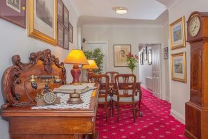
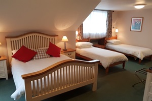
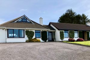
We use a variety of accommodation on the Kerry Way comprising boutique hotels, detached family run guesthouses and charming bed and breakfast in rural hamlets. You will experience a mix of all of these.
Here are some examples of the accommodation we use on the Kerry Way:
 Breda assures you of a warm welcome at Abbey Lodge Bed and Breakfast in Killarney. Boasting fifteen luxurious bedrooms the house is tastefully decorated throughout and features many interesting antiques and art pieces. You are guaranteed friendly personal service backed by the highest standards throughout. Visit their website
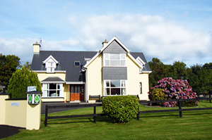
San Antoine, hosted by Alan and Ann Landers, offers a warm, family-run stay in Cahersiveen on the Wild Atlantic Way. With over 60 years of hospitality experience, it’s an ideal base to explore the Ring of Kerry, Valentia Island, and local landmarks like Ballycarbery Castle and Cahergeal Ring Fort. Visit their website
Didier & Eleonore guarantee you a warm welcome at Derrynane Bay House in Caherdaniel. Their family run Bed and Breakfast overlooking Derrynane Beach offers stunning views of the mountains, sea and beautiful Islands, and their spacious bedrooms offer an exceptionally high level of comfort. Visit their website. Visit their website
At Ashfield B&B in Kenmare, Mary and Paul extend a warm and heartfelt welcome, making every guest feel at home. Their 4-star accommodation offers peaceful rooms with spacious en suites and stunning mountain views. Whether you’re enjoying a cup of tea or a glass of wine in the inviting lounge, their hospitality ensures a relaxing and memorable stay. Visit their website
Passport and Visa Requirements
UK residents do not legally require a passport to travel to Ireland, thanks to the Common Travel Area (CTA). However, most airlines and ferry operators will ask for valid photo identification, such as a passport or driving licence, so it’s essential to check with your carrier before travelling. UK residents do not need a visa to visit Ireland.
For information on the British Embassy in Dublin please click here
For further information on passports and visa requirements from the UK Government, please click here
Anyone travelling from abroad should check foreign travel advice, passport and visa requirements, as well as information on embassies, issued by their own government.
Health Requirements
There are no compulsory health requirements or vaccinations for UK residents travelling to Ireland. Similarly, there are no compulsory health requirements for visitors from Europe, America, or other countries, however, travellers should ensure they are up to date with routine vaccinations recommended in their home country. Further travel health advice can be found here
–
General travel information for the Kerry Way will be in your holiday pack.
Detailed instructions on getting to your first night’s accommodation by car, or on foot from the nearest train or bus station, will also be included in the holiday pack on individual accommodation maps.
To view train times please visit Irish Rail. For information on bus timetables please visit Bus Éireann.
If you require secure car parking whilst walking this route, please contact us for information.
Getting to Killarney:
By Air: The nearest and most convenient International Airport to Killarney is Cork. Buses regularly depart for Cork city centre where trains run frequently to Killarney.
By Ferry: The most convenient Ferry Ports for Killarney are Rosslare (from Fishguard, Pembrokeshire or Cherbourg, France) and Dublin (from Liverpool or Holyhead, Anglesey). Trains run regularly from Dublin and Rosslare to Killarney.
By Public Transport: There is a railway station at Killarney. Killarney Station is located on the Mallow to Tralee line, from Mallow there are fast and frequent services to and from Dublin and Cork.
By Road: Killarney is located on the N22 from Cork and at the end of the N72 from Mallow.
If travelling from Dublin, take the N7/M7 to Limerick then exit at Junction 30 and follow signs for the N21 Tralee. On reaching the roundabouts for Castleisland, continue straight on following signs for the N23 Killarney & Farranfore. Pass Kerry Airport and on reaching Farranfore village, turn left to follow the N22 to Killarney.
If travelling from Rosslare Ferry Port, follow the N25 to Waterford then continue on the N25 towards Dungarvan. Just before reaching Dungarvan, follow signs for the N72 Mallow. Stay on the N27 as passes through Mallow and continue onward to Killarney.
Getting Back:
As this is essentially a circular route you will be walking back to your starting location so you can depart by the same means you arrived.
Killarney
The Killarney National Park visitor centre at Muckross House along with the Information Point at Torc Waterfall and the Education Centre at Knockreer House are all well worth a visit. The park, famous for its beautiful lakes and mountains covers 10,000 hectares and is home to a host of native natural habitats and species including oak and holly woods, yew woods and red deer.
Visit Ross Castle and take a boat trip out on the Killarney Lakes with Innisfallen Island and O’Sullivan’s Cascade among the sights to see. Look to the sky also, you might just spot a White Tailed Sea Eagle.
Looking for something more adventurous than a lake tour, then why not try your hand at canoeing or kayaking, and journey into the hidden inlets on Loch Lein and the River Laune.
Killarney town centre offers an array of restaurants, food outlets and unique shops while shows, events and festivals ensure the town is always buzzing.
Glenbeigh
Having made your way through the Black Valley and beneath MacGillycuddy's Reeks why not reward yourself with a day off at the beach? The spectacular Rossbeigh beach stretches out for five miles along a north south spit into Dingle Bay. Opposite, reaching out from the Dingle peninsula is the magnificent Inch Strand.
This charming village offers a fine selection of food and you can enjoy traditional music sessions in the pubs throughout the year. A great location to simply relax and recharge for the miles ahead.
Cahersiveen
Cahersiveen, described by local poet and playwright Sigerson Clifford as ‘The Town that Climbs the Mountain and Looks upon the Sea’, is the capital of the Iveragh Peninsula.
Discover the history of Cahersiveen at the Old Royal Irish Constabulary Barracks located on the banks for the River Feartha and take time to visit Ballycarberry Castle and the Iron Age Stone Forts of Cahergal and Leacanabuaile, two of the most remarkable examples in Ireland.
Sandy beaches are plentiful here. Why not spend some time horse riding on the coast? If you want to see more of the area, hire a bike and spend the day exploring Valentia Island and the Skellig Ring.
In need of a little retail therapy? The town has a fine selection of high-class shops.
Cahersiveen also boasts a superb selection of restaurants as well as a great mix of modern and traditional bars with music available throughout the year.
Waterville
Waterville is a charming little village overlooking the spectacular Ballinskelligs Bay. Furthermore it is also nestled on the stunning Lake Currane, celebrated for the some of the best Salmon & Sea Trout Angling in Europe.
There’s a wealth of archaeological, botanical and historical features to be discovered around Waterville.
Welcoming bars, cafes and restaurants situated among some of the most spectacular scenery in Europe make Waterville a perfect place to take a day away from the trail.
Caherdaniel
Sometimes there are places where you just simply have to spend more time and switch off. Caherdaniel is one such place. This picturesque village stands on the shores of the magnificent Derrynane Bay. Spend a quiet day here and you are assured to be blown away by the views overlooking the Harbour, out to Scariff and Deenish Islands, Kenmare Bay and the vast Atlantic Ocean.
With delightful places to eat and drink too, a rest day in Caherdaniel is an experience that will live long in your memory.
Kenmare
Kenmare is renowned as a haven of tranquillity, gourmet food and breathtaking scenery. Located at the head of the exquisite Kenmare Bay which stretches 30 miles out to the Atlantic Ocean, this in one of the most natural, unspoilt environments in Europe.
This desirable tourist destination is famed for its vibrant coloured, characterful buildings.
There is an array of activities on offer to fill your day including cruising on the bay, horse riding, golfing and fishing.
| Prices | CAD ($) |
|---|---|
| Accommodation, map & guidebook only | $1762 |
| with Luggage Transport | $2099 |
| with Packed Lunches | $1938 |
| with Luggage & Lunches | $2259 |
Other Options |
|
| Extra Nights (per night) | $181 |
| Single Supplement (per night) | $120 |
| Solo Luggage Supplement (per day) | $42 |