South Devon Coast Path: Plymouth to Brixham
Plymouth to Brixham in 6 Days Walking Code: DSW7
We offer a 6 day walk from Plymouth to Brixham. This challenging yet rewarding journey follows a breathtaking stretch of coastline, with sweeping clifftop views and secluded sandy coves. Be prepared to roll your trousers up!
Six days walking from Plymouth to Brixham which involves wading across the River Erme at low tide midway through the third day. The crossing is only possible an hour either side of low tide. It’s crucial therefore that you are aware of when this will be and pace your day accordingly. The crossing itself should only take a few minutes. Expect the sea to be at least at knee level and although mainly on sand, be prepared to be walking on pebbles at times.
Please be aware when planning your holiday, should Day 4 Bigbury-on-Sea to Salcombe fall on a Sunday, we will transfer you back as far as Bantham, as the ferry required to cross the River Avon at Bigbury-on-Sea does not run on a Sunday.
| Miles | Km | ||
|---|---|---|---|
| Day 1 | Travel to Plymouth for your first nights accommodation | ||
| Day 2 | Plymouth to Wembury | 11 | 18 |
| Day 3 | Wembury to Bigbury-on-Sea then transfer to Salcombe | 15 | 24 |
| Day 4 | Transfer back to Bigbury-on-Sea then walk to Salcombe | 13 | 21 |
| Day 5 | Salcombe to Beesands then transfer to Dartmouth | 12 | 19 |
| Day 6 | Transfer back to Beesands then walk to Dartmouth | 11 | 18 |
| Day 7 | Dartmouth to Brixham | 11 | 18 |
| Day 8 | Depart from Brixham after breakfast |
Plymouth to Noss Mayo
The South West Coast Path crosses the River Plym via the Laira Bridge. However, in the interests of pressing on with more scenic, clifftop walking, we suggest avoiding the five urban and less interesting miles and taking the ferry from the Barbican over to Mount Batten Park. The ferry runs every 30 minutes, daily throughout the year.
Once on the trail you are soon into your stride and enjoying woods, meadows and stunning views along the rugged coastline. The sublime scenery is only briefly interrupted as you pass the Radar Station at Bovisand Point, which some will surely find fascinating. Beyond there you return to lovely countryside and clifftops as you cross Haybrook Bay and on to Wembury. The now uninhabited island of Great Mewstone, best viewed from Wembury Point, was once occupied by a gent named Sam Wakeman. He’d been exiled there for seven years for some offence or other and apparently paid his rent by providing rabbits for the table of the local manor.
This section of the trail ends with another river crossing to reach Noss Mayo. The River Yealm is crossed from Warren Point by means of a small ferry. The core hours for crossings are from 10:00 to 12:00 and 15:00 to 16:00 each day, so pace your day accordingly. Should you miss the ferry, be sure to catch the bus.
As with all ferry services, it’s always worth checking before setting off.
Noss Mayo to Bigbury-on-Sea
The crux of this section of the trail is at the midway point and involves wading across the River Erme. Noticeboards will tell you this is only possible an hour either side of low tide. It’s crucial therefore that you are aware of when this will be and pace your day around it. Failure to do so will result in having to take a taxi round the estuary as the road has no pavements. The crossing itself should only take a few minutes. There are information panels with aerial photos showing the best route across. Expect the sea to be at least at knee level and although mainly on sand, be prepared to be walking on pebbles at times.
Ahead of the Erme is a pleasant stretch of grassy coast above Stoke Beach, wooded in places with occasional sea views. Take time to marvel at the magnificent tor, St Anchorites Rock.
Beyond the Erme is equally as pleasant. Lovely clifftop walking with stunning views all the way to Bigbury-on-Sea.
Just off Bigbury-on-Sea lies Burgh Island which you can walk out to at low tide. Otherwise, the island can be reached aboard the specially adapted sea tractor. The small island boasts a 1920s Art Deco Hotel, a pub and the remains of a chapel.
Bigbury-on-Sea to Salcombe
This section of the trail begins with a short ferry crossing of the River Avon between Cockleridge and Bantham. Crossing times are normally from 10:00 to 11:00 and 15:00 to 16:00. The river is not safe to ford, therefore the alternative would involve a 9 mile walk via the first bridging point at Aveton Gifford. There is no ferry service on a Sunday.
Once back on the trail the walking is easy as you pass by the edge of Thurlestone Golf Course. Look out for the holed Thurlestone Rock as you make your way to the neighbouring villages of Outer Hope and Inner Hope.
The second half of this section is bookended by the promontories of Bolt Tail and Bold Head. Between the two is a beautiful stretch of walking, particularly over Bolberry Down which is owned by the National Trust.
Salcombe to Beesands
Once again there’s a river crossing to get things underway. Ferries cross from Salcombe to East Portlemouth continuously throughout the day, 8:00 to 18:00, from April till October.
There’s something of a theme in the opening stretch of this section; Pig’s Nose, Ham Stone and Gammon Head are all passed as you make your way to the Coastguard Hut and Visitor Centre at Prawle Point.
Beyond Lannacombe Beach is a beautiful nature trail which is preserved for the benefit of the declining population of cirl buntings. Soon after is Start Point Lighthouse which you may be able to look around should you visit during the summer holiday.
Midway between Start Point and Beesands, beneath the cliffs, sits the abandoned village of Old Hallsands. Take time to visit the viewing platform and read the dramatic story of the ill-fated settlement.
Beesands to Dartmouth
At 1.5 miles long, Slapton Ley is the largest natural freshwater lake in south-west England. It is separated from Start Bay by a shingle beach, known as Slapton Sands. The level walking here is lovely and there’s much to look out for at this National Nature Reserve including badgers, bats and otters. Birdlife is plentiful too; cetti’s warbler, greater crested grebes and cirl buntings can all be observed here.
The easy walking continues before a steep zig zag climb to the village of Strete. From here on, fields, country lanes and a little clifftop walking lead to the pleasant town of Dartmouth, home to some charming medieval streets.
A section free from ferry crossings!
Dartmouth to Brixham
A short ferry crossing transports you from Dartmouth over to Kingsmear. Ferries operate continuously throughout the day from 07:30 Monday to Saturday and from 9:00 on Sundays.
The final section of this route begins and ends with relatively flat and easy walking. What happens in between is a little more strenuous.
Warren Woods lead to the site of Brownstone Battery. Now managed by the National Trust, the WWII coastal defense position is an assortment of gun batteries, store huts and observation posts as well as a coastguard station and small visitor centre. See if you can spot seals on Mew Stone and the smaller rocky outcrops. Next up is the pretty Pudcombe Cove and from there a walk along the exposed hillside path to the picturesque Scabbacombe Sands and its crystal clear waters.
The ascents and descents are well underway now, however the incredibly rewarding views are a distraction from the hard work. Sharkham Point and nearby Berry Head National Nature Reserves are home to a colony of guillemots and greater horseshoe bats as well as eight species of orchids. Between the reserves, at St Mary’s Bay, look out to sea and see if you can spot dolphins and porpoises.
The final stretch of the walk into Brixham is as promised, easy.
Moderate
This is not a technically difficult walk and should be easy to tackle for most reasonably fit people. However, this stretch of the coastal path has many ferry crossings as well as a river crossing that can only be achieved by wading through at low tide. It is therefore essential that you are confident in your ability and comfortable walking within a strict time frame. Ferry times and tide timetables will need to be adhered to.
Terrain: The paths are good, and there are no major route finding challenges.
What’s it like underfoot?: Generally good paths and tracks, although a few sections can get muddy after heavy rain.
How much up & down? More than you’d think! Although you never reach more than 400m above sea level (and most of the time not more than 200m) there are many short steep sections. Most days involve ascents of 200-400m metres, although no section is very steep for very long.
Signposting: Good – the path is well waymarked.
Navigation: Pretty straightforward – good signposting, and generally well defined tracks, and there are high tide alternatives in places.
Weather: You may be lucky enough to encounter warm, dry weather over the whole route and enjoy dry paths and tremendous views, but you must be prepared because the weather can change quickly. Good clothing and waterproofs are essential, but don’t forget you sunhat, sunblock and shorts!
|
All Holidays
|
|
| Accommodation | Overnight Bed and Breakfast accommodation in selected hotels, farmhouses, village inns, guest houses and family B&Bs. Full English or Continental breakfast. |
| Guidebook | A detailed guidebook with route information, maps, photos and background information. |
| Information of Services Along the Route | A comprehensive Service Info sheet, including services such as cash points, banks, post offices, village shops, inns, cafes and taxis. |
| Maps | A waterproof (1:40,000) Harvey Map covering the route. |
| Personal Itinerary | A personal itinerary setting out each overnight stop, including large-scale maps of each accommodation to ensure you find it easily. |
| Emergency Telephone Support | If you get in to difficulties during your holiday, we are always available to help, even out of office hours. |
|
Options
|
|
| Luggage Transport | We will transfer your luggage between each overnight stop if you leave your luggage at the accommodation when you set off in the morning, it will be moved on to your next B&B. You only need to carry a small day sack with the clothes and provisions you require during the day’s walk. |
| Packed Lunches |
We are unable to pre book packed lunches on this route. However, some accommodations will be happy to prepare a packed lunch if requested on arrival. |
| Off Road Parking | It is not possible to leave your car for the duration of the walk, the B&B’s do not have the space have the space to allow long term parking. Please see the public transport tab for more information on travelling to and from the route. |
|
What’s not Included
|
|
| Evening Meals | Your evening meal isn’t included in the package, but we include full details and recommendations for each evening meal in your itinerary. You will normally be within walking distance of a pub and/or restaurant, or where there is good food available at the accommodation, we’ll book that for you. Allow about £30.00 per night. |
| Transport to the Start & Away from the Finish | Have a look at the ‘Travel Info’ tab above for suggestions. If you’re still struggling, get in touch and we’ll help you sort it out. |
| Travel Insurance | Even if you are based in the UK travel insurance is worth having. |
Good accommodation and friendly hosts are an essential part of any holiday. We understand this and go out of our way to find the best. We put a great deal of effort into hand picking our accommodation and matching it to individual customer requirements. As well as visiting the accommodation ourselves, we ask all our customers to complete a short evaluation on each night’s accommodation, which then gives us an insight into the day-to-day operation and lets us spot any potential issues before they become a problem.
We use a variety of accommodation. Over the course of your trip you might stay in a village inn, a bed and breakfast in a converted barn, a Victorian guest house, or on a working farm. In selecting the accommodation we look for helpful, friendly hosts with good quality, characterful accommodation close to the trail. Occasionally we may use a chain hotel.
We always try to arrange en suite accommodation, i.e. rooms with their own bathrooms for each night of your stay. However, in some of the more remote locations accommodation is limited and occasionally we may have to book rooms with shared bathrooms for one or two nights of your holiday, (especially if the booking is made at short notice), but we will always let you know if this is likely to be the case.
We are happy to book single rooms on our holidays but cannot normally book more than two for any one group. Single room bookings include a supplement.
Here are some examples of the accommodation we use on the South Devon Coast:
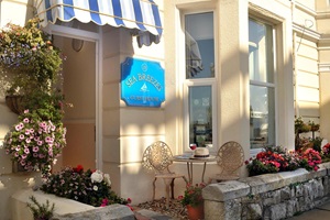 Sea Breezes, in the heart of Plymouth, Britain’s Ocean City, offers a warm welcome and sea-view comfort. Ideally located within walking distance of the city’s top restaurants, shops, and attractions, this inviting boutique guest house thrives on exceeding expectations. Host Jenny looks forward to ensuring you have an unforgettable stay. Visit their website
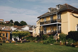 Ranscombe House, just a five-minute walk from Brixham’s vibrant town center, offers a peaceful coastal escape. Guests can enjoy a large lawned garden, a charming summer house, and a hearty English breakfast. With eight uniquely designed rooms, including the luxurious Admiral’s Suite with sea views, it’s the perfect base for a Devon getaway. Visit their website
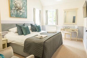
 The Torcroft, lovingly run by Gary and Philip since 2019, offers a warm and inviting stay in the heart of Torquay. Thoughtfully restored to honour its period charm, this boutique hotel blends elegant design with personal touches. Guests enjoy a home-like atmosphere where every detail is crafted to ensure a memorable Riviera experience. Visit their website
 Woodlands Hotel, a family-run boutique retreat in Sidmouth, combines historic charm with modern luxury on the Jurassic Coast. Consistently top-rated, it features spacious rooms, a tranquil garden, and locally sourced dining. Just a short stroll from the seafront, it’s the perfect base to explore Sidmouth’s beaches and shops. Visit their website
General Travel information for the South West Coastal Path will be in your holiday pack including train and bus timetables where available.
Detailed instructions on getting to your first night’s accommodation by car, or on foot from the nearest train or bus station, will also be included in the holiday pack on individual accommodation maps.
To view train times please visit trainline where you can also purchase tickets in advance. For information on bus timetables please visit traveline
If you require secure car parking whilst walking this route, please contact us for information.
Getting to Plymouth:
By Air: The nearest and most convenient International Airports to the trail are any of the London Airports. Trains run hourly from London Paddington station to Plymouth direct (journey time approx. 3 ½ hours).
Alternatively, you may wish to travel via Cornwall Airport Newquay (direct flights from Europe and connecting flights from London Gatwick). There is an hourly shuttlebus from Newquay Airport to Newquay Railway Station from where trains run between Newquay and Plymouth changing at Par.
By Public Transport: There is a railway station at Plymouth. Plymouth Railway Station (PLY) is located on the Cornish Mainline from where there are onward services throughout Cornwall and further afield to London (Paddington), Birmingham, Leeds and Edinburgh. It is also the western terminus of the Exeter-Plymouth branch line.
By Road: Plymouth is located on the A38. Leave the M5 motorway just after Exeter at Junction 31 and follow signs for A38 Plymouth.
Returning from Brixham:
By Public Transport: The nearest railway stations to Brixham are Paignton and Newton Abbot. Both Newton Abbot (NTA) and Paignton Railway Station (PGN) located on the Riviera Line (Paignton being the terminus) which connects at Exeter St Davids to the West of England Mainline (with fast and frequent services to London Waterloo) and the Reading-Taunton Line (with fast and frequent services to London Paddington).
First Dorset bus services run hourly between Lyme Regis and Axminster daily.
By Road: Brixham is located on the A3022, just after Torquay and Paignton. Just after Exeter at Junction 31 the M5 motorway splits and becomes the A30 and A38. Continue straight on along the A38 (Devon Expressway) then just after Kennford turn on to the A380, signposted to Torquay. Continue on the A380 for approximately 10 miles then at Paignton continue south on the A3022 following signs for Brixham.
Plymouth
Whether you’re finishing one section of the South West Coast Path or setting off on another, why not relax a little on your walking holiday with a rest day in Plymouth? There’s plenty to see and do in this lively waterfront city and its surrounding area. Take a walk along the Barbican’s charming cobbled quayside. Enjoy the view from the iconic Smeaton’s Tower lighthouse, or dive into the restored Art Deco Tinside Lido. The River Tamar is set in the UK’s youngest area of outstanding natural beauty and you can explore it further on a boat trip or from the Tamar Valley Train.
Salcombe
Take a break from the trail in Salcombe and try some watersports. Kayaking, paddle boarding and sailing are all on offer or you could simply swim in the clear blue waters. Afterwards head into town and sample some of the flavours in this haven for food lovers.
Dartmouth
Dartmouth is an enchanting town, situated as you’d expect, on the mouth of the River Dart. In addition to being a watersports playground, Dartmouth has plenty of history and heritage and a visit to Dartmouth Castle is a must. As is a visit to Agatha Christie’s Greenway National Trust Holiday Home. The town also has a museum, art galleries, a host of independent shops and lots of lovely places to eat.
Brixham
In the heart of England’s Seafood Coast is the gorgeous harbourside town of Brixham with its famous fish market. Enjoy a walk along the magnificent half mile long breakwater to the lighthouse or take a dip in the Art Deco seawater lido. Brixham is an important part of the UNESCO accredited English Riviera Global Geopark and nearby Berry head National Nature Reserve is well worth exploring. Afterwards, unwind in one the towns many popular cafes, restaurants and bars.
| Prices | CAD ($) |
|---|---|
| Accommodation, map & guidebook only | $1852 |
| with Luggage Transport | $2053 |
Other Options |
|
| Extra Nights (per night) | $181 |
| Single Supplement (per night) | $124 |
| Solo Luggage Supplement (per day) | $32 |