Walking Hadrian’s Wall – Our Guide
 By Tara Walker-Rose
Stretching for 84 miles from east coast to west, hikers come from all over the world to walk along Hadrian’s Wall.
This unique World Heritage Site passes Roman settlements, forts, barracks and temples along its path. You’ll see the giant earthworks that accompanied the wall, built as a last defence against invading hordes from the north. Every step you take is like walking back in time, from the rolling countryside of Northumberland to the historic Roman city of Carlisle.
You’ll walk past the watchtowers, once manned by Roman centurions, and visit ancient battlefields. Discover more about the region’s industrial heritage and learn how the wall fell into ruin before being saved from total obliteration by local heroes.
With a path running the entire length of the wall’s route, you can experience life through the ages of this incredible monument. Walks covering the full route can take as little as six days but many choose to slow down the pace, taking their time to explore and learn more about the history and culture that flourish here.
With a range of accommodation options on route, plus plenty of towns and villages where you can stop to eat out and recharge your batteries, you can make Hadrian’s Wall as much of an adventure or as relaxing as you like. Plan your own Hadrian’s Wall walking holiday
Building of Hadrian’s Wall
Hadrian’s Wall formed the northwest frontier of the Roman Empire for almost three centuries. That’s an incredible amount of time if you think about it, both in terms of the history of just one empire but also just of the physical structure itself. As a defensive fortification, to be in use for almost three hundred years is an incredible achievement. And, of course, it is still standing in large sections today, almost 1900 years later.
The wall was commissioned by the emperor Hadrian, following his visit to Britain in 122 AD. It stretched from Wallsend in Newcastle and the River Tyne to Bowness-on Solway on the west coast. But why did Hadrian think that the mightiest empire ever known needed a wall to protect it?
It all starts with the Roman conquest of Britain, which historians date to around 43 AD. By around 50 years later, they had formed a northernmost settlement of forts along the Tyne-Solway isthmus. These forts were linked by a single road between Carlisle and Corbridge, which we now call the Stanegate. But the Romans were finding the people and armies of the north extremely difficult to conquer and pacify.
By the time Hadrian visited in 122 AD, he decided that it was time to build a wall to separate his empire from the barbarians to the north. He commissioned a wall from sea to sea, and because whatever the emperor wanted, the emperor got, building started almost immediately. Impressively, construction is thought to have only taken around six years.
The initial plan was for a wall made of stone, with some large turf sections to the west. And the path of the wall was carefully chosen to make use of the natural lay of the land.
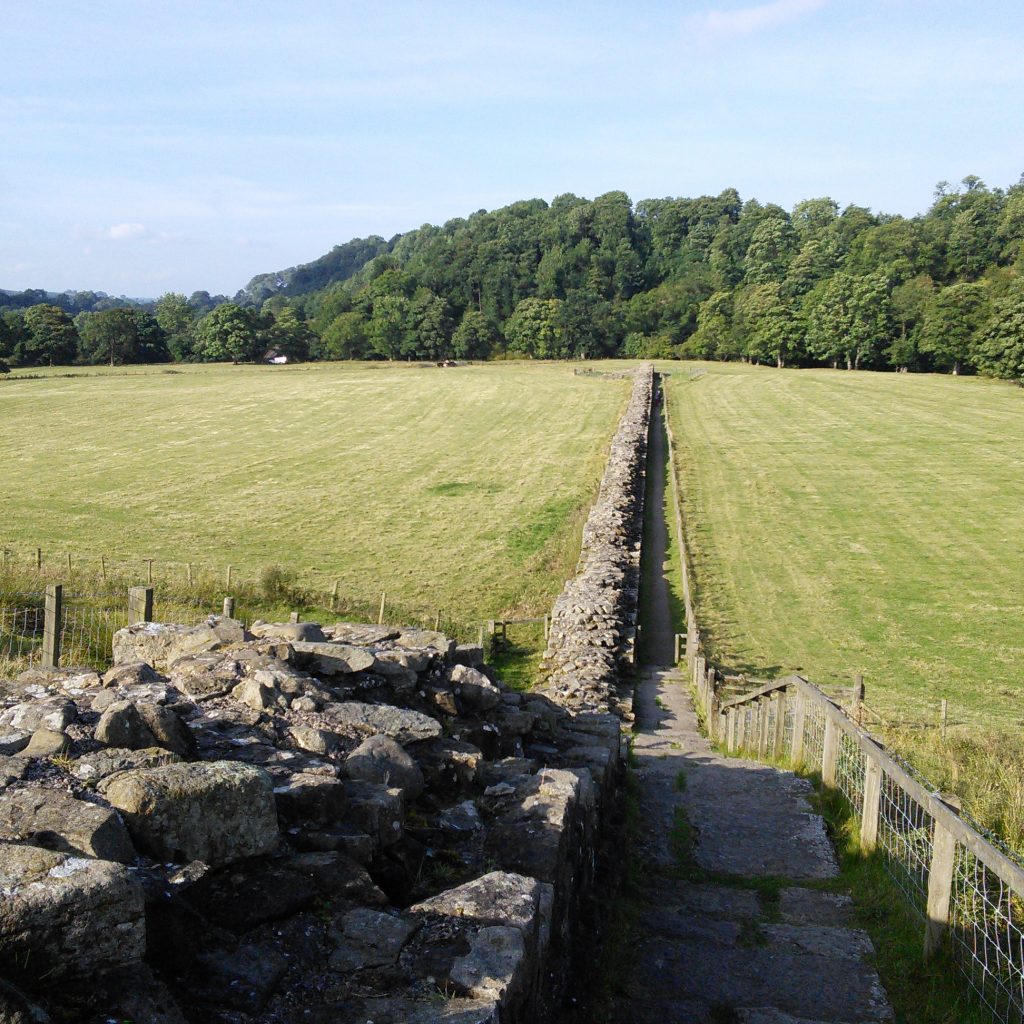
Building was to start at the eastern point, at the place that was to become appropriately known as Wallsend (which it still is today). In front of the wall section would be a large ditch, except in areas where rivers or natural topography made it unnecessary. At intervals of a mile, a gate was to be placed, which was to be guarded at all times. These guard posts became known as milecastles, and between each two were two towers. That meant there would be an observation point every third of a mile.
As you can see, the Romans and Hadrian took the threat from the north very seriously indeed. A fact further underlined by the 15 foot (4.6 metre) maximum height and 10 feet (three metre) initial width. This was plenty wide enough for men to walk along the top, even with the parapet wall.
However, as with every large building project, the plans changed during construction. It appears that Hadrian decided more forts were needed to further reinforce the wall, with each containing a single military unit and being placed around seven miles apart. The forts straddled the wall and were designed with plenty of access points to allow for increased mobility.
In addition, a further 120 foot (35 metre) wide earthwork with central ditch was placed to the south, with gated causeways built at each fort. This large earthwork was known as the Vallum and was designed to protect the rear in the event of attack. In order to speed up the building process, they narrowed the overall width of the wall by around two feet (66cm).
It is possible, according to some historians, that the initial building started before Hadrian’s visit, and the alterations were made to the design by him during his visit to Britain, although this is disputed.
As many of the inscriptions along the wall note, it was built by the army of Britain. This consisted of three legions of trained troops, each containing around 5,000 men. They provided the main muscle for the wall but were assisted by other units, including members of the British fleet. Just imagine 15,000 men, all toiling away as the cold north wind blew, with a general riding along on his horse inspecting their work and demanding they build faster so as not to anger the emperor.
History of the wall: Use through the ages
Once finished, the wall was mostly manned by auxiliary units. They would have been organised into regiments of either 500 or 1000 men and featured an intimidating mixture of infantry and cavalry. Each of the forts along the wall would have housed around 500.
The men who made up these tough fighting units were most likely to have been drawn from the north-western provinces of the empire, though it’s possible some came from other more exotic places. Around the main unit of men, there would have been an array of other services such as cooks and servants, though they were not allowed to live in the forts or in the area between the wall and the Vallum. The remains of some civilian settlements have been found along the wall. Due to the nature of construction they have proved hard to date, although it’s most likely they are from around the third century.
Although after a brief period following Hadrian’s death the wall was abandoned, it was quickly reinstated after about 20 years and repairs were made to damaged areas. However, this didn’t stop a major war in around 180 AD when tribes crossed the wall and killed many Roman soldiers and even a general.
It was probably incidents like this that led to the continual evolvement of the wall during its 300-year lifespan. Over the decades, barracks and headquarter blocks were built, and some forts grew in size. It remained in use until the early 5th century. Coins have been found on the wall that were minted between 400 and 406 AD, which seem to show its continued use.
However, by then the Roman empire was on the wane and there was no longer a great need to protect it from the northern barbarians. The central authorities decided to abandon Britain, and despite some efforts to keep the wall in use under local command, it fell into disrepair.
Seeing it as a great source of building materials, it became a quarry out of which to build castles, churches and houses. For 1400 years the wall was largely ignored (it’s incredible to imagine today). It wasn’t until the conservation movement of the 18th and 19th centuries that people began to take an interest from a historic perspective.
People such as John Clayton, John Collingwood Bruce and John Hodgson saw the importance of the wall and made efforts to keep it safe from further degradation. Their studies began what has been decade after decade of continued interest in the wall, with research yielding new findings year after year.
In fact, although it’s been studied and excavated for centuries, there still remains a lot to learn. With only a few percent of the wall being adequately examined by archaeological digs, who knows what treasures it still hides and what people may find in its environs for years to come?
Even if you are not lucky enough to discover a Roman coin or pottery, then its immense beauty and historical significance are still enough to enthral.
Key dates
- 43 AD – Roman conquest of Britain begins with the Claudian invasion. This is perhaps one of the single biggest events in the history of Britain, and one that would change the landscape and culture of the country forever.
- 70 – 80 AD – The Romans start building forts and some roads in the northern parts of England, reaching the area around the wall but coming up against some severe opposition from the north.
- 83/84 AD – The Battle of Mons Graupius in Scotland. A Roman military victory although many modern historians suggest that historian and chronicler Tacitus might have exaggerated the size and nature of the victory.
- 122 AD – Emperor Hadrian visits Britain and either lays or adapts plans for a wall at the northern edge of his empire.
- 140 – 158 AD – After the death of Hadrian, his wall is briefly abandoned as the army establishes the Antoine turf wall in southern Scotland. They return to the original wall but much of the destruction is never fully repaired, especially to the Vallum.
- 208 – 211 AD – Emperor Septimius Severus launches a series of campaigns in northern Britain.
- 286 – 296 AD – Carausian Revolt sees Britain ruled by a series of breakaway emperors.
- 367 AD – The ‘Barbarian Conspiracy’ sees Roman Britain devastated and a general killed.
- 410 AD – The Roman Empire loses Britain and the wall falls into a state of disrepair. It remains of little interest for the next 1400 years.
- 8th century – Material from the wall is used in the construction of the Jarrow Priory, amongst other buildings of local importance.
- 17th century – John Speed, English cartographer and historian, describes the site as the ‘Picts Wall’.
- 1834 – Local lawyer John Clayton becomes enthusiastic about the wall and acquires some land with a section of remaining wall, carrying out some of the first excavations on the milecastles. This leads to a general revised interest in the wall amongst many historians.
- 1987 – Hadrian’s Wall is named as a UNESCO World Heritage Site.
- 2003 – A National Trail footpath opens following the line of the wall, from Wallsend to Bowness-on-Solway.
- 2005 – The wall becomes part of the transnational ‘Frontiers of the Roman Empire’ which also features sites in Germany.
Preservation
Following John Clayton’s initial acquisition of large stretches of the wall and his first excavations, interest in the wall grew. He was able to employ workmen to restore sections, which was usually up to a height of about seven courses. The best example of Clayton’s restored wall is at Housesteads. But his relatives did not share his passion for restoration and after his death, work to repair the wall largely stopped.
However, after some more years of neglect, the National Trust began to purchase sections of the wall and preserve them as best as possible. After the wall achieved World Heritage Status in 1987 it has remained unguarded and visitors are still able to climb on some sections which has caused further damage. Walkers along its length are now encouraged not to climb on any sections, as this could undermine the structural integrity.
Housesteads is still one of the best-preserved sections of wall (thanks to John Clayton). Here you can see the foundations of a hospital, barracks and even flushable toilets. At Heddon-on-the-Wall, a big section of the frontier still stands and if you head from here eastwards towards the city of Newcastle, you can see the ruined remains of a Roman bridge which once crossed the River Irthing.
Today, it is maintained by a number of charitable bodies, and you can even sponsor stones to help with the maintenance costs.
Geography of the area
Although many people mistakenly believe that the wall was the border between England and Scotland, this is not the case. In fact, the wall lies in northern English counties of Northumberland and Cumbria.
The landscapes through which the wall passes are varied but almost uniformly beautiful in their own ways. It passes through Northumberland National Park and the Solway Coast Area of Outstanding Natural Beauty. There are also several sites of Special Scientific interest and Natural Nature Reserves. Today, with a six-mile buffer around the wall, it is one of the UK’s most protected areas.
295 million years ago, movement of the earth’s tectonic plates caused the formation of the Great Whin Sill, and it is easy to see why they built the wall here. In fact, many argue that the wall was already there in natural form, the Romans just added to it. Elsewhere along the path, the Crag Lough dominates everything around it, in the shade of the towering Whin Sill.
As you might expect along 80 miles of countryside, the landscape, geology and vegetation change dramatically. From the river plains of the Tyne area, to rocky and rolling hills of the middle section, and flat pastures around Carlisle. Finally ending up in the peaceful wetland areas along the northwest coast.
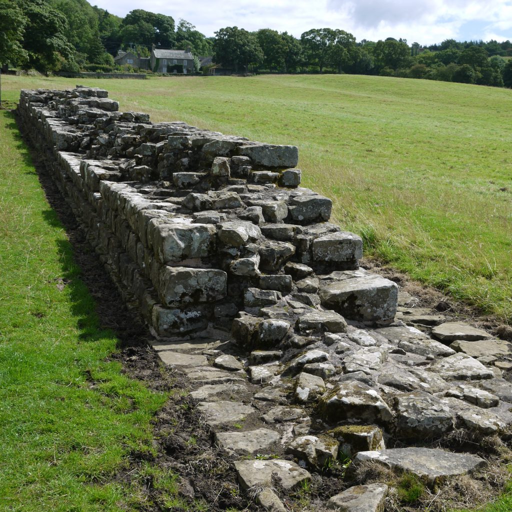
Each section would have offered up different challenges for the wall builders, with a mixture of soft and hard ground, and different stone with which to build. In general, the builders went for a cobble stone foundation, rubble core and large facing stones fixed with lime mortar. Mules and oxen would have been used to drag the stones around, even in the formidable central section. Horses were reserved for the well-to-do to ride or use for their carriages. And it’s no surprise to know that historians believe they opted to use stone from areas as close to the wall as possible.
Fauna and Flora
Along the route you will doubtless see plenty of flora and fauna, much of it being very particular to the area. Keep your eyes peeled for the endangered large heath butterfly and rare fungi.
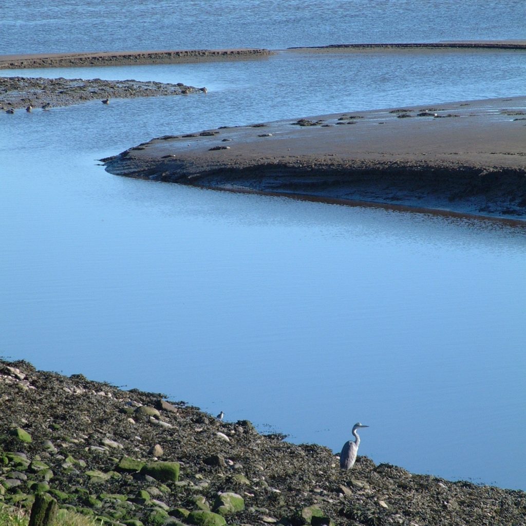
With lush green fields, water and plenty of habitat spaces, the area around the wall is teeming with wildlife. Common sights include the house martin, although they do migrate to Africa during winter. Wheatear and meadow pipits are also common, and in summer you’ll see plenty of swallows. Plus, as well as the rare large heath, you can also spot orange tip butterflies. Around Crag Lough you will see mute swans, busy coots, mallards and goldeneyes.
Hiking the wall
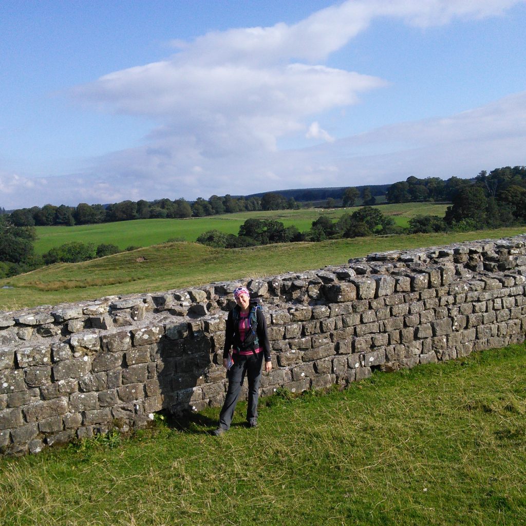
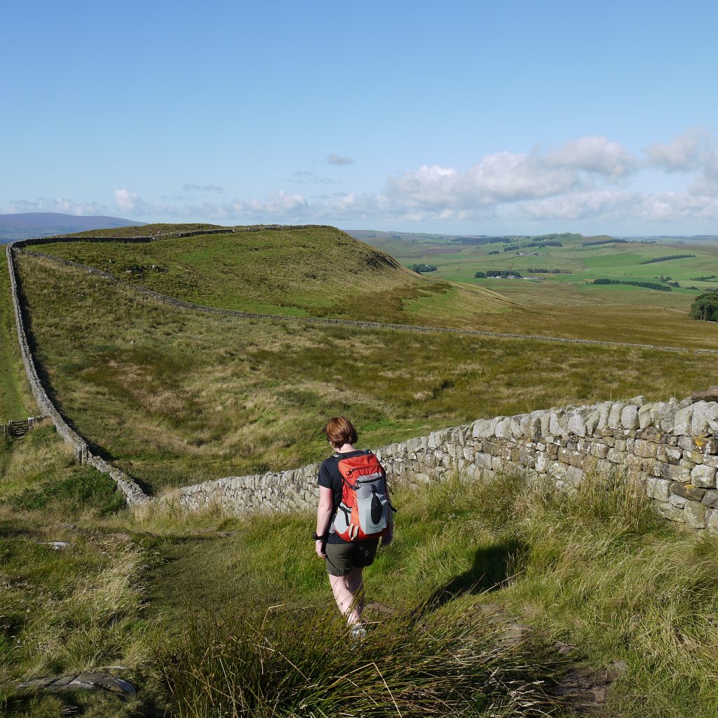
The Hadrian’s Wall Path, opened in 2003, follows the path of the wall from east to west, for 89 miles (143 kilometres) in total. Depending on your pace, the whole walk will take between six and ten days, with longer trips involving shorter walking days. It is also possible to tackle smaller sections of the wall if you are limited for time but we’ll cover those in more detail below.
While you can obviously start at either end, it makes sense to begin in Wallsend, where the construction process began. Then you can follow along the course of the wall in the same way it would have been built nearly 2000 years ago. However many days you choose to allow for your trip, there are plenty of pubs, inns and hostelries along the way to stop for some great food and accommodation. You’ll pass through bustling cities, thriving towns and quaint villages along the way, getting a view of modern Britain as you follow one of its ancient landmarks.
But to help you keep track of what you might see, we’ve broken the wall down into the sections. Highlighting some of the major landmarks and places of interest, you will pass these at your own pace, but each makes up an integral piece of this incredible structure.
Wallsend to Newburn
From your departure point in Tynemouth you will travel to the start of the wall in Wallsend at the site of Segedunum, a major site of a Roman Fort with a museum, surviving foundations of many buildings, and a full scale reconstruction of a Roman Bath House and part of the Wall. You will pass through the vibrant and rejuvenated city of Newcastle, famous for its seven bridges over the River Tyne. This was once the beating heart of the British Empire’s shipbuilding industry and while few ships are made here today, it’s a buzzing metropolis with plenty of history and culture of its own.
Newburn to East Wallhouses
Setting off along a former Wagonway, train and industrial enthusiasts can make a detour to see the birthplace of George Stephenson, the Father of the Railways and one of the architects of the modern world. After a while, the path leaves the River Tyne and leads you through the pastures and meadows of the old Military Road.
Along its course, you’ll notice the old, earthen defence works on either side. Even though they have been battered by the elements for two millennia, it’s possible to clearly make out the amount of work and effort that must have gone into their construction. Passing through the fort at Rudchester, you’ll arrive at East Wallhouses near milecastle 18.
East Wallhouses to Corbridge
After East Wallhouses you pass the Portgate roundabout at milecastle 22, this is the site of a fortified gateway north of Corbridge Roman Town, where the main Roman road in the north used to intersect with the wall. Customers starting from Corbridge will join the route here.
Corbridge to Humshaugh
From Portgate your walk follows the line of the wall with the vallum evident. You will pass St Oswalds Church and the site of the Heavenfield battle. This was where the king of Northumbria, Oswald, won his famous victory in the 8th century. Soon after you will see your first wall remains just before reaching Chollerford and Humshaugh. Here there’s a well-preserved Roman bridge and a fascinating fort and museum at Chesters.
As you can see, even after a couple of sections, the wall has already traversed through areas of great importance to the British Empire, Industrial Revolution and medieval Britain. It’s amazing to think that Hadrian’s Wall has been there through it all.
Humshaugh to Twice Brewed
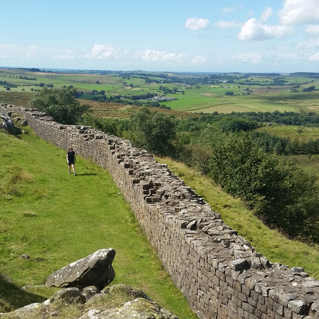
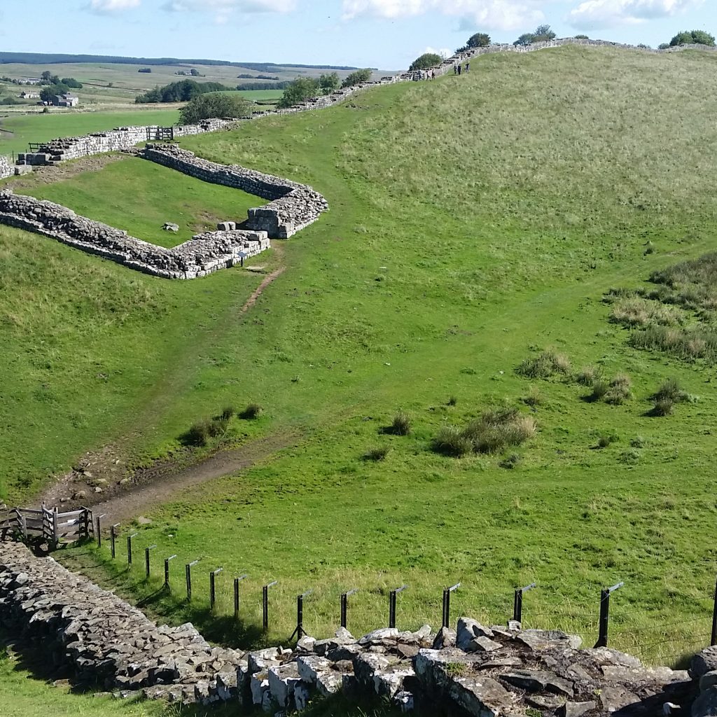
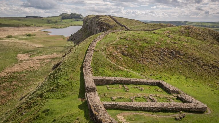
Entering into the Northumberland National Park you will come to the fort of Brocolitia and a Roman temple. This section of wall is dotted with castles and turrets, and thanks to the efforts of John Clayton, these are some of the best-preserved sections. The views of open moorland, the South Tyne Valley, the Pennines and of the wall itself following ridges ahead are breathtaking. The route passes the well preserved Housesteads Fort and continues in a similar dramatic fashion past Sycamore Gap to Twice Brewed. This is one of the most internationally famous sections of the wall, as Sycamore Gap was used in the filming of the Robin Hood: Prince of Thieves.
Many of our customers take a rest day in this section, usually at Twice Brewed, as it is close to the extensive and fascinating site of Roman Vindolanda. This is the most excavated site on the Roman Frontier with a world class museum full of artefacts. In the summer months you can usually see the archaeologists at work. The Roman Army Museum nearby is also well worth a visit.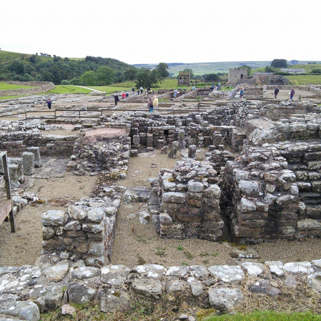
Twice Brewed to Gilsland
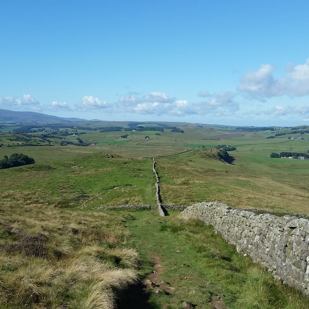
With rugged cliffs and the highest point of the wall at Winshields Crags, you can see why the Romans chose this line to follow. As some wall experts have pointed out, the wall already existed in natural form, the Romans just built on top of it.
Your walk continues along the top of the crags towards Thirlwall Castle. These are more of the best-preserved sections of the wall, perhaps because their remote nature meant they were less likely to be quarried for stone or destroyed over time by human action.
Gilsland to Lanercost
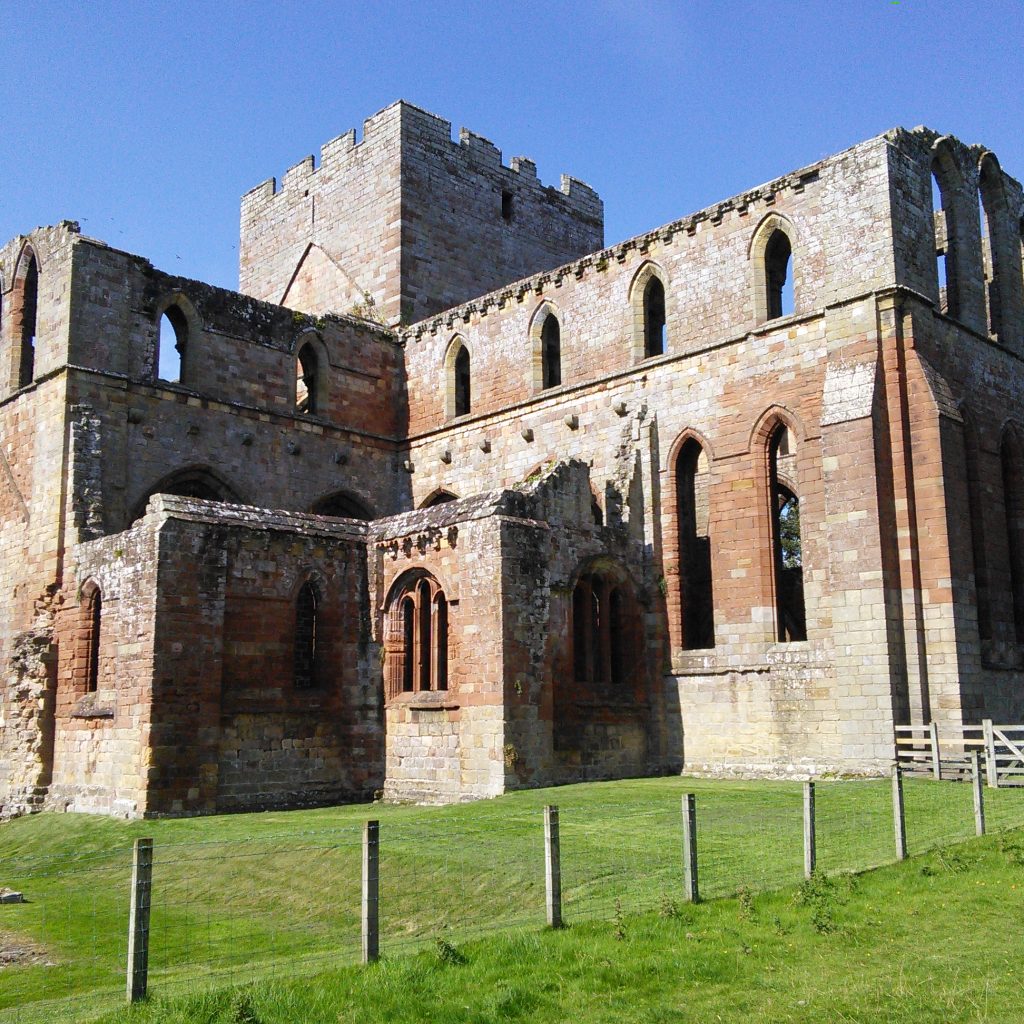
Cross the River Irthing on the Roman bridge in Gilsland and you’ll come to some very well preserved milecastles. You’ll also be able to look around Birdoswald fort, which was inhabited for almost two millennia. You can visit Lanercost Priory with a short detour, which was at one point made the capital of England – but only for six months.
This section of the wall sees a descent from the more rugged, higher sections down towards more gentle landscape, which is more accessible for casual walkers.
Lanercost to Carlisle
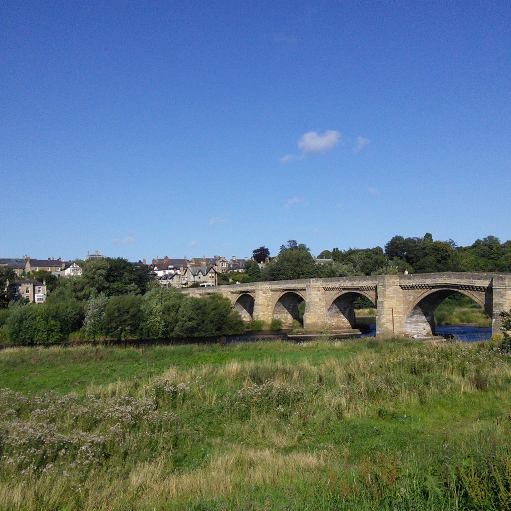
Passing through fields and along public bridleways towards the River Eden, you’ll follow this meandering waterway until you reach the historic city of Carlisle. This Roman hub is home to many artefacts stored in the Tullie House Museum. Visit the cathedral or Carlisle Castle, or learn more about British history at the Cumbria Museum of Military History.
Carlisle to Burgh-by-Sands
Continuing along the course of the river Eden, you’ll pass through parks, along charming waterside paths and through a number of quaint English villages on your way to Burgh-by-Sands. This is the place where King Edward I, known as the Hammer of the Scots, died in 1307. Another remarkable piece of history linked to the wall.
Burgh-by-Sands to Bowness-on-Solway
The final section of the walk follows the course that the wall took, straight to the Solway Coast. It’s an Area of Outstanding Natural Beauty passing along the pristine coastal area to Bowness. Finally you reach the Irish Sea and have reached the end of Hadrian’s Wall.
Hopefully it will have been an incredible journey, and you will have learned a lot about the history of the wall and culture in the surrounding area. You will have seen ancient landmarks, beautiful countryside and fascinating city landscapes.
Shorter walks
As mentioned above, it might not always be possible to walk the whole length of the wall due to time and ability constraints. But it is possible to take on shorter sections that still give you an incredible insight into life around the wall and its environs. Here are some of the most popular options.
Corbridge to Bowness-on-Solway – 64 miles/103 kilometres
If you can’t do the whole length but still fancy taking on a hefty section, then you can miss out the initial urban section in and around Newcastle. While it’s a beautiful city with a rich industrial heritage, not much of the wall remains in this urban environment. Starting at Corbridge, you will be able to walk the best-preserved sections of the wall, while enjoying open countryside.Corbridge to Carlisle – 48 miles/77 kilometres
After Carlisle, not much of the wall remains. And while it is a beautiful part of the country, if you’re really most captivated by the thought of the wall itself, then why not end your journey in the Roman city of Carlisle?
Corbridge to Brampton – 39 miles/63 kilometres
This takes in just the most dramatic sections of the wall where the landscape is at its most impressive. Large stretches of the wall remain in great condition, and this route starts in Corbridge where there is an impressive Roman site.
Humshaugh to Gilsland – 26 miles/42 kilometres
A short route focusing on the areas where the wall is intact and the landscape is at its most dramatic. By doing this route and only spending a few hours walking each day, you will have more time to focus on the historical aspects of the wall. Visit the forts, milecastles and other remains that are dotted along this impressive section, and gain a better understanding of real wall life.
Fitness levels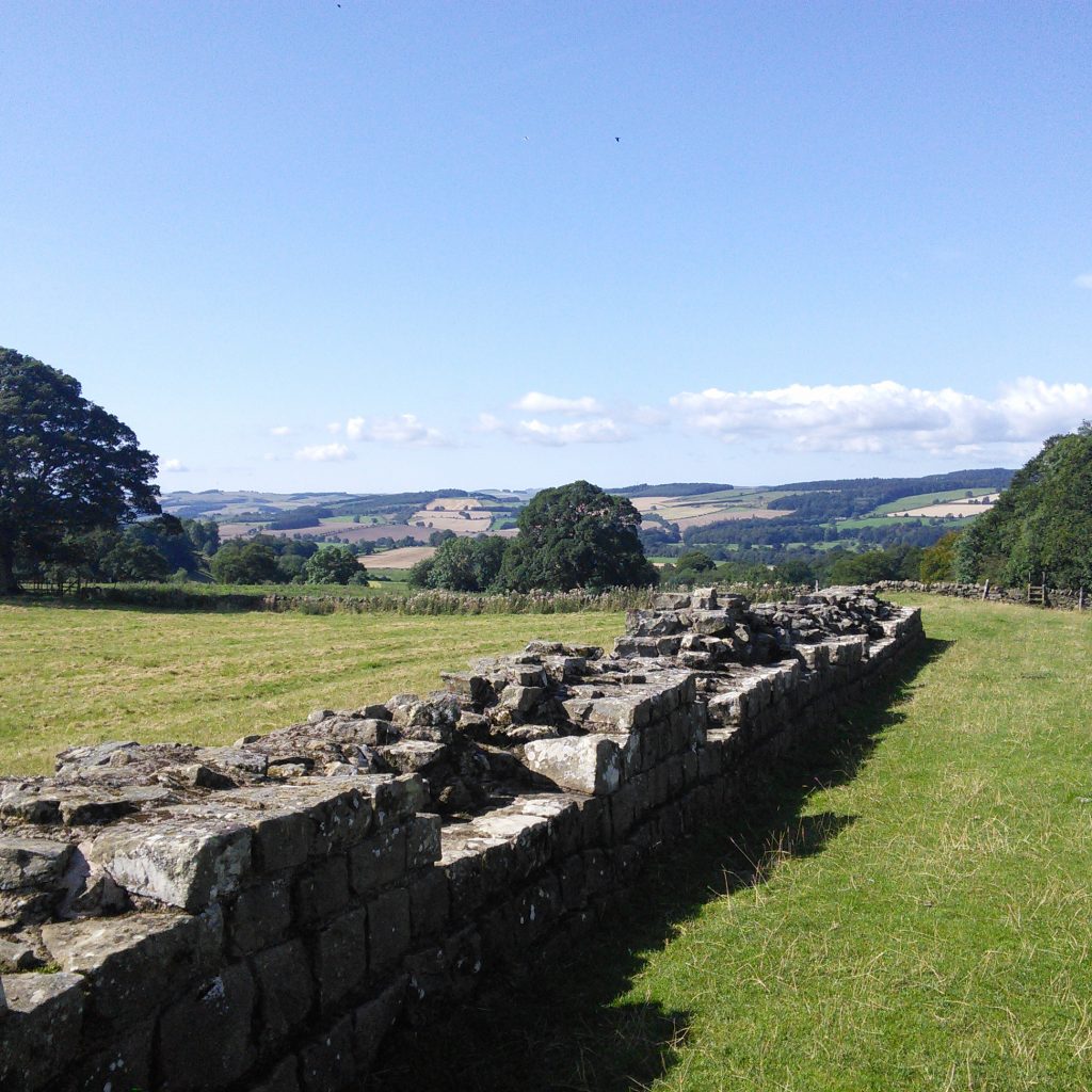
Of the National Trails that we offer, this is the easiest. If you have a reasonable level of fitness, then you should be able to walk the Hadrian’s Wall path – although there are some sections that are more difficult.
In particular, the 23-mile (37 kilometre) section between Chollerford and Birdoswald involves some short steep climbs and sharp descents. If you’ve walked along an undulating, rocky coastal path, then this is probably the closest comparison.
The majority of the walking surface is grass, except for some paved sections in the Tyneside area. Navigation is not all that difficult. The route is clearly marked with arrows and symbols. And even if visibility gets low in the higher sections of the walk, you should still be able to follow the route without too many problems.
And, of course, for much of the route you will have the wall itself and its extensive earthworks as a guide. But you should always have a map, compass and a guide book on hand, this will help you keep track of your progress and ensure you don’t go wrong.
The path is managed by the National Trail Partnership, which is made up of the Northumberland National Park Authority, Cumbria and Northumberland County Councils, Newcastle City Council, English Heritage and Natural England.
Packing list
Daypack
We can transport most of your luggage between accommodations, leaving you to just carry the things you need for the day’s walking, so you you need something small enough to carry easily but big enough to fit everything in. A 20 to 30 litre size should be sufficient. Dry bags are useful to protect delicate belongings in the bag from leaky water bottles or rain. If you prefer to carry your own belongings then you need to bring something much bigger and comfortable to fit in everything you need for the duration of your trip.
Boots
Just as important as your backpack is your footwear. The right shoes and socks are essential. Ideally go for fully waterproof boots, although waterproof trekking shoes may suffice if you prefer that style. Make sure your footwear is well worn in before starting the trek.
This is the UK, and the north of the UK at that, so you never know what weather to expect. And with much of the walk on grass, if it does rain your feet are going to get wet quickly. And squelching around all day in wet boots is no fun at all.
Second footwear
Bring a comfortable pair of shoes or sandals for the evenings. When you’ve been in your boots for eight hours, the last thing you want to do is put them back on again when you head to the pub.
Socks
Good socks are essential for avoiding blisters, so opt for good quality. Merino wool hiking socks are excellent, with perhaps an inner sock too. Wool socks will also dry quickly if they do get wet.
Clothing
Bring a sensible pair of walking trousers with plenty of pockets. These should be made from synthetic fabric and not cotton or denim. Those that zip off into shorts are useful. Try and go for water resistant or quick drying varieties if possible. If pockets are big enough to hold your map or guide book, you won’t have to keep stopping to put it away in your backpack.
Tops should be a good mix of warm weather and cold weather. T-shirts are fine in the summer but should be synthetic so they dry faster. If temperatures are cooler you’ll need a quick drying base layer, warm middle and waterproof outer layers to stay properly protected.
Whatever time of year you will need to bring waterproof, windproof and breathable hooded jacket and trousers.
Hat and sunnies
A pair of good quality sunglasses with UV protection are a must, as is a hat if the sun does shine, or a beanie if it is cold.
Provisions
The route does passes through some villages but not often, and not always at a time convenient for lunch! We can arrange for you to have packed lunches for each walking day if you prefer, otherwise you can choose to buy these at your accommodation where available or you can buy your own provisions to carry with you. You should always carry some emergency supplies with you in the form of lightweight energy bars. Some parts of the path pass through some high terrain and it’s always a good idea to have an emergency supply, just in case.
Water
Water is also an essential and you should carry enough water to last a day and fill it at every available opportunity. A good quality metal bottle one is always better than plastic, a hydro pack is a great alternative.
First aid kit
A small first aid kit containing a few essential items is a must. Plasters are always needed, as even with good shoes and socks, blisters do happen and can be a real pain. A bandage to be used to support sprains is recommended and can keep you moving.
Also carry some painkillers, in the form of ibuprofen or paracetamol. Ibuprofen is particularly important if you are prone to inflammation in the joints. A pair of tweezers for removing thorns or splinters is useful. And insect repellent or ointment for treating bites is recommended.
Suncream
Even in the north of the UK you can get sunburnt, so be sure to pack sun lotion.
Technology
While some walkers never leave home without a GPS, the route is well marked and you are rarely too far from civilisation. Still, if you feel more comfortable then bring it with you. But for most people a mobile phone will suffice. While signal depends on network coverage and phone model, you will be fine most of the time.
While smartphones have excellent cameras, there will be some stunning views to capture so a dedicated camera is well worth packing.
Map and compass
The route is clearly marked, and few people have any issues but you should always hike with a good map and compass. It can tell you your exact location and let you know what’s coming up. Also if you do get lost, a map (and knowing how to read it) could save the day.
Guidebook
Likewise, a guidebook will give you a greater insight into the overall history and specific points of interest that you pass along the way.
Try not to get carried away while packing. Of course, there are some essential items as we’ve outlined above. But in general, you will be able to get anything you forget as you travel. It’s better to travel light than to carry unnecessary items on your back for ten days. While distances are not huge and terrain is fairly easy, comfort and mobility are more important than packing the kitchen sink.
Interested?
Then why not take a look at our Hadrian’s Wall itineraries, email us, or give us a call on +44 (0)17687 72335 to find out how you could soon be walking through history!